

March 2025
-
Pas_Bon
- Posts: 968
- Joined: Tue Sep 11, 2018 7:58 am
- Location: League City, TX
- Contact:
-
tireman4

- Global Moderator

- Posts: 7161
- Joined: Wed Feb 03, 2010 9:24 pm
- Location: Humble, Texas
- Contact:
Today's Outlook
- Attachments
-
- small1-4.png (219.53 KiB) Viewed 7485 times
-
- small2-3.png (309.3 KiB) Viewed 7485 times
-
- small3-1.png (283.65 KiB) Viewed 7485 times
-
tireman4
- Global Moderator
- Posts: 7161
- Joined: Wed Feb 03, 2010 9:24 pm
- Location: Humble, Texas
- Contact:
Outlook
- Attachments
-
- img_1_1742755354874.jpg
- (171.08 KiB) Downloaded 3572 times
-
- img_3_1742755363924.jpg
- (170.34 KiB) Downloaded 3572 times
-
tireman4
- Global Moderator
- Posts: 7161
- Joined: Wed Feb 03, 2010 9:24 pm
- Location: Humble, Texas
- Contact:
Tonight
- Attachments
-
- img_2_1742771220977.jpg
- (180.21 KiB) Downloaded 3555 times
-
tireman4
- Global Moderator
- Posts: 7161
- Joined: Wed Feb 03, 2010 9:24 pm
- Location: Humble, Texas
- Contact:
Tonight
- Attachments
-
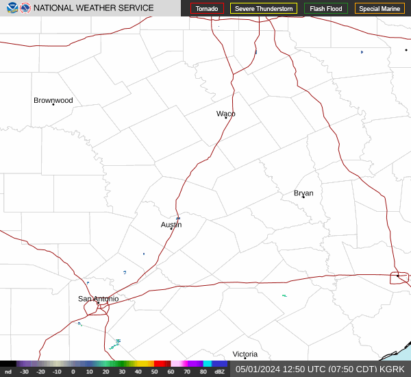
- hgx.png (41.13 KiB) Viewed 7441 times
-
DoctorMu

- Posts: 8089
- Joined: Sun Jun 28, 2015 11:58 am
- Location: College Station
- Contact:
Some hail core cells to watch out for.
-
DoctorMu
- Posts: 8089
- Joined: Sun Jun 28, 2015 11:58 am
- Location: College Station
- Contact:
TWC pre-cog radar has the storms jumping over us a few miles from our yard - maybe some rain in Houston? Looks iffy. We'll see.
NWS has a 60% chance here, 40% in Houston.
NWS has a 60% chance here, 40% in Houston.
-
Cpv17
- Posts: 7109
- Joined: Fri Aug 31, 2018 1:58 pm
- Location: El Campo/Wharton
- Contact:
-
DoctorMu
- Posts: 8089
- Joined: Sun Jun 28, 2015 11:58 am
- Location: College Station
- Contact:
5 drops here. Hope y'all do better.

-
Rip76

- Posts: 2151
- Joined: Mon Feb 15, 2010 12:38 am
- Location: The Woodlands
- Contact:
Woodlands getting hammered right now.
-
jasons2k

- Posts: 6201
- Joined: Thu Feb 04, 2010 12:54 pm
- Location: Imperial Oaks
- Contact:
Woke-up to 0.74”
Quite the lightning show last night.
Plants are happy - we needed that.
Quite the lightning show last night.
Plants are happy - we needed that.
-
tireman4
- Global Moderator
- Posts: 7161
- Joined: Wed Feb 03, 2010 9:24 pm
- Location: Humble, Texas
- Contact:
284
FXUS64 KHGX 241131
AFDHGX
Area Forecast Discussion
National Weather Service Houston/Galveston TX
631 AM CDT Mon Mar 24 2025
...New AVIATION...
.SHORT TERM...
(Today through Tuesday Night)
Issued at 213 AM CDT Mon Mar 24 2025
The front is still on track to reach the coast a little after
sunrise. As mentioned in the previous forecast, it is anticipated to
stall and wash out. Onshore flow will return by late this evening
with southeasterly winds prevailing. Despite the FROPA, not
expecting much of a cooldown today. Highs will be in the 80s across
the area.
Similar conditions expected Tuesday as high pressure lies to our
east...onshore winds will contribute to warm and humid weather with
highs in the 80s to near 90 degrees.
Lows for tonight and Tuesday night will be in the 60s (northernmost
locations may dip into the upper 50s).
Adams
&&
.LONG TERM...
(Wednesday through Sunday)
Issued at 213 AM CDT Mon Mar 24 2025
Calm weather should persist into Wednesday with only a slight chance
of isolated showers, mainly across the Piney Woods area. This comes
as the result of a surface high moving through the Plains/SE CONUS
while a warm sector lifts north with a boundary/convergence zone
forming near the ArkLaTex area on Wednesday. Otherwise conditions
remain similar to that of the day before with higher cloud cover
translating to a slight decrease in high temperatures, but still
reaching the 70s to mid 80s.
Substantial rainfall is still expected late in the workweek,
courtesy of a mid/upper level shortwave. This system should dig
through Desert Southwest/Northern Mexico on Thursday, bringing
widespread rainfall into the early weekend as it fills northeast
through the Southern Plains. PWs are still anticipated to range from
around 1.4-1.6 inches with a 25 to 40 knot LLJ jet moving into the
area Thursday evening. Forecast soundings still show profiles
suggesting high precipitation efficiency, with tight IQR spreads and
deep saturation still depicted in LREF soundings. A few long-range
deterministic models place the aforementioned shortwave further
south, though the broad picture still hasn`t changed in the ensemble
means. Rainfall totals over this two day period are still expected
to be around 1.0-2.5 inches, seemingly manageable amounts given
CREST soil moisture is under 20% area-wide. Still, locally heavy
rains remain possible during this time frame.
WPC currently has areas along/west of I-45 under a Marginal (level
1/4) Risk of Excessive Rainfall on Thursday, extending to all areas
on Friday. While there is still some uncertainty with regards to
timing, the broader picture continues to suggest that locally heavy
rains will be possible throughout this period. Any stronger storms
with higher rainfall rates could result in ponding on roadways and
minor street flooding, especially in urban and low-lying areas.
Global models still show timing discrepancies over the weekend,
though guidance broadly suggests less active weather for Saturday as
the aforementioned disturbance pushes off to the northeast. Isolated
showers and storms continue over the weekend as another midlevel
shortwave trough traverses the Southern Plains. This next
disturbance is poised to push another cold front through SE Texas on
Sunday/early next week.
03
&&
.AVIATION...
(12Z TAF Issuance)
Issued at 625 AM CDT Mon Mar 24 2025
Rain has cleared the area, leaving behind generally clear skies
and light winds. Expect clouds to increase again during the day,
but remaining VFR through the evening. Late tonight into the
morning hours Tuesday VSBYs and CIGs expected to deteriorate.
Residual moisture and light winds will contribute to patchy/areas
of fog, some of which could become dense.
&&
.MARINE...
Issued at 213 AM CDT Mon Mar 24 2025
A line of strong thunderstorms along a cold front will move off the
coast this morning, bringing strong winds across the Gulf waters.
Patches of sea fog may still develop early today ahead of the front,
but should clear with it`s passage. East/northeast winds briefly
develop behind the front Monday afternoon with onshore flow quickly
returning Monday evening. Substantial rain chances return on
Thursday and continue into the weekend as the next storm system
moves through Texas. Stronger onshore winds and a long fetch across
the gulf could bring some swells to 6-7 feet Thursday through the
early weekend.
03
&&
.PRELIMINARY POINT TEMPS/POPS...
College Station (CLL) 83 62 88 61 / 0 0 0 0
Houston (IAH) 83 63 88 64 / 20 0 0 0
Galveston (GLS) 74 64 79 64 / 40 0 0 0
&&
.HGX WATCHES/WARNINGS/ADVISORIES...
TX...None.
GM...None.
&&
$$
SHORT TERM...Adams
LONG TERM....03
AVIATION...Adams
MARINE...03
-
JDsGN
- Posts: 174
- Joined: Tue May 23, 2017 10:25 pm
- Location: Cypress TX
- Contact:
May have hit the jackpot with that storm. Heck of a lightning storm. Picked up 1.58" last night. I took a chance and put some weed and feed down yesterday evening just in case. Worked out perfect.
-
Pas_Bon
- Posts: 968
- Joined: Tue Sep 11, 2018 7:58 am
- Location: League City, TX
- Contact:
Well, it did rain after all. Wind was insane. Only picked up about 0.10" in League City, but that's 0.10" more than I've had in several weeks.
Neighbor's large oak tree split in two from the storm. I haven't heard wind like that in a good while.
Neighbor's large oak tree split in two from the storm. I haven't heard wind like that in a good while.
-
Pas_Bon
- Posts: 968
- Joined: Tue Sep 11, 2018 7:58 am
- Location: League City, TX
- Contact:
Does anyone have a bead on how high the winds/gusts got to for the metro area with this line of weather early this morning?
Looks like League City had gusts to 55mph at around 3:15am.
Looks like League City had gusts to 55mph at around 3:15am.
-
Cpv17
- Posts: 7109
- Joined: Fri Aug 31, 2018 1:58 pm
- Location: El Campo/Wharton
- Contact:
Really good chances coming later this week! I was surprised about this mornings rain. Didn’t see that one coming at all.
-
DoctorMu
- Posts: 8089
- Joined: Sun Jun 28, 2015 11:58 am
- Location: College Station
- Contact:
-
don

- Posts: 3148
- Joined: Wed Feb 03, 2010 3:33 pm
- Location: Wichita Falls
- Contact:
Someone in SC and SE Texas may get a lot of rain this week. Looks kind of like a warm core low setup, and there could be a core rain event. Areas west of I-45 look’s to be where the heaviest rains may setup.Stay tuned!