
As expected. At least the temps are down.
July 2025
-
Cpv17
- Posts: 7109
- Joined: Fri Aug 31, 2018 1:58 pm
- Location: El Campo/Wharton
- Contact:
-
DoctorMu

- Posts: 8089
- Joined: Sun Jun 28, 2015 11:58 am
- Location: College Station
- Contact:
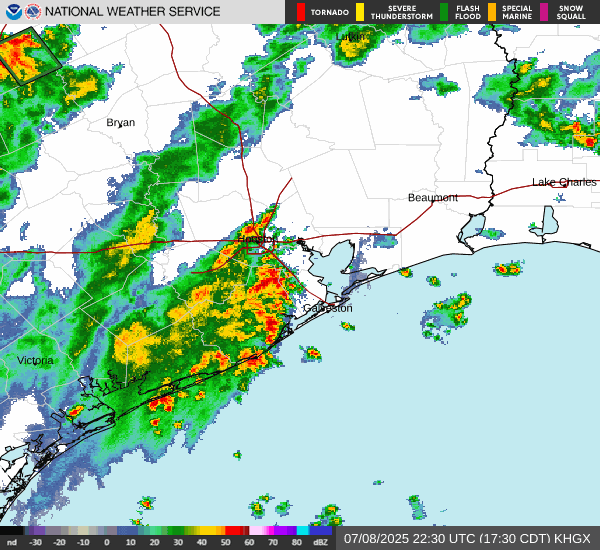
NWS missed this one - they had a 50% chance of rain in Houston, 10% here in CLL. We have a few showers in the area. Pretty weak, and no surprise seeing the TS lemonade move north and outta here.
-
DoctorMu
- Posts: 8089
- Joined: Sun Jun 28, 2015 11:58 am
- Location: College Station
- Contact:
Yep. Give me 83° until CFB season - no questions asked.
Buffalo and Madisonville will see a shower, but no cigar outside the Piney Woods, even with most of the rain inside Texas now. The I-45 wall has come to fruition.
-
DoctorMu
- Posts: 8089
- Joined: Sun Jun 28, 2015 11:58 am
- Location: College Station
- Contact:
Euro AI eyes another retrograde weak sauce lemonade system in about a week.
So, there's a chance...
Even the ridges are moving in retrograde. An interesting and a different summer. Keep the retrograde lemonade coming!
So, there's a chance...
Even the ridges are moving in retrograde. An interesting and a different summer. Keep the retrograde lemonade coming!
- Attachments
-
- ec-aifs_mslp_pcpn_us_34.png
- (152.1 KiB) Downloaded 1395 times
-
user:null
- Posts: 465
- Joined: Fri Jul 01, 2022 7:04 pm
- Location: The Land of Sugar
- Contact:
There are some small areas of showers building in from the Gulf. Could provide rain for a lucky few despite the earlier bulk activity staying north.
-
DoctorMu
- Posts: 8089
- Joined: Sun Jun 28, 2015 11:58 am
- Location: College Station
- Contact:
This weaksauce low is retrograding west south west? Showers/cells are increasing in Houston and a blob of light rain is retreating from the Piney Woods sagging toward B/CS. If we're lucky we might see a couple of drops and maybe an outflow before dissipating this evening. Don't think there's a strong enough warm core center to produce nighttime rainfall. Proto-Dexter has been an interesting little beast.
-
DoctorMu
- Posts: 8089
- Joined: Sun Jun 28, 2015 11:58 am
- Location: College Station
- Contact:
More of the same late next week:
Area Forecast Discussion
National Weather Service Houston/Galveston TX
1257 PM CDT Fri Jul 18 2025
...New DISCUSSION, MARINE...
.KEY MESSAGES...
Issued at 1255 PM CDT Fri Jul 18 2025
- Rain chances diminish and temperatures increase this weekend into
the middle parts of next week.
- The next decent chances of precipitation re-enter the forecast
late next week.
&&
.DISCUSSION...
Issued at 1255 PM CDT Fri Jul 18 2025
Mid-upper inverted trof/disturbance situated over east/southeast Tx
should further weaken and lift nnw out of the vicinity tonight &
Saturday. Ridging should then gradually build in from the east as we
go through the weekend and into at least the middle parts of next
week. Increasing subsidence and lower PW`s with time will limit, or
eliminate, rain chances...and more sunshine will allow for a bump in
daytime highs.
Heading into the second part of next week, guidance is depicting
another inverted trof making its way wwd across FL, under the ridge
and toward the western Gulf Coast around Friday. (Looks like a
similar setup as to what we saw this week). If nothing else, it
should bring some increasing clouds/moisture and associated rain
chances back into the area. Some guidance tries to eventually
develop a weak surface circulation, but as of now, moderate winds
aloft could be a limiting factor for development. 47
&&
-
tireman4

- Global Moderator

- Posts: 7161
- Joined: Wed Feb 03, 2010 9:24 pm
- Location: Humble, Texas
- Contact:
Today's Forecast
- Attachments
-
- small3.png (259.47 KiB) Viewed 3381 times
-
Pas_Bon
- Posts: 968
- Joined: Tue Sep 11, 2018 7:58 am
- Location: League City, TX
- Contact:
-
DoctorMu
- Posts: 8089
- Joined: Sun Jun 28, 2015 11:58 am
- Location: College Station
- Contact:
Even GFS with the Euro is seeing it. Zombie see and Zombie do.
- Attachments
-
- gfs_mslp_pcpn_us_32.png
- (164.23 KiB) Downloaded 1180 times
-
tireman4
- Global Moderator
- Posts: 7161
- Joined: Wed Feb 03, 2010 9:24 pm
- Location: Humble, Texas
- Contact:
Upcoming
- Attachments
-
- FB_IMG_1752960575476.jpg
- (158.94 KiB) Downloaded 1107 times
-
DoctorMu
- Posts: 8089
- Joined: Sun Jun 28, 2015 11:58 am
- Location: College Station
- Contact:
-
DoctorMu
- Posts: 8089
- Joined: Sun Jun 28, 2015 11:58 am
- Location: College Station
- Contact:
It got up to 97°F briefly, then the clouds roled in. More easterly stuff under the ridge. Check out the new cluster of storms on the FL Gulf coast. Come to poppa! Maybe by Friday for some late July Relief.
GOES:
https://www.star.nesdis.noaa.gov/GOES/s ... &length=24
https://www.star.nesdis.noaa.gov/GOES/s ... &length=24
GOES:
https://www.star.nesdis.noaa.gov/GOES/s ... &length=24
https://www.star.nesdis.noaa.gov/GOES/s ... &length=24
-
tireman4
- Global Moderator
- Posts: 7161
- Joined: Wed Feb 03, 2010 9:24 pm
- Location: Humble, Texas
- Contact:
Today's forecast and this week
- Attachments
-
- small1.png (254.73 KiB) Viewed 3124 times
-
- small2.png (248.02 KiB) Viewed 3124 times
-
- small4.png (208.23 KiB) Viewed 3124 times
-
tireman4
- Global Moderator
- Posts: 7161
- Joined: Wed Feb 03, 2010 9:24 pm
- Location: Humble, Texas
- Contact:
-
Stratton20
- Posts: 5870
- Joined: Tue Feb 09, 2021 11:35 pm
- Location: College Station, Texas
- Contact:
Fingers crossed the GFS is correct, it keeps a persistent weakness over se texas, underneath the monster heat ridge over the central texas, it keeps that weakness in place even in the long term, decent chance for daily thunderstorms
-
captainbarbossa19

- Pro Met

- Posts: 460
- Joined: Mon Jun 28, 2021 2:50 pm
- Location: Conroe, TX
- Contact:
Not really seeing any signs of a persistent ridge for us in the near-future. This summer has been one of weaknesses, which could end up being problematic as we head towards peak hurricane season.Stratton20 wrote: ↑Sun Jul 20, 2025 8:06 pm Fingers crossed the GFS is correct, it keeps a persistent weakness over se texas, underneath the monster heat ridge over the central texas, it keeps that weakness in place even in the long term, decent chance for daily thunderstorms
-
Pas_Bon
- Posts: 968
- Joined: Tue Sep 11, 2018 7:58 am
- Location: League City, TX
- Contact:
As the wise Han Solo once said…..”I’ve got a bad feeling about this…..”captainbarbossa19 wrote: ↑Sun Jul 20, 2025 9:03 pmNot really seeing any signs of a persistent ridge for us in the near-future. This summer has been one of weaknesses, which could end up being problematic as we head towards peak hurricane season.Stratton20 wrote: ↑Sun Jul 20, 2025 8:06 pm Fingers crossed the GFS is correct, it keeps a persistent weakness over se texas, underneath the monster heat ridge over the central texas, it keeps that weakness in place even in the long term, decent chance for daily thunderstorms
I honestly do.
-
tireman4
- Global Moderator
- Posts: 7161
- Joined: Wed Feb 03, 2010 9:24 pm
- Location: Humble, Texas
- Contact:
900
FXUS64 KHGX 211100
AFDHGX
Area Forecast Discussion
National Weather Service Houston/Galveston TX
600 AM CDT Mon Jul 21 2025
...New AVIATION...
.KEY MESSAGES...
Issued at 1200 AM CDT Mon Jul 20 2025
- Other than a few isolated showers/thunderstorms associated with
the sea breeze, we are expecting a mostly dry and hot pattern to
prevail through Thursday.
- The heat is expected to crank as we head into the middle of the
week, with most inland areas forecast to be in the upper 90s on
Thursday. Heat will be hazardous all week even if we technically
remain below advisory criteria.
- A late week surge of tropical moisture increases rain chances
beyond Thursday.
&&
.DISCUSSION...
Issued at 1118 PM CDT Sun Jul 20 2025
Mid/upper ridging (currently centered over the Gulf) will dominate
the pattern through Thursday. Thus, summer weather will reign
supreme, with highs generally well into the 90s and heat index
values in the triple digits. The thermodynamic profile is looking
a little too suppressive for afternoon convection. However, we
can`t rule out some isolated showers or even a thunderstorm along
the sea breeze boundary as it pushes inland in the afternoon. But
most areas are expected to remain dry. Could not rule out a few
spots reaching the 100 degree mark, especially on Wednesday and
Thursday. Our current dew point forecast features enough mixing
to keep heat index values just below advisory criteria. But the
heat will still be hazardous enough to warrant heat safety
(drinking fluids, taking breaks in the shade / AC, not leaving
children or animals in the car, and so on). Perhaps worth
mentioning are the high Wet Bulb Globe Temp (WBGT) values we are
expecting in the early afternoon through Thursday. WBGT (based off
a combo of heat, humidity, sun angle, cloud cover, and wind) is a
good way to measure the heat stress on a body doing strenuous
activity outside. So if you do plan on doing any strenuous
activity outside, be advised that the most hazardous heat will be
from around noon to about 4PM.
While we roast under the July sun here in SE Texas, a low/mid
level trough is expected to push southward from the Carolinas into
Florida, before moving westward across either the northern Gulf or
over the Deep South. The system may bring a surge of deep tropical
moisture by the end of the week. Thus, rain chances beyond
Thursday remain elevated. In case you are curious, NHC has NOT
highlighted the disturbance for potential tropical development.
That being said, the guidance is suggesting that we could have a
suspicious looking disturbance (similar to that last one, 93L) by
the middle of the week. If current global guidance is to be
believed, then much of the system would remain over land,
resulting in the same fate 93L faced last week.
Self
&&
.AVIATION...
(12Z TAF Issuance)
Issued at 600 AM CDT Mon Jul 21 2025
Intermittent periods of MVFR ceilings possible at CLL/UTS through
15Z before VFR conditions prevail areawide throughout the day.
Winds will be southerly throughout the morning/early afternoon
and becoming southeasterly in the mid to late afternoon behind the
sea breeze. Expect sustained winds to peak in the 10-15 kt range.
An isolated shower/storm or two will be possible again along the
sea breeze, but there is no mention of this in any TAF due to the
low confidence on exactly where it will develop. Winds trend
towards becoming light again going into tonight, and there is
potential for another round of MVFR ceilings early Tuesday morning
at the northern terminals (CLL/UTS).
Batiste
&&
.MARINE...
Issued at 1118 PM CDT Sun Jul 20 2025
Mostly dry and hot conditions with light to occasionally moderate
onshore winds (5 to 15 knots) and 2-3 foot seas expected through
the middle of the week. By Thursday and especially Friday, a
disturbance from the east is expected to increase the chance of
rain and thunderstorms. There is some potential for seas and winds
to increase somewhat as well. But confidence in the wind forecast
is lower than normal beyond Thursday.
&&
.PRELIMINARY POINT TEMPS/POPS...
College Station (CLL) 96 75 95 74 / 0 0 0 0
Houston (IAH) 96 78 95 76 / 20 0 20 0
Galveston (GLS) 91 83 91 82 / 10 0 10 0
&&
.HGX WATCHES/WARNINGS/ADVISORIES...
TX...None.
GM...None.
&&
$$
DISCUSSION...Self
AVIATION...Batiste
MARINE...Self
-
DoctorMu
- Posts: 8089
- Joined: Sun Jun 28, 2015 11:58 am
- Location: College Station
- Contact:
I haven't seen one either. More easterlies.captainbarbossa19 wrote: ↑Sun Jul 20, 2025 9:03 pmNot really seeing any signs of a persistent ridge for us in the near-future. This summer has been one of weaknesses, which could end up being problematic as we head towards peak hurricane season.Stratton20 wrote: ↑Sun Jul 20, 2025 8:06 pm Fingers crossed the GFS is correct, it keeps a persistent weakness over se texas, underneath the monster heat ridge over the central texas, it keeps that weakness in place even in the long term, decent chance for daily thunderstorms
lol The Ghost of 93L is still a mid level, near naked swirl twirling around central Texas.
https://www.star.nesdis.noaa.gov/GOES/s ... &length=24
The GFS is absolutely useless now anyway. We don't have enough weather balloons up with budget cuts.
Euro and Euro AI are retrograding more moisture for LaTx from Florida, and arriving Fri/Sat...then another the following Wednesday under the Ridge of America or w/e.
Gotta go with the Captain...
- Attachments
-
- ec-aifs_mslp_pcpn_us_18.png
- (156.5 KiB) Downloaded 658 times
-
- ec-aifs_mslp_pcpn_us_38.png
- (154.24 KiB) Downloaded 658 times