
A May of Rain is good with me.
We should be careful though. Some of Texas’ worst flooding events have been in the month of May from cutoff lows in getting stalled out.
April 2025
-
jasons2k

- Posts: 6196
- Joined: Thu Feb 04, 2010 12:54 pm
- Location: Imperial Oaks
- Contact:
-
DoctorMu

- Posts: 8048
- Joined: Sun Jun 28, 2015 11:58 am
- Location: College Station
- Contact:
-
DoctorMu
- Posts: 8048
- Joined: Sun Jun 28, 2015 11:58 am
- Location: College Station
- Contact:
Speaking of the seabreeze, we just saw a seabreeze shower breeze through here. Just a bit of light rain at the casa but a deluge a couple of miles away.
The shower ran out of steam with the sun setting.
The shower ran out of steam with the sun setting.
-
Cpv17
- Posts: 7095
- Joined: Fri Aug 31, 2018 1:58 pm
- Location: El Campo/Wharton
- Contact:
Picked up .53” here today! Hallelujah lol
-
tireman4

- Global Moderator

- Posts: 7141
- Joined: Wed Feb 03, 2010 9:24 pm
- Location: Humble, Texas
- Contact:
Outlook
- Attachments
-
- small5.png (210.86 KiB) Viewed 12103 times
-
- small3.png (366.51 KiB) Viewed 12103 times
-
- small4.png (328.21 KiB) Viewed 12103 times
-
DoctorMu
- Posts: 8048
- Joined: Sun Jun 28, 2015 11:58 am
- Location: College Station
- Contact:
Only 0.22 inches of rain here. Beggars can't be...
We really need an inch or two over the next couple of days.
We really need an inch or two over the next couple of days.
-
jasons2k
- Posts: 6196
- Joined: Thu Feb 04, 2010 12:54 pm
- Location: Imperial Oaks
- Contact:
Added another.49” here today. Wouldn’t mind a sunny weekend.
-
DoctorMu
- Posts: 8048
- Joined: Sun Jun 28, 2015 11:58 am
- Location: College Station
- Contact:
Trough activated daytime heating through Friday - rain chances are disappearing. Hoping to roll some 7s...before some ridging to end April.
Area Forecast Discussion
National Weather Service Houston/Galveston TX
635 PM CDT Wed Apr 23 2025
...New AVIATION...
.SHORT TERM...
(This evening through Thursday Night)
Issued at 153 PM CDT Wed Apr 23 2025
As of the writing of this forecast discussion, we have so far
observed a low temperature of 73.2 and a high temperature of 74.0
at our office in League City- thanks to the passage of a line of
thunderstorms and widespread cloud cover that has inhibited
diurnal heating up to this point. With the exit of this
aforementioned line of thunderstorms, it appears we will still see
a few hours of heating before the end of the afternoon and highs
may reach as high as the upper 70s to near 80 area wide.
We remain in a seasonable, humid pattern overnight and into
tomorrow with another shortwave expected to traverse the quasi-
zonal midlevel flow and pass just to our north tomorrow afternoon.
Overnight lows tonight will struggle to escape the 70s- with
fairly widespread stratus expected to remain in place across the
area. Some patchy fog is also possible through sunrise tomorrow,
with low dewpoint depressions and a saturated surface after
today`s rainfall. As the aforementioned trough pushes eastward
tomorrow, a few isolated showers and storms are possible across
the northern zones. Rainfall coverage and intensity should be
lower than today, and strong storms are not expected. Look for
daytime highs in the lower 80s and overnight lows in the upper 60s
to lower 70s.
Cady
&&
.LONG TERM...
(Friday through next Tuesday)
Issued at 153 PM CDT Wed Apr 23 2025
Mid to upper level ridge builds across the Plains on Friday,
decreasing rain chances into the weekend. However, isolated to
scattered showers and thunderstorms are still possible on Friday.
A few shortwaves embedded in the flow aloft will move through the
ridge. That combined with sufficient low-level moisture and
diurnal heating will lead to rain/storm chances, mainly north of
I-10.
A drier pattern returns during the weekend, with the ridge
prevailing into early next week. It will be mostly dry, but also
warm or even hot! Temperatures will gradually climb into the mid
80s to low 90s this weekend into the upcoming week. Warmer than
average lows are also anticipated with readings in the 60s and
70s. An upper level trough will deepen across the Rockies this
weekend, dragging a frontal boundary through the region into the
Tuesday to Wednesday time frame. Given this far out, specific
details and timing on this next rain maker are uncertain. As of
now, we can see an increase in showers and storm chances after
next Tuesday.
JM
&&
-
tireman4
- Global Moderator
- Posts: 7141
- Joined: Wed Feb 03, 2010 9:24 pm
- Location: Humble, Texas
- Contact:
480
FXUS64 KHGX 241139
AFDHGX
Area Forecast Discussion
National Weather Service Houston/Galveston TX
639 AM CDT Thu Apr 24 2025
...New AVIATION...
.SYNOPSIS...
Issued at 255 AM CDT Thu Apr 24 2025
An unsettled week of weather continues, but we`ll be transitioning
to drier weather for the weekend and early next week, before rain
potential returns towards the middle of next week. Some of the key
points to remember for the week to come:
- Rain potential looks to gradually step downwards each day into
the weekend. At the same time, afternoon highs near seasonal
averages will gradually creep higher up into the 80s as weather
becomes more fair.
- Another slow-moving/stalling front blobs into the picture
heading into the middle of next week. This will bring out next
stretch of days with rain chances.
- We are not currently in any outlooked threat levels for severe
storms or excessive rain. Of course, whenever a slow moving
front and lots of moisture get involved, the potential for
isolated/localized concerns (particularly heavy rain) is
something those in vulnerable spots are prudent to be mindful
of, even in the absence of a more organized threat. Keep up
with the latest forecast information into next week as we refine
our expectations with the latest data.
&&
.SHORT TERM...
(Today through Friday Night)
Issued at 255 AM CDT Thu Apr 24 2025
With persistent onshore flow and no shortage of ground moisture
from recent rains, it`s no surprise to see most of Southeast Texas
under a veil of nocturnal stratus, and even some patchy fog here
and there. This will continue into the early/mid-morning hours,
until the heating of the rising sun lifts and scatters the cloud
deck, setting the stage for isolated to scattered showers and
thunderstorms in the afternoon.
Now, where things might start to get a little interesting is how
exactly we get those showers and storms. Like last night, we have
thunderstorm complexes out to our west and northwest. Unlike last
night, I don`t have expectations that the southern complex will
survive into tomorrow to give us a repeat of yesterday. However,
whatever remnant boundaries, outflow, showers, whatever could help
provide the inciting factor for homegrown showers and storms. That
is...unless the northern complex of storms has something to say
about it. Some runs of the HRRR have suggested that this line of
storms hangs a right, and makes its way into the area late in the
afternoon, and brings a more impressive number of storms into the
area. The 00Z NAM actually also hinted at this (albeit *much*
slower), and actually makes a case for it in that the MCS actually
induces a stronger shortwave trough aloft, which deforms the wind
field enough to generate that right turn. However, should that not
happen, these storms would steam off to the east, safely north of
our area (and this is what more recent HRRR runs show). This is
one where I would tend to go with the less chaotic solution, and
keep our rains more locally grown. My forecast grids tend to favor
that (with a bit of a hedge in higher PoPs along the northern
border). But thinking more holistically than a single
deterministic forecast, a stronger outcome with storms making
their way in from the northwest is at least plausible. Either way,
showers and storms are still on the menu today...this would be
more a modulator on how many we see, and how strong they may get.
Once we get through the day`s activity, we`ll get right into the
nocturnal cycle of developing overnight stratus, keeping
low temperatures up above seasonal averages yet again. Tomorrow
should give us one more shot at isolated to widely scattered
showers/storms, but as ridging builds into the region, we should
see a noticeable decrease in coverage compared to previous days.
&&
.LONG TERM...
(Saturday through Wednesday)
Issued at 255 AM CDT Thu Apr 24 2025
Saturday begins with a broad upper level ridge spanning across the
Plains with an upper level closed low over the west
coast/California. This ridging aloft will lead to mostly benign
weather over the weekend with sparse rain chances as weak impulses
pass overhead. Otherwise it should be warm and humid with highs in
the 80s, reaching the 90 degree mark in some spots.
Next week, the aforementioned closed low will transition to an
elongated upper level trough as pushes eastward towards the Plains.
We`ll see a gradual increase in rain chances and reduction in
temperatures with each passing day as this systems draws closer to
SE Texas, supplying additional shortave energy/impulses. Long range
model guidance indicate that this system may drape a slow-moving
cold front/quasi-stationary boundary over portions of Oklahoma/the
ArkLaTex area by Wednesday, serving as a focus for shower/storms and
possibly some higher rainfall totals as the trough continues
eastward. Current guidance suggests that this boundary will likely
push southward through the later half of next week, though the
timing and position remains uncertain. As it currently stands, LREF
members are suggesting the highest rainfall totals to fall roughly
around Wednesday night through Thursday afternoon with higher totals
north of I-10. This may change in the coming days, so stay tuned for
additional updates.
&&
.AVIATION...
(12Z TAF Issuance)
Issued at 639 AM CDT Thu Apr 24 2025
Most sites across SETX are IFR or LIFR this morning, but IAH, GLS,
and SGR are all currently at MVFR. We may be a bit squirrelly for
the next couple hours, but they are the vanguard of area-wide
improvement through the morning, sneaking up to VFR for the
afternoon. SE winds will pick up modestly as well, with a return
of lighter winds and lower CIGs overnight.
That`s the higher certainty part - a bit fuzzier is rain
potential. Expect scattered SHRA/TSRA today, but somewhat unclear
exactly which terminals will see impacts. Mostly depends on path
of current storms to the northwest. Anticipating they will mostly
push eastward, and have PROB30 mentions only at CLL and UTS.
Elsewhere, maybe a small smattering of showers, but not enough for
a TAF mention. However, some potential that line takes a right
turn and heads more down I-45. If this occurs, will need to bring
TSRA mentions farther south into the Houston terminals.
&&
.MARINE...
Issued at 255 AM CDT Thu Apr 24 2025
Onshore winds of 10 to 15 knots as seas of 3 to 5 feet can be
expected up through the beginning of next week. Isolated showers and
thunderstorms will be possible daily, moreso through Friday with
sparse to near-zero rain chances over the weekend. Persistent
onshore winds will also bring a higher risk of rip currents along
Gulf-facing beaches.
&&
.PRELIMINARY POINT TEMPS/POPS...
College Station (CLL) 85 68 86 67 / 40 30 40 10
Houston (IAH) 85 71 86 69 / 20 10 20 0
Galveston (GLS) 82 73 82 73 / 10 10 10 0
&&
.HGX WATCHES/WARNINGS/ADVISORIES...
TX...None.
GM...None.
&&
$$
SHORT TERM...Luchs
LONG TERM....03
AVIATION...Luchs
MARINE...03
-
don

- Posts: 3148
- Joined: Wed Feb 03, 2010 3:33 pm
- Location: Wichita Falls
- Contact:
We’ve been getting MCS’s every night this week. As storms develop along the dryline in the panhandle and congeal into a MCS overnight. Picked up over 3 inches so far over the last week with over 6 inches in total for April so far.
With more rounds of widespread storms in the forecast thru the weekend and next week. With the dryline nearby it doesn’t take much to produce storms up here this time of year. MCS’s from the last two nights below.
With more rounds of widespread storms in the forecast thru the weekend and next week. With the dryline nearby it doesn’t take much to produce storms up here this time of year. MCS’s from the last two nights below.
- Attachments
-
- IMG_0362.jpeg
- (3.15 MiB) Downloaded 5818 times
-
- IMG_0364.jpeg
- (2.99 MiB) Downloaded 5818 times
Last edited by don on Thu Apr 24, 2025 8:40 am, edited 3 times in total.
-
jasons2k
- Posts: 6196
- Joined: Thu Feb 04, 2010 12:54 pm
- Location: Imperial Oaks
- Contact:
Just read the overnight AFD. A couple of takeaways:
- Previous discussions alluded to a wet pattern with no ridging or capping through Friday. Looks like they’ve shaved a day off with today being the last day of real chances for rain until next week’s system.
- They state in the AFD “Tomorrow….we should see a noticeable decrease in coverage compared to previous days.”
OK
Actual rain chances for today and tomorrow:
IAH: 20% / 20%
CLL: 40% / 40%
GLS: 10% / 10%
Home: 30% / 30%
Anyone see a “noticeable decrease” in the actual forecast?

-
tireman4
- Global Moderator
- Posts: 7141
- Joined: Wed Feb 03, 2010 9:24 pm
- Location: Humble, Texas
- Contact:
Jim Cantore
- Attachments
-
- Jim Cantore 04 24 25.jpg (206.49 KiB) Viewed 12057 times
-
jasons2k
- Posts: 6196
- Joined: Thu Feb 04, 2010 12:54 pm
- Location: Imperial Oaks
- Contact:
Keeping a close watch on the storms to the northwest. Nice outflow pushing into sustained gulf inflow as downstream heating progresses = decent shot of storms moving in later.
-
Cpv17
- Posts: 7095
- Joined: Fri Aug 31, 2018 1:58 pm
- Location: El Campo/Wharton
- Contact:
-
Stratton20
- Posts: 5827
- Joined: Tue Feb 09, 2021 11:35 pm
- Location: College Station, Texas
- Contact:
12z Euro really showing the southern stream getting sctive as we head toward the end of april and going into may, that is an extremely wet run with a cut off low getting stuck in the desert sw
-
jasons2k
- Posts: 6196
- Joined: Thu Feb 04, 2010 12:54 pm
- Location: Imperial Oaks
- Contact:
NWS take:
“Late in the afternoon, we will probably be looking at a band of showers and thunderstorms moving into the area from the north and have incorporated tempos into the CLL, UTS, and CXO`s TAFs for anticipated arrival. Think the primary issue with the band of storms would be heavy downpours MVFR cigs & reduced vis. Stronger segments could have to potential to produce some gusts >30kt.
Think this precip should mainly be breaking up between CXO-IAH between 2 - 4z...but it is springtime and worth monitoring in the metro area.”
-
DoctorMu
- Posts: 8048
- Joined: Sun Jun 28, 2015 11:58 am
- Location: College Station
- Contact:
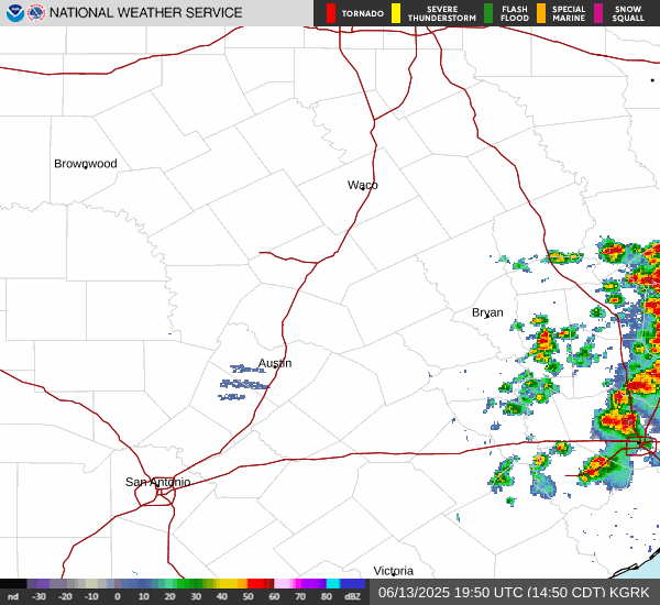
There is an MCS brewing. We'll see if it has legs as it rolls in this general direction.jasons2k wrote: ↑Thu Apr 24, 2025 1:31 pmNWS take:
“Late in the afternoon, we will probably be looking at a band of showers and thunderstorms moving into the area from the north and have incorporated tempos into the CLL, UTS, and CXO`s TAFs for anticipated arrival. Think the primary issue with the band of storms would be heavy downpours MVFR cigs & reduced vis. Stronger segments could have to potential to produce some gusts >30kt.
Think this precip should mainly be breaking up between CXO-IAH between 2 - 4z...but it is springtime and worth monitoring in the metro area.”
-
DoctorMu
- Posts: 8048
- Joined: Sun Jun 28, 2015 11:58 am
- Location: College Station
- Contact:
After Friday, there's ridging in place until April 30/May 1...then more a more active pattern begins.
-
DoctorMu
- Posts: 8048
- Joined: Sun Jun 28, 2015 11:58 am
- Location: College Station
- Contact:
-
DoctorMu
- Posts: 8048
- Joined: Sun Jun 28, 2015 11:58 am
- Location: College Station
- Contact:
We definitely need some rain. If that's what it takes.
Severe Thunderstorm Watch
4/24/2025 15:04 CDT through 4/24/2025 20:00 CDT
Severe Thunderstorm Watch issued April 24 at 3:04PM CDT until April 24 at 8:00PM CDT by NWS Houston/Galveston TX
The National Weather Service has issued Severe Thunderstorm Watch
166 in effect until 8 PM CDT this evening for the following areas
In Texas this watch includes 9 counties
In southeast Texas
Brazos Burleson Grimes
Houston Madison Polk
San Jacinto Trinity Walker
This includes the cities of Bryan, Caldwell, Coldspring,
College Station, Corrigan, Crockett, Groveton, Huntsville,
Livingston, Madisonville, Navasota, Shepherd, Somerville,
and Trinity.
Sender NWS Houston/Galveston TX
Sent 4/24/2025 15:04 CDT
Brazos, TX; Burleson, TX; Grimes, TX; Houston, TX; Madison, TX; Polk, TX; San Jacinto, TX; Trinity, TX; Walker, TX