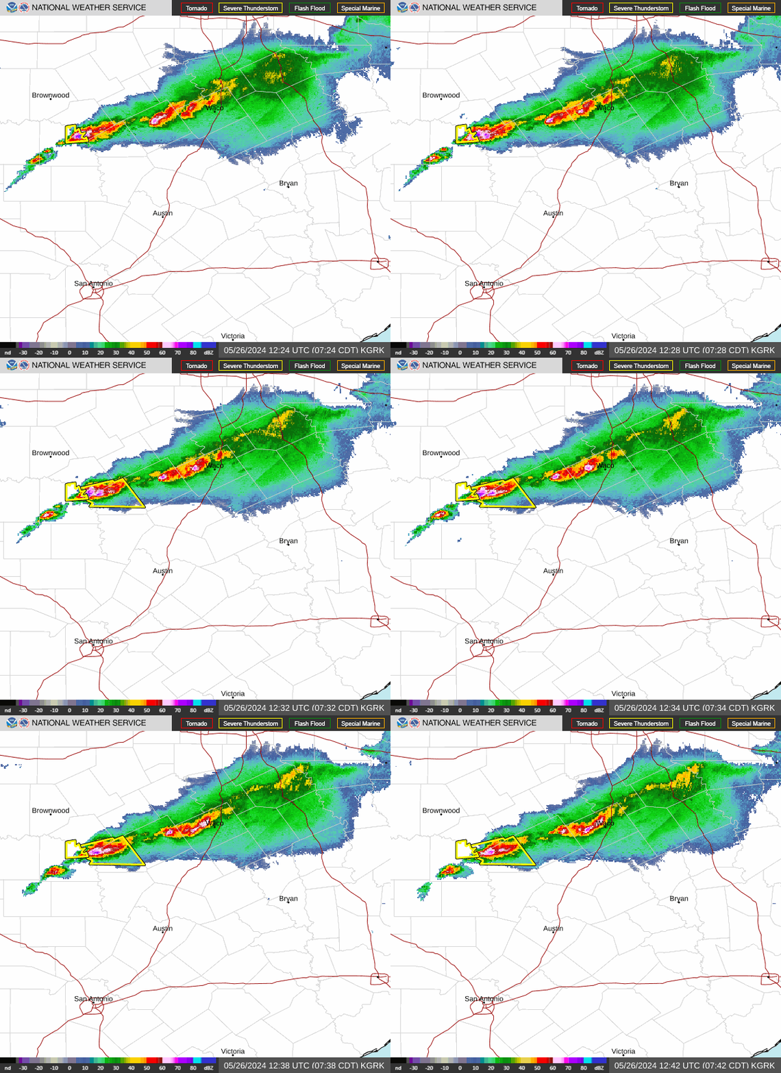
I looked at Doppler radar and see thunderstorms in Central Texas and some firing up over Mexico.
May 2024
The 0Z HRRR shows 3 separate disturbances moving through SE Texas over the next 48 hours. One early tomorrow morning,another one tomorrow evening, and the third on Saturday morning.FWIW
I believe Saturdays rain chance may need to be raised and that’s exactly why I said earlier about I’m not so sure about a dry pattern developing after tomorrow.
10 minutes up the road from our ranch house in Paint Rock. Not my pictures, but we were going out there in a week.


Oh boy, the latest run of the HRRR is looking quite interesting.
Transition zone is the key. CLL is both. The line of demarcation is between Navasota and Hempstead.don wrote: ↑Thu May 02, 2024 5:42 pmCollege Station may be closer to a semi arid climate like Austin and San Antonio than tropical.The weather can be sometimes completely different in the coastal counties compared to up there in the summer.Texas being in a transition zone between climate zones creates a LARGE variation in yearly rainfall over the state.DoctorMu wrote: ↑Thu May 02, 2024 5:14 pm It's feast or famine. 3.83 inches from the latest MCV this morning. That is 10.24 inches of rain for the week!
Welcome to Texas! We'll continue to see a ramping up of extremes in Texas over the coming years. Longer periods of drought in the summer and more flooding rains.
Stratton - you must be thinking of North Carolina, my old stomping grounds. We had no need for a sprinkler system, and watering with a hose was very occasional. There's a nice shower every other day...and then it moves on.
Burlington, NC
Average rain:
June: 4.63 inches
July: 4.39 in
September 4.91 inches
August: 4.12 in
Yearly total: 49.5 inches. Plants, including more acidic loving gardenias thrive.
NC is God's Country.
Texas is Godforsaken Country.
Texas is sandwiched between the GoM, Mexico, Great Plains, Southwest and Louisiana. We're not far enough east to take advantage of more consistent rain from Gulf moisture. Texas in the transition zone, so numerous elements fight it out and we bear load of the Death Ridge in the summer. The dry line battles The Cap, etc.
In the summer in CLL, we're a humid subtropical desert.
Even with "dry" meaning lack of rain in the summers, the DP is usually 70°F+. Occasional mixdowns and desiccation with prolonged droughts. We did have a few years on NW flow in the summer, which were more bearable. We feel the wrath of the Death Ridge nearly every summer and just miss out on sea breezes as they die near Navasota or the wayward summer FROPA which die near Hearne...ergo the "AggieDome."
We'll see.


The MCV near Waco *could* take a right hand turn.


Mesoscale Precipitation Discussion 0212
NWS Weather Prediction Center College Park MD
155 AM EDT Fri May 03 2024
Areas affected...central/eastern Texas
Concerning...Heavy rainfall...Flash flooding possible
Valid 030553Z - 030853Z
Summary...Brief/localized heavy rainfall could lead to a flash
flood risk in areas just east of Waco over the next couple hours.
Discussion...Convection that had formed along a dryline in
west-central Texas earlier this evening has persisted while
growing upscale into a small linear segment that now extends from
near Waco to near Temple along I-35 in central Texas currently.
The storms had been sustained primarily due to upscale growth into
a focused, propagating linear segment along the leading edge of a
mature cold pool. These cells were producing 1-1.5 inch/hr rain
rates (estimated per MRMS), which ordinarily wouldn't be
significant for the region. However, parts of the area downstream
of the convection have experienced 2-5 inches of rain in the past
24 hours (and 5-10 inches over the past 72 hours), with wet local
ground conditions supporting efficient runoff and flash flood
potential.
The cluster is currently outperforming many models in terms of
longevity, and may continue to do so for a couple more hours given
its organization. Weaker instability immediately downstream of
the convection may allow for gradual weakening over time, however,
and a more southward propagation of this cluster into greater
instability may be needed for any further persistence beyond
09-10Z. Given the scenario and doubts about persistence of this
cluster through the night, a relatively short-duration MPD is
being issued, and the convective scenario will be re-evaluated
closer to 08Z.
Cook
ATTN...WFO...EWX...FWD...HGX...SHV...
ATTN...RFC...WGRFC...NWC...
LAT...LON 32049621 31739492 30439514 30419657 30679751
31569745 31869717
-
Stratton20
- Posts: 4295
- Joined: Tue Feb 09, 2021 11:35 pm
- Location: College Station, Texas
- Contact:
Seeing new cell development in areas that desperately do not need anymore rain, concerning, will see if this development moves south over time
- tireman4
- Global Moderator

- Posts: 4534
- Joined: Wed Feb 03, 2010 9:24 pm
- Location: Humble, Texas
- Contact:
The same areas that were affected yesterday are getting rounded now, including mine. Be careful.
- Attachments
-
- KHGX_loop-2.gif (744.46 KiB) Viewed 506 times
-
- image3-1.png (173.7 KiB) Viewed 506 times
-
- hgx.png (12.05 KiB) Viewed 506 times
Obscene how the north side has gotten so much that it's going to flood people out of homes and it's bone dry south of I-10
I like how that outflow boundary is triggering off storms to the SW now. Hopefully some folks south of 10 can get something.
I’ve gotten over 3” since midnight, over 10” for the event.
