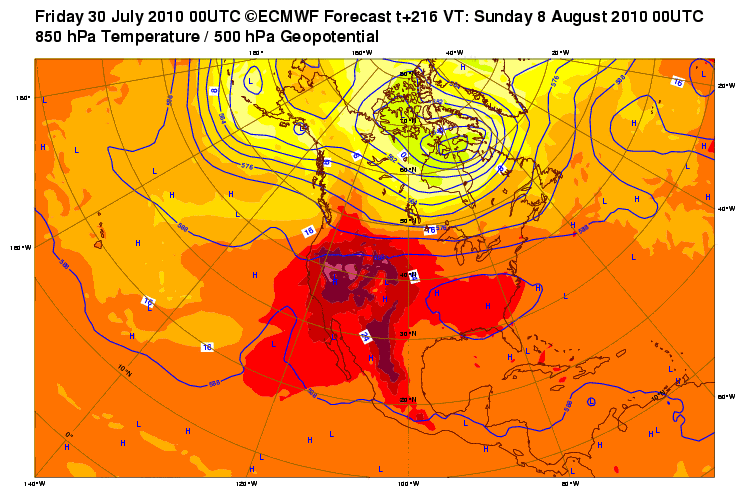
Now that the calendar is turning to August, the weather is right on cue to turn around yet again. The upper ridge that has sat around the SE and brought areas to our east some very hot to record breaking temps while we basked in the wetness that was the rain, has finally decided to retrograde westward and sit over Texas a little bit. A couple of days around 100 are possible for the first few days of the month (especially north), but thanks to afternoon mixing, dewpoints should lower enough (60s) to prevent the heat index from going too crazy.
hot ridge of fire:
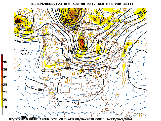
Luckily, I don't think the 100 degree heat will last too long. The GFS, its ensembles, and the Euro all agree on weakening the ridge a bit and sliding it a ways north of the region. This should allow for temperatures to fall back to a more normal summertime heat with some rain chances returning to the area by the end of next week thanks to the Gulf opening back up a bit.
A few days of 100 degree heat at this point of the season is certainly nothing unusual. Hopefully models are correct and this hot and dry pattern is only temporary!
Also of note, and probably for the hurricane forum, if the long range Euro solution is correct with upper level pattern after the first week of August, upper ridge may slide back to its position over the SE, opening a possible path for any possible tropical entity to head this way (or Mexico)... This may also really increase rain chances again. This, of course, is just speculation at this point.
Happy August!