
Friday morning briefing from Jeff:
Bands of heavy rainfall are progressing inland across the mid and upper TX coast this morning in association with the disorganized area of low pressure over the extreme western Gulf of Mexico.
Generally rainbands have been moving on the order of 15-20mph which has limited overall rates to 1-2 inches along the coast with lesser amounts north of I-10. There was some minor street flooding earlier this morning in portions of Galveston County, but nothing more significant than that thus far.
Expect the greatest rainfall today to be focused along and SW of a line from College Station to Houston to High Islands where moisture is highest and this area will also feature the most likely location for any sustained banding trends. Overall rainfall amounts of 1-3 inches will be possible with isolated totals up to 5 inches. Since early September has been extremely wet (Galveston has recorded 16.47 inches making it the 4th September on record) the grounds along the coast are saturated and additional rainfall will lead to run-off and potentially some flooding…hence a flash flood watch is in effect until noon today generally along and SE of US 59.
Tropical wave over the western Gulf will move inland and WNW toward SW TX on Saturday while high pressure attempts to build toward the area from the NE and the far western influences of Florence begin to help draw drier air into the region. Can’t rule out a few banding features before midday on Saturday especially around Matagorda Bay, but think the weather will begin to transition back toward a more typical summer pattern of scattered afternoon showers and thunderstorms that diminish by late afternoon and early evening. This pattern will continue into next week.
Isaac:
There really is not much left of this feature over the eastern Caribbean this morning. Upper level wind shear has taken a heavy toll on the system with the surface center having been void of deep convection for most of yesterday. The surface center is spinning down without thunderstorms to help maintain the vorticity and it is very possible that the tropical depression is no longer a closed low and has opened into a tropical wave. The depression continues to move toward the west in the deep steering flow of the easterly trade winds and this motion will continue which will bring Isaac to the western Caribbean Sea by early next week. Some global models have shown Isaac attempting to redevelop and turning NW toward the Gulf of Mexico next week…but the more reliable GFS and ECMWF latest runs show little to no development and maintain Isaac as a tropical wave.
Something to keep an eye on at this time, but nothing to be overly concerned about.
SEPTEMBER 2018 - Very Wet Month Wrap Up
-
srainhoutx

- Site Admin

- Posts: 19700
- Joined: Tue Feb 02, 2010 2:32 pm
- Location: Maggie Valley, NC
- Contact:
- Attachments
-
Carla/Alicia/Jerry(In The Eye)/Michelle/Charley/Ivan/Dennis/Katrina/Rita/Wilma/Humberto/Ike/Harvey
Member: National Weather Association
Facebook.com/Weather Infinity
Twitter @WeatherInfinity
Member: National Weather Association
Facebook.com/Weather Infinity
Twitter @WeatherInfinity
-
MontgomeryCoWx

- Posts: 2750
- Joined: Wed Dec 14, 2011 4:31 pm
- Location: Weimar, TX
- Contact:
The rain can stop now. I get 7 Saturdays in the fall to host people at the tailgate. It's putting a damper on this Saturday.
Give me some NW flow and Sunshine from Wednesday to Saturday every week.
Give me some NW flow and Sunshine from Wednesday to Saturday every week.
Team #NeverSummer
-
DoctorMu

- Posts: 8048
- Joined: Sun Jun 28, 2015 11:58 am
- Location: College Station
- Contact:
Where's that 10 year drought pattern when you need it?!MontgomeryCoWx wrote:The rain can stop now. I get 7 Saturdays in the fall to host people at the tailgate. It's putting a damper on this Saturday.
Give me some NW flow and Sunshine from Wednesday to Saturday every week.
(I guess the long-term drought is officially over?)
-
don

- Posts: 3148
- Joined: Wed Feb 03, 2010 3:33 pm
- Location: Wichita Falls
- Contact:
Looks like the system is trying to become a depression before landfall, it probably won't be classified though due to lack of a windfield and proximity to land. We really need to watch the radar today to make sure training doesn't set up...
-
Texaspirate11

- Posts: 1278
- Joined: Tue Dec 31, 2013 12:24 am
- Contact:
7.4 inches of rain since Monday
Just because you're disabled, you don't have to be a victim
Be Weather Aware & Prepared!
Barbara Jordan Winner in Media
Disability Integration Consultant
Be Weather Aware & Prepared!
Barbara Jordan Winner in Media
Disability Integration Consultant
-
don
- Posts: 3148
- Joined: Wed Feb 03, 2010 3:33 pm
- Location: Wichita Falls
- Contact:

Mesoscale Precipitation Discussion 0835
NWS Weather Prediction Center College Park MD
929 AM EDT Fri Sep 14 2018
Areas affected...TX Coast & Vicinity
Concerning...Heavy rainfall...Flash flooding possible
Valid 141328Z - 141858Z
Summary...A tropical disturbance is poised to make its TX
landfall. Hourly rain totals to 2" with local amounts to 4" are
expected over the next several hours.
Discussion...Radar imagery and polar orbiting satellite estimates
show a broad area of rain with embedded showers and thunderstorms
which should soon make a TX landfall. This is in association with
a tropical disturbance that the National Hurricane Center has been
monitoring for some time. Precipitable water values are 2.3-2.6"
per recent GPS data, exceedingly high for any time of the year.
Inflow at 850 hPa is cyclonic at 25-30 knots per VAD wind
profiles, which combined with surface observations indicate a low
level center/1008 hPa low pressure system somewhat east-southeast
of Rockport TX. There is no CIN per SPC mesoanalyses due to the
high degree of moisture. ML CAPE values of 1000-2500 J/kg lurk
near and just offshore the coast.
The expectation is for this low/inverted trough to move ashore in
2-3 hours, which should lead to and increase in rain rates/totals
from there on out, as instability from the warm Gulf of Mexico is
ushered in within the wake of the tropical disturbance. The
mesoscale guidance is not unified in its messaging, though
seemingly low in convective coverage, showing a scattershot signal
for local amounts in the 3-4" range through 19z. Hourly rain
totals to 2" are expected, though cell mergers and long enough
bouts of training could exceed this number. The expectation is
that the rainfall would lead to an instability gradient remaining
near the coast during the MPD period as skies are cloudy farther
inland. Considering the wet conditions across the region during
the past couple weeks depressing flash flood guidance, heavy rain
issues are expected, particularly within urban areas.
-
srainhoutx
- Site Admin
- Posts: 19700
- Joined: Tue Feb 02, 2010 2:32 pm
- Location: Maggie Valley, NC
- Contact:
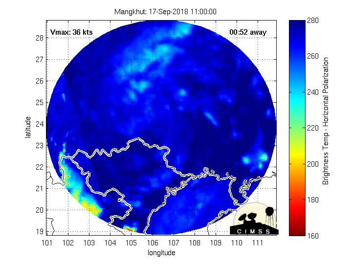
For those that follow one of our own members Hurricane Josh or iCyclone, Josh is about to feel the wrath of Super Typhoon Mangkhut at the Northern tip of Luzon.
Josh MorgermanVerified account @iCyclone · 43m43 minutes ago
12 midnight. Road blocked by wreckage, had to turn around. Final location: Pattao Market in Buguey (blue dot). I feel good about this location—splits difference between N & S solutions. Too dangerous to be out any longer. CHASE OVER. Come what may. Super #Typhoon #MANGKHUT
Carla/Alicia/Jerry(In The Eye)/Michelle/Charley/Ivan/Dennis/Katrina/Rita/Wilma/Humberto/Ike/Harvey
Member: National Weather Association
Facebook.com/Weather Infinity
Twitter @WeatherInfinity
Member: National Weather Association
Facebook.com/Weather Infinity
Twitter @WeatherInfinity
-
mcheer23
- Global Moderator

- Posts: 606
- Joined: Fri Jan 11, 2013 11:15 am
- Location: Missouri City/ Sugar Land
- Contact:
GFS and CMC want to bring a cold front through here ..next weekend.
-
Texaspirate11
- Posts: 1278
- Joined: Tue Dec 31, 2013 12:24 am
- Contact:
Bring itmcheer23 wrote:GFS and CMC want to bring a cold front through here ..next weekend.
Just because you're disabled, you don't have to be a victim
Be Weather Aware & Prepared!
Barbara Jordan Winner in Media
Disability Integration Consultant
Be Weather Aware & Prepared!
Barbara Jordan Winner in Media
Disability Integration Consultant
-
tireman4

- Global Moderator
- Posts: 7140
- Joined: Wed Feb 03, 2010 9:24 pm
- Location: Humble, Texas
- Contact:
Some of our members are Euro only....LOL..So until the Euro shows it...
-
tireman4
- Global Moderator
- Posts: 7140
- Joined: Wed Feb 03, 2010 9:24 pm
- Location: Humble, Texas
- Contact:
Rain Since September 1
-
javakah
- Posts: 142
- Joined: Thu Jun 02, 2016 9:20 pm
- Location: Fulshear
- Contact:
Kind of neat- it looks like the center of Florence is going directly over the KLTX radar site at the moment.
-
mcheer23
- Global Moderator
- Posts: 606
- Joined: Fri Jan 11, 2013 11:15 am
- Location: Missouri City/ Sugar Land
- Contact:
EURO is showing a little hint...tireman4 wrote:Some of our members are Euro only....LOL..So until the Euro shows it...
-
Cpv17
- Posts: 7094
- Joined: Fri Aug 31, 2018 1:58 pm
- Location: El Campo/Wharton
- Contact:
It looks like we’ll remain in an active wet pattern for the next couple weeks.


-
srainhoutx
- Site Admin
- Posts: 19700
- Joined: Tue Feb 02, 2010 2:32 pm
- Location: Maggie Valley, NC
- Contact:
The "coldest air" remains up across Central Canada and then eventually push East and SE into the NE United States. Perhaps some 'cooler and drier' air with a light NW flow aloft, but we are still a couple or three weeks away from our climatological favored time of the first legit Fall front. The time for summer weather is quickly fading away... 
Prognostic Discussion for Week 3-4 Temperature and Experimental Precipitation Outlooks
NWS Climate Prediction Center College Park MD
300PM EDT Fri Sep 14 2018
Week 3-4 Forecast Discussion Valid Sat Sep 29 2018-Fri Oct 12 2018
The doldrums of the forecasting season continue in terms of predictability for the mid-latitudes at the subseasonal scale. ENSO neutral conditions persist in the equatorial Pacific, while the Madden-Julian Oscillation index appears weak due to competing signals of the low frequency in the Pacific and a Kelvin wave over the Americas. The mid-latitude circulation pattern in recent weeks has been fairly persistent and amplified for the time of year, with anomalous ridging over Alaska and a downstream trough over the Yukon, but there are signs of this pattern starting to break down during the next two weeks. Dynamical model guidance for Week 3-4, the evolving extended range pattern, and long-term trends are the primary guidance used to inform the present Week 3-4 outlook. Among dynamical models used in the present outlook, the ECMWF is favored given its transition from Week-2 being the least drastic.
Model guidance overall shows low amplitude anomalies, typical of the relaxed vorticity gradients during late boreal summer. The CFS breaks down the ridge over Alaska by Week-2, in disagreement with the entire CPC model suite utilized during the extended range period, with negative height anomalies across the state during both Week-3 and Week-4. The ECMWF and JMA maintain this feature, as do most of the Subseasonal Experiment (SubX) models. The resulting downstream impacts are felt in the CFS, with amplified ridging along the Canadian border for Weeks 3-4, while the ECMWF appears to have a better handle with anomalous troughing extending from the Canadian prairies through Hudson Bay. The JMA model favors generally positive height anomalies across the CONUS, potentially tied to the model overplaying decadal trends. Both the ECMWF and JMA maintain anomalous ridging off the Eastern Seaboard in Week 3-4, along with much of the SubX guidance.
The favored pattern in line with the ECMWF solution would support a mean frontal zone extending from the Midwest through New England, with surface high pressure over much of the West and along the eastern seaboard. Given that pattern, the ECMWF anticipates substantial chances of below-normal temperatures from the Northern Plains through the Northeast, which may be overdone given the difficulties observed in recent weeks for cold air built up over Canada to push south into the CONUS. Similarly, the positive height anomalies from the JMA and discounted CFS are at odds with potential cold along the northern tier, resulting in a forecast of equal chances in the outlook. More consistency exists among forecasts for above-normal temperatures over the West and Southeast, given the positive height anomalies favored for these regions. Above-normal temperatures are also favored in Alaska, with southerly flow anticipated for much of the mainland, while well above-normal sea-surface temperatures (SSTs) in the Bering Sea may help to offset anomalous northerly flow across the Aleutians. Model guidance is consistent in indicating an increase in below-normal temperature chances across portions of the Southern Plains, tied to either increased precipitation or the mean front being east of the region, depending on the model.
Forecast ridging across the West Coast supports increased chances of anomalously dry conditions for many areas from the Plains westward. The exception to this is across Arizona, where above-median precipitation odds are increased due to model signals of a surge of moisture into the state from the Gulf of California associated with tropical cyclone activity off of the Baja Peninsula. The enhanced subtropical ridge forecast by model guidance also leads to increased above-median rainfall chances for much of the East, tied to amplified transport of moisture from the Gulf of Mexico, as has been observed in recent weeks. This area was extended slightly westward from what models indicated due to the forecast weakness in the model height fields across the central CONUS, suggesting any potential tropical cyclone activity could be focused towards the western or central Gulf of Mexico coastline. With anomalous ridging favored over the Western CONUS, the storm track appears likely to shift northward into southern Alaska, yielding increased odds of above-median precipitation for portions of the Aleutians, Kenai Peninsula vicinity, and Alaska Panhandle.
Persistent positive SST anomalies continue to surround Hawaii, supporting increased chances of above-normal temperatures and precipitation across the island chain. Dynamical model guidance is similarly unanimous in the increased chances of above-normal temperatures and above-median rainfall for the island chain.
Carla/Alicia/Jerry(In The Eye)/Michelle/Charley/Ivan/Dennis/Katrina/Rita/Wilma/Humberto/Ike/Harvey
Member: National Weather Association
Facebook.com/Weather Infinity
Twitter @WeatherInfinity
Member: National Weather Association
Facebook.com/Weather Infinity
Twitter @WeatherInfinity
-
Texaspirate11
- Posts: 1278
- Joined: Tue Dec 31, 2013 12:24 am
- Contact:
Damn Skippy...LOLtireman4 wrote:Some of our members are Euro only....LOL..So until the Euro shows it...
So happy the SUN has peaked out for a bit
Total of 8 inches of rain & I'm over it.
Just because you're disabled, you don't have to be a victim
Be Weather Aware & Prepared!
Barbara Jordan Winner in Media
Disability Integration Consultant
Be Weather Aware & Prepared!
Barbara Jordan Winner in Media
Disability Integration Consultant
-
CrashTestDummy
- Posts: 203
- Joined: Mon Jul 25, 2016 3:44 pm
- Location: Pearland, Texas
- Contact:
Almost 6” here in Northern Brazoria county. Our ‘water dog’ standard poodle has been LOVING it.
Gene Beaird,
Pearland, Texas
"You can learn a lot from a Dummy."
Pearland, Texas
"You can learn a lot from a Dummy."
-
Cromagnum
- Posts: 3065
- Joined: Thu Feb 03, 2011 10:42 pm
- Location: Georgetown
- Contact:
Looks like Isaac is dead. Any thoughts on whether his ghost springs to life once it gets out of the Caribbean?
-
Texaspirate11
- Posts: 1278
- Joined: Tue Dec 31, 2013 12:24 am
- Contact:
Never say never...it could pop up in the GOM....some models are sniffingCromagnum wrote:Looks like Isaac is dead. Any thoughts on whether his ghost springs to life once it gets out of the Caribbean?
Just because you're disabled, you don't have to be a victim
Be Weather Aware & Prepared!
Barbara Jordan Winner in Media
Disability Integration Consultant
Be Weather Aware & Prepared!
Barbara Jordan Winner in Media
Disability Integration Consultant
-
Cpv17
- Posts: 7094
- Joined: Fri Aug 31, 2018 1:58 pm
- Location: El Campo/Wharton
- Contact:
Here in Wharton we’ve received 12” in the past 18 days.