
I believe you live in the hottest spot in southeast TX sir. 88° here with a feels like of 95°. DP is 71°.
May 2021:
-
Cpv17
- Posts: 7091
- Joined: Fri Aug 31, 2018 1:58 pm
- Location: El Campo/Wharton
- Contact:
-
JDsGN
- Posts: 174
- Joined: Tue May 23, 2017 10:25 pm
- Location: Cypress TX
- Contact:
Its pretty dang hot out. 91 here in Katy at my work with a feels like of 98*
-
Iceresistance
- Posts: 580
- Joined: Fri Apr 30, 2021 11:48 pm
- Location: Tecumseh, OK/Norman, OK
- Contact:
A very mean line of storms has blown up & is impacting DFW . . .
-
Iceresistance
- Posts: 580
- Joined: Fri Apr 30, 2021 11:48 pm
- Location: Tecumseh, OK/Norman, OK
- Contact:
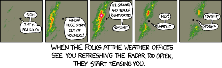
Well, that's not the case for me 80% of the time!unome wrote: ↑Mon May 10, 2021 12:32 pmreminded me of one of my fav xkcd https://xkcd.com/831/djmike wrote: ↑Mon May 10, 2021 7:39 am Grrr. Why is everything staying north? This is so frustrating. Have not seen a drop so far for May in Beaumont so far. Seems like Beaumont southward just doesn’t get storms anymore this time of year, like our highway of storms we always got 5-10 years ago has shifted northward. Always forecasting 60-90% for us then when the system enters our area, poof.
And btw, is there a comic on when the storms/snow rates EXPLODE over you?
-
Cpv17
- Posts: 7091
- Joined: Fri Aug 31, 2018 1:58 pm
- Location: El Campo/Wharton
- Contact:
This is a very wet signal for an ensemble:

-
don

- Posts: 3148
- Joined: Wed Feb 03, 2010 3:33 pm
- Location: Wichita Falls
- Contact:
The EURO looks very wet starting this weekend and through next week, we'll see.
- Attachments
-
-
txbear
- Posts: 249
- Joined: Wed Oct 31, 2018 12:54 pm
- Contact:
In other news this morning, brief, very small tornado touchdown up in Huntsville yesterday. I wasn't even aware that the far north of the area was getting rain yesterday amidst the stifling humidity.
https://www.khou.com/article/weather/to ... 9c31f12a1a
https://www.khou.com/article/weather/to ... 9c31f12a1a
-
Iceresistance
- Posts: 580
- Joined: Fri Apr 30, 2021 11:48 pm
- Location: Tecumseh, OK/Norman, OK
- Contact:
4 Inch hail has been reported in Ponder, TX Last Night . . .
-
jasons2k

- Posts: 6192
- Joined: Thu Feb 04, 2010 12:54 pm
- Location: Imperial Oaks
- Contact:
Lots of action close to home.
Anyone else notice all the convection moving into the Bay of Campeche?
Anyone else notice all the convection moving into the Bay of Campeche?
-
Iceresistance
- Posts: 580
- Joined: Fri Apr 30, 2021 11:48 pm
- Location: Tecumseh, OK/Norman, OK
- Contact:
-
Cromagnum
- Posts: 3065
- Joined: Thu Feb 03, 2011 10:42 pm
- Location: Georgetown
- Contact:
-
don
- Posts: 3148
- Joined: Wed Feb 03, 2010 3:33 pm
- Location: Wichita Falls
- Contact:
Rights now the NWS has a 60% chance of rain Saturday night and a 70% on Sunday, but exact timing and how much rain coverage we get this weekend is still questionable.We'll need to see a few more model runs over the next few days to see if the wet trend continues.
-
Cpv17
- Posts: 7091
- Joined: Fri Aug 31, 2018 1:58 pm
- Location: El Campo/Wharton
- Contact:
Tomorrow doesn’t look like much per the latest mesoscale models. Probably because it has the storm coming through in the morning and it has the line weakening as it pushes through the area. If it were to come through a few hours earlier or during the evening hours when there’s more instability in the atmosphere then we’d probably be looking at some good rains.
-
DoctorMu

- Posts: 8016
- Joined: Sun Jun 28, 2015 11:58 am
- Location: College Station
- Contact:
The atmosphere looks more stable today. Massive bust so far, and now on the wrong side of the front in CLL. Potential for a line coming through late this afternoon. The models are faring poorly up until now.
The stuff in the Bay of Campeche is not headed this way. Just a bit too early.
The stuff in the Bay of Campeche is not headed this way. Just a bit too early.
-
Iceresistance
- Posts: 580
- Joined: Fri Apr 30, 2021 11:48 pm
- Location: Tecumseh, OK/Norman, OK
- Contact:
And it's gone . . .DoctorMu wrote: ↑Tue May 11, 2021 11:12 am The atmosphere looks more stable today. Massive bust so far, and now on the wrong side of the front in CLL. Potential for a line coming through late this afternoon. The models are faring poorly up until now.
The stuff in the Bay of Campeche is not headed this way. Just a bit too early.
-
don
- Posts: 3148
- Joined: Wed Feb 03, 2010 3:33 pm
- Location: Wichita Falls
- Contact:
The EURO is showing some really high rainfall totals this weekend,definitely something to watch over the next few days.
- Attachments
-
-
jasons2k
- Posts: 6192
- Joined: Thu Feb 04, 2010 12:54 pm
- Location: Imperial Oaks
- Contact:
Getting busy...
- Attachments
-
-
DoctorMu
- Posts: 8016
- Joined: Sun Jun 28, 2015 11:58 am
- Location: College Station
- Contact:
Tornado Warning - east of Madisonville.:
https://twitter.com/chrisnunley/status/ ... 78209?s=20
Message: NOAA-NWS-ALERTS-TX1261A0570724.TornadoWarning.1261A0571DCCTX.HGXTORHGX.55aa1c0ba11dd7e0a8abc9018442df78 from w-nws.webmaster@noaa.gov
Sent: 13:57 CDT on 05-11-2021
Effective: 13:57 CDT on 05-11-2021
Expires: 14:15 CDT on 05-11-2021
Event: Tornado Warning
Alert:
The National Weather Service in League City has issued a
* Tornado Warning for...
Southwestern Houston County in southeastern Texas...
Northeastern Madison County in southeastern Texas...
North central Walker County in southeastern Texas...
* Until 215 PM CDT.
* At 157 PM CDT, a severe thunderstorm capable of producing a tornado
was located 13 miles south of Austonio, moving northeast at 15 mph.
HAZARD...Tornado and quarter size hail.
SOURCE...Radar indicated rotation.
IMPACT...Flying debris will be dangerous to those caught without
shelter. Mobile homes will be damaged or destroyed.
Damage to roofs, windows, and vehicles will occur. Tree
damage is likely.
* This tornadic thunderstorm will remain over mainly rural areas of
southwestern Houston, northeastern Madison and north central Walker
Counties.
TORNADO...RADAR INDICATED
HAIL...1.00IN
-
jasons2k
- Posts: 6192
- Joined: Thu Feb 04, 2010 12:54 pm
- Location: Imperial Oaks
- Contact:
URGENT - IMMEDIATE BROADCAST REQUESTED
Severe Thunderstorm Watch Number 164
NWS Storm Prediction Center Norman OK
305 PM CDT Tue May 11 2021
The NWS Storm Prediction Center has issued a
* Severe Thunderstorm Watch for portions of
Parts of east central and southeast Texas
* Effective this Tuesday afternoon and evening from 305 PM until
900 PM CDT.
* Primary threats include...
Scattered large hail and isolated very large hail events to 2
inches in diameter possible
Scattered damaging wind gusts to 70 mph possible
A tornado or two possible
SUMMARY...Isolated supercells along a surface front may persist for another couple of hours, prior to outflow from central Texas
convection overtaking the front and leading to additional storm
development and intensification. An brief tornado or two may occur in the short term, but large hail and damaging winds will be the main threats through the afternoon/evening as storm coverage increases.
The severe thunderstorm watch area is approximately along and 55 statute miles east and west of a line from 45 miles north northwest of Lufkin TX to 35 miles southeast of College Station TX. For a complete depiction of the watch see the associated watch outline update (WOUS64 KWNS WOU4).
- Attachments
-
-
DoctorMu
- Posts: 8016
- Joined: Sun Jun 28, 2015 11:58 am
- Location: College Station
- Contact:
That should read 35 miles southWEST of College Station. Pretty nice wall cloud to the west. Light rain here.