
why?Ed Mahmoud wrote:New improved parallel GFS says 97L dies over Florida. Seems quite possible...
Tropical Depression Bonnie forms 5:15 PM 7/22/2010
-
Mr. T

- Posts: 992
- Joined: Wed Feb 03, 2010 4:22 pm
- Location: Kingwood
- Contact:
-
Scott747
- Posts: 1648
- Joined: Tue Feb 23, 2010 9:56 am
- Location: Freeport/Surfside Beach
- Contact:
0z HWRF -
Initializes it where the 2pm TWO suggested the llc may be forming about the eastern tip of Hispaniola. Takes a much more pronounced westward heading once entering the Gulf through 84 hrs. Light on intensity with this run.
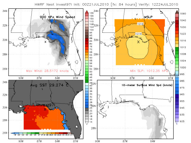
Initializes it where the 2pm TWO suggested the llc may be forming about the eastern tip of Hispaniola. Takes a much more pronounced westward heading once entering the Gulf through 84 hrs. Light on intensity with this run.
-
Mr. T
- Posts: 992
- Joined: Wed Feb 03, 2010 4:22 pm
- Location: Kingwood
- Contact:
0z CMC = Texas bound
looks like a Corpus hit
looks like a Corpus hit
-
Scott747
- Posts: 1648
- Joined: Tue Feb 23, 2010 9:56 am
- Location: Freeport/Surfside Beach
- Contact:
I tell you one thing. The overall energy sure hasn't moved much in the last 24 hrs.
-
Mr. T
- Posts: 992
- Joined: Wed Feb 03, 2010 4:22 pm
- Location: Kingwood
- Contact:
Gotta love the HWRF
It's somehow going to be near 26N by tommorow morning
It's somehow going to be near 26N by tommorow morning
-
Scott747
- Posts: 1648
- Joined: Tue Feb 23, 2010 9:56 am
- Location: Freeport/Surfside Beach
- Contact:
The timing seems to be off on all the models though. Euro was way to fast with it.Mr. T wrote:Gotta love the HWRF
It's somehow going to be near 26N by tommorow morning
I'm pretty much resigned to the fact that the HWRF/GFDL are going to be somewhat worthless until whatever possible changes may occur once the the parallel goes operational.
-
Mr. T
- Posts: 992
- Joined: Wed Feb 03, 2010 4:22 pm
- Location: Kingwood
- Contact:

Chugs on westward to Corpus right after this
-
Mr. T
- Posts: 992
- Joined: Wed Feb 03, 2010 4:22 pm
- Location: Kingwood
- Contact:
We've seen their uselessness already this year.Scott747 wrote:I'm pretty much resigned to the fact that the HWRF/GFDL are going to be somewhat worthless until whatever possible changes may occur once the the parallel goes operational.
With the Canadian shifting westward to Texas, it'll be nice if the storm actually shows up well on the Euro so we can see what it really thinks...
-
Paul

- Posts: 535
- Joined: Wed Feb 03, 2010 11:46 pm
- Location: Pearland
- Contact:
EURO up in a few......CMC falls in line with its last run....both see something in the GOM in 96hrs that weakens this to a 1009MB low....not much to look at....maybe dry air..I have to agree with the HWRF and GFDL...pointless gidance IMO.... Maybe for entertainment purposes...
-
Mr. T
- Posts: 992
- Joined: Wed Feb 03, 2010 4:22 pm
- Location: Kingwood
- Contact:
0z Euro takes a very weak surface reflection to the Texas coast by day 5, like the last run
0z UKMET very similar
The CMC, Euro, and UKMET all show a Texas hit, while the GFS and its counterpart GFDL and HWRF are way east outliers
sound famaliar?
One thing is for sure though, all of these models do not show that great of an environment in the Gulf once 97L enters...
0z UKMET very similar
The CMC, Euro, and UKMET all show a Texas hit, while the GFS and its counterpart GFDL and HWRF are way east outliers
sound famaliar?
One thing is for sure though, all of these models do not show that great of an environment in the Gulf once 97L enters...
-
desiredwxgd

- Posts: 125
- Joined: Wed Feb 03, 2010 6:30 pm
- Location: TX/LA/Southern New England
- Contact:
So what are your thoughts “T”? Tropical Storm at minimum I think. I do think the models have “future Bonnie” to far to the east. Not too sure if I buy into a Texas hit, just yet that is.Mr. T wrote:0z Euro takes a very weak surface reflection to the Texas coast by day 5, like the last run
0z UKMET very similar
The CMC, Euro, and UKMET all show a Texas hit, while the GFS and its counterpart GFDL and HWRF are way east outliers
sound famaliar?
One thing is for sure though, all of these models do not show that great of an environment in the Gulf once 97L enters...
JMS
SR. ENSC.
SR. ENSC.
-
Mr. T
- Posts: 992
- Joined: Wed Feb 03, 2010 4:22 pm
- Location: Kingwood
- Contact:
My thoughts are pretty much unchanged from earlier. The strong SE ridge that has been in place throughout the summer will again flex its muscles and push future Bonnie westward, threatning locations from LA westward...desiredwxgd wrote:
So what are your thoughts “T”? Tropical Storm at minimum I think. I do think the models have “future Bonnie” to far to the east. Not too sure if I buy into a Texas hit, just yet that is.
Tonight's Euro defnitely increases confidence a bit

With such a monster ridge across the SE, any model trying to turn this storm east of LA is full of bad granola. That trough you see about to traverse the Great Lakes will have little effect, if the Euro is to be believed.
-
biggerbyte
- Posts: 1437
- Joined: Thu Feb 04, 2010 12:15 am
- Location: Porter, Texas. (Montgomery County)
- Contact:
Agreed!
T. the man...
Dwayne
T. the man...
Dwayne
-
desiredwxgd
- Posts: 125
- Joined: Wed Feb 03, 2010 6:30 pm
- Location: TX/LA/Southern New England
- Contact:
Thanks T
JMS
SR. ENSC.
SR. ENSC.
-
desiredwxgd
- Posts: 125
- Joined: Wed Feb 03, 2010 6:30 pm
- Location: TX/LA/Southern New England
- Contact:
So having yet again one of those sleepless nights (many in the last few days) I was going through different news studios websites (meteorology department) and came across KBMT Channel 12 (Beaumont). Here’s a snippet from an online article about 97L……” It appears, at this point, that this will be a Texas storm, however better data is expected to give a clearer picture tomorrow [Wednesday].” Rather presumptive? Jumping the gun at this point? Any thoughts?
JMS
SR. ENSC.
SR. ENSC.
-
srainhoutx

- Site Admin

- Posts: 19700
- Joined: Tue Feb 02, 2010 2:32 pm
- Location: Maggie Valley, NC
- Contact:
TROPICAL WEATHER OUTLOOK
NWS TPC/NATIONAL HURRICANE CENTER MIAMI FL
800 AM EDT WED JUL 21 2010
FOR THE NORTH ATLANTIC...CARIBBEAN SEA AND THE GULF OF MEXICO...
EARLY MORNING SATELLITE IMAGES INDICATE THAT THE SHOWER ACTIVITY
ASSOCIATED WITH THE TROPICAL WAVE MOVING ACROSS HISPANIOLA HAS
BECOME LESS ORGANIZED. CONSEQUENTLY...THE AIR FORCE RECONNAISSANCE
MISSION HAS BEEN POSTPONED UNTIL TOMORROW. A TROPICAL DEPRESSION
IS NOT EXPECTED TO FORM TODAY BUT ENVIRONMENTAL CONDITIONS ARE
STILL FAVORABLE FOR SOME DEVELOPMENT AS THE SYSTEM MOVES TOWARD THE
WEST-NORTHWEST AT ABOUT 10 MPH AWAY FROM HISPANIOLA INTO THE
BAHAMAS ON THURSDAY. THERE IS A HIGH CHANCE...60 PERCENT...OF THIS
SYSTEM BECOMING A TROPICAL CYCLONE DURING THE NEXT 48 HOURS.
REGARDLESS OF DEVELOPMENT...LOCALLY HEAVY RAINS AND GUSTY WINDS
WILL CONTINUE TO AFFECT THE VIRGIN ISLANDS...PUERTO RICO AND
HISPANIOLA TODAY AND WILL LIKELY SPREAD OVER THE TURKS AND CAICOS
ISLANDS...AND THE BAHAMAS DURING THE NEXT COUPLE OF DAYS. THE HEAVY
RAINS COULD CAUSE LIFE-THREATENING FLASH FLOODS AND MUD SLIDES IN
MOUNTAINOUS AREAS.
ELSEWHERE...TROPICAL CYCLONE FORMATION IS NOT EXPECTED DURING THE
NEXT 48 HOURS.
$$
FORECASTER AVILA
Carla/Alicia/Jerry(In The Eye)/Michelle/Charley/Ivan/Dennis/Katrina/Rita/Wilma/Humberto/Ike/Harvey
Member: National Weather Association
Facebook.com/Weather Infinity
Twitter @WeatherInfinity
Member: National Weather Association
Facebook.com/Weather Infinity
Twitter @WeatherInfinity
-
srainhoutx
- Site Admin
- Posts: 19700
- Joined: Tue Feb 02, 2010 2:32 pm
- Location: Maggie Valley, NC
- Contact:
Keep an eye to the W of the convection N of Hispaniola. The wave axis is moving and some 'lower level rotation' is evident on the early VIS Imagery. The system may be further W than models suggested.
Carla/Alicia/Jerry(In The Eye)/Michelle/Charley/Ivan/Dennis/Katrina/Rita/Wilma/Humberto/Ike/Harvey
Member: National Weather Association
Facebook.com/Weather Infinity
Twitter @WeatherInfinity
Member: National Weather Association
Facebook.com/Weather Infinity
Twitter @WeatherInfinity
-
wxman57

- Global Moderator

- Posts: 2621
- Joined: Thu Feb 04, 2010 5:34 am
- Location: Southwest Houston (Westbury)
- Contact:
That's Friday evening, though. Note the trof digging down the central U.S. on the map. The Euro weakens the ridge and moves the center to the East U.S. Coast on Saturday, opening up the mid Gulf Coast. I am not very concerned about this system in Texas, assuming it develops.Mr. T wrote:My thoughts are pretty much unchanged from earlier. The strong SE ridge that has been in place throughout the summer will again flex its muscles and push future Bonnie westward, threatning locations from LA westward...desiredwxgd wrote:
So what are your thoughts “T”? Tropical Storm at minimum I think. I do think the models have “future Bonnie” to far to the east. Not too sure if I buy into a Texas hit, just yet that is.
Tonight's Euro defnitely increases confidence a bit
http://i144.photobucket.com/albums/r199 ... 065710.gif
With such a monster ridge across the SE, any model trying to turn this storm east of LA is full of bad granola. That trough you see about to traverse the Great Lakes will have little effect, if the Euro is to be believed.
Just noticed 12Z models shifted eastward again, barely taking it into the NE Gulf now. Seems a bit too far east.
-
srainhoutx
- Site Admin
- Posts: 19700
- Joined: Tue Feb 02, 2010 2:32 pm
- Location: Maggie Valley, NC
- Contact:
It will be nice to have an actual center point for future model output. The spin near 20/70 is looking better by the frame. I suspect this disturbance will appear much better (development wise) 24 hours from now.wxman57 wrote: Just noticed 12Z models shifted eastward again, barely taking it into the NE Gulf now. Seems a bit too far east.
Code: Select all
TROPICAL CYCLONE GUIDANCE MESSAGE
NWS TPC/NATIONAL HURRICANE CENTER MIAMI FL
1223 UTC WED JUL 21 2010

DISCLAIMER...NUMERICAL MODELS ARE SUBJECT TO LARGE ERRORS.
PLEASE REFER TO NHC OFFICIAL FORECASTS FOR TROPICAL CYCLONE
AND SUBTROPICAL CYCLONE INFORMATION.

ATLANTIC OBJECTIVE AIDS FOR

DISTURBANCE INVEST (AL972010) 20100721 1200 UTC

...00 HRS... ...12 HRS... ...24 HRS. .. ...36 HRS...
100721 1200 100722 0000 100722 1200 100723 0000

LAT LON LAT LON LAT LON LAT LON
BAMS 20.0N 70.0W 20.9N 72.5W 21.8N 75.0W 22.8N 76.9W
BAMD 20.0N 70.0W 21.0N 72.0W 22.2N 74.2W 23.4N 76.7W
BAMM 20.0N 70.0W 21.0N 72.2W 22.0N 74.3W 23.2N 76.4W
LBAR 20.0N 70.0W 20.8N 72.1W 22.0N 74.4W 23.1N 76.7W
SHIP 30KTS 34KTS 39KTS 44KTS
DSHP 30KTS 34KTS 39KTS 44KTS

...48 HRS... ...72 HRS... ...96 HRS. .. ..120 HRS...
100723 1200 100724 1200 100725 1200 100726 1200

LAT LON LAT LON LAT LON LAT LON
BAMS 23.9N 78.8W 26.0N 82.7W 27.5N 86.7W 28.4N 90.3W
BAMD 24.6N 79.4W 27.0N 85.3W 29.3N 89.8W 30.2N 92.5W
BAMM 24.4N 78.6W 26.2N 83.1W 27.5N 87.2W 28.2N 90.5W
LBAR 24.4N 79.1W 27.0N 83.8W 29.6N 86.9W 32.7N 87.8W
SHIP 49KTS 54KTS 58KTS 62KTS
DSHP 49KTS 49KTS 54KTS 57KTS

...INITIAL CONDITIONS...
LATCUR = 20.0N LONCUR = 70.0W DIRCUR = 280DEG SPDCUR = 9KT
LATM12 = 19.8N LONM12 = 68.2W DIRM12 = 281DEG SPDM12 = 8KT
LATM24 = 19.4N LONM24 = 66.6W
WNDCUR = 30KT RMAXWD = 60NM WNDM12 = 30KT
CENPRS = 1013MB OUTPRS = 1016MB OUTRAD = 175NM SDEPTH = M
RD34NE = 0NM RD34SE = 0NM RD34SW = 0NM RD34NW = 0NM 
Carla/Alicia/Jerry(In The Eye)/Michelle/Charley/Ivan/Dennis/Katrina/Rita/Wilma/Humberto/Ike/Harvey
Member: National Weather Association
Facebook.com/Weather Infinity
Twitter @WeatherInfinity
Member: National Weather Association
Facebook.com/Weather Infinity
Twitter @WeatherInfinity
-
srainhoutx
- Site Admin
- Posts: 19700
- Joined: Tue Feb 02, 2010 2:32 pm
- Location: Maggie Valley, NC
- Contact:
HPC thoughts this morning...
THE PRESSURES STARTED WITH A BLEND OF THE 00Z CANADIAN/06Z GFS
PARALLEL...BEFORE SWITCHING TO A 06Z GFS PARALLEL/00Z ECMWF
ENSEMBLE MEAN COMPROMISE AFTER MONDAY MORNING WHICH MAINTAINS
REASONABLE CONTINUITY. MINOR ADJUSTMENTS WERE THEN MADE TO
ENHANCE DEFINITION... AND TO YIELD A COMPROMISE FCST BETWEEN
FARTHER NORTHEASTWARD CONTINUITY VERSUS THE MAJORITY OF LATEST
ENSEMBLE AND DETERMINISTIC GLOBAL GUIDANCE WITH THE TROPICAL
DISTURBANCE FORECAST TO MOVE THROUGH THE GULF OF MEXICO EARLY IN
THE PERIOD. A PERSISTENTLY STRONG SOUTHEASTERN RIDGE ALOFT ALONG
WITH VERIFICATION OF RECENT FEATURES FORECAST OVER THE GULF OF
MEXICO DO NOT APPEAR TO SUPPORT THE RECURVATURE SCENARIO INTO THE
CENTRAL/EASTERN GULF COAST FAVORED BY POINTS MENTIONED ON THE 16Z
NHC/MEDIUM RANGE COORDINATION CALL YESTERDAY...HENCE THE SOUTHWEST
ADJUSTMENT. A PERSISTENT LACK OF ECMWF ENSEMBLE SUPPORT FOR THIS
SYSTEM CALLS INTO QUESTION HOW STRONG OF A FEATURE WILL ACTUALLY
MATERIALIZE IN THE GULF OF MEXICO FROM THIS DISTURBANCE.
Carla/Alicia/Jerry(In The Eye)/Michelle/Charley/Ivan/Dennis/Katrina/Rita/Wilma/Humberto/Ike/Harvey
Member: National Weather Association
Facebook.com/Weather Infinity
Twitter @WeatherInfinity
Member: National Weather Association
Facebook.com/Weather Infinity
Twitter @WeatherInfinity