
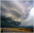
That westward bend is beginning...
My cousin lives in SPI and they have closed the causeway = they can't leave if they have to.
Hurricane Alex. 40 Miles NNE of La Pesca. 100 MPH/948MB
-
Rip76

- Posts: 2126
- Joined: Mon Feb 15, 2010 12:38 am
- Location: The Woodlands
- Contact:
-
srainhoutx

- Site Admin

- Posts: 19700
- Joined: Tue Feb 02, 2010 2:32 pm
- Location: Maggie Valley, NC
- Contact:
000
WTNT31 KNHC 301447
TCPAT1
BULLETIN
HURRICANE ALEX ADVISORY NUMBER 20
NWS TPC/NATIONAL HURRICANE CENTER MIAMI FL AL012010
1000 AM CDT WED JUN 30 2010
...ALEX HAS NOT STRENGTHENED YET...BUT FORECAST TO DO SO TODAY...
SUMMARY OF 1000 AM CDT...1500 UTC...INFORMATION
-----------------------------------------------
LOCATION...23.8N 95.5W
ABOUT 145 MI...235 KM E OF LA PESCA MEXICO
ABOUT 190 MI...310 KM SE OF BROWNSVILLE TEXAS
MAXIMUM SUSTAINED WINDS...80 MPH...130 KM/HR
PRESENT MOVEMENT...NW OR 320 DEGREES AT 7 MPH...11 KM/HR
MINIMUM CENTRAL PRESSURE...961 MB...28.38 INCHES
Carla/Alicia/Jerry(In The Eye)/Michelle/Charley/Ivan/Dennis/Katrina/Rita/Wilma/Humberto/Ike/Harvey
Member: National Weather Association
Facebook.com/Weather Infinity
Twitter @WeatherInfinity
Member: National Weather Association
Facebook.com/Weather Infinity
Twitter @WeatherInfinity
-
Snowman
- Posts: 191
- Joined: Sun Jun 27, 2010 11:25 pm
- Location: Mountain View, CA
- Contact:
im not sure if you look at the radar on wunderground.com you can see the eye pretty well and it looks like a clear northwest movement but that is to my amateur, untrained eye
-
srainhoutx
- Site Admin
- Posts: 19700
- Joined: Tue Feb 02, 2010 2:32 pm
- Location: Maggie Valley, NC
- Contact:
000
WTNT41 KNHC 301448
TCDAT1
HURRICANE ALEX DISCUSSION NUMBER 20
NWS TPC/NATIONAL HURRICANE CENTER MIAMI FL AL012010
1000 AM CDT WED JUN 30 2010
SATELLITE PRESENTATION HAS IMPROVED THIS MORNING WITH T-NUMBERS FROM
TAFB AND SAB REACHING 5.0 AND 5.5 ON THE DVORAK SCALE AND THE
MINIMUM PRESSURE HAS BEEN OSCILLATING BETWEEN 958 MB AND 961 MB.
HOWEVER...BOTH FLIGHT LEVEL WINDS AND SFMR DATA SUPPORT AN
INITIAL INTENSITY OF ONLY 70 KNOTS AT THIS TIME. LATEST
RECONNAISSANCE DATA SHOW THAT THERE ARE TWO WIND MAXIMA ON THE
NORTHEAST QUADRANT OF THE HURRICANE AND WINDS ARE SPREAD OUT IN
OTHER QUADRANTS. GIVEN SUCH A LOW MINIMUM PRESSURE...THE CURRENT
SATELLITE PRESENTATION AND A FAVORABLE ENVIRONMENT FOR
INTENSIFICATION...THE WINDS SHOULD INCREASE TODAY AND ALEX COULD
REACH CATEGORY TWO BEFORE LANDFALL.
FIXES FROM THE AIRCRAFT INDICATE THAT ALEX IS MOVING TOWARD THE
NORTHWEST OR 320 DEGREES AT 6 KNOTS. THE CURRENT WEAKNESS IN
THE SUBTROPICAL RIDGE TO THE NORTH OF THE CYCLONE SHOULD BE
REPLACED BY A RIDGE SOON. THIS FLOW PATTERN SHOULD FORCE ALEX
ON A MORE WESTWARD TRACK LATER TODAY AS INDICATED IN THE OFFICIAL
FORECAST. IN FACT...MOST OF THE DYNAMICAL GUIDANCE FORECAST A SHARP
TURN TO THE WEST OR EVEN SOUTH OF DUE WEST DEPENDING UPON THE
FORECAST STRENGTH OF THE RIDGE IN EACH MODEL. THIS TRACK SHOULD
BRING THE CORE OF THE HURRICANE TO THE COAST WITHIN THE WARNING
AREA LATE TONIGHT OR EARLY THURSDAY. HOWEVER...ALEX IS A LARGE
HURRICANE WITH TROPICAL STORM FORCE WINDS EXTENDING A GREAT
DISTANCE FROM THE CENTER. RADAR DATA SHOW THAT STRONG SQUALLS AND
GUSTY WINDS ARE ALREADY NEARING THE SOUTH TEXAS AND NORTHERN MEXICO
COASTS.
FORECAST POSITIONS AND MAX WINDS
INITIAL 30/1500Z 23.8N 95.5W 70 KT
12HR VT 01/0000Z 24.1N 96.7W 85 KT
24HR VT 01/1200Z 24.5N 98.5W 45 KT...INLAND
36HR VT 02/0000Z 24.5N 101.0W 25 KT...INLAND
48HR VT 02/1200Z...DISSIPATED
$$
FORECASTER AVILA
Carla/Alicia/Jerry(In The Eye)/Michelle/Charley/Ivan/Dennis/Katrina/Rita/Wilma/Humberto/Ike/Harvey
Member: National Weather Association
Facebook.com/Weather Infinity
Twitter @WeatherInfinity
Member: National Weather Association
Facebook.com/Weather Infinity
Twitter @WeatherInfinity
-
ronyan
- Posts: 214
- Joined: Tue Jun 29, 2010 7:23 pm
- Location: Clute, TX
- Contact:
I don't see evidence of that on the satellite. It still appears to be moving NW.Rip76 wrote:That westward bend is beginning...
My cousin lives in SPI and they have closed the causeway = they can't leave if they have to.

-
srainhoutx
- Site Admin
- Posts: 19700
- Joined: Tue Feb 02, 2010 2:32 pm
- Location: Maggie Valley, NC
- Contact:
Carla/Alicia/Jerry(In The Eye)/Michelle/Charley/Ivan/Dennis/Katrina/Rita/Wilma/Humberto/Ike/Harvey
Member: National Weather Association
Facebook.com/Weather Infinity
Twitter @WeatherInfinity
Member: National Weather Association
Facebook.com/Weather Infinity
Twitter @WeatherInfinity
-
djjordan

- Posts: 929
- Joined: Fri Feb 05, 2010 7:19 pm
- Location: Montgomery, Texas
- Contact:
I have to chuckle at the term "Within the Hurricane Warning area" in this update and disco.
~~~When Thunder Roars Go Indoors~~~
~~~Turn Around Don't Drown~~~
~~~Run From The Water, Hide From The Wind~~~
~~~Turn Around Don't Drown~~~
~~~Run From The Water, Hide From The Wind~~~
-
ronyan
- Posts: 214
- Joined: Tue Jun 29, 2010 7:23 pm
- Location: Clute, TX
- Contact:
I have a feeling that Alex might try to open up his eye again pretty soon.
-
Bluefalcon
- Posts: 129
- Joined: Fri Jun 25, 2010 6:14 pm
- Location: Round Rock, TX
- Contact:
Conditions from South Padre Island: 1.06 inches of rain, wind east at 43 mph, with gusts to 55 mph. via weather bug reporting station. All webcams I could find are down.
Put the wet stuff on the red stuff!
-
Rip76
- Posts: 2126
- Joined: Mon Feb 15, 2010 12:38 am
- Location: The Woodlands
- Contact:
Only one I could find.
http://www.instacam.com/showcam.asp?id=STHPD&size=S
Everything you wanted to know about Alex, and more.
http://www.crownweather.com/?page_id=1184
http://www.instacam.com/showcam.asp?id=STHPD&size=S
Everything you wanted to know about Alex, and more.
http://www.crownweather.com/?page_id=1184
-
ticka1
- Posts: 1265
- Joined: Wed Feb 03, 2010 3:02 pm
- Location: Baytown/Mont Belvieu
- Contact:
-
updraft
- Posts: 37
- Joined: Wed Feb 03, 2010 3:11 pm
- Location: Pearland - Hwy 288/518 - SCR
- Contact:
>>>>>>>>>>>>>>>>>>>>>>>>>>>>>>>>>>>>>>>>>>>>>>>>>>>>>>>>>>>>>>>>>>>>>>>>>>>>biggerbyte wrote:Well, with my exit from this forum, I must say that this has been one of the most difficult storms to predict. The models were all over the place for days, as were conditions that would manipulate him. In the end, we have come full circle to the first suggested landing. Alex had many opportunities to go elsewhere, one being S.E. Texas at one point or another. Thank God that did not happen.
He will be inland soon. Many will get lots of rain, some way too much. So we wait for the next one. I've tried hard to help folks stay in one piece over the years, but I don't feel a part of anything here anymore. I'll be lurking now and again, but there will be no posts during the remainder of this hurricane season.
Best of luck to everyone...
BB
BB, I hope you get this while in "lurking-stealth" mode:
It's very unfortunate how quickly an exchange of words between "weather-enthusiasts" can turn sour. Last I checked, the First Amendment of the Constitution hasn't been repealed or thrown out (yet). You did not post anything remotely "against the rules" or unethical.
It's very easy for all of us weather-enthusiasts to become passionate during a significant event. Sometimes that passion can come across in very pointed opinions and it's easy to get caught-up in the moment. In reading these forum posts, it's always great to see varying opinions, and I for one, appreciate BB's reminders to "don't always get caught up in the models." To me this is always great sound advice and reminds everyone to use the tools to build the best possible forecast, but remember there's always uncertainty with the weather and especially tropical systems.
I truly hope that you continue to offer your balancing opinions and views on this board because I for one, appreciate them.
>>>>>>>>>>>>>>>>>>>>>>>>>>>>>>>>>>>>>>>>>>>>>>>>>>>>>>>>>>>>>>>>>>>>>>>>>>>
"Weather forecast for tonight: dark. Continued dark overnight, with widely scattered light by morning." - The late/great George Carlin
-
Hardcoreweather
SEVERE WEATHER STATEMENT
NATIONAL WEATHER SERVICE BROWNSVILLE TX
1022 AM CDT WED JUN 30 2010
TXC061-301545-
/O.CON.KBRO.TO.W.0007.000000T0000Z-100630T1545Z/
CAMERON-
1022 AM CDT WED JUN 30 2010
...A TORNADO WARNING REMAINS IN EFFECT UNTIL 1045 AM CDT FOR
SOUTHEASTERN CAMERON COUNTY...
AT 1021 AM CDT NATIONAL WEATHER SERVICE DOPPLER RADAR INDICATED A
TORNADO 9 MILES WEST OF PORT ISABEL...MOVING SOUTHWEST AT 50 MPH.
THE TORNADO WILL BE NEAR...
DEL MAR HEIGHTS.
BROWNSVILLE.
RANCHO VIEJO.
IN ADDITION TO THE TORNADO...WIND GUSTS NEAR 60 MPH WILL ALSO BE
POSSIBLE.
-
updraft
- Posts: 37
- Joined: Wed Feb 03, 2010 3:11 pm
- Location: Pearland - Hwy 288/518 - SCR
- Contact:
Bob Hall Pier in Corpus: Wind and wave forecast from Surfline's LOLA model:
"Weather forecast for tonight: dark. Continued dark overnight, with widely scattered light by morning." - The late/great George Carlin
-
wxdata

- Site Admin
- Posts: 1059
- Joined: Wed Feb 03, 2010 3:04 pm
- Location: Houston, TX
- Contact:
As to be expected, Tornado Watch for deep South Texas until 8pm.
-
sau27
- Posts: 415
- Joined: Sat Apr 24, 2010 12:04 am
- Location: Bellaire
- Contact:
I think I'm going to call my shot, hit right at Brownsville.
Eye one long range radar
Eye one long range radar
- Attachments
-
- alex eye 6-30.png (63.29 KiB) Viewed 7978 times
-
srainhoutx
- Site Admin
- Posts: 19700
- Joined: Tue Feb 02, 2010 2:32 pm
- Location: Maggie Valley, NC
- Contact:
NW motion is becoming worrisome for Matamoros/Brownsville area.
Carla/Alicia/Jerry(In The Eye)/Michelle/Charley/Ivan/Dennis/Katrina/Rita/Wilma/Humberto/Ike/Harvey
Member: National Weather Association
Facebook.com/Weather Infinity
Twitter @WeatherInfinity
Member: National Weather Association
Facebook.com/Weather Infinity
Twitter @WeatherInfinity
-
ticka1
- Posts: 1265
- Joined: Wed Feb 03, 2010 3:02 pm
- Location: Baytown/Mont Belvieu
- Contact:
And points north because that will put them closer to the dirty side of the storm. Another Dolly making landfall in Texas perhaps?srainhoutx wrote:NW motion is becoming worrisome for Matamoros/Brownsville area.
-
Hardcoreweather
OFF THE SPOTTER NET:
NEAR BRETON SOUND (west of venice)
Quote:
Wind 2010-06-30 15:38:00 UTC
Crewboat reporting
winds of 50 knots on the water.
NEAR BRETON SOUND (west of venice)
Quote:
Wind 2010-06-30 15:38:00 UTC
Crewboat reporting
winds of 50 knots on the water.