
Possible center. Waiting for vortex message...and then going to bed!
02:54:30Z 19.233N 91.217W 924.8 mb
(~ 27.31 inHg) 608 meters
(~ 1,995 feet) 991.0 mb
(~ 29.26 inHg)
Hurricane Alex. 40 Miles NNE of La Pesca. 100 MPH/948MB
-
srainhoutx

- Site Admin

- Posts: 19700
- Joined: Tue Feb 02, 2010 2:32 pm
- Location: Maggie Valley, NC
- Contact:
Carla/Alicia/Jerry(In The Eye)/Michelle/Charley/Ivan/Dennis/Katrina/Rita/Wilma/Humberto/Ike/Harvey
Member: National Weather Association
Facebook.com/Weather Infinity
Twitter @WeatherInfinity
Member: National Weather Association
Facebook.com/Weather Infinity
Twitter @WeatherInfinity
-
Ptarmigan

- Statistical Specialist

- Posts: 4521
- Joined: Wed Feb 03, 2010 7:20 pm
- Contact:
I wonder why they did not issue a tropical storm warning for Yucatan Peninsula since tropical storm force winds could be felt there.
-
texoz
- Posts: 291
- Joined: Tue Mar 02, 2010 8:01 am
- Contact:
I've been impressed with the size of this system. For storm that took a long time to form, and has yet to reach hurricane status, it has an enormous footprint. However, the latest sat images look like it's getting squeezed a bit from the NW.
-
srainhoutx
- Site Admin
- Posts: 19700
- Joined: Tue Feb 02, 2010 2:32 pm
- Location: Maggie Valley, NC
- Contact:
texoz wrote:I've been impressed with the size of this system. For storm that took a long time to form, and has yet to reach hurricane status, it has an enormous footprint. However, the latest sat images look like it's getting squeezed a bit from the NW.
Carla/Alicia/Jerry(In The Eye)/Michelle/Charley/Ivan/Dennis/Katrina/Rita/Wilma/Humberto/Ike/Harvey
Member: National Weather Association
Facebook.com/Weather Infinity
Twitter @WeatherInfinity
Member: National Weather Association
Facebook.com/Weather Infinity
Twitter @WeatherInfinity
-
Mr. T

- Posts: 992
- Joined: Wed Feb 03, 2010 4:22 pm
- Location: Kingwood
- Contact:
The 0z GFS through 78 is at the same position as the 18z run. No changes to the track so far...
-
wxdata

- Site Admin
- Posts: 1059
- Joined: Wed Feb 03, 2010 3:04 pm
- Location: Houston, TX
- Contact:
That's a forecast model they run locally. Channel 11 calls theirs "Super Microcast." Both forecasts come from raw data right off the NAM. When Ike was heading our way, the NAM kept forecasting a hit near Matagorda Bay, so we never could air the forecast. If you believe in the NAM's forecast, then you'll buy right into channel 13's forecast..txsnowmaker wrote:I sure hope Ed is right on landfall being far from Houston. Did anyone catch Ch. 13's on-air met a few minutes ago? He said their futurecast is showing a more northerly movement toward the Upper Texas coast. He also intimated that he would not be surprised to see the NHC cone move further north at the 4am udpdate.

-
Mr. T
- Posts: 992
- Joined: Wed Feb 03, 2010 4:22 pm
- Location: Kingwood
- Contact:
The parallel GFS shifted south and shows a landfall south of Brownsville
OP GFS looks the same, Upper Texas Coast hit
OP GFS looks the same, Upper Texas Coast hit
-
redfish1
- Posts: 73
- Joined: Sat Jun 19, 2010 9:44 am
- Location: port arthur, tx
- Contact:
when is the next model run coming out?
-
Andrew
- Site Admin
- Posts: 3508
- Joined: Wed Feb 03, 2010 9:46 pm
- Location: North-West Houston
- Contact:
Mr. T wrote:The parallel GFS shifted south and shows a landfall south of Brownsville
OP GFS looks the same, Upper Texas Coast hit
Thing is it still has the trof digging hard

For Your Infinite Source For All Things Weather Visit Our Facebook
-
srainhoutx
- Site Admin
- Posts: 19700
- Joined: Tue Feb 02, 2010 2:32 pm
- Location: Maggie Valley, NC
- Contact:
Models will run until around 2 ish...(AM)redfish1 wrote:when is the next model run coming out?
Carla/Alicia/Jerry(In The Eye)/Michelle/Charley/Ivan/Dennis/Katrina/Rita/Wilma/Humberto/Ike/Harvey
Member: National Weather Association
Facebook.com/Weather Infinity
Twitter @WeatherInfinity
Member: National Weather Association
Facebook.com/Weather Infinity
Twitter @WeatherInfinity
-
Snowman
- Posts: 191
- Joined: Sun Jun 27, 2010 11:25 pm
- Location: Mountain View, CA
- Contact:
this storm looks to have stalled out. i dont believe any model predicted that. would this give more time for the trough to dig and make a northerly track more likely?
-
txsnowmaker
- Posts: 733
- Joined: Wed Feb 03, 2010 4:07 pm
- Location: SW Houston (Galleria area)
- Contact:
wxdata wrote:That's a forecast model they run locally. Channel 11 calls theirs "Super Microcast." Both forecasts come from raw data right off the NAM. When Ike was heading our way, the NAM kept forecasting a hit near Matagorda Bay, so we never could air the forecast. If you believe in the NAM's forecast, then you'll buy right into channel 13's forecast..txsnowmaker wrote:I sure hope Ed is right on landfall being far from Houston. Did anyone catch Ch. 13's on-air met a few minutes ago? He said their futurecast is showing a more northerly movement toward the Upper Texas coast. He also intimated that he would not be surprised to see the NHC cone move further north at the 4am udpdate.
Thanks wxdata. I didn't realize these were mirror spit-outs of the NAM. Based on what has been said about the NAM in the past regarding events more than a day or so away, I definitely have reservations about putting a lot of credibility into that one at this point in time.
-
Andrew
- Site Admin
- Posts: 3508
- Joined: Wed Feb 03, 2010 9:46 pm
- Location: North-West Houston
- Contact:
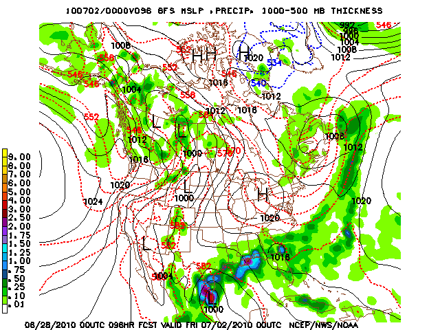
hmm parallel GFS sends it back out to sea:

Also Tyler you know it is too early to say who is the winner and is almost foolish. I believe that a Texas strike is very well possible and what if the Euro shifts north tonight what then? I think it is a flip at this point.
Also Tyler you know it is too early to say who is the winner and is almost foolish. I believe that a Texas strike is very well possible and what if the Euro shifts north tonight what then? I think it is a flip at this point.
For Your Infinite Source For All Things Weather Visit Our Facebook
-
srainhoutx
- Site Admin
- Posts: 19700
- Joined: Tue Feb 02, 2010 2:32 pm
- Location: Maggie Valley, NC
- Contact:
Welcome. That is the big question. NHC has stated they expected Alex to be a slow mover.Snowman wrote:this storm looks to have stalled out. i dont believe any model predicted that. would this give more time for the trough to dig and make a northerly track more likely?
Carla/Alicia/Jerry(In The Eye)/Michelle/Charley/Ivan/Dennis/Katrina/Rita/Wilma/Humberto/Ike/Harvey
Member: National Weather Association
Facebook.com/Weather Infinity
Twitter @WeatherInfinity
Member: National Weather Association
Facebook.com/Weather Infinity
Twitter @WeatherInfinity
-
srainhoutx
- Site Admin
- Posts: 19700
- Joined: Tue Feb 02, 2010 2:32 pm
- Location: Maggie Valley, NC
- Contact:
Good night folks. Tomorrow is another day.  Have fun night crew...
Carla/Alicia/Jerry(In The Eye)/Michelle/Charley/Ivan/Dennis/Katrina/Rita/Wilma/Humberto/Ike/Harvey
Member: National Weather Association
Facebook.com/Weather Infinity
Twitter @WeatherInfinity
Member: National Weather Association
Facebook.com/Weather Infinity
Twitter @WeatherInfinity
-
Mr. T
- Posts: 992
- Joined: Wed Feb 03, 2010 4:22 pm
- Location: Kingwood
- Contact:
Check the 850 vorticity. The main low has moved well inland by that point. That is just leftover low pressure in the GulfAndrew wrote:hmm parallel GFS sends it back out to sea:
I'm not saying that we should completely let our guard down, but the evidence is really against the GFS at this point... With its own parallel run flipping to the Euro's thinking, I wouldn't expect the Euro to shift much tonight. Interestingly, the 12z Euro shifted a little south of the 0z Euro landfall point.Also Tyler you know it is too early to say who is the winner and is almost foolish. I believe that a Texas strike is very well possible and what if the Euro shifts north tonight what then? I think it is a flip at this point.
Indeed, there is stil the remote chance of there being enough of a weakness across Texas to pull this north.
Last edited by Mr. T on Sun Jun 27, 2010 11:42 pm, edited 1 time in total.
-
Scott747
- Posts: 1648
- Joined: Tue Feb 23, 2010 9:56 am
- Location: Freeport/Surfside Beach
- Contact:
The parallel GFS is further S on this run. Doesn't take it back out into the Gulf as it dissipates over Mexico.
-
Stormrider
- Posts: 109
- Joined: Wed Feb 03, 2010 11:50 pm
- Contact:
G'night srain.Catch you in the AM 