September 2016 - Cool & Drier To End Month
- Katdaddy
- Global Moderator

- Posts: 2521
- Joined: Thu Feb 04, 2010 8:18 am
- Location: League City, Tx
- Contact:
Fall 2016 arrives at 9:21AM CDT this morning. The small low over the NW GOM is approaching the Middle TX Coast currently. A wind gust to 55MPH was reported at one of the elevated platforms this morning. Increasing moisture through the rest of the week and weekend. The potential remains for our first real cold front early next week.
- srainhoutx
- Site Admin

- Posts: 19700
- Joined: Tue Feb 02, 2010 2:32 pm
- Location: Maggie Valley, NC
- Contact:
Complicated and complex forecast challenge ahead, particularly as we get to the weekend and next week. The overnight global guidance are suggesting a very potent storm system organizing in the Desert SW as a deepening Western longwave trough stretches from Mexico to Canada.

The fly in the ointment is the possibility of a Coastal low organizing next week as the developing upper low meanders NE toward the Plains and a strong frontal boundary stalls near the Texas Coast. The morning quantitative precipitation forecast continues to increase suggesting the possibility of a heavy rainfall potential with rainfall totals of 2 to 4 inches across our Region with isolated higher amounts possible, depending on the actual development of a Coastal Low. Will need to monitor the future trends the next several days rather closely. Expect day to day changes as we get a bit closer to this significant pattern change. Stay tuned!

The fly in the ointment is the possibility of a Coastal low organizing next week as the developing upper low meanders NE toward the Plains and a strong frontal boundary stalls near the Texas Coast. The morning quantitative precipitation forecast continues to increase suggesting the possibility of a heavy rainfall potential with rainfall totals of 2 to 4 inches across our Region with isolated higher amounts possible, depending on the actual development of a Coastal Low. Will need to monitor the future trends the next several days rather closely. Expect day to day changes as we get a bit closer to this significant pattern change. Stay tuned!
Carla/Alicia/Jerry(In The Eye)/Michelle/Charley/Ivan/Dennis/Katrina/Rita/Wilma/Humberto/Ike/Harvey
Member: National Weather Association
Facebook.com/Weather Infinity
Twitter @WeatherInfinity
Member: National Weather Association
Facebook.com/Weather Infinity
Twitter @WeatherInfinity
-
unome
- Posts: 3062
- Joined: Fri Feb 12, 2010 6:11 pm
5-day total looks less ominous, but still plenty of precip, most from days 4-5 for us
http://www.wpc.ncep.noaa.gov/discussion ... isc=pmdepd


http://www.wpc.ncep.noaa.gov/discussion ... isc=pmdepd


-
BlueJay
- Posts: 938
- Joined: Tue Mar 04, 2014 10:47 am
- Location: Alden Bridge-The Woodlands, Texas
- Contact:
Hmmm. I wonder if I should wait for the rain or go ahead and water the lawn just a bit.
Maybe I'll water a bit.
Maybe I'll water a bit.
- jasons2k
- Posts: 6161
- Joined: Thu Feb 04, 2010 12:54 pm
- Location: Imperial Oaks
- Contact:
Looks like a split with us caught in the middle to me...any wagers the coastal low robs us?
-
Ounce
- Posts: 470
- Joined: Sat Apr 17, 2010 10:18 pm
- Location: Houston
- Contact:
With your luck, you'll be in the donut hole.jasons wrote:Looks like a split with us caught in the middle to me...any wagers the coastal low robs us?
-
unome
- Posts: 3062
- Joined: Fri Feb 12, 2010 6:11 pm
from WPC's Extended Forecast Discussion this AM - looks like I water the lawn today...
...central/southern plains...
as the aforementioned cold front pushes out into the plains... the tail end of the cold front will slow down while crossing through central and eastern tx. this will be facilitated by the separation of shortwave energy from the ejecting upper trough lifting out through the northern plains. this shortwave energy will develop into a relatively broad mid level low over the southern high plains while interacting with the frontal zone. the guidance though shows some rather significant differences with the evolution of this mid level center. most of the models show a gradual retrogression of the energy to southwest and then the west underneath a building mid level ridge to the north. they also allow the cold front to more progressively to the south and east through the period. the ecmwf in particular shows less retrogression of the energy and a slower evolution of the surface front. the cmc also tends to show less retrogression. the gfs/ukmet and nam through along with the gefs mean also suggest the energy retrograding farther west and eventually becoming more removed from the front. the preference for now is to lean generally away from the ecmwf and toward the gfs. in any case... there will a period of very heavy rainfall potential as the front settles across the central and especially southern plains. the main focus of the heavy rainfall is expected to be down across central and southwest tx... and essentially from the tx hill country down to the tx big bend area. a substantial amount of tropical moisture will be pooling northwest across this region... with pwats increasing to near or above 2 inches given a persistent low level fetch from the western gulf of mexico... and also a mid and high level fetch from the eastern tropical pacific. this dual fetch of moisture is likely to result in some very heavy rains given the transport into the frontal zone and coupled with divergent flow aloft around the eastern flank of the aforementioned mid level low center. the expectation is for as much as 3 to 5 inches of rain to fall sun and sun night across parts of central and southwest tx... with lesser amounts farther north along the front. locally heavier amounts will be expected... and given the set-up... a moderate risk of excessive rains will be highlighted in the day 3 excessive rainfall outlook.
and graphics from http://www.wpc.ncep.noaa.gov/qpf/excess_rain.shtml
day 1
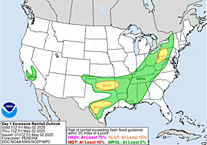
day 2
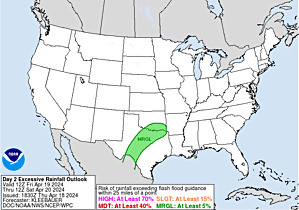
day 3
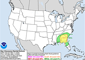
...central/southern plains...
as the aforementioned cold front pushes out into the plains... the tail end of the cold front will slow down while crossing through central and eastern tx. this will be facilitated by the separation of shortwave energy from the ejecting upper trough lifting out through the northern plains. this shortwave energy will develop into a relatively broad mid level low over the southern high plains while interacting with the frontal zone. the guidance though shows some rather significant differences with the evolution of this mid level center. most of the models show a gradual retrogression of the energy to southwest and then the west underneath a building mid level ridge to the north. they also allow the cold front to more progressively to the south and east through the period. the ecmwf in particular shows less retrogression of the energy and a slower evolution of the surface front. the cmc also tends to show less retrogression. the gfs/ukmet and nam through along with the gefs mean also suggest the energy retrograding farther west and eventually becoming more removed from the front. the preference for now is to lean generally away from the ecmwf and toward the gfs. in any case... there will a period of very heavy rainfall potential as the front settles across the central and especially southern plains. the main focus of the heavy rainfall is expected to be down across central and southwest tx... and essentially from the tx hill country down to the tx big bend area. a substantial amount of tropical moisture will be pooling northwest across this region... with pwats increasing to near or above 2 inches given a persistent low level fetch from the western gulf of mexico... and also a mid and high level fetch from the eastern tropical pacific. this dual fetch of moisture is likely to result in some very heavy rains given the transport into the frontal zone and coupled with divergent flow aloft around the eastern flank of the aforementioned mid level low center. the expectation is for as much as 3 to 5 inches of rain to fall sun and sun night across parts of central and southwest tx... with lesser amounts farther north along the front. locally heavier amounts will be expected... and given the set-up... a moderate risk of excessive rains will be highlighted in the day 3 excessive rainfall outlook.
and graphics from http://www.wpc.ncep.noaa.gov/qpf/excess_rain.shtml
day 1

day 2

day 3

-
unome
- Posts: 3062
- Joined: Fri Feb 12, 2010 6:11 pm
but the local discussion gives me hope ?
Area Forecast Discussion
National Weather Service Houston/Galveston TX
451 AM CDT Fri Sep 23 2016
.DISCUSSION...
Mid-upper level ridging over the northern areas this morning with moist low level flow from the Gulf across the southwestern area and on into the Hill Country. Showers becoming more numerous over the Gulf waters and expanding into the coastal counties up to around I-10. The low level flow will drag in greater moisture today and by mid morning expect scattered showers and isolated thunderstorms to have spread well inland. Rich plume of low level moisture from the central Gulf will flow into the region in advance of longwave trough that will be advancing southeastward today and Saturday before stalling. This keeps the moist environment in place with strongest moisture advection focused more toward the Hill Country/Central TX area. By late Sunday the trough should be cutting off and drifting southwest... this may spare SETX from the threat of very heavy rain but still not out of the woods on heavy rain Sunday/Monday. PW 1-8-2.1" with respectable instability but relatively light forcing today through Saturday then only slightly more favorable forcing followed by a cold front (timing is certainly in question on the front... will it reach the area Monday as upper low sags southwest - or will it stall just northwest of the area) Monday or Tuesday. Models have been having a great deal of trouble with the trough's evolution and it continues... on a more positive note as the speed max moves into the Pacific northwest today by 12z Saturday models should have a much better sample on the upper air pattern and should have a more reliable forecast. If the area is going to receive heavy rainfall it should be in the Sunday through Monday time frame as things stand now. Tuesday is a very low confidence forecast - the front could be through the area and dry by afternoon or stalled near the coast and wet. Eventually Wednesday the surface ridging should be pushing south and drier air should be intruding into the region with a corresponding lessening chance for rainfall. Temperatures should continue to run above normal through Sunday then dip back toward normal. Lows by Wednesday morning could easily be in the 60s and possibly even around 60 (low chance but possible if ensemble guidance is to be believed).
45
&&
.MARINE...
South to southeast winds around 10-15 knots are expected to persist through Sunday, but may approach caution criteria late tonight and again Saturday night as a frontal system approaches Texas. This onshore flow will continue to push deeper Gulf moisture onto the Upper Texas Coast, resulting in periods of showers and thunderstorms this weekend. There is still considerable uncertainty regarding the timing of the cold front as it moves into Texas on Sunday (and whether or not it will make it off the Upper Texas Coast). With mid and upper level flow continuing to look unfavorable for the front to make considerable progress across Southeast Texas, expect onshore flow to continue through Monday as the front stalls inland. However, winds look to back to the east/northeast by late Monday as a weak surface low develops over the southwest Gulf.
Increasing winds tonight and Saturday night combined with elevated astronomical tides may result in tide levels approaching 2.7-3.0 feet above MLLW at high tide along the coast. Another period of elevated tides is possible early to mid next week as east to northeast winds become established.
Huffman
- srainhoutx
- Site Admin

- Posts: 19700
- Joined: Tue Feb 02, 2010 2:32 pm
- Location: Maggie Valley, NC
- Contact:
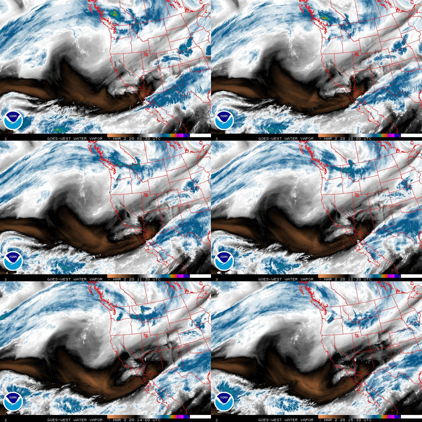
The models are clueless right now on handling the longwave trough out West and the approach speed max in the Pacific jet stream nearing the NW Pacific Coastline. As the jet streak hits the NW Pacific Coast later today, we may see improved solutions from the various modeling schemes. The ensembles are not much help either as they are struggling with the synoptic pattern in the evolution of the 500mb upper low out West as well as a developing tropical cyclone in the Eastern Pacific. As stated yesterday, this is a very complicated and complex forecasting challenge and until there is some sort of consensus, all bets are off regarding exactly where the cold front will stall and exactly which locations will have a chance for witnessing the heaviest rainfall. As of this morning, West Central Texas, The Big Bend and Permian Basin have the best odds of receiving flooding rains.


Carla/Alicia/Jerry(In The Eye)/Michelle/Charley/Ivan/Dennis/Katrina/Rita/Wilma/Humberto/Ike/Harvey
Member: National Weather Association
Facebook.com/Weather Infinity
Twitter @WeatherInfinity
Member: National Weather Association
Facebook.com/Weather Infinity
Twitter @WeatherInfinity
- tireman4
- Global Moderator

- Posts: 7012
- Joined: Wed Feb 03, 2010 9:24 pm
- Location: Humble, Texas
- Contact:
00
FXUS64 KHGX 231531
AFDHGX
Area Forecast Discussion
National Weather Service Houston/Galveston TX
1031 AM CDT Fri Sep 23 2016
.UPDATE...
Sufficient moisture continues to filter into the area, keeping rain
chances higher over the coastal waters and along the coast.
12Z soundings at CRP and LCH are keeping precipitable waters up
around 1.70 to 2.00 inches for this morning. Moisture will be in a
surplus for this afternoon and into the evening. A convective
temperature around 84 degrees should also be met today with the help
of daytime heating. Raised PoPs a bit to match current radar trends.
Onshore flow is helping to push showers developing over the coastal
waters over the coastal counties. A weak coastal trough has helped
aid storm development right along the coastline. This coastal
trough is acting as a boundary, where onshore winds are from the
southeast, and winds to the north of the boundary are from the east.
The change in wind direction along with a change in wind speed, is
acting as a zone of convergence. This area of convergence, will also
provide lift as indicated by both European the GFS omega fields over
the coastal counties early this afternoon. Cloud cover along with
the scattered showers will help to keep high temperatures a bit
cooler for this afternoon. Adjusted temperatures a degree down to
account for this.
Hathaway
&&
.PREV DISCUSSION... /ISSUED /
AVIATION...
MVFR to VFR ceilings in place across the Southeast Texas
terminals this morning are expected to transition to VFR by mid-
morning, with patchy IFR/MVFR fog at Conroe also expected to
dissipate around this time.
Beyond low ceilings and visibilities this morning, the main
aviation concern will be timing SHRA/possible TSRA near the
terminals. Scattered SHRA near Angleton and Galveston now will
expand inland with heating today. Convective temperatures are in
the low to mid 80s and expect shower coverage to increase near the
inland terminals 15-17Z as these temperatures are reached. Have
included TEMPO groups for SHRA midday with enhanced coverage
possible near the Houston terminals along a weak seabreeze. MVFR
ceilings and visibilities will be possible with stronger activity,
as well as gusty and variable winds. Expect SHRA/TSRA to end by
early evening with loss of heating, but another round of showers
is expected to spread inland towards the Houston terminals from
the Gulf early Saturday morning. Otherwise, southeast winds 10
knots or less are expected to prevail through the period.
Huffman
PREV DISCUSSION... /ISSUED /
DISCUSSION...
Mid-upper level ridging over the northern areas this morning with
moist low level flow from the Gulf across the southwestern area
and on into the Hill Country. Showers becoming more numerous over
the Gulf waters and expanding into the coastal counties up to
around I-10. The low level flow will drag in greater moisture
today and by mid morning expect scattered showers and isolated
thunderstorms to have spread well inland. Rich plume of low level
moisture from the central Gulf will flow into the region in
advance of longwave trough that will be advancing southeastward
today and Saturday before stalling. This keeps the moist
environment in place with strongest moisture advection focused
more toward the Hill Country/Central TX area. By late Sunday the
trough should be cutting off and drifting southwest...this may
spare SETX from the threat of very heavy rain but still not out of
the woods on heavy rain Sunday/Monday. PW 1-8-2.1" with
respectable instability but relatively light forcing today through
Saturday then only slightly more favorable forcing followed by a cold
front (timing is certainly in question on the front...will it
reach the area Monday as upper low sags southwest - or will it
stall just northwest of the area) Monday or Tuesday. Models have
been having a great deal of trouble with the trough`s evolution
and it continues...on a more positive note as the speed max moves
into the Pacific northwest today by 12z Saturday models should
have a much better sample on the upper air pattern and should
have a more reliable forecast. If the area is going to receive
heavy rainfall it should be in the Sunday through Monday time
frame as things stand now. Tuesday is a very low confidence
forecast - the front could be through the area and dry by
afternoon or stalled near the coast and wet. Eventually Wednesday
the surface ridging should be pushing south and drier air should
be intruding into the region with a corresponding lessening chance
for rainfall. Temperatures should continue to run above normal
through Sunday then dip back toward normal. Lows by Wednesday
morning could easily be in the 60s and possibly even around 60
(low chance but possible if ensemble guidance is to be believed).
45
MARINE...
South to southeast winds around 10-15 knots are expected to
persist through Sunday, but may approach caution criteria late
tonight and again Saturday night as a frontal system approaches
Texas. This onshore flow will continue to push deeper Gulf
moisture onto the Upper Texas Coast, resulting in periods of
showers and thunderstorms this weekend. There is still
considerable uncertainty regarding the timing of the cold front
as it moves into Texas on Sunday (and whether or not it will make
it off the Upper Texas Coast). With mid and upper level flow
continuing to look unfavorable for the front to make considerable
progress across Southeast Texas, expect onshore flow to continue
through Monday as the front stalls inland. However, winds look to
back to the east/northeast by late Monday as a weak surface low
develops over the southwest Gulf.
Increasing winds tonight and Saturday night combined with
elevated astronomical tides may result in tide levels approaching
2.7-3.0 feet above MLLW at high tide along the coast. Another
period of elevated tides is possible early to mid next week as
east to northeast winds become established.
Huffman
&&
.PRELIMINARY POINT TEMPS/POPS...
College Station (CLL) 94 76 92 75 89 / 40 10 50 20 60
Houston (IAH) 92 77 91 76 89 / 40 20 40 30 60
Galveston (GLS) 90 82 88 81 85 / 40 30 40 40 50
&&
.HGX WATCHES/WARNINGS/ADVISORIES...
TX...NONE.
GM...NONE.
&&
$$
-
unome
- Posts: 3062
- Joined: Fri Feb 12, 2010 6:11 pm
we've had some nice rain already 
http://www.harriscountyfws.org/
http://wdssii.nssl.noaa.gov/web/wdss2/p ... ecip.shtml
http://www.srh.noaa.gov/ridge2/
http://www.harriscountyfws.org/
http://wdssii.nssl.noaa.gov/web/wdss2/p ... ecip.shtml
http://www.srh.noaa.gov/ridge2/
Last edited by unome on Sat Sep 24, 2016 4:18 am, edited 1 time in total.
- DoctorMu
- Posts: 7889
- Joined: Sun Jun 28, 2015 11:58 am
- Location: College Station
- Contact:
Still thirsty.
But hope spring eternal this weekend.
000
FXUS64 KHGX 232038
AFDHGX
Area Forecast Discussion
National Weather Service Houston/Galveston TX
338 PM CDT Fri Sep 23 2016
.DISCUSSION...
Forecast is on track for this evening. Scattered
showers and thunderstorms continue to redevelop, while storms from
over the coastal waters continue to move onshore. Isolated cells
are associated with frequent lightning, and some are dropping
higher rain rates up to about 1.5 inches per hour. Forecast
soundings still show precipitable waters remaining higher at
1.6-1.8 inches Friday night. Therefore, the lower levels of the
atmosphere will stay fairly saturated, aiding in early Saturday
morning development along the coast especially in the western
coastal counties of our CWA.
The moisture and chance for precip will linger throughout the
weekend. According to forecast soundings, on both Saturday and
Sunday, our convective temperatures remain low around 83 degrees
while our high temperatures get up into the upper 80s, lower 90s.
This should allow for convective initiation, as daytime heating
primes the atmosphere for shower and thunderstorm development. An
upper-level disturbance also moves into the eastern half of our CWA
early Saturday into Sunday. This should also help enhance the lift
in this region, helping in storm development.
Our best chance for widespread precipitation really moves in Sunday
evening into Monday. Winds remain onshore, helping to advect the
moisture plume sitting over the northwestern Gulf of Mexico as seen
on water vapor imagery into our forecast area. A weakness in the
winds becomes evident as we move into Monday, with the approach of
first "cold" front of the season. A majority of the moisture driving
the precipitation will be brought in ahead of the front, rather than
associated with the moisture in the Gulf. Models are continuing to
diverge of the timing of the front, keeping confidence low. The GFS
and European guidance are trending towards bringing in the precip
ahead of the front between 12Z Monday into 00z Tuesday. This front
will drop our temperatures a tad starting Tuesday, placing low
temperatures in the upper 60s and high temperatures in the mid 80s.
This front should place our temperature back to normal climo for mid-
September. The more significant impact associated with this front
will be the surplus of dry air that filters into the region from the
northeast. Precipitable waters start to drop Tuesday night to about
1.67 inches, drying out the lower layers of the atmosphere.
Maximum relative humidity values will remain in the 70s throughout
the week until next Saturday.
- srainhoutx
- Site Admin

- Posts: 19700
- Joined: Tue Feb 02, 2010 2:32 pm
- Location: Maggie Valley, NC
- Contact:
Friday afternoon briefing from Jeff:
Upper air pattern change to bring a period of wet weather to the state through this weekend into at least Monday…confidence in overall forecast is low.
First large scale trough and cold front of the season is on tap to affect the area late this weekend into early next week. Models continue to struggle with how strong and when the front actually moves off the coast or if it hangs up near the coast next week which will have a big influence on the forecast. For the short term tropical moisture continues to spread inland from the central Gulf of Mexico with bands of showers and thunderstorms moving NNW to NW across the region. Some of the rainfall has been fairly heavy with 1-2 inches under the strongest cells today. Influx of tropical moisture continues through the weekend. A weak coastal trough will help to focus showers and thunderstorms near the coast especially during the morning hours with activity spreading inland during the day with heating.
Lift increases late Sunday into Monday as the actual surface front begins to arrive from the west, but the actual upper level system cuts off and begins to move back west toward western MX at this time never really brining strong lift into SE TX. Majority of the lift may remain anchored over SW TX/Hill Country during this period where flooding rainfall will be possible along a south to north oriented frontal boundary. With that said convective outflow could push the boundary eastward and shift the excessive rainfall threat toward I-35 or even SE TX late Sunday into Monday. For now will go with widespread 1-2 inches over the area through the weekend with isolated totals upwards of 4-5 inches.
As for the front…hard to say if and when it moves off the coast. GFS wants to push it offshore late Monday into early Tuesday with much lower dewpoints and dry air mass filtering into the area. Not 100% sold just yet that it will progress far enough offshore to allow much dry air to filter across the entire region and could even keep rain chances going near the coast for the early part of next week.
Carla/Alicia/Jerry(In The Eye)/Michelle/Charley/Ivan/Dennis/Katrina/Rita/Wilma/Humberto/Ike/Harvey
Member: National Weather Association
Facebook.com/Weather Infinity
Twitter @WeatherInfinity
Member: National Weather Association
Facebook.com/Weather Infinity
Twitter @WeatherInfinity
-
unome
- Posts: 3062
- Joined: Fri Feb 12, 2010 6:11 pm
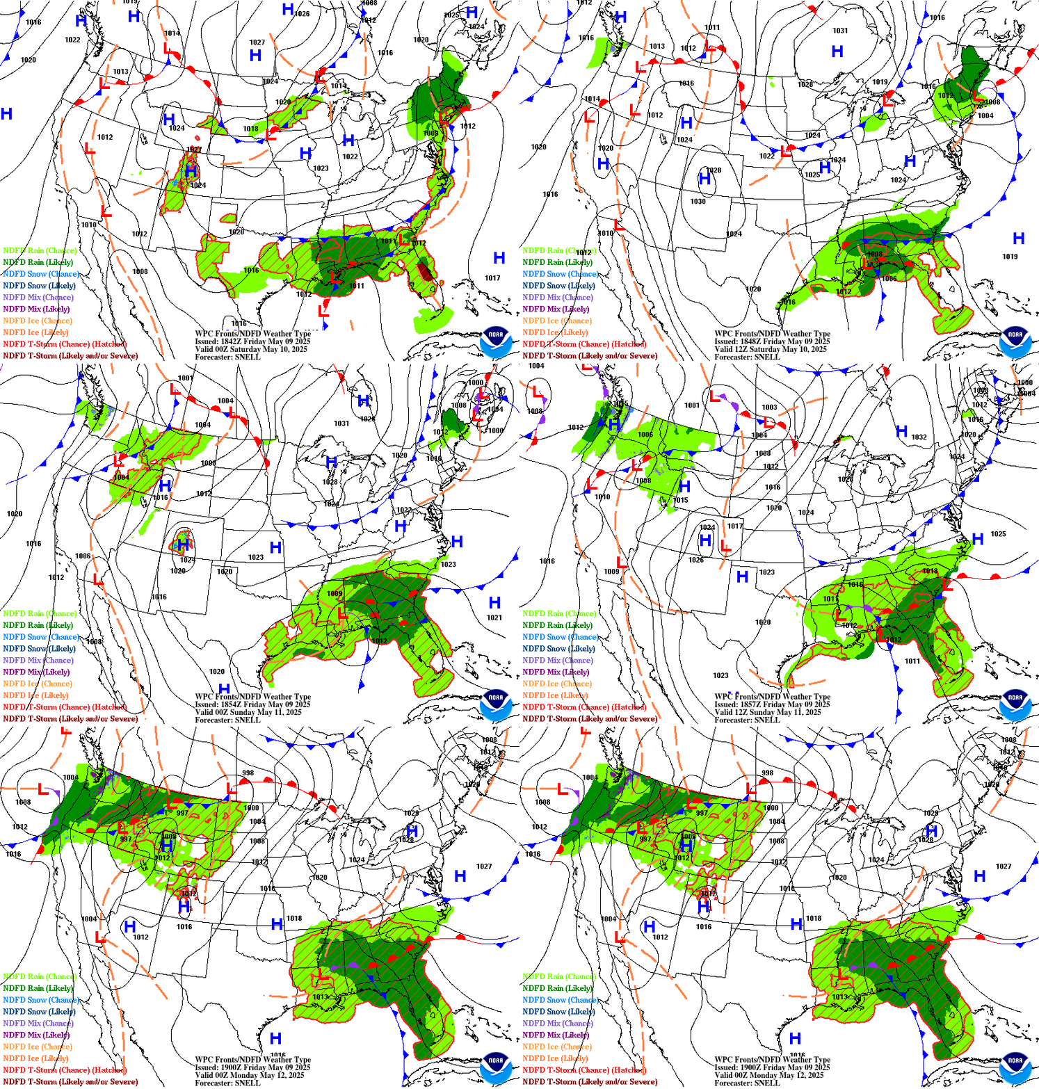
San Antonio/Austin WFO might be busy this weekend
Short Range Forecast Discussion: http://www.wpc.ncep.noaa.gov/discussion ... isc=pmdspd
Extended Range Discussion: http://www.wpc.ncep.noaa.gov/discussion ... isc=pmdepd
QPF Discussion: http://www.wpc.ncep.noaa.gov/discussion ... isc=qpfpfd
Excessive Rainfall Discussion: http://www.wpc.ncep.noaa.gov/discussion ... isc=qpferd

-
unome
- Posts: 3062
- Joined: Fri Feb 12, 2010 6:11 pm
closer to home: https://twitter.com/iembot_hgx
Area Forecast Discussion
National Weather Service Houston/Galveston TX
445 AM CDT Sat Sep 24 2016
.DISCUSSION...
Showers starting to quickly develop this morning over the Gulf waters and spread into the coastal counties at 4 am. Moist axis with higher PW air should be mainly over the western areas this morning and afternoon and have kept pops higher in the west. Storms should be moving at around 10-13 knots today and don't see any focus for storms so don't expect any flooding just periods with moderate to heavy rainfall mixed with periods of sun. Good day for an umbrella. More cloud cover on tap today but still plenty of humidity so it is still going to feel warm and humid. By late afternoon most of the showers should be along and north of the I-10 corridor and waning with the loss of heating by early evening. Sunday morning by the 1-3AM time frame expect to see showers redevelop over the water and spread inland, again fairly slow moving in a moisture rich environment. Perhaps some heavy downpours and gusty winds. Upper low sagging south from NM/AZ border into Mexico with upper ridging over E TX so not a lot of upper forcing but low levels will likely see winds back with surface low developing S of Big Bend helping to fuel very heavy rains from Big Bend to Midland. Might have a slightly higher chance for some waterspouts Sunday morning thanks to the abundant moisture/instability/backed low level winds. Scattered to numerous showers and thunderstorms Sunday with redevelopment throughout the day which will likely continue throughout Sunday night. The much hoped for cold front should be traversing the DFW metroplex around 7 pm Sunday and slow reaching the College Station area around 9 am Monday. Weak cold advection with the upper low still spinning over norther Baja will likely be just enough to help 'nudge' the front south Monday night. Drier air lined up to the east of the area Sunday may well be edging westward which could lead to a fairly sharp precipitation gradient Monday with greater chances over the western CWA and much lighter amounts if any in the east. Tuesday looking mostly dry across the area but with a cooler start to the day and abundant cloud cover. The cold front should push out well into the Gulf Tuesday. Dry air continues to flow into the area Tuesday and Wednesday as 1020mb high settles over NETX with the dry air pushing well out into the central Gulf by early Thursday. Low temperatures should finally fall below normal by Wednesday morning! The cooler and drier weather should prevail Wednesday and Thursday albeit followed by a gradual warming trend Fri/Sat. Shallow moisture should start to intrude Friday with easterly flow. Rain chances may return by next Sunday. Will need to keep an eye on the tropics for the development of a tropical wave as it moves into the Caribbean. Some of the extend guidance showing the possibility of rapid intensification in the central and western Caribbean Sat/Sun if it can get away from the South American Coast.
45
&&
.MARINE...
Southeast winds around 10-15 knots are expected to persist through Sunday. This onshore flow will continue to push deeper Gulf moisture onto the Upper Texas Coast, resulting in periods of showers and thunderstorms ahead of a cold front approaching the Upper Texas Coast. There is still considerable uncertainty regarding the timing of the cold front as it reaches Southeast Texas on Monday, but the front may receive enough of a push to move off the coast Monday night into Tuesday morning. Winds may approach caution criteria behind the frontal boundary, with light to occasionally moderate east to northeast winds continuing through late next week as a weak surface low develops over the southwest Gulf.
Onshore flow tonight combined with elevated astronomical tides may result in tide levels approaching 2.7-3.0 feet above MLLW at times of high tide along the coast. Another period of elevated tides is possible Tuesday through much of the upcoming week as east to northeast winds become established.
Huffman
&&
.PRELIMINARY POINT TEMPS/POPS...
College Station (CLL) 89 75 89 73 83 / 40 20 70 60 60
Houston (IAH) 89 75 87 75 87 / 40 30 60 40 50
Galveston (GLS) 85 80 86 80 86 / 40 50 60 50 50
&&
.HGX WATCHES/WARNINGS/ADVISORIES...
TX...NONE.
GM...NONE.
&&
$$
Discussion...45
Aviation/Marine...14
-
mckinne63
- Posts: 553
- Joined: Fri Jul 08, 2011 4:50 pm
- Location: Stafford, TX
- Contact:
Just heard a clap of thunder here in Stafford that shook the house! Sun is still out, but looking outside, skies in the front of house are getting darker.
-
unome
- Posts: 3062
- Joined: Fri Feb 12, 2010 6:11 pm
to steal a line from Forrest Gump, we are having "big 'ol fat rain"...
(.44" in 5 minutes at one point, 1.64" in 1 hr: http://www.harriscountyfws.org/GageDeta ... 55:55%20PM
http://weather.cod.edu/satrad/nexrad/in ... X-N0Q-1-48
http://traffic.houstontranstar.org/cctv ... _Northwest
(.44" in 5 minutes at one point, 1.64" in 1 hr: http://www.harriscountyfws.org/GageDeta ... 55:55%20PM
http://weather.cod.edu/satrad/nexrad/in ... X-N0Q-1-48
http://traffic.houstontranstar.org/cctv ... _Northwest
-
unome
- Posts: 3062
- Joined: Fri Feb 12, 2010 6:11 pm
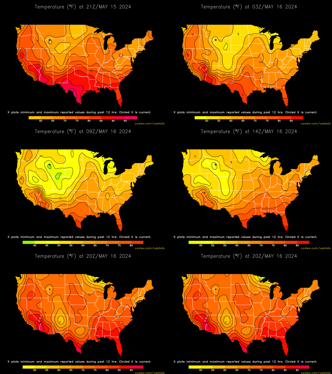
50s in the panhandle, even 40s at Hereford !
http://www.wrh.noaa.gov/zoa/getobext.php?sid=KHRX
http://www.wrh.noaa.gov/zoa/temperature ... fw&limit=2
http://www.wrh.noaa.gov/zoa/getobext.php?sid=KHRX
http://www.wrh.noaa.gov/zoa/temperature ... fw&limit=2

- Katdaddy
- Global Moderator

- Posts: 2521
- Joined: Thu Feb 04, 2010 8:18 am
- Location: League City, Tx
- Contact:
Another day with a tropical atmosphere in place across SE TX as we await the cool front next week.
...TROPICAL FUNNEL CLOUDS AND WATERSPOUTS POSSIBLE TODAY...
DEEP TROPICAL MOISTURE ALONG THE UPPER TEXAS COAST WILL LINGER BEFORE A COLD FRONT CLEARS THE REGION TUESDAY... AND AS A RESULT CONDITIONS ARE FAVORABLE FOR FUNNEL CLOUD AND WATERSPOUT
DEVELOPMENT TODAY.
FUNNEL CLOUDS IN THIS ENVIRONMENT ARE USUALLY SHORT LIVED AND RARELY REACH THE GROUND. HOWEVER... IF ONE IS OBSERVED BE PREPARED
TO SEEK SHELTER IF IT APPEARS TO DESCEND TO THE GROUND. THESE FUNNELS CAN AND SOMETIMES DO BRIEFLY TOUCH DOWN... PRODUCING
LOCALIZED GUSTY WINDS.
WATERSPOUTS ARE ALSO POSSIBLE FOR THE UPPER TEXAS COASTAL WATERS TODAY... MAINLY DURING THE MORNING TO EARLY AFTERNOON HOURS. WATERSPOUTS ARE HAZARDOUS TO BOATERS AND BEACH GOERS AS THEY CAN
PRODUCE WINDS IN EXCESS OF 40 MPH. IF A WATERSPOUT IS OBSERVED… MOVE AT A 90 DEGREE ANGLE FROM ITS APPARENT MOTION AND SEEK STURDY SHELTER UNTIL IT HAS PASSED OR DISSIPATES. IF ON A BEACH... DO NOT
ATTEMPT TO NAVIGATE THROUGH ONE.
- jasons2k
- Posts: 6161
- Joined: Thu Feb 04, 2010 12:54 pm
- Location: Imperial Oaks
- Contact:
Yesterday, I got my first rain since September 9th. From two different storms - amazing! But alas, the curse tried to continue its grip as I got .04" the first round and .03" the second round. The ground under the tree canopy stayed completely dry. I'm optimistic for better luck over the next couple of days.