
May Weather Discussion.
-
wxdata

- Site Admin

- Posts: 1059
- Joined: Wed Feb 03, 2010 3:04 pm
- Location: Houston, TX
- Contact:
Close, but no cigar. I think we've lost our chance for storms developing our way.
-
wxdata
- Site Admin
- Posts: 1059
- Joined: Wed Feb 03, 2010 3:04 pm
- Location: Houston, TX
- Contact:
The map mirrors may concerns about the lack of rain over most of SE TX. Even with a potent shortwave moving across Texas Tuesday, the 12z GFS is showing only .02" here for the next 16 days. We're quickly approaching the time of year when we start looking southward for rain rather than north and west.
-
sleetstorm
- Posts: 651
- Joined: Thu Feb 04, 2010 12:33 pm
- Contact:
It seems as though the components in the atmosphere over all of southeast Texas, including Houston and the cities beleaguering it, are simply not coming together adequately/at the right time.
-
sleetstorm
- Posts: 651
- Joined: Thu Feb 04, 2010 12:33 pm
- Contact:
I honestly do not remember when the city of Houston, and other cities beleaguering it, had a good severe thunderstorm outbreak. Do any of you?
-
Mr. T

- Posts: 992
- Joined: Wed Feb 03, 2010 4:22 pm
- Location: Kingwood
- Contact:
You are really annoying.Ed Mahmoud wrote:............................... HOUSTON HELL DROUGHT 2010
I just wanted to make that clear...
-
Mr. T
- Posts: 992
- Joined: Wed Feb 03, 2010 4:22 pm
- Location: Kingwood
- Contact:
Anyway, as the NWS states this morning, both the GFS and Euro do show a relaxation and an eastward shift of the upper ridge's control over our area after the day 7 period. If you want some rain, you're probably going to have to wait one more week...
Ensembles trying to help out...


Cross your fingers
Ensembles trying to help out...
Cross your fingers
-
srainhoutx

- Site Admin
- Posts: 19700
- Joined: Tue Feb 02, 2010 2:32 pm
- Location: Maggie Valley, NC
- Contact:
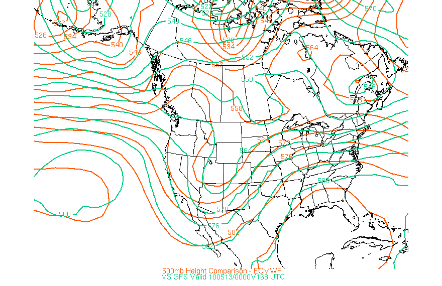
As Mr. T pointed out, we may be a bit closer to seeing a shift in the Upper Flow next week. A rather potent Long Wave Trough is forecast to move slowy E and push the persisant ridge that has dominated our area for the past several weeks. The GFS and ECMWF are in fairly good agreement at this range...
We need some rain!
We need some rain!
Carla/Alicia/Jerry(In The Eye)/Michelle/Charley/Ivan/Dennis/Katrina/Rita/Wilma/Humberto/Ike/Harvey
Member: National Weather Association
Facebook.com/Weather Infinity
Twitter @WeatherInfinity
Member: National Weather Association
Facebook.com/Weather Infinity
Twitter @WeatherInfinity
-
Mr. T
- Posts: 992
- Joined: Wed Feb 03, 2010 4:22 pm
- Location: Kingwood
- Contact:
It'll be our pattern breaker.srainhoutx wrote:As Mr. T pointed out, we may be a bit closer to seeing a shift in the Upper Flow next week. A rather potent Long Wave Trough is forecast to move slowy E and push the persisant ridge that has dominated our area for the past several weeks. The GFS and ECMWF are in fairly good agreement at this range...
We need some rain!
Hopefully this idea actually comes to pass. We need a big Pacific system like that to eat away on the ridge.
-
wxman57

- Global Moderator

- Posts: 2621
- Joined: Thu Feb 04, 2010 5:34 am
- Location: Southwest Houston (Westbury)
- Contact:
GFS long range almost always shows some "big rain event" here. Most of the time it doesn't materialize. We are definitely in a dry pattern for May.
-
Kludge

- Posts: 280
- Joined: Wed Feb 03, 2010 11:53 pm
- Location: Montgomery (Walden) TX
- Contact:
During "Hell Drought 2009" we would've been merciful enough to just shoot the messenger.Ed Mahmoud wrote:Mr. T wrote:You are really annoying.Ed Mahmoud wrote:............................... HOUSTON HELL DROUGHT 2010
I just wanted to make that clear...
Shooting the messenger...
If this year becomes another Hell Drought, we're gonna tie the messenger to a tree and make him watch it happen.
I'm starting to think that this cap is the REAL montezuma's revenge...
-
Ptarmigan

- Statistical Specialist

- Posts: 4519
- Joined: Wed Feb 03, 2010 7:20 pm
- Contact:
I want this cockroach cap, wind aloft, and ridge to go away once and for all. 
-
srainhoutx
- Site Admin
- Posts: 19700
- Joined: Tue Feb 02, 2010 2:32 pm
- Location: Maggie Valley, NC
- Contact:
SPC Update removes Slight Risk for all of SE TX. It does appear the front is a bit stronger than forecast and should give us a brief break from the 90's and higher humidity over the weekend. Enjoy it while it lasts. 
Carla/Alicia/Jerry(In The Eye)/Michelle/Charley/Ivan/Dennis/Katrina/Rita/Wilma/Humberto/Ike/Harvey
Member: National Weather Association
Facebook.com/Weather Infinity
Twitter @WeatherInfinity
Member: National Weather Association
Facebook.com/Weather Infinity
Twitter @WeatherInfinity
-
kayci

- Posts: 358
- Joined: Thu Feb 04, 2010 10:30 am
- Location: Alvin
- Contact:
No hope for Galveston County huh????
-
wxdata
- Site Admin
- Posts: 1059
- Joined: Wed Feb 03, 2010 3:04 pm
- Location: Houston, TX
- Contact:
About the same as for Houston, little to none. A small chance as the front approaches today, 20% at best.kayci wrote:No hope for Galveston County huh????
In fact the 12z GFS shows only .2 inches at rain at IAH for the next 15 days...
-
srainhoutx
- Site Admin
- Posts: 19700
- Joined: Tue Feb 02, 2010 2:32 pm
- Location: Maggie Valley, NC
- Contact:
Getting the lawn sprinklers going. Darn pesky Ridge! 
Carla/Alicia/Jerry(In The Eye)/Michelle/Charley/Ivan/Dennis/Katrina/Rita/Wilma/Humberto/Ike/Harvey
Member: National Weather Association
Facebook.com/Weather Infinity
Twitter @WeatherInfinity
Member: National Weather Association
Facebook.com/Weather Infinity
Twitter @WeatherInfinity
-
wxdata
- Site Admin
- Posts: 1059
- Joined: Wed Feb 03, 2010 3:04 pm
- Location: Houston, TX
- Contact:
Seabreeze moving inland...
-
wxdata
- Site Admin
- Posts: 1059
- Joined: Wed Feb 03, 2010 3:04 pm
- Location: Houston, TX
- Contact:
Life in the ol' mare yet (although a strong cap and shallow moisture may starve any line from making it this far south..)
MESOSCALE DISCUSSION 0498
NWS STORM PREDICTION CENTER NORMAN OK
0846 PM CDT FRI MAY 07 2010
AREAS AFFECTED...SERN TX...NRN LA...SERN AR...NWRN MS
CONCERNING...SEVERE POTENTIAL...WATCH UNLIKELY
VALID 080146Z - 080415Z
ISOLATED SEVERE HAIL AND/OR WIND GUSTS WILL BE POSSIBLE THIS
EVENING...BUT COVERAGE OF SEVERE SHOULD NOT WARRANT A WW.
VISIBLE IMAGERY PRIOR TO SUNSET SHOWED TCU ALONG A COLD FRONT FROM
ERN AR INTO ERN TX. MOST OF THE CU AHEAD OF THE BOUNDARY WAS FLAT
AND INDICATIVE OF CAPPING. INDEED...AREA SOUNDINGS AT 00Z REVEAL A
CAPPING INVERSION NEAR 700 MB. HOWEVER...THE SHV SOUNDING ALSO
SHOWED A VERY DEEP AND MOIST BOUNDARY LAYER. GPS PWAT READINGS ARE
AVERAGING NEAR 1.50-1.60 INCHES ALONG THE COLD FRONT...WITH DRIER
READINGS AWAY FROM THE BOUNDARY.
ALTHOUGH FORCING WILL BE WEAK AND FOCUSED IN THE LOW LEVELS ALONG
THE FRONT...SOME NOCTURNAL COOLING IN THE DRY CAPPING LAYER SHOULD
ALLOW FOR STORMS TO ERUPT FROM ERN TX INTO MS. LARGE INSTABILITY AS
WELL AS STEEP MID LEVEL LAPSE RATES WILL SUPPORT A FEW STORMS WITH
HAIL AND GUSTY DOWNBURSTS...BUT ORGANIZED SEVERE STORMS ARE NOT
EXPECTED.
-
Mr. T
- Posts: 992
- Joined: Wed Feb 03, 2010 4:22 pm
- Location: Kingwood
- Contact:
It still looks like (good?) rain chances should finally return back to the area next weekend...
-
wxdata
- Site Admin
- Posts: 1059
- Joined: Wed Feb 03, 2010 3:04 pm
- Location: Houston, TX
- Contact:
0z GFS still points to things 'moistening up' about mid-month. Let's hope it's a valid forecast and not a La-La Land forecast...
-
Ptarmigan
- Statistical Specialist
- Posts: 4519
- Joined: Wed Feb 03, 2010 7:20 pm
- Contact:
We must keep the faith for rain. 