Could be. Both the 12z GFS and NAM do put a marginally unstable atmosphere over SE TX by Tuesday afternoon.Tuesday afternoon and evening bears watching for the potential for some isolated strong storms.
Lifted Index;
Cape


Could be. Both the 12z GFS and NAM do put a marginally unstable atmosphere over SE TX by Tuesday afternoon.Tuesday afternoon and evening bears watching for the potential for some isolated strong storms.


Yeah, there appears to be some passing moisture around mid day, but not much at 12Z or 00Z.Ed Mahmoud wrote:NAM does develop some showers Wednesday.wxman57 wrote:That sounding is pretty dry. Without much moisture aloft, it'll be hard to get storms. Our best shot of any storms will be this afternoon and this evening. After that, dry air moves in. Severe chances look to be very minimal.
http://www.nco.ncep.noaa.gov/pmb/nwprod ... f_054s.gif
I went to Tia Maria's here in Baytown on 1711 Garth Rd. with my parents, my youngest sister, and my aunt, and received some money from some of my relatives.Ed Mahmoud wrote:Outback on 1960 near Champions.
And a Hawaiian shirt.
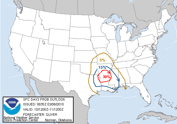
SHORTWAVE TROF TRAVELING DOWN ACROSS CALIFORNIA THIS MORNING TO
HEAD DUE EAST OVER THE DESERT SW AND LIFT OUT IN THIS CURRENT
LOW`S WAKE OVER OK WEDNESDAY. CONSIDERING ALL OF THE ABOVE AND THE
MODERATE CHANCE OF THE INITIATION OF A WESTERN TX DRY LINE MOVING
OUR WAY...WED POPS WILL INCREASE. LAY ON TOP OF THIS NEARING DRY
LINE...RESIDUAL BOUNDARIES IN A MODESTLY MOIST ENVIRONMENT...AND A
STRONG CENTRAL TX 190 KT JET STREAK PUNCHING INTO THE REGION AND
YOU HAVE ALL OF THE SIGNS POINTING TO HIGH CHANCE POPS INCREASING
INTO LIKELY THROUGH THE DAY. IF ALL OF THESE ELEMENTS COME INTO
PHASE...WE WILL BE DEALING WITH SEVERE WEATHER COME WEDNESDAY
AFTERNOON. TOO EARLY TO GET SPECIFIC IN ZONES...BUT WILL HIGHLIGHT
THIS POSSIBLE SEVERE THREAT IN THIS MORNING`S HWO. ALAS...SPRING
HAS SPRUNG!
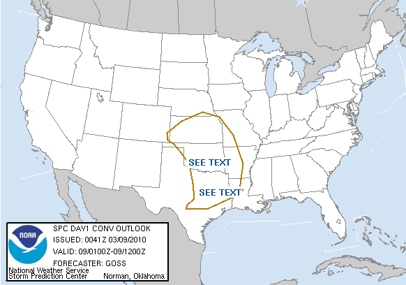
Let's keep things in this Topic for now. A bigger severe threat would probably warrant a new Topic.weatherguy425 wrote:I'm heading out the door but perhaps a new topic?
SHORTWAVE TROF TRAVELING DOWN ACROSS CALIFORNIA THIS MORNING TO
HEAD DUE EAST OVER THE DESERT SW AND LIFT OUT IN THIS CURRENT
LOW`S WAKE OVER OK WEDNESDAY. CONSIDERING ALL OF THE ABOVE AND THE
MODERATE CHANCE OF THE INITIATION OF A WESTERN TX DRY LINE MOVING
OUR WAY...WED POPS WILL INCREASE. LAY ON TOP OF THIS NEARING DRY
LINE...RESIDUAL BOUNDARIES IN A MODESTLY MOIST ENVIRONMENT...AND A
STRONG CENTRAL TX 190 KT JET STREAK PUNCHING INTO THE REGION AND
YOU HAVE ALL OF THE SIGNS POINTING TO HIGH CHANCE POPS INCREASING
INTO LIKELY THROUGH THE DAY. IF ALL OF THESE ELEMENTS COME INTO
PHASE...WE WILL BE DEALING WITH SEVERE WEATHER COME WEDNESDAY
AFTERNOON. TOO EARLY TO GET SPECIFIC IN ZONES...BUT WILL HIGHLIGHT
THIS POSSIBLE SEVERE THREAT IN THIS MORNING`S HWO. ALAS...SPRING
HAS SPRUNG!
Users browsing this forum: ejburas, Google [Bot], TexasBreeze and 3 guests