June Ends - Hottest on Record
-
jasons2k

- Posts: 6191
- Joined: Thu Feb 04, 2010 12:54 pm
- Location: Imperial Oaks
- Contact:
Yeah, it's raining big drops here now 
-
Portastorm

- Posts: 800
- Joined: Wed Feb 03, 2010 3:04 pm
- Location: Southwest Austin/Oak Hill, TX
- Contact:
Jason ... I'm jealous. 
Meanwhile, NWSFO Austin/San Antonio says "pish-posh, apple sauce" on rain chances for us next week as a result of tropical influences from the Gulf.
A snippet:
LONG RANGE MODELS CONTINUE TO SHOW A TROPICAL SYSTEM MOVING WESTWARD ACROSS THE
YUCATAN TOWARD THE BAY OF CAMPECHE NEXT WEEK. GFS INDICATING THE
MOST NORTHWESTERLY TRACK TOWARD THE MOUTH OF THE RIO GRANDE LATE
NEXT WEEK. WILL REMAIN CONSISTENT WITH PREVIOUS PACKAGE AND
FORECAST HOT AND DRY UNTIL MORE RUN TO RUN CONSISTENCY DICTATES A
CHANGE.
-
srainhoutx

- Site Admin

- Posts: 19700
- Joined: Tue Feb 02, 2010 2:32 pm
- Location: Maggie Valley, NC
- Contact:
That boundary is getting a bit more active...

Carla/Alicia/Jerry(In The Eye)/Michelle/Charley/Ivan/Dennis/Katrina/Rita/Wilma/Humberto/Ike/Harvey
Member: National Weather Association
Facebook.com/Weather Infinity
Twitter @WeatherInfinity
Member: National Weather Association
Facebook.com/Weather Infinity
Twitter @WeatherInfinity
-
rnmm
- Posts: 352
- Joined: Fri Feb 05, 2010 12:16 am
- Location: Santa Fe, Texas
- Contact:
Whooo hoooo Srain does that mean we may see rain tonight??
My name is Nicole and I love weather!!
~~~~~~~~~~~~~~~~~~~~~~~~~~~~~~~~~~~~~~~~~~~~~~~~~~~~~~~~~~~~~~~~~~~~~~~~~~~~~~~~~~~~~~~~~~~~~~~~
Alicia, Allison, Rita, Ike
~~~~~~~~~~~~~~~~~~~~~~~~~~~~~~~~~~~~~~~~~~~~~~~~~~~~~~~~~~~~~~~~~~~~~~~~~~~~~~~~~~~~~~~~~~~~~~~~
Alicia, Allison, Rita, Ike
-
jasons2k
- Posts: 6191
- Joined: Thu Feb 04, 2010 12:54 pm
- Location: Imperial Oaks
- Contact:
I got a whole .07"today. That's a storm total of 1.62"...maybe we can get something next week to replenish the vegetation.
-
srainhoutx
- Site Admin
- Posts: 19700
- Joined: Tue Feb 02, 2010 2:32 pm
- Location: Maggie Valley, NC
- Contact:
SPECIAL WEATHER STATEMENT
NATIONAL WEATHER SERVICE HOUSTON/GALVESTON TX
957 AM CDT FRI JUN 24 2011
TXZ200-213-214-226-227-235>238-241800-
LIBERTY-HARRIS-CHAMBERS-WHARTON-FORT BEND-JACKSON-MATAGORDA-
BRAZORIA-GALVESTON-
INCLUDING THE CITIES OF...LIBERTY...CLEVELAND...DAYTON...
HOUSTON...PASADENA...KATY...TOMBALL...HUMBLE...WINNIE...
MONT BELVIEU...ANAHUAC...EL CAMPO...WHARTON...PIERCE...
SUGAR LAND...MISSOURI CITY...RICHMOND...ROSENBERG...EDNA...
BAY CITY...PALACIOS...PEARLAND...LAKE JACKSON...ALVIN...
ANGLETON...FREEPORT...LEAGUE CITY...TEXAS CITY...FRIENDSWOOD...
GALVESTON
957 AM CDT FRI JUN 24 2011
...BRIEF FUNNEL CLOUDS POSSIBLE TODAY...
AT 950 AM CDT...LAW ENFORCEMENT REPORTED A FUNNEL CLOUD AT THE
INTERSECTION OF INTERSTATE 10 AND STATE HIGHWAY 65 IN CHAMBERS
COUNTY. CONDITIONS ARE FAVORABLE TODAY FOR THE DEVELOPMENT OF
BRIEF FUNNEL CLOUDS THROUGH MIDDAY AS SCATTERED SHOWERS AND
THUNDERSTORMS MOVE ONSHORE. THESE FUNNEL CLOUDS MAY OCCASIONALLY
TOUCH DOWN WITH LITTLE OR NO WARNING AND PRODUCE BRIEF DAMAGE.
PLEASE REPORT ANY FUNNEL CLOUD SIGHTINGS TO LOCAL LAW ENFORCEMENT
WHO WILL RELAY YOUR REPORT TO THE NATIONAL WEATHER SERVICE.
Carla/Alicia/Jerry(In The Eye)/Michelle/Charley/Ivan/Dennis/Katrina/Rita/Wilma/Humberto/Ike/Harvey
Member: National Weather Association
Facebook.com/Weather Infinity
Twitter @WeatherInfinity
Member: National Weather Association
Facebook.com/Weather Infinity
Twitter @WeatherInfinity
-
srainhoutx
- Site Admin
- Posts: 19700
- Joined: Tue Feb 02, 2010 2:32 pm
- Location: Maggie Valley, NC
- Contact:
Scattered showers/storms across SE TX this mid day. It just goes to show that sometimes the models don't have a clue... 
Carla/Alicia/Jerry(In The Eye)/Michelle/Charley/Ivan/Dennis/Katrina/Rita/Wilma/Humberto/Ike/Harvey
Member: National Weather Association
Facebook.com/Weather Infinity
Twitter @WeatherInfinity
Member: National Weather Association
Facebook.com/Weather Infinity
Twitter @WeatherInfinity
-
srainhoutx
- Site Admin
- Posts: 19700
- Joined: Tue Feb 02, 2010 2:32 pm
- Location: Maggie Valley, NC
- Contact:
It looks like Jorge (wxmx) may see a decent chance of rain down in Monterrey this week as the tropical disturbance heads into the Western Gulf...

Carla/Alicia/Jerry(In The Eye)/Michelle/Charley/Ivan/Dennis/Katrina/Rita/Wilma/Humberto/Ike/Harvey
Member: National Weather Association
Facebook.com/Weather Infinity
Twitter @WeatherInfinity
Member: National Weather Association
Facebook.com/Weather Infinity
Twitter @WeatherInfinity
-
Portastorm
- Posts: 800
- Joined: Wed Feb 03, 2010 3:04 pm
- Location: Southwest Austin/Oak Hill, TX
- Contact:
FWIW, JB is tweeting this morning that the worst of the summer heat in Texas (namely east of I-35) will be done after July 5th. Let's hope that also means a more tropical influence and copious rainfall for much of our state.
-
unome
- Posts: 3062
- Joined: Fri Feb 12, 2010 6:11 pm
there's a good blog today on Weather Underground by Christopher Burt that covers the heat/drought in Texas & surrounding areas
http://www.wunderground.com/blog/weathe ... ntrynum=31
http://www.wunderground.com/blog/weathe ... ntrynum=31
-
sleetstorm
- Posts: 651
- Joined: Thu Feb 04, 2010 12:33 pm
- Contact:
This may sound like a silly query, but are all of the wildfires that were burning in this state doused out via the recent rainfall?
-
TexasBreeze
- Posts: 1025
- Joined: Sun Sep 26, 2010 4:46 pm
- Location: NW Houston, TX
- Contact:
There looks to be a new fire of some sort in southern Brazoria County according to NWS radar. It's still dry out there...
-
unome
- Posts: 3062
- Joined: Fri Feb 12, 2010 6:11 pm
nosleetstorm wrote:This may sound like a silly query, but are all of the wildfires that were burning in this state doused out via the recent rainfall?
http://ticc.tamu.edu/Response/FireActivity/
-
sleetstorm
- Posts: 651
- Joined: Thu Feb 04, 2010 12:33 pm
- Contact:
Okay, thank you, TexasBreeze and unome.
-
srainhoutx
- Site Admin
- Posts: 19700
- Joined: Tue Feb 02, 2010 2:32 pm
- Location: Maggie Valley, NC
- Contact:
Fingers crossed that after a hot and dry early/mid week that the models are correct in breaking down the Ridge yet again and increasing our chances of rain as we head toward the 4th of July Holiday weekend. HGX is morning:
AM NOT EXPECTING MUCH IN THE
WAY OF PRECIPITATION AS THE RIDGE SHOULD SHUNT MUCH OF THE RAIN TO
THE EAST AND SOUTH OF SE TX. ON TUESDAY...THE GFS BRINGS PW VALUES
TO 1.8 INCHES WITH A STOUT BUT BREAKABLE CAP. FEEL SUBSIDENCE FROM
THE RIDGE WILL INHIBIT CONVECTION SO WILL KEEP THINGS DRY FOR NOW.
THE GFS TRAPS SOME MSTR BENEATH THE RIDGE ON THURSDAY. FCST
SOUNDINGS SHOW K INDEX VALUES IN THE LOWER 30S AND A BREAKABLE CAP
ON THURSDAY AFTERNOON. WILL KEEP THURSDAY DRY FOR NOW AS OTHER
LONG RANGE MODELS KEEP THINGS QUIET. THE RIDGE SHOULD SHIFT WEST
NEXT WEEKEND. THIS SHOULD ALLOW FOR AT LEAST SOME SEA BREEZE
ACTIVITY TO BEGIN ON SATURDAY. THE CANADIAN BRINGS A WELL
DEVELOPED TUTT ACROSS TEXAS NEXT WEEKEND AND THE ECMWF HINTS AT
LOWER HEIGHTS WITH A WEAK UPPER TROUGH RETROGRADING INTO THE
REGION. THE GFS MAINTAINS THE STRONG UPPER LEVEL RIDGE WITH DRY
CONDITIONS PREVAILING. WILL LEAN TOWARD THE ECMWF DUE TO ITS RUN
TO RUN CONSISTENCY. HEAT INDEX VALUES WILL APPROACH 105 DEGREES BY
MID WEEK. THIS IS BELOW ADVISORY CRITERIA BUT THE VALUES ARE STILL
RATHER HIGH.
- Attachments
-
Carla/Alicia/Jerry(In The Eye)/Michelle/Charley/Ivan/Dennis/Katrina/Rita/Wilma/Humberto/Ike/Harvey
Member: National Weather Association
Facebook.com/Weather Infinity
Twitter @WeatherInfinity
Member: National Weather Association
Facebook.com/Weather Infinity
Twitter @WeatherInfinity
-
srainhoutx
- Site Admin
- Posts: 19700
- Joined: Tue Feb 02, 2010 2:32 pm
- Location: Maggie Valley, NC
- Contact:
Perhaps someone would like to start a discussion concerning July...
Carla/Alicia/Jerry(In The Eye)/Michelle/Charley/Ivan/Dennis/Katrina/Rita/Wilma/Humberto/Ike/Harvey
Member: National Weather Association
Facebook.com/Weather Infinity
Twitter @WeatherInfinity
Member: National Weather Association
Facebook.com/Weather Infinity
Twitter @WeatherInfinity
-
gocuse22

- Posts: 134
- Joined: Thu Feb 04, 2010 3:50 pm
- Contact:
Personally I think there should be a 20-30 percent chance of rain tomorrow through saturday
-
srainhoutx
- Site Admin
- Posts: 19700
- Joined: Tue Feb 02, 2010 2:32 pm
- Location: Maggie Valley, NC
- Contact:
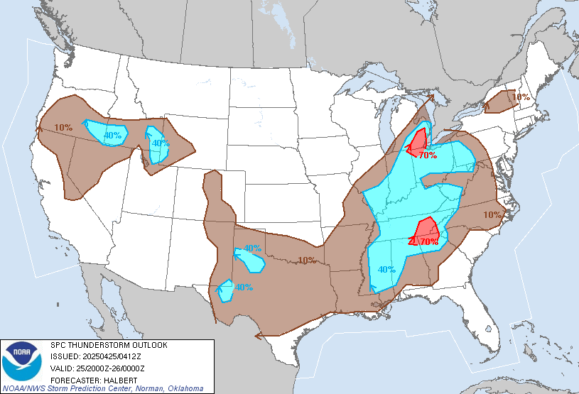
Looks like there is a boundary across our NE zones and the SPC does mention a chance of isolated stronger storms later in the day...
...GULF CST/LWR MS VLY/S ATLANTIC CST THIS AFTN...
SCTD MAINLY DIURNAL STORMS ARE EXPECTED ALONG AND AHEAD OF
AFOREMENTIONED COLD FRONT OVER PARTS OF THE SERN AND S CNTRL U.S.
HOWEVER...GIVEN EXTENSIVE OVER-TURNING THAT OCCURRED OVER THE REGION
YESTERDAY...UPDRAFT COVERAGE/INTENSITY SHOULD BE MARKEDLY REDUCED.
NEVERTHELESS...ISOLD WET MICROBURSTS MAY YET OCCUR IN A FEW SPOTS
WHERE HEATING WILL BE STRONG AND PW WILL REMAIN RELATIVELY
HIGH...SUCH AS LA/SE TX...NRN/CNTRL FL...AND CSTL NC.
Carla/Alicia/Jerry(In The Eye)/Michelle/Charley/Ivan/Dennis/Katrina/Rita/Wilma/Humberto/Ike/Harvey
Member: National Weather Association
Facebook.com/Weather Infinity
Twitter @WeatherInfinity
Member: National Weather Association
Facebook.com/Weather Infinity
Twitter @WeatherInfinity
-
unome
- Posts: 3062
- Joined: Fri Feb 12, 2010 6:11 pm