
I have a report from a student at A&M of heavy sleet.HouTXmetro wrote:http://www.corad.org/texas_radar.htm
According that Radar Areas near College Station to the North are getting SLAMMED with Sleet!
February Weather Discussion. Wild Winter Storms?
-
wxman57

- Global Moderator

- Posts: 2621
- Joined: Thu Feb 04, 2010 5:34 am
- Location: Southwest Houston (Westbury)
- Contact:
-
srainhoutx

- Site Admin

- Posts: 19700
- Joined: Tue Feb 02, 2010 2:32 pm
- Location: Maggie Valley, NC
- Contact:
AREA FORECAST DISCUSSION
NATIONAL WEATHER SERVICE HOUSTON/GALVESTON TX
1016 AM CST TUE FEB 23 2010
.DISCUSSION...
FORECAST STILL LOOKING GOOD. JUST A COUPLE OF SMALL TWEAKS TO THE
PACKAGE TO INCREASE RAINFALL QPF OVER THE COASTAL COUNTIES AND
INCREASE CLOUD COVER TODAY. TEMPERATURES IN THE NORTHWEST SHOULD
HAVE HIT THEIR HIGHS AND SHOULD BE A SLIDE DOWN FROM HERE AS THE
PRECIPITIATION (WHICH HAS SOME SLEET MIXED INTO IT) EXPANDS EAST.
HAVE ALREADY SEEN THE REPORT OF ONE HALF INCH OF SLEET/SNOW IN
PALESTINE AND 2" IN KILLEEN. THIS HEAIVER PRECIP/SNOW SHOULD START
TO SPREAD INTO THE NORTHWEST COUNTIES THE NEXT COUPLE OF HOURS. DID
ADD THE MENTION OF SLEET TO THE PACKAGE TODAY.
REST OF THE PACKAGE LOOKS ON TRACK AND SO NO CHANGES
Carla/Alicia/Jerry(In The Eye)/Michelle/Charley/Ivan/Dennis/Katrina/Rita/Wilma/Humberto/Ike/Harvey
Member: National Weather Association
Facebook.com/Weather Infinity
Twitter @WeatherInfinity
Member: National Weather Association
Facebook.com/Weather Infinity
Twitter @WeatherInfinity
-
HouTXmetro
- Posts: 78
- Joined: Thu Feb 11, 2010 10:39 pm
- Location: Houston, TX (Medical Center/Reliant Park)
- Contact:
That looks like an excellent radar, however if accurate it doesn't appear that Frozen precip line is making much progress to the Southeast. The good thing is that moisture is increasing to our West/Northwest. Just praying it mixes in.
-
brazoria_county22
- Posts: 61
- Joined: Thu Feb 04, 2010 6:39 am
- Location: angleton,tx
- Contact:
FORECAST STILL LOOKING GOOD. JUST A COUPLE OF SMALL TWEAKS TO THE
PACKAGE TO INCREASE RAINFALL QPF OVER THE COASTAL COUNTIES
so dose that mean no mix for us just rain?
PACKAGE TO INCREASE RAINFALL QPF OVER THE COASTAL COUNTIES
so dose that mean no mix for us just rain?
-
redneckweather
- Posts: 1063
- Joined: Mon Feb 08, 2010 7:29 pm
- Location: Montgomery, Texas
- Contact:
Got good snow mixing with sleet in Nacogdoches now. It looks like they will be in the frozen stuff for a good while today and into the evening!
-
srainhoutx
- Site Admin
- Posts: 19700
- Joined: Tue Feb 02, 2010 2:32 pm
- Location: Maggie Valley, NC
- Contact:
Light rain and a couple of small sleet pellets in NW Harris County now.
Carla/Alicia/Jerry(In The Eye)/Michelle/Charley/Ivan/Dennis/Katrina/Rita/Wilma/Humberto/Ike/Harvey
Member: National Weather Association
Facebook.com/Weather Infinity
Twitter @WeatherInfinity
Member: National Weather Association
Facebook.com/Weather Infinity
Twitter @WeatherInfinity
-
Portastorm

- Posts: 800
- Joined: Wed Feb 03, 2010 3:04 pm
- Location: Southwest Austin/Oak Hill, TX
- Contact:
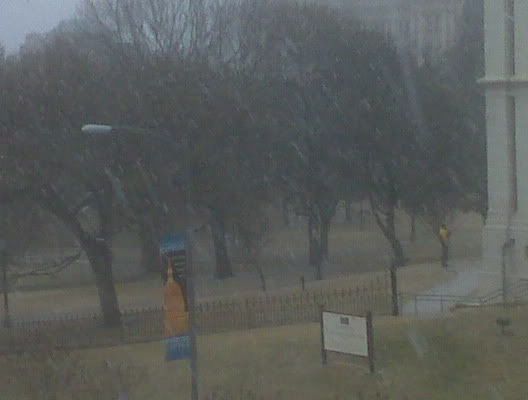
Downtown Austin, near the Capitol, around 10:30 am.
-
BigNorthSide
- Posts: 40
- Joined: Thu Feb 04, 2010 11:49 pm
- Location: Coldspring, TX
- Contact:
I was afraid that I would get up this morning to a change in the forecast and a possible bust. I am glad to see that there is a huge amount of moisture on its way! 
It is dry here in San Jacinto county 20 miles due east of Lake Conroe but looks like it's coming
It is dry here in San Jacinto county 20 miles due east of Lake Conroe but looks like it's coming
-
rnmm
- Posts: 352
- Joined: Fri Feb 05, 2010 12:16 am
- Location: Santa Fe, Texas
- Contact:
Thank you all and I hope I didn't bother anyone with that question, just rather err on the side of caution
My name is Nicole and I love weather!!
~~~~~~~~~~~~~~~~~~~~~~~~~~~~~~~~~~~~~~~~~~~~~~~~~~~~~~~~~~~~~~~~~~~~~~~~~~~~~~~~~~~~~~~~~~~~~~~~
Alicia, Allison, Rita, Ike
~~~~~~~~~~~~~~~~~~~~~~~~~~~~~~~~~~~~~~~~~~~~~~~~~~~~~~~~~~~~~~~~~~~~~~~~~~~~~~~~~~~~~~~~~~~~~~~~
Alicia, Allison, Rita, Ike
-
snowman65

- Posts: 1415
- Joined: Thu Feb 04, 2010 6:39 am
- Location: Orange, Tx
- Contact:
What's the latest outlook for Beaumont/Orange area for this evening???? Thanks!
-
nuby3
- Posts: 387
- Joined: Mon Feb 22, 2010 10:25 pm
- Location: THE WOODLANDS PARKWAY and FM 2978
- Contact:
just go to nws.noaa.govsnowman65 wrote:What's the latest outlook for Beaumont/Orange area for this evening???? Thanks!
for Beaumont
Today: Rain likely after noon. Cloudy, with a high near 51. North wind around 10 mph. Chance of precipitation is 60%.
Tonight: Rain before 9pm, then snow. Low around 34. North wind between 10 and 15 mph. Chance of precipitation is 80%. New snow accumulation of less than a half inch possible.
-
Paul

- Posts: 535
- Joined: Wed Feb 03, 2010 11:46 pm
- Location: Pearland
- Contact:
Radar trends suggest we should start seeing some rain soon in the Houston area. Steve you dont count your in NW Harris....
Nice to see you Matt....long time....I look forward to your analysis this upcoming tropical season.
Nice to see you Matt....long time....I look forward to your analysis this upcoming tropical season.
-
hlewis
- Posts: 81
- Joined: Fri Feb 05, 2010 6:29 am
- Location: Wharton County
- Contact:
It's not lookin good for my area, is it?
-
wxdata

- Site Admin
- Posts: 1059
- Joined: Wed Feb 03, 2010 3:04 pm
- Location: Houston, TX
- Contact:
NOUS64 KHGX 231515
FTMHGX
Message Date: Feb 23 2010 15:15:04
HGX has switched to the Marshall Palmer ZR 200 1.6 in anticipation of incoming event.
FTMHGX
Message Date: Feb 23 2010 15:15:04
HGX has switched to the Marshall Palmer ZR 200 1.6 in anticipation of incoming event.
-
randybpt
- Posts: 114
- Joined: Thu Feb 04, 2010 11:20 am
- Contact:
WELL it looks like it is our neighbors to our north that will have the fun this go around. still looking to me the snow line will not reach south of a sealy conroe jasper line. i do not expect any accumalating snow near ih10 or south. doubt we will see much snow or sleet if any. right now temps are running in the low to mid forties with dew point in upper 30's.
-
polisciaggie

- Posts: 19
- Joined: Wed Feb 03, 2010 10:06 pm
- Location: Houston, TX
- Contact:
Really? I was just outside on campus and it was just rain.wxman57 wrote:I have a report from a student at A&M of heavy sleet.HouTXmetro wrote:http://www.corad.org/texas_radar.htm
According that Radar Areas near College Station to the North are getting SLAMMED with Sleet!
-
redneckweather
- Posts: 1063
- Joined: Mon Feb 08, 2010 7:29 pm
- Location: Montgomery, Texas
- Contact:
Up to 43 degrees now in Conroe with a dp or 34. I'm thinking that should be it and the temp should start to SLOWLY drop.
-
kayci

- Posts: 358
- Joined: Thu Feb 04, 2010 10:30 am
- Location: Alvin
- Contact:
Just a light misty rain in Texas City. *yuk*
-
wxdata
- Site Admin
- Posts: 1059
- Joined: Wed Feb 03, 2010 3:04 pm
- Location: Houston, TX
- Contact:
WOAI-TV San Antonio-
Moderate sleet falling downtown now, but again its melting on the ground, but bouncing off cars and such, its also raining lightly as well.
Moderate sleet falling downtown now, but again its melting on the ground, but bouncing off cars and such, its also raining lightly as well.
-
CypressEmerald
- Posts: 1
- Joined: Fri Feb 05, 2010 10:52 pm
- Contact:
Sleet on 290 between Skinner and Fry about 20 minutes ago. Probaby all that we will see.
-
- Information
-
Who is online
Users browsing this forum: Cpv17, Samantha550, Semrush [Bot] and 10 guests