
URGENT - IMMEDIATE BROADCAST REQUESTED
Severe Thunderstorm Watch Number 246
NWS Storm Prediction Center Norman OK
1150 PM CDT Tue May 26 2026
The NWS Storm Prediction Center has issued a
* Severe Thunderstorm Watch for portions of
Southeast Texas
Coastal Waters
* Effective this Tuesday night and Wednesday morning from 1150 PM
until 500 AM CDT.
* Primary threats include...
Isolated damaging wind gusts to 70 mph possible
SUMMARY...A well-developed squall line will move eastward into
southeast Texas with the potential to produce occasional wind damage
for the next several hours.
The severe thunderstorm watch area is approximately along and 35
statute miles east and west of a line from 75 miles north of
Palacios TX to 25 miles south southwest of Palacios TX. For a
complete depiction of the watch see the associated watch outline
update (WOUS64 KWNS WOU6).
PRECAUTIONARY/PREPAREDNESS ACTIONS...
REMEMBER...A Severe Thunderstorm Watch means conditions are
favorable for severe thunderstorms in and close to the watch area.
Persons in these areas should be on the lookout for threatening
weather conditions and listen for later statements and possible
warnings. Severe thunderstorms can and occasionally do produce
tornadoes.
&&
OTHER WATCH INFORMATION...CONTINUE...WW 245...
AVIATION...A few severe thunderstorms with hail surface and aloft to
0.5 inches. Extreme turbulence and surface wind gusts to 60 knots. A
few cumulonimbi with maximum tops to 500. Mean storm motion vector
27035.
...Thompson
May 2026
-
spadilly
- Posts: 103
- Joined: Mon Feb 08, 2010 3:24 pm
- Location: SW side
- Contact:
- Attachments
-
- IMG_6601.gif (69.92 KiB) Viewed 2898 times
-
DoctorMu

- Posts: 8089
- Joined: Sun Jun 28, 2015 11:58 am
- Location: College Station
- Contact:
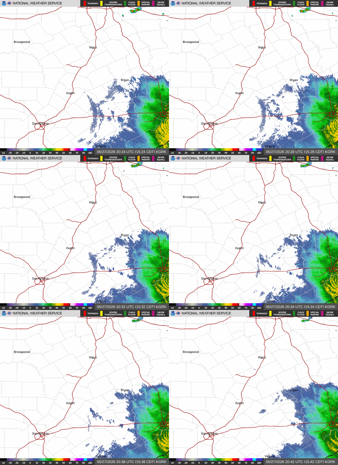
Incoming.
-
Stratton20
- Posts: 5870
- Joined: Tue Feb 09, 2021 11:35 pm
- Location: College Station, Texas
- Contact:
Oh boy, the one cell thats headed my way in this line has a tornado warning issued for it , definitely feeling slightly uncomfortable right now about that
-
Cpv17
- Posts: 7109
- Joined: Fri Aug 31, 2018 1:58 pm
- Location: El Campo/Wharton
- Contact:
Well hell, I slept right through a tornado warning. Anyway, just as I suspected, the storms were able to hold up. I didn’t really believe those dry runs of the HRRR yesterday. Drought is pretty much over now for us after that big rain. Now we have to deal with the mosquitoes.
-
tireman4

- Global Moderator

- Posts: 7161
- Joined: Wed Feb 03, 2010 9:24 pm
- Location: Humble, Texas
- Contact:
More rain coming....
- Attachments
-
- Radar 05 27 26.jpg (186.66 KiB) Viewed 2830 times
-
Pas_Bon
- Posts: 968
- Joined: Tue Sep 11, 2018 7:58 am
- Location: League City, TX
- Contact:
Last I checked, we do not have mosquitoes in SE Texas.Cpv17 wrote: ↑Wed May 27, 2026 7:08 am Well hell, I slept right through a tornado warning. Anyway, just as I suspected, the storms were able to hold up. I didn’t really believe those dry runs of the HRRR yesterday. Drought is pretty much over now for us after that big rain. Now we have to deal with the mosquitoes.
-
tireman4
- Global Moderator
- Posts: 7161
- Joined: Wed Feb 03, 2010 9:24 pm
- Location: Humble, Texas
- Contact:
Jeff Lindner on Facebook
- Attachments
-
- Jeff Lindner Facebook 05 27 26.jpg (140.36 KiB) Viewed 2766 times
-
tireman4
- Global Moderator
- Posts: 7161
- Joined: Wed Feb 03, 2010 9:24 pm
- Location: Humble, Texas
- Contact:
This is a slow moving set of storms coming into the Metro area. I would not be surprised with urban street flooding or ponding on the roads.
- Attachments
-
- Radar 05 27 26 A.jpg (168.28 KiB) Viewed 2737 times
-
Pas_Bon
- Posts: 968
- Joined: Tue Sep 11, 2018 7:58 am
- Location: League City, TX
- Contact:
-
jasons2k

- Posts: 6201
- Joined: Thu Feb 04, 2010 12:54 pm
- Location: Imperial Oaks
- Contact:
Up to .84” for today as it tapers off. Not bad, but my 7-day rain total was about half of what was anticipated.
Oh well, it’s green.
Looks like a landcane moving into Oklahoma.
Oh well, it’s green.
Looks like a landcane moving into Oklahoma.
-
DoctorMu
- Posts: 8089
- Joined: Sun Jun 28, 2015 11:58 am
- Location: College Station
- Contact:
1.11 in of rain last night. The high today never got above 75°F under partly cloudy to later sunny skies this evening. Bottle it up.
If there was a deal with the devil to be made...it would be more of the last 24 hours of weather all summer long. lol
If there was a deal with the devil to be made...it would be more of the last 24 hours of weather all summer long. lol
-
tireman4
- Global Moderator
- Posts: 7161
- Joined: Wed Feb 03, 2010 9:24 pm
- Location: Humble, Texas
- Contact:
Eric Berger
- Attachments
-
- Eric Berger 05 28 26.jpg (138.08 KiB) Viewed 2539 times
-
tireman4
- Global Moderator
- Posts: 7161
- Joined: Wed Feb 03, 2010 9:24 pm
- Location: Humble, Texas
- Contact:
-
Stratton20
- Posts: 5870
- Joined: Tue Feb 09, 2021 11:35 pm
- Location: College Station, Texas
- Contact:
Looks like we could have a weak tropical disturbance/ low move in from the yucatan / BOC region that slides generally north towards se texas or the texas Louisiana state border, development is unlikely given shear in place across the gulf, but could see an enhanced surge of tropical moisture that could bring a heavy rain threat back late next week. Worth watching
-
Cpv17
- Posts: 7109
- Joined: Fri Aug 31, 2018 1:58 pm
- Location: El Campo/Wharton
- Contact:
Latest CPC precipitation forecast looks like it’s siding with the Euro.Stratton20 wrote: ↑Thu May 28, 2026 11:42 am Looks like we could have a weak tropical disturbance/ low move in from the yucatan / BOC region that slides generally north towards se texas or the texas Louisiana state border, development is unlikely given shear in place across the gulf, but could see an enhanced surge of tropical moisture that could bring a heavy rain threat back late next week. Worth watching
-
Stratton20
- Posts: 5870
- Joined: Tue Feb 09, 2021 11:35 pm
- Location: College Station, Texas
- Contact:
Cpv17 yup, euro has been for the past 24-36 hours now showing some sort of weak low pressure approaching the texas coast line late next weekend, that combining with a cut off low over west texas could make for a very wet period
-
Cpv17
- Posts: 7109
- Joined: Fri Aug 31, 2018 1:58 pm
- Location: El Campo/Wharton
- Contact:
Herzog is already mentioning next week on FB.Stratton20 wrote: ↑Thu May 28, 2026 3:04 pm Cpv17 yup, euro has been for the past 24-36 hours now showing some sort of weak low pressure approaching the texas coast line late next weekend, that combining with a cut off low over west texas could make for a very wet period
-
Stratton20
- Posts: 5870
- Joined: Tue Feb 09, 2021 11:35 pm
- Location: College Station, Texas
- Contact:
Cpv17 yup, im watching it, especially after this 18z GFS run coming in, does show a weak TD/ TS forming in the BOC before drifting towards rockport , tx. Falls apart so not much QPF, not that it means much at this range, but we might have something to watch as there will be a lot of tropical moisture pilling into the BOC/ western gulf next week
-
Pas_Bon
- Posts: 968
- Joined: Tue Sep 11, 2018 7:58 am
- Location: League City, TX
- Contact:
Euro, CMC, GFS all show similar solutions with a highly elongated mess of a weak tropical storm making its way into the upper Tx coast/SW La. Stay tuned.
-
Stratton20
- Posts: 5870
- Joined: Tue Feb 09, 2021 11:35 pm
- Location: College Station, Texas
- Contact:
I think at the bare minimum, a lot of tropical moisture is going to head our way, especially with models showing an upper low developing and sitting in west texas , thats already a look for a wet pattern, you get a weak low or even a weak tropical depression to form, that upper low is going to help steer whatever is in the BOC, towards the texas coast, that would up the chances for a much more significant heavy rain event