
Proto-Dexter is still riding easterlies on the bottom side of a mid-level N. Texas mini-ridge. It's doing it's own thing, as weak and unstructured as it is.
https://www.star.nesdis.noaa.gov/GOES/s ... &length=24
Tropical Discussion 2025
-
DoctorMu

- Posts: 8016
- Joined: Sun Jun 28, 2015 11:58 am
- Location: College Station
- Contact:
-
DoctorMu
- Posts: 8016
- Joined: Sun Jun 28, 2015 11:58 am
- Location: College Station
- Contact:
Yep. Finnegan, do it again. The easterlies won't give up the ghost yet. Retrograde lemonade.
Area Forecast Discussion
National Weather Service Houston/Galveston TX
1257 PM CDT Fri Jul 18 2025
...New DISCUSSION, MARINE...
.KEY MESSAGES...
Issued at 1255 PM CDT Fri Jul 18 2025
- Rain chances diminish and temperatures increase this weekend into
the middle parts of next week.
- The next decent chances of precipitation re-enter the forecast
late next week.
&&
.DISCUSSION...
Issued at 1255 PM CDT Fri Jul 18 2025
Mid-upper inverted trof/disturbance situated over east/southeast Tx
should further weaken and lift nnw out of the vicinity tonight &
Saturday. Ridging should then gradually build in from the east as we
go through the weekend and into at least the middle parts of next
week. Increasing subsidence and lower PW`s with time will limit, or
eliminate, rain chances...and more sunshine will allow for a bump in
daytime highs.
Heading into the second part of next week, guidance is depicting
another inverted trof making its way wwd across FL, under the ridge
and toward the western Gulf Coast around Friday. (Looks like a
similar setup as to what we saw this week). If nothing else, it
should bring some increasing clouds/moisture and associated rain
chances back into the area. Some guidance tries to eventually
develop a weak surface circulation, but as of now, moderate winds
aloft could be a limiting factor for development. 47
&&
-
tireman4

- Global Moderator

- Posts: 7123
- Joined: Wed Feb 03, 2010 9:24 pm
- Location: Humble, Texas
- Contact:
The Eyewall
Matt Lanza
In brief: Neither Invest 94L or a potential disturbance in the Gulf are expected to develop this week. Locally heavy rains have fallen in Missouri and Illinois leading to numerous instances of flash flooding. Building heat will make it feel pretty uncomfortable this week across much of the Midwest and South.
Invest 94L
We start out in the Atlantic today, where the tropical wave we've been watching is now tagged as Invest 94L. Nothing has changed here, and we expect little to no development out of this feature as it approaches the Lesser Antilles.
Invest 94L looks rather disheveled this morning in the open Atlantic. It has minimal odds of development before reaching the Caribbean. (Tropical Tidbits)
Modeling is in really good agreement that this will plow through the northern Windward Islands, move into the Caribbean, and fall apart. Perhaps we'll see some added rain and thunderstorm chances in the islands as this moves in, but aside from that, no real impacts are expected out of 94L at this time.
Gulf disturbance
Modeling continues to show a redux of last week's Invest 93L in the Gulf later this week. A fairly disorganized disturbance will emerge in the Gulf probably on Wednesday and track west. I think this one will enter the Gulf a bit farther south than 93L did, which should allow it to track more toward Texas than Louisiana. Wind shear doesn't look horrendous, but it will be present. More importantly, the building heat wave north of this disturbance and hot, dry weather in Texas will likely surround this thing with dry air that should limit any development risk.
Rainfall will be locally heavy along the Gulf Coast later this week with the passing disturbance. (Pivotal Weather)
Rainfall will be the primary calling card of this disturbance. Look for locally heavy rain again this week from Florida across the Gulf Coast into Louisiana. The heavier rains may extend a little farther west into parts of Texas by the weekend as well, but major flooding issues are not currently expected.
Overall, odds of any organization are quite low (no models showing anything of note), and again rainfall will be the primary thing to watch here.
Currently, there are no other items of interest in the Atlantic.
Illinois/Missouri flooding
We almost got through yesterday without a flash flood emergency, but one was issued for Fayette County, Illinois just after 11 PM CT on Sunday. That area saw an estimated 7 to 9 inches of rain yesterday from periods of heavy rainfall.
Estimates of over 9 inches of rain yesterday near Vandalia, Illinois. (NOAA MRMS)
Additional heavy rain led to multiple serious flash flooding reports across parts of Missouri, especially just northwest of St. Louis. Flash flood warnings continue in this area this morning. Flooding along the Kaskaskia River at Vandalia, IL is ongoing, and it may approach moderate levels before cresting.
(NOAA)
Some rivers in this region have risen 5 to 10 feet or more in the last 24 hours. The heavy rain risk should shift south and east today, with more risk focused into Kentucky.
Slight risk (2/4) for flooding today across the Quad State region into southern Kentucky and much of Tennessee. (NOAA WPC)
Heat wave
Meanwhile, if it's not water falling from the sky, it's water vapor in the atmosphere, and the combination of heat and humidity looks rather stout this week across the Mississippi Valley.
Pockets of "extreme" heat risk dot the region from near Memphis south to near New Orleans by Wednesday. (NOAA)
Widespread high and isolated pockets of "extreme" heat risk per the National Weather Service are expected by Wednesday across the Mississippi Valley and South. Very few record temperatures are currently forecast, but the combination heat and humidity will make it feel pretty rough through the week. More heat is on the way for next week too. More to come.
- Attachments
-
- Screenshot 2025-07-21 081206.jpg (131.08 KiB) Viewed 2867 times
-
- Screenshot 2025-07-21 081228.jpg (117.7 KiB) Viewed 2867 times
-
- Screenshot 2025-07-21 081245.jpg (89.17 KiB) Viewed 2867 times
-
- Screenshot 2025-07-21 081307.jpg (98.14 KiB) Viewed 2867 times
-
- Screenshot 2025-07-21 081327.jpg (98.6 KiB) Viewed 2867 times
-
- Screenshot 2025-07-21 081348.jpg (89.57 KiB) Viewed 2867 times
-
Stratton20
- Posts: 5814
- Joined: Tue Feb 09, 2021 11:35 pm
- Location: College Station, Texas
- Contact:
our tropical “ disturbance” is over florida now and should be over the gulf tommorow, I can’t completely rule out a weak depression or maybe marginal TS out of this before moving inland into texas, the short range guidance is getting a little more interesting with many showing a weak circulation trying to form as it heads west
-
DoctorMu
- Posts: 8016
- Joined: Sun Jun 28, 2015 11:58 am
- Location: College Station
- Contact:
^ It's already emerging from FL.
Easterlies, FTW.

Easterlies, FTW.
-
Stratton20
- Posts: 5814
- Joined: Tue Feb 09, 2021 11:35 pm
- Location: College Station, Texas
- Contact:
Well than lol, i guess we will see if we get any sort of weak circulation to form, that could enhance rain chances further
-
Cpv17
- Posts: 7091
- Joined: Fri Aug 31, 2018 1:58 pm
- Location: El Campo/Wharton
- Contact:
10% from the NHC with their 8pm update.
-
Pas_Bon
- Posts: 948
- Joined: Tue Sep 11, 2018 7:58 am
- Location: League City, TX
- Contact:
“Proto-Dexter”. LolDoctorMu wrote: ↑Fri Jul 18, 2025 5:04 pm Proto-Dexter is still riding easterlies on the bottom side of a mid-level N. Texas mini-ridge. It's doing it's own thing, as weak and unstructured as it is.
https://www.star.nesdis.noaa.gov/GOES/s ... &length=24
-
DoctorMu
- Posts: 8016
- Joined: Sun Jun 28, 2015 11:58 am
- Location: College Station
- Contact:
Freshly squeezed.
ZCZC MIATWOAT ALL
TTAA00 KNHC DDHHMM
Tropical Weather Outlook
NWS National Hurricane Center Miami FL
200 AM EDT Wed Jul 23 2025
For the North Atlantic...Caribbean Sea and the Gulf of America:
1. North-Central Gulf:
A trough of low pressure on the southern end of a frontal boundary
is located just offshore of the Southeastern U.S. coast and is
associated with a broad area of disorganized showers and
thunderstorms. Over the next few days, this system is forecast to
move west-southwestward into the north-central portion of the Gulf,
where environmental conditions could allow for some slow
development. By this weekend, the system is likely to move inland,
ending its chances for development. Regardless of formation, heavy
rainfall could be possible for portions of Florida over the next day
or so, and for the northern Gulf coast through this weekend.
* Formation chance through 48 hours...low...10 percent.
* Formation chance through 7 days...low...10 percent.
- Attachments
-
- 518397035_1289442482539086_8127649996330210069_n.jpg (124.89 KiB) Viewed 2551 times
-
tireman4
- Global Moderator
- Posts: 7123
- Joined: Wed Feb 03, 2010 9:24 pm
- Location: Humble, Texas
- Contact:
The Eyewall
Matt Lanza
In brief: The odds of a tropical system in the Gulf remain low, but we explain the evolution of things below. Also, we look at the ridiculous duration of flooding risks we've seen since June. We also talk about the ongoing and continuing heat wave and why despite not setting a bunch of records, it's still a big deal.
Gulf tropical system
Late yesterday, the National Hurricane Center tagged the disturbance heading into the Gulf on their outlook map, giving it about a 10% chance of development. That still seems fair today.
(NOAA NHC)
Currently, the disturbance is very, very sloppy and spread out a good bit between the Gulf and off the east coast of Florida.
The majority of thunderstorms are about 300 miles west of the disturbance itself. (Weathernerds.org)
Wind shear in the Gulf is not exactly hospitable right now for development, as this disturbance will probably at least initially encounter a good bit of that. Wind shear tends to limit tropical development because storms prefer a less hostile environment in which to thrive.
But as this chugs west today and tomorrow, it may encounter a few periods of time where it will be less hostile, and that could lead to at least an attempt to organize. The only model suite right now that seems to be supportive of organization (and even in that case, it's not particularly much) is the European ensemble. It seems to lack support from most other modeling, including the typically more aggressive ICON and Canadian models. Even in the Euro ensemble's case, despite the ensemble mean showing 60 to 70 percent probabilities of a depression, only about one-third of members show any real organization.
The European ensemble is only a little more excited today about low-end development risk than it has been in recent days. (Weathernerds.org)
Yes, it's the Gulf, and yes, you should probably check back in tomorrow to see if anything has changed. However, it seems unlikely that this will develop beyond tropical depression status if it gets there at all.
What it will do is drop some locally heavy rain along the Gulf Coast.
Rainfall this week looks to be locally heavy along the Gulf Coast. (Pivotal Weather)
Flooding concerns aren't zero, but as we've noted this week there's some breathing room here, and with a generally progressive moving system, rainfall amounts in any single location will probably be manageable.
So bottom line on the Gulf? Yes, something may try to briefly develop before moving into Texas on Friday. However, the ceiling is low and model support is extremely limited. The main impact from this system regardless will be locally heavy rain, and that should hopefully be manageable everywhere through Saturday.
It's rain o'clock somewhere
The daily Weather Prediction Center excessive rainfall outlooks, or what we call the EROs are required consumption if you're a meteorologist. Most of us look at them daily and read the discussions fairly regularly. The WPC does a phenomenal job at identifying and homing in on areas of excessive rainfall and flooding risk.
A slight risk (2/4) is once again in place today from the central Plains into Minnesota, Wisconsin, and the U.P. of Michigan. (NOAA WPC)
The risks are on a 4-level scale, from marginal to slight to moderate to high. Not that serious flooding can't occur on a marginal risk day; it can, but typically, once you see the slight risks (2/4) or higher, you sit up a little more and pay a little closer attention. The last day that saw no slight risks of flooding was over a month ago, June 22nd. It has been non-stop somewhere in the country since then. One day it's Texas, the next it's the monsoon, the next it's the Carolinas, after that it's Iowa, then it's New Jersey and New York City, etc., etc. Almost all corners of the country have been blanketed by a slight risk of flash flooding at some point in the last month. It has been exhausting for forecasters in many spots.
Today's risk is highlighted in the Upper Midwest, once again a slight (2/4) risk. Some of those areas saw 1 to 3 inches of rain yesterday, and today's forecast will probably lead to another 1 to 3 inches of rain.
Rainfall today and tomorrow should tally 1 to 3 inches more across Minnesota, northern Wisconsin, and Michigan's Upper Peninsula. (Pivotal Weather)
Flash flooding is a possibility, as are locally higher amounts as some of these storms pass repetitively over the same areas.
Heat wave: All bark, no bite? It's complicated
The interesting thing about this heat wave that's ongoing across the country and likely to expand even farther afield next week is that very few record temperatures are being attained. Usually when you see a setup like this, you expect a fair number of records to fall. In reality, we're getting the upper-level signal in the atmosphere of a pretty healthy heat wave. For example, if you look at the probability of 500 mb heights hitting the 99.5th percentile (or a high-end event) next Monday, you see a broad section of the Deep South, Mid-South, and Ohio Valley in play.
The European model's ensemble probability that 500 mb heights will reach or exceed the 99.5th percentile is pretty high across the South on Monday. (PolarWx.com)
The 500 mb height is a good metric to use to analyze whether we see ridging or troughing, hotter than normal or cooler than normal. It tells us what the pattern is about 20,000 feet up, and for next week it says it's gonna be hot!
But then if you look at temperatures in the lower levels of the atmosphere, up around 5,000 feet, you can see that the potential for a 99.5th percentile (or a high-end event) is quite low.
The probability of 850 mb temperatures (or the temperature of the air mass about 5,000 feet up) reaching the 99.5th percentile on Monday is quite low.
So in theory, we have a couple conflicting pieces of information here. The upper pattern strongly supports heat, but the actual air mass we're pulling from isn't ridiculously hot for this time of year. The outcome? A lot of heat over a broad area, but very little record heat. I would also speculate perhaps that since we're sitting right near the climatological peak of summer right now, it just is genuinely more difficult to see record highs. It's hot during the hottest time of year; that's not terribly abnormal.
NWS HeatRisk for Wednesday has much of the Mississippi Valley under major to extreme levels of heat. (NOAA)
But the duration is what's at play here. Multiple days of this type of mid-grade heat in a row plus humidity can take a toll on the human body, particularly in vulnerable communities, and that's why it's an important event to discuss and cover.
- Attachments
-
- Screenshot 2025-07-23 081210.jpg (71.45 KiB) Viewed 2504 times
-
- Screenshot 2025-07-23 081230.jpg (112.25 KiB) Viewed 2504 times
-
- Screenshot 2025-07-23 081253.jpg (61.81 KiB) Viewed 2504 times
-
- Screenshot 2025-07-23 081314.jpg (123.66 KiB) Viewed 2504 times
-
- Screenshot 2025-07-23 081336.jpg (90.08 KiB) Viewed 2504 times
-
- Screenshot 2025-07-23 081353.jpg (131.88 KiB) Viewed 2504 times
-
- Screenshot 2025-07-23 081413.jpg (103 KiB) Viewed 2504 times
-
- Screenshot 2025-07-23 081438.jpg (90.29 KiB) Viewed 2504 times
-
- Screenshot 2025-07-23 081458.jpg (77.94 KiB) Viewed 2504 times
-
tireman4
- Global Moderator
- Posts: 7123
- Joined: Wed Feb 03, 2010 9:24 pm
- Location: Humble, Texas
- Contact:
The Eyewall
Matt Lanza
In brief: The Gulf tropical disturbance will come ashore in Texas later today, unlikely to develop at all, but bringing some locally heavy downpours at times to Houston and Lake Charles. A tropical wave next week in the Atlantic may (or may not) develop. And today's flooding risk is highest near and southwest of Kansas City.
Gulf tropical disturbance
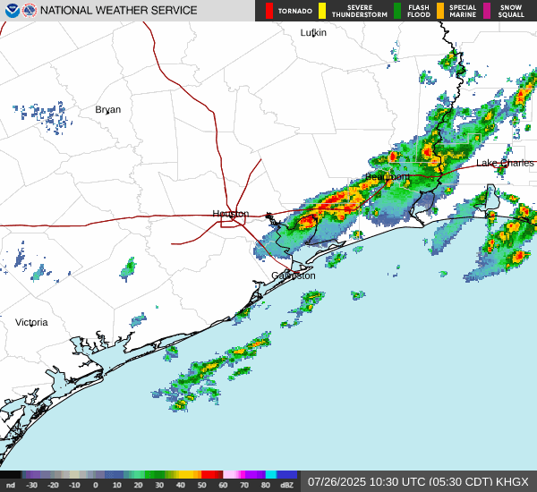
The disturbance in the Gulf that's been carrying a 10 percent risk the last few days is at the end of the road. It will crash ashore in Texas today, bringing some downpours to the Houston area.
Forecast rainfall in the Houston area through western Louisiana today into Sunday. (Pivotal Weather)
Overall, this should be a manageable event, but perhaps one or two places will see some street flooding concerns crop up from Houston through Beaumont into Lake Charles.
Interestingly, this system is going to continue to race west across Texas. Some of the added atmospheric moisture from it may get tired up within the monsoon pattern out West, which could lead to some enhanced moisture for New Mexico, Colorado, Arizona, and Utah.
Above normal atmospheric moisture (green) associated with the Gulf disturbance will work across Texas and get entrained into the monsoon pattern by Monday or Tuesday. (Pivotal Weather)
Otherwise, assuming nothing major changes, we'll close the book on this one today.
What's next in the tropics?
Well, it appears that we're going to have our first true item to watch in the Atlantic next week. The system this past weekend only sort of counted. Next up, we're watching models (and some of the usual social media suspects) get a little worked up about a tropical wave expected to emerge in the Atlantic next week.
Dots showing various European ensemble and Google AI ensemble member locations of tropical disturbance next Friday in the Atlantic. (Google Weather Lab)
So, ok, that's actually not terrible agreement for a 7 day forecast for a nascent wave that hasn't developed yet. Where is this disturbance now? Wayyyyyy over Africa.
Area of thunderstorms over Africa that appears to be the disturbance to focus on for late next week. (Colorado State CIRA)
This thing has 2,000 miles of land yet to traverse before it even emerges in the Atlantic. And then from there, it's got about 7 more days to get to the Caribbean. So, we're at least 10 days out from something making it to the islands, let alone to the U.S. or elsewhere in the Western Hemisphere. So what can we say today? Models are latching onto a disturbance that has at least some chance to develop as it traverses the Atlantic later next week. But it's far too soon to speculate on anything else, and thus, not worth hypothesizing or fantasizing about what may happen in 14 or more days.
Bottom line: We'll keep watching and leave the rampant speculation to others.
Flooding risk focuses on Kansas and Missouri
Some parts of Missouri and Kansas on either side of Kansas City saw anywhere from 4 to 6 inches of rain yesterday, with even some higher radar estimates. Those same areas are now in a moderate risk (3/4) today for excessive rainfall and flooding.
A moderate risk (3/4) is in place for flooding from north of Wichita through Topeka into the Kansas City Metro today. (NOAA WPC)
Flash flood warnings are already ongoing in some of these areas, including for the southeast half of the KC Metro. An additional 2 to 5 inches is possible in spots through the day today.
(NWS Topeka)
Showers and storms will wax and wane through the day.
Matt Lanza
In brief: The Gulf tropical disturbance will come ashore in Texas later today, unlikely to develop at all, but bringing some locally heavy downpours at times to Houston and Lake Charles. A tropical wave next week in the Atlantic may (or may not) develop. And today's flooding risk is highest near and southwest of Kansas City.
Gulf tropical disturbance
The disturbance in the Gulf that's been carrying a 10 percent risk the last few days is at the end of the road. It will crash ashore in Texas today, bringing some downpours to the Houston area.
Forecast rainfall in the Houston area through western Louisiana today into Sunday. (Pivotal Weather)
Overall, this should be a manageable event, but perhaps one or two places will see some street flooding concerns crop up from Houston through Beaumont into Lake Charles.
Interestingly, this system is going to continue to race west across Texas. Some of the added atmospheric moisture from it may get tired up within the monsoon pattern out West, which could lead to some enhanced moisture for New Mexico, Colorado, Arizona, and Utah.
Above normal atmospheric moisture (green) associated with the Gulf disturbance will work across Texas and get entrained into the monsoon pattern by Monday or Tuesday. (Pivotal Weather)
Otherwise, assuming nothing major changes, we'll close the book on this one today.
What's next in the tropics?
Well, it appears that we're going to have our first true item to watch in the Atlantic next week. The system this past weekend only sort of counted. Next up, we're watching models (and some of the usual social media suspects) get a little worked up about a tropical wave expected to emerge in the Atlantic next week.
Dots showing various European ensemble and Google AI ensemble member locations of tropical disturbance next Friday in the Atlantic. (Google Weather Lab)
So, ok, that's actually not terrible agreement for a 7 day forecast for a nascent wave that hasn't developed yet. Where is this disturbance now? Wayyyyyy over Africa.
Area of thunderstorms over Africa that appears to be the disturbance to focus on for late next week. (Colorado State CIRA)
This thing has 2,000 miles of land yet to traverse before it even emerges in the Atlantic. And then from there, it's got about 7 more days to get to the Caribbean. So, we're at least 10 days out from something making it to the islands, let alone to the U.S. or elsewhere in the Western Hemisphere. So what can we say today? Models are latching onto a disturbance that has at least some chance to develop as it traverses the Atlantic later next week. But it's far too soon to speculate on anything else, and thus, not worth hypothesizing or fantasizing about what may happen in 14 or more days.
Bottom line: We'll keep watching and leave the rampant speculation to others.
Flooding risk focuses on Kansas and Missouri
Some parts of Missouri and Kansas on either side of Kansas City saw anywhere from 4 to 6 inches of rain yesterday, with even some higher radar estimates. Those same areas are now in a moderate risk (3/4) today for excessive rainfall and flooding.
A moderate risk (3/4) is in place for flooding from north of Wichita through Topeka into the Kansas City Metro today. (NOAA WPC)
Flash flood warnings are already ongoing in some of these areas, including for the southeast half of the KC Metro. An additional 2 to 5 inches is possible in spots through the day today.
(NWS Topeka)
Showers and storms will wax and wane through the day.
- Attachments
-
- Screenshot 2025-07-25 081549.jpg (102.52 KiB) Viewed 2258 times
-
- Screenshot 2025-07-25 081611.jpg (129.24 KiB) Viewed 2258 times
-
- Screenshot 2025-07-25 081643.jpg (56.37 KiB) Viewed 2258 times
-
- Screenshot 2025-07-25 081709.jpg (85.51 KiB) Viewed 2258 times
-
- Screenshot 2025-07-25 081733.jpg (83.59 KiB) Viewed 2258 times
-
- Screenshot 2025-07-25 081754.jpg (69.17 KiB) Viewed 2258 times
-
DoctorMu
- Posts: 8016
- Joined: Sun Jun 28, 2015 11:58 am
- Location: College Station
- Contact:
I think we're going to see more onshore action over the next 36 hours than anticipated.
-
tireman4
- Global Moderator
- Posts: 7123
- Joined: Wed Feb 03, 2010 9:24 pm
- Location: Humble, Texas
- Contact:
Texas Hurricanes (Josh Morgeman)
- Attachments
-
- FB_IMG_1753574430191.jpg
- (76.02 KiB) Downloaded 900 times
-
tireman4
- Global Moderator
- Posts: 7123
- Joined: Wed Feb 03, 2010 9:24 pm
- Location: Humble, Texas
- Contact:
Texas Hurricanes Since (2000) Josh Morgeman
- Attachments
-
- FB_IMG_1753648583726.jpg
- (74.58 KiB) Downloaded 830 times
-
tireman4
- Global Moderator
- Posts: 7123
- Joined: Wed Feb 03, 2010 9:24 pm
- Location: Humble, Texas
- Contact:
The Eyewall
Matt Lanza
In brief: Tampa reached an all-time high temperature record yesterday. The Atlantic tropics, while busier, still lack a lot of organized risks. And a destructive wind event is possible later today and tonight, primarily in South Dakota and Minnesota.
Torching Tampa
We start today in Tampa, where it hit 100 degrees on Sunday. While that may seem like a relatively pedestrian number, it happens to be the hottest temperature recorded in that city since records began in the 1890s.
(NWS Tampa Bay)
Even 99 degrees has only been reached two times, the 2020 instance noted above and back on June 5, 1985. Notably, only four of the 25 hottest days on record in Tampa have occurred in July or August. Typically, you have a sea breeze or thunderstorms or humidity that's too high to allow for such heat. Yesterday, the area was under the influence of an abnormally strong ridge of high pressure over the Gulf, as well as a very abnormal offshore directed wind at the time of peak heating. The combination allowed for temperatures to surge at a time of relatively low humidity. It's a very localized nuance, but we'd be lying if we didn't also note that it's certainly symptomatic of a warming Gulf as well.
Gulf sea surface temperatures are quite strong near Tampa and near Port Arthur, TX, as well as near coastal Mexico. (Tropical Tidbits)
Tampa has set or tied 107 record highs and 150 record warm low temperatures since 2020. That's not a typo. Their records go back to 1890 and 30 to 40 percent of their warm records have been met in less than 6 years. That's remarkable.
The forecast high today is a more tolerable 97° for Tampa.
A slightly busier Atlantic
Taking a snapshot of the Atlantic basin this morning, it looks a bit more interesting than we've seen lately. First, we have a pretty healthy-looking area of thunderstorms north of the Caribbean islands. This is associated with a tropical wave in the area. There is very, very little model support for anything here, despite how it looks this morning. High pressure should serve to inhibit any sort of organization.
The Atlantic is busier than it has been, but it's not likely to produce anything notable this week. (Weathernerds.org)
Secondly, we have the tropical wave that we discussed a bit last week that's now emerging off Africa. This one still has a puncher's chance of doing something as it comes westward through the week. Will it actually get anywhere? I don't know; model support has continuously slipped for this one since last week. At least through Friday, en-route to the islands, there should be a very minimal chance of development.
After Friday, the picture gets a little more complex. Some modeling lifts this area more to the northwest at the same time that thunderstorms roll off the Southeast coast. The result? Something. If you look at the different ensembles, both from AI-derived models and traditional physics-based models, you see a sloppy mess off the Southeast coast in about 8 days.
Google Weather Lab's plot of various European and AI-based ensemble members shows a signal for something off the Southeast coast next week, with an out to sea outcome favored right now. (Google Weather Lab)
I really like Google's tool here because it gives you a good initial overview of what is percolating. Looking into this further from other models, I get the sense that there's a signal here, but exactly what that signal is (some hybrid subtropical sloppy system, a more formal tropical entity, or something else) remains to be seen. Also, it seems that support right now favors an out to sea outcome ultimately, but again, we're 8 days out from something that hasn't formed yet. But I think we pretty clearly have our next area to watch, even if it isn't a terribly serious concern.
You may have noticed on the Google plot above action in the Pacific. Indeed, it is busy out there now, with Tropical Storm Iona (expected to become a hurricane south of Hawaii) and 3 other areas to watch.
Tropical Storm Iona will pass well south of Hawaii as a hurricane this week. (NOAA NHC)
No impacts for Hawaii are expected at this time.
South Dakota & Minnesota with potent severe weather risk today
Flash flooding impacted the Reno area yesterday evening. Severe storms with heavy rain ripped across Minnesota yesterday, with rain totals of 4 to 8 inches in parts of southwest Minnesota. Eastern South Dakota was also smacked by heavy rainfall and a tornado near Watertown.
Rain totals north of 6 inches occurred in portions of southwest Minnesota and just south of Watertown, South Dakota yesterday. (NOAA MRMS)
The focus today is less on flooding and more on severe weather. There's a fairly strong signal for a powerful line of thunderstorms to develop in the Dakotas later and rocket eastward across South Dakota and into Minnesota. The Storm Prediction Center is already qualifying this setup as a "derecho is likely." A moderate risk (4/5) has been issued for portions of South Dakota and Minnesota. For those new to derecho, it is a long-lived area of thunderstorms that produces significant wind damage over hundreds of miles.
High-end wind damage is possible, if not likely across much of South Dakota later today, extending into Minnesota tonight. (NOAA SPC)
Storms should develop through the day in western North and South Dakota. As they come east later this afternoon and this evening, they will likely intensify into significant wind producers, along with isolated tornadoes. The highest-end risk for destructive winds appears to be from eastern South Dakota into southwest Minnesota. However, it is possible that these storms will hold together and bring significant wind damage concerns to eastern Minnesota too, including the Twin Cities later tonight. Storms should finally begin to weaken once in Wisconsin.
Bottom line: A destructive wind event is a good possibility tonight in a good chunk of South Dakota and southern Minnesota, possibly extending into northern Iowa.
- Attachments
-
- Screenshot 2025-07-28 082019.jpg (87.59 KiB) Viewed 1918 times
-
- Screenshot 2025-07-28 082101.jpg (82.98 KiB) Viewed 1918 times
-
- Screenshot 2025-07-28 082120.jpg (96.63 KiB) Viewed 1918 times
-
- Screenshot 2025-07-28 082142.jpg (61.45 KiB) Viewed 1918 times
-
- Screenshot 2025-07-28 082206.jpg (90.38 KiB) Viewed 1918 times
-
- Screenshot 2025-07-28 082250.jpg (103.1 KiB) Viewed 1918 times
-
DoctorMu
- Posts: 8016
- Joined: Sun Jun 28, 2015 11:58 am
- Location: College Station
- Contact:
The first volley is fired by Euro - AI
- Attachments
-
- ec-aifs_mslp_pcpn_us_60.png
- (164.1 KiB) Downloaded 738 times
-
Pas_Bon
- Posts: 948
- Joined: Tue Sep 11, 2018 7:58 am
- Location: League City, TX
- Contact:
-
Stratton20
- Posts: 5814
- Joined: Tue Feb 09, 2021 11:35 pm
- Location: College Station, Texas
- Contact:
Looks like we are going to find out how good the Euro AI will be or wont lol. Its been pretty consistent with showing something, problem is the other models have been pretty consistent with not showing anything lol
-
tireman4
- Global Moderator
- Posts: 7123
- Joined: Wed Feb 03, 2010 9:24 pm
- Location: Humble, Texas
- Contact:
Pacific
- Attachments
-
- Screenshot 2025-07-29 140920.jpg (75.18 KiB) Viewed 1727 times
-
Cpv17
- Posts: 7091
- Joined: Fri Aug 31, 2018 1:58 pm
- Location: El Campo/Wharton
- Contact: