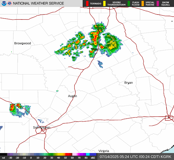
A line of showers is forming west of CLL. I don't anticipate flooding rains like the Hill Country, especially as the line is picking up speed and gobbling streamer showers. The NWS forecast suggests the MCV could stall or slow this evening.
A dose of rain for NW Harris Co. and beyond is very possible. The seabreeze provide more showers tomorrow. After some brief ridging mid-week, a trough retrogrades our way next weekend, consistent with the Euro forecast we've been discussing. GFS continues on IGNORE for the foreseeable future.
Area Forecast Discussion
National Weather Service Houston/Galveston TX
125 PM CDT Sun Jul 13 2025
...New KEY MESSAGES, DISCUSSION, MARINE...
.KEY MESSAGES...
Issued at 117 PM CDT Sun Jul 13 2025
-
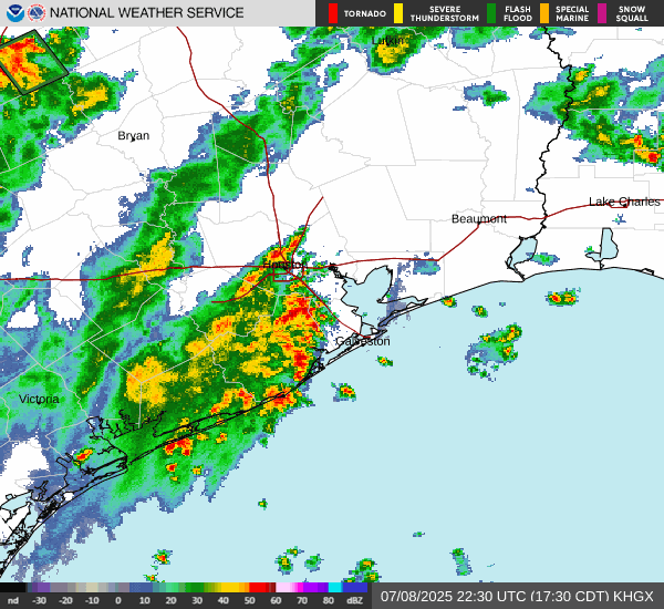
Showers and thunderstorms, a few capable of becoming strong to
severe, are expected this afternoon and evening. Potential hazards
include localized heavy downpours leading to minor flooding,
damaging winds and hail. The greatest risk of this activity is
anticipated to be north of I-10, especially across the Brazos Valley
and Piney Woods area through late evening.
-
Hit-or-miss showers and thunderstorms are expected Monday and
Tuesday, especially in the afternoon along the sea breeze.
- A drier weather pattern is anticipated Wednesday and Thursday
accompanied by increasing temperatures and heat indices in the
triple digits.
-
A coastal trough approaches the north-central Gulf coast towards
the end of the work week, bringing an increasing chance of
showers and storms across most of the region.
&&
.DISCUSSION...
Issued at 117 PM CDT Sun Jul 13 2025
We`re monitoring two key features influencing our weather conditions
today and Monday.
A Mesoscale Convective Vortex(MCV) is moving
across central TX. Its eastward motion means we must closely
monitor it through the rest of the day for any generated outflow
boundaries that could push into our area, sparking rounds of
thunderstorms. We`re also watching an area of surface high
pressure situated along the southeastern coast and north-central
Gulf. While high pressure typically brings fair weather, in this
setup for TX, increased moisture along with daytime heating is
providing fuel for scattered thunderstorms this afternoon. This is
currently evident in our radar, where scattered activity
continues to develop and slowly move northward. As the afternoon
progresses, expect an increase in coverage, particularly in areas
north of I-10. With ample moisture, decent instability and a good
amount of dry air aloft, a few storms will be capable of becoming
strong to severe. Damaging winds and locally heavy rain will be
the primary hazards. Hail cannot be ruled out with any stronger
cells. Given the slow-moving nature of these storms, localized
heavy downpours are expected, which could lead to isolated/minor
flooding.
Rainfall totals up to 1 inch are expected with pockets
of 2 to 3+ inches possible. These risks are highlighted in the SPC
and WPC day 1 severe weather and excessive rainfall outlooks.
Most of this activity will depend on the eastward motion of the
MCV. Therefore, rain and storm chances continue this
evening/tonight, especially across portions of the Brazos Valley
and Piney Woods areas.
The main longwave trough across the Southern Plains will continue
its northeastward motion, moving away from the region. However, some
lingering forcing along the
southeastern edge will remain over the
region, enough to produce showers and storms on Monday. Afternoon
activity is once again expected, mainly along the sea breeze.
Tuesday keeps afternoon chances for rain and storms; however, with
the surface high centered more towards our region, these showers
will need to overcome stronger subsidence. Wednesday and Thursday
continue to be the driest days of the week thanks to the influence
of the ridge over the region. With a drier airmass, hot conditions
are also expected. Above normal temperatures will generally be
expected with highs in the mid to upper 90s.
As we head into the end of the long-term range, we`ll see an
increase in rain and storm chances. We`re closely monitoring a
possible area of low-pressure system likely to develop across the
northeastern Gulf in the next few days. Deterministic models
continue to show a westward movement of this system, potentially
reaching our region Friday into the weekend with increasing rain and
storm chances from the east.
JM