
July 2025
-
tireman4

- Global Moderator

- Posts: 7161
- Joined: Wed Feb 03, 2010 9:24 pm
- Location: Humble, Texas
- Contact:
What shall we see? Wet month? Dry month? Tropical mischief?
-
DoctorMu

- Posts: 8089
- Joined: Sun Jun 28, 2015 11:58 am
- Location: College Station
- Contact:
Assume bleak in CLL for July, August. Hope for a backdoor front or tropical moisture shunt.
-
Ptarmigan

- Statistical Specialist

- Posts: 4536
- Joined: Wed Feb 03, 2010 7:20 pm
- Contact:
Halfway through the year already.
-
Cromagnum
- Posts: 3076
- Joined: Thu Feb 03, 2011 10:42 pm
- Location: Georgetown
- Contact:
Crazy groovy tornado that's been making the rounds on social media.
https://www.facebook.com/share/v/1CKitzsxbv/
https://www.facebook.com/share/v/1CKitzsxbv/
-
tireman4
- Global Moderator
- Posts: 7161
- Joined: Wed Feb 03, 2010 9:24 pm
- Location: Humble, Texas
- Contact:
907
FXUS64 KHGX 011117
AFDHGX
Area Forecast Discussion
National Weather Service Houston/Galveston TX
617 AM CDT Tue Jul 1 2025
...New UPDATE, AVIATION...
.KEY MESSAGES...
Issued at 1209 AM CDT Tue Jul 1 2025
- The pattern of widespread afternoon showers and thunderstorms is
over, but still could see an isolated afternoon shower or storm
over the next few days.
- Temperatures are on a warming trend with high temperatures
expected to be in the mid to upper 90s by the end of the week.
- Hazy skies persist as a layer of Saharan Dust moves over the
region.
- Got plans for July 4th? Make sure to stay hydrated and apply
sunscreen if hanging out in the sun.
Fowler
&&
.UPDATE...
Issued at 616 AM CDT Tue Jul 1 2025
Forecast remains on track, but nudged POPs up in the southern metro
area later this afternoon. The last 10 runs of the HRRR have consistently
shown a small cluster of storms pop up around the Houston Ship
Channel/downtown area in the 2-5pm timeframe and probably worth
the mention considering the population and possible impact to the
late afternoon commute. 47
&&
.DISCUSSION...
Issued at 1201 AM CDT Tue Jul 1 2025
The afternoon thunderstorms we experienced earlier had some oomph
to them with rain rates approaching 2-4" per hour at times - but
luckily they had enough movement to not cause any significant
flooding concerns. There will be a slight chance of isolated
showers or thunderstorms through at least midweek along and south
of the I- 10 corridor, but coverage and intensity of these storms
will much less compared to the past several days as high pressure
builds overhead. However, this high pressure building overhead
will also lead to rising temperatures through the remainder of the
week. Temperatures are expected to peak Friday or Saturday with
highs in the mid to upper 90s inland, and low to mid 90s along the
coast. Expect continued hazy skies through this week as surges of
Saharan Dust move through the region.
If you have outdoor plans for July 4th, make sure to stay hydrated,
take breaks in the shade or A/C, and apply sunscreen when outside.
Fowler
&&
.AVIATION...
(12Z TAF Issuance)
Issued at 616 AM CDT Tue Jul 1 2025
Just some thin cirrus out there right now, but that has allowed
for temps to cool to the dewpoint at several locations allowing
for some patchy fog development. This should burn off a few hours
after sunrise. Otherwise, VFR conditions should mostly prevail
today...but terminals around the metro area should be on the lookout
for some scattered pop-up tstms in the vicinity in the 20-23z
timeframe as consistently indicated by the HRRR model. Precip
should die off by early evening. SREF guidance indicates the potential
for some more fog development along the I-10/US59 corridor later
tonight...moreso just west of the I-45 terminals. 47
&&
.MARINE...
Issued at 1201 AM CDT Tue Jul 1 2025
Light onshore winds between 5-10kt and low seas will persist through
this week. An isolated shower or thunderstorm will be possible
through midweek, but chances are much lower than compared to the
past few days.
Fowler
&&
.PRELIMINARY POINT TEMPS/POPS...
College Station (CLL) 95 73 95 75 / 10 0 10 0
Houston (IAH) 95 75 95 76 / 30 10 20 0
Galveston (GLS) 90 80 90 81 / 10 0 10 0
&&
.HGX WATCHES/WARNINGS/ADVISORIES...
TX...None.
GM...None.
&&
$$
-
DoctorMu
- Posts: 8089
- Joined: Sun Jun 28, 2015 11:58 am
- Location: College Station
- Contact:
Clear Lake - SD - MN border over the weekend - a massive stove pipe tornado and roped in and out.. Reed and some other chasers were there. A bit of a late season traffic jam. A couple of houses were hit badly.Cromagnum wrote: ↑Mon Jun 30, 2025 10:23 pm Crazy groovy tornado that's been making the rounds on social media.
https://www.facebook.com/share/v/1CKitzsxbv/
-
tireman4
- Global Moderator
- Posts: 7161
- Joined: Wed Feb 03, 2010 9:24 pm
- Location: Humble, Texas
- Contact:
93
FXUS64 KHGX 011759
AFDHGX
Area Forecast Discussion
National Weather Service Houston/Galveston TX
1259 PM CDT Tue Jul 1 2025
...New KEY MESSAGES, DISCUSSION, MARINE...
.KEY MESSAGES...
Issued at 1259 PM CDT Tue Jul 1 2025
- Isolated showers/storms possible through midweek...rain chances
return late in the weekend into early next week.
- Temperatures on the rise throughout the week with mid to upper
90s towards the end of the week with heat indices in the triple
digits.
- Saharan dust leading to hazy skies will prevail throughout most
of the week.
- 4th of July forecast still looks hot and dry...no issues
anticipated for the evening firework shows, but please practice
heat safety.
Batiste
&&
.DISCUSSION...
Issued at 1259 PM CDT Tue Jul 1 2025
We`ve made it to the halfway point of 2025, and our prize will be an
increasing temperature trend that takes us into the holiday weekend.
There will continue to be the potential for isolated showers/storms
in the afternoon...and speaking of that let`s talk about that
potential for today. The HRRR continues to be consistent on
developing a few storms around the I-10 corridor generally between
3pm-8pm. It was right yesterday, so I don`t see any reason to not
believe it for today as well. Locally heavy downpours will again be
possible and higher rainfall rates could lead to brief periods of
minor street flooding in vulnerable areas. These chances for
isolated showers/storms generally continue throughout the week, but
they`ll mainly be around 10% as ridging aloft remains in control and
the main ridge axis slides in. The decreased rain chances means that
we`ll an increasing temperature trend...and yep it is going to be
hot on the 4th of July!
850 mb temperatures by midweek will be around the 90th percentile
and that`ll pair with the persistent layer of Saharan dust. By the
end of the work week, high temperatures will be in the mid to upper
90s. Heat indices will be well into the triple digits. Towards the
end of the work week and into the weekend, heat indices will top out
in the 104-107F range. This is below our threshold for a Heat
Advisory, but with an outdoor focused holiday coming up...heat
safety should be at the top of your minds. On the 4th of July in
particular, high temperatures will be mainly in the mid 90s with a
few upper 90s mixed in. There will be a southerly wind around 5-10
mph, so not much help there. We already talked about the heat
indices, so you know it`ll be humid out there. Be sure to practice
heat safety: know the signs of heat related illnesses, stay hydrated
(with water), take frequent breaks from the heat, wear loose/light-
colored clothing and sunscreen, and ALWAYS LOOK before you LOCK your
vehicle. Don`t forget about your pets as well! If the ground is too
hot for the palm of your hand, then it is too hot for their paws.
Temperatures will still be in the upper 80s/low 90s at the start of
most of the firework shows in the evening.
The current plume of Saharan dust will drift eastward out of the
area by Thursday, and we`re looking at another plume moving in late
Friday and remaining overhead throughout the weekend. The next plume
appears that it`ll have lighter concentrations of dust compared to
the one that`s currently ongoing. Speaking of the weekend,
temperatures are expected to reach into the upper 90s. On Sunday,
model guidance hints that we`ll be wedged between two mid-level
areas of high pressure. This break in subsidence looks to give us
our next mentionable chance for showers/storms. The mid-level high
to our west becomes the stronger of the two going into early next
week and leaves us on the eastern periphery. That should allow for
intermittent rounds of shortwaves/upper level disturbances leading
to elevated chances for showers/storms.
Batiste
&&
.AVIATION...
(12Z TAF Issuance)
Issued at 616 AM CDT Tue Jul 1 2025
Just some thin cirrus out there right now, but that has allowed
for temps to cool to the dewpoint at several locations allowing
for some patchy fog development. This should burn off a few hours
after sunrise. Otherwise, VFR conditions should mostly prevail
today...but terminals around the metro area should be on the lookout
for some scattered pop-up tstms in the vicinity in the 20-23z
timeframe as consistently indicated by the HRRR model. Precip
should die off by early evening. SREF guidance indicates the potential
for some more fog development along the I-10/US59 corridor later
tonight...moreso just west of the I-45 terminals. 47
&&
.MARINE...
Issued at 1259 PM CDT Tue Jul 1 2025
Generally light to occasionally moderate onshore flow and low seas
will prevail throughout the week. Isolated showers/storms will be
possible through midweek, then the next notable rain chances will be
late in the weekend into next week. Conditions will be hot and dry
for the 4th of July. Saharan dust will continue to produce hazy
skies through midweek, and another plume is expected to move in
Friday and prevail over the weekend.
Batiste
&&
.PRELIMINARY POINT TEMPS/POPS...
College Station (CLL) 74 94 75 94 / 0 10 0 10
Houston (IAH) 76 95 76 95 / 0 10 0 10
Galveston (GLS) 81 90 81 90 / 0 10 0 10
&&
.HGX WATCHES/WARNINGS/ADVISORIES...
TX...None.
GM...None.
&&
$$
DISCUSSION...Batiste
AVIATION...47
MARINE...Batiste
-
tireman4
- Global Moderator
- Posts: 7161
- Joined: Wed Feb 03, 2010 9:24 pm
- Location: Humble, Texas
- Contact:
277
FXUS64 KHGX 021027
AFDHGX
Area Forecast Discussion
National Weather Service Houston/Galveston TX
527 AM CDT Wed Jul 2 2025
...New AVIATION...
.KEY MESSAGES...
Issued at 1259 PM CDT Tue Jul 1 2025
- Isolated showers and storms possible through Thursday, mainly
west of I-45.
- A thin plume of Saharan dust remains over SE TX, resulting in
hazy skies.
- Hot and dry conditions are expected for the 4th of July and into
the holiday weekend.
- Heat index values up to 107F are expected this week and into the
weekend. Remember to practice proper heat safety.
&&
.DISCUSSION...
Issued at 1225 AM CDT Wed Jul 2 2025
Latest satellite imagery and mesoanalysis show the mid-level ridge
building over our region while remnants of Barry continue to move
across the South/Central Texas. Locally, the influence of the ridge
is bringing a drier airmass that will persist through the rest of
the week. In fact, part of this dry airmass is due to Saharan dust
that will remain over us through at least late Wednesday. This is a
thin layer of dust; therefore, minimal impacts are expected other
than some hazy skies. Despite a drier airmass over us, we cannot
rule out a few showers and storms on Wednesday and Thursday.
Moderate PWs remain over the region with values into the 1.5 to 1.7
inch range, which is close to the daily mean of climatology.
Therefore, an isolated storm or two will be possible, especially in
the afternoon with the combination of peak daytime heating and
sea/bay breezes. The best rain/storm chances will be across our
southwestern counties/areas west of I-45. Hot conditions and low
rain chances will continue through the holiday weekend.
Ridging aloft also means hotter conditions. 850mb temperatures show
values into the 18 to 22 degC, suggesting surface highs in the mid
to upper 90s. With south to southeasterly surface flow bringing
warmer and more humid Gulf air, afternoon heat index reaching up to
107F can be expected through the weekend. With the holiday weekend
coming up, remember to practice proper heat safety by staying
hydrated, staying cool (taking breaks in A/C), and wearing light-
colored clothes. Please, don`t forget to check on kids, the elderly,
and pets.
Ridge aloft weakens/shifts to the west early next week as a sfc
trough develops across the northwestern Gulf. This pattern will
bring back increasing rain and storm chances early next week.
JM
&&
.AVIATION...
(12Z TAF Issuance)
Issued at 523 AM CDT Wed Jul 2 2025
With the exception of some early morning & late night fog, mainly
outside of the main Houston terminals, VFR conditions and light
winds are expected. There may be an isolated pop-up shower/tstm or
two in the area in the 20-23 timeframe, but chances are too low
to mention in the TAFs attm. 47
&&
.MARINE...
Issued at 1225 AM CDT Wed Jul 2 2025
Surface high pressure to our east continues to bring light onshore
winds and low seas early this week. Drier and hot conditions are
anticipated through the week with only a few storms possible through
Thursday. Rain and storm chances increase late Sunday into early
next week as a disturbance moves through the region. Hazy skies due
to Saharan dust remains over the region at least through late
Wednesday, before returning into the area early this weekend.
Beach conditions: Use caution heading to the beach as a moderate
risk of rip currents along all Gulf-facing beaches continues through
Saturday. Always swim near a lifeguard and avoid swimming near piers
and jetties.
JM
&&
.PRELIMINARY POINT TEMPS/POPS...
College Station (CLL) 95 75 93 75 / 10 0 20 10
Houston (IAH) 96 77 94 77 / 10 0 20 0
Galveston (GLS) 90 81 89 82 / 10 0 10 0
&&
.HGX WATCHES/WARNINGS/ADVISORIES...
TX...None.
GM...None.
&&
$$
DISCUSSION...Adams
AVIATION...Adams
MARINE...Adams
-
jasons2k

- Posts: 6201
- Joined: Thu Feb 04, 2010 12:54 pm
- Location: Imperial Oaks
- Contact:
Back to the blast furnace. It’s not even that bad for Texas and I already hate being back.
-
DoctorMu
- Posts: 8089
- Joined: Sun Jun 28, 2015 11:58 am
- Location: College Station
- Contact:
SAT, Hill Country, even Austin are seeing some showers and benefits from Barry moisture. Allegedly, tomorrow we have a better chance of showers.
Area Forecast Discussion
National Weather Service Houston/Galveston TX
1257 PM CDT Wed Jul 2 2025
...New KEY MESSAGES, DISCUSSION, MARINE...
.KEY MESSAGES...
Issued at 1257 PM CDT Wed Jul 2 2025
- Isolated showers/storms possible throughout the work week.
- Hot temperatures persist with highs in the 90s and heat indices
in the 100s.
- Saharan dust leading to hazy skies will prevail into the weekend.
- 4th of July forecast still hot and mostly dry...can`t rule out a
shower/storm but no issues anticipated for the evening firework
shows, but continue to practice heat safety.
&&
.DISCUSSION...
Issued at 1257 PM CDT Wed Jul 2 2025
A quick summary of the forecast is brought to you by the letter H:
hot, hazy, and hardly a chance of rain...at least for the next few
days for that last part. With mid to upper level ridging in place
and the main ridge axis continuing to nudge eastward over the
Central/Southern Plains, we remain with increased subsidence.
Combine that with the layer of Saharan dust today and we have a very
slight chance that a rogue shower/storm could develop. Interestingly
enough, this is the 3rd day in a row that the HRRR has been
consistent on showing that the lone storm that develops will be
right in the Houston metro area...because of course! Thursday
features a rather decent chance of rainfall as an embedded shortwave
trough along with a weak frontal boundary (don`t get too excited)
breaches the ridging pattern. The best rain chances for Thursday
will be west of I-45 and north of SH 30/US-190 (near Huntsville).
Otherwise, the next best chances of rain come during the latter half
of the weekend and into next week as mid-level high pressure slides
off to the west allowing for various disturbances to drift into the
area. A coastal trough looks to also come into play some time next
week as well, so for this timeframe the best rain chances will be
along and south of the I-10 corridor. That covers all of the
rain...now let`s talk about the heat!
High temperatures will top out in the low to mid 90s through Friday
and then rise into the mid to upper 90s over the weekend as 850mb
temperatures go on the rise. As y`all know...it ain`t Houston
without the humidity. Dew points will be mostly in the mid 70s but
will mix out into the upper 60s/low 70s during the afternoon hours.
We`ll still see heat indices peaking into the 102-106F range, which
is below our threshold for a Heat Advisory. Keep in mind though,
that these temperatures still pose a hazard if you are outdoors for
an extended period of time. The 4th of July still looks to be hot
and mostly dry (slight chance of rain in the afternoon before the
firework shows begin) with high temperatures mainly in the mid 90s.
This`ll be a day where a lot of you will be outdoors for an extended
period of time, so please have heat safety at the top of your mind.
It`ll still be in the upper 80s/low 90s when the firework shows
begin with southerly winds around 10 mph at most. Practice heat
safety: know the signs of heat related illnesses, stay hydrated
(with water), take frequent breaks from the heat, wear loose/light-
colored clothing and sunscreen, and ALWAYS LOOK before you LOCK your
vehicle. Don`t forget about your pets as well! If the ground is too
hot for the palm of your hand, then it is too hot for their paws.
While I still have y`all`s attention, I`m sure y`all have been
noticing the grayish tint to the skies over the past few days due to
the ongoing Saharan dust plume. The good news is that this plume
will work its way out of here by Thursday...the bad news is that
another plume will move in late Friday through Sunday...and there`s
another plume that looks to move in around the middle of next week.
The best news is that these constant plumes of Saharan dust will
help to keep the Gulf quiet in terms of the forbidden T word
(*whispers* "tropical"), but it does come at the price of decreased
air quality along with irritants to eyes/sinuses for some of
us...I`m scratching my eyes as I type this!
Batiste
-
DoctorMu
- Posts: 8089
- Joined: Sun Jun 28, 2015 11:58 am
- Location: College Station
- Contact:
Relatively close, but no cigar today.
-
Cpv17
- Posts: 7109
- Joined: Fri Aug 31, 2018 1:58 pm
- Location: El Campo/Wharton
- Contact:
-
tireman4
- Global Moderator
- Posts: 7161
- Joined: Wed Feb 03, 2010 9:24 pm
- Location: Humble, Texas
- Contact:
660
FXUS64 KHGX 021757
AFDHGX
Area Forecast Discussion
National Weather Service Houston/Galveston TX
1257 PM CDT Wed Jul 2 2025
...New KEY MESSAGES, DISCUSSION, MARINE...
.KEY MESSAGES...
Issued at 1257 PM CDT Wed Jul 2 2025
- Isolated showers/storms possible throughout the work week.
- Hot temperatures persist with highs in the 90s and heat indices
in the 100s.
- Saharan dust leading to hazy skies will prevail into the weekend.
- 4th of July forecast still hot and mostly dry...can`t rule out a
shower/storm but no issues anticipated for the evening firework
shows, but continue to practice heat safety.
&&
.DISCUSSION...
Issued at 1257 PM CDT Wed Jul 2 2025
A quick summary of the forecast is brought to you by the letter H:
hot, hazy, and hardly a chance of rain...at least for the next few
days for that last part. With mid to upper level ridging in place
and the main ridge axis continuing to nudge eastward over the
Central/Southern Plains, we remain with increased subsidence.
Combine that with the layer of Saharan dust today and we have a very
slight chance that a rogue shower/storm could develop. Interestingly
enough, this is the 3rd day in a row that the HRRR has been
consistent on showing that the lone storm that develops will be
right in the Houston metro area...because of course! Thursday
features a rather decent chance of rainfall as an embedded shortwave
trough along with a weak frontal boundary (don`t get too excited)
breaches the ridging pattern. The best rain chances for Thursday
will be west of I-45 and north of SH 30/US-190 (near Huntsville).
Otherwise, the next best chances of rain come during the latter half
of the weekend and into next week as mid-level high pressure slides
off to the west allowing for various disturbances to drift into the
area. A coastal trough looks to also come into play some time next
week as well, so for this timeframe the best rain chances will be
along and south of the I-10 corridor. That covers all of the
rain...now let`s talk about the heat!
High temperatures will top out in the low to mid 90s through Friday
and then rise into the mid to upper 90s over the weekend as 850mb
temperatures go on the rise. As y`all know...it ain`t Houston
without the humidity. Dew points will be mostly in the mid 70s but
will mix out into the upper 60s/low 70s during the afternoon hours.
We`ll still see heat indices peaking into the 102-106F range, which
is below our threshold for a Heat Advisory. Keep in mind though,
that these temperatures still pose a hazard if you are outdoors for
an extended period of time. The 4th of July still looks to be hot
and mostly dry (slight chance of rain in the afternoon before the
firework shows begin) with high temperatures mainly in the mid 90s.
This`ll be a day where a lot of you will be outdoors for an extended
period of time, so please have heat safety at the top of your mind.
It`ll still be in the upper 80s/low 90s when the firework shows
begin with southerly winds around 10 mph at most. Practice heat
safety: know the signs of heat related illnesses, stay hydrated
(with water), take frequent breaks from the heat, wear loose/light-
colored clothing and sunscreen, and ALWAYS LOOK before you LOCK your
vehicle. Don`t forget about your pets as well! If the ground is too
hot for the palm of your hand, then it is too hot for their paws.
While I still have y`all`s attention, I`m sure y`all have been
noticing the grayish tint to the skies over the past few days due to
the ongoing Saharan dust plume. The good news is that this plume
will work its way out of here by Thursday...the bad news is that
another plume will move in late Friday through Sunday...and there`s
another plume that looks to move in around the middle of next week.
The best news is that these constant plumes of Saharan dust will
help to keep the Gulf quiet in terms of the forbidden T word
(*whispers* "tropical"), but it does come at the price of decreased
air quality along with irritants to eyes/sinuses for some of
us...I`m scratching my eyes as I type this!
Batiste
&&
.AVIATION...
(12Z TAF Issuance)
Issued at 523 AM CDT Wed Jul 2 2025
With the exception of some early morning & late night fog, mainly
outside of the main Houston terminals, VFR conditions and light
winds are expected. There may be an isolated pop-up shower/tstm or
two in the area in the 20-23 timeframe, but chances are too low
to mention in the TAFs attm. 47
&&
.MARINE...
Issued at 1257 PM CDT Wed Jul 2 2025
Generally light to occasionally moderate onshore flow and low seas
will prevail throughout the week. Isolated showers/storms will be
possible through the work week with the next best rain chances late
in the weekend into next week. Conditions will be hot and dry for
the 4th of July. Saharan dust will continue to produce hazy skies
throughout the day today, and another plume is expected to move in
Friday and persist through the weekend.
Batiste
Beach conditions: Use caution heading to the beach as a moderate
risk of rip currents along all Gulf-facing beaches continues through
Saturday. Always swim near a lifeguard and avoid swimming near piers
and jetties.
JM
&&
.PRELIMINARY POINT TEMPS/POPS...
College Station (CLL) 75 93 76 94 / 0 30 10 10
Houston (IAH) 77 95 77 94 / 0 20 10 20
Galveston (GLS) 81 89 81 90 / 0 10 10 10
&&
.HGX WATCHES/WARNINGS/ADVISORIES...
TX...None.
GM...None.
&&
$$
DISCUSSION...Batiste
AVIATION...47
MARINE...Batiste
-
DoctorMu
- Posts: 8089
- Joined: Sun Jun 28, 2015 11:58 am
- Location: College Station
- Contact:
-
jasons2k
- Posts: 6201
- Joined: Thu Feb 04, 2010 12:54 pm
- Location: Imperial Oaks
- Contact:
I wish we had more rain when we were away. It’s drying out quickly over here. The next several days look dry. I’m OK with the 4th being dry. After that it needs to dump.
-
tireman4
- Global Moderator
- Posts: 7161
- Joined: Wed Feb 03, 2010 9:24 pm
- Location: Humble, Texas
- Contact:
541
FXUS64 KHGX 031104
AFDHGX
Area Forecast Discussion
National Weather Service Houston/Galveston TX
604 AM CDT Thu Jul 3 2025
...New AVIATION...
.KEY MESSAGES...
Issued at 1207 AM CDT Thu Jul 3 2025
- Scattered showers and storms are expected on Thursday with the
best chances in the afternoon.
- Hot and humid conditions with hazy skies are expected for the 4th
of July and into the holiday weekend.
- Heat index values up to 107F are expected this week and into the
weekend. Remember to practice proper heat safety!
&&
.DISCUSSION...
Issued at 1207 AM CDT Thu Jul 3 2025
After a warm and muggy night with some regions seeing patchy fog
(mostly low-lying fog), expect another hot and humid Thursday across
southeast TX. Thursday will bring back precipitation chances in
response to a shortwave trough embedded in the southwest flow aloft.
The best timing for scattered activity is from mid morning through
late afternoon due to the combination of upper-lvl forcing, sfc
convergence and heating, and decent low to mid-level moisture. Based
on latest Hi-Res models/CAMS, the greatest chances will be for areas
west of I-45.
The 4th of July is shaping up to be hot, humid and hazy as the
region remains under the influence of the ridge. Highs will climb in
the low to mid 90s, with peak heat index values reaching up to 107
F. Temperatures in the evening won`t cool off much. It will
generally remain in the 80s, with heat indices up to 94F. Remember
to practice heat safety when outdoors! Always stay hydrated (drink
plenty of water), take frequent breaks from the heat, wear
comfortable, light-colored clothes and please, don`t forget to check
on kids, the elderly and pets.
Another hot and relatively dry day is anticipated for Saturday.
Beyond Sunday, ridging aloft shifts westward, giving way to a parade
of shortwaves aloft moving across the region. At the surface, a
coastal trough is progged to develop across the northwestern
Gulf/upper TX coast. These features will be enough to support
increasing rain/storm chances for portions of the region at least
through Monday. Looking further ahead, surface high pressure builds
again across the Gulf, bringing a drier airmass through at least
Thursday. However, a daily risk of isolated to scattered afternoon
showers/storms continues each day.
We`ll have a break from the Saharan dust on Thursday. But it won`t
last long as another plume of dust is on its way, arriving by
Friday. Hazy skies will prevail through at least Sunday, before
another plume arrives later next week.
JM
&&
.AVIATION...
(12Z TAF Issuance)
Issued at 547 AM CDT Thu Jul 3 2025
Weak showers are currently moving in across the north/norteast
early today, and may bring light rain at times thoughout the
morning. Anothers cluster of showers/storms should develop west
of the city towards central/southern Texas during the afternoon.
A few thunderstorms could develop during this period, though
coverage and confidence remains too low still to warrant a mention
in the TAFs. Rain chances taper off in the evening with light
southerly winds prevailing overnight. Isolated patchy fog will be
possible Friday morning. Otherwise, VFR conditions will dominate
the TAF period.
03
&&
.MARINE...
Issued at 1207 AM CDT Thu Jul 3 2025
Light south to southeast winds and low seas continue across the
Upper TX coast as the surface high remains in control to the east.
Rain and storm chances remain low for the rest of the week; though
an isolated shower/storm or two cannot be ruled out. Another round
of Saharan dust will arrive on Friday, persisting into the weekend.
This will result in hazy skies. The next best chance for showers and
storms arrives after Sunday as a weak disturbance moves across the
northwestern Gulf. Rain chances will be on the increase during the
upcoming week over the coastal waters. Overall, light to occasional
moderate onshore winds and seas will persist over the next 7 days.
Beach conditions: Use caution heading to the beach as a moderate
risk of rip currents along all Gulf-facing beaches continues through
early Saturday. Always swim near a lifeguard and avoid swimming near
piers and jetties.
JM
&&
.PRELIMINARY POINT TEMPS/POPS...
College Station (CLL) 92 75 92 75 / 40 20 10 0
Houston (IAH) 95 78 93 77 / 30 10 20 0
Galveston (GLS) 89 82 90 82 / 20 10 10 0
&&
.HGX WATCHES/WARNINGS/ADVISORIES...
TX...None.
GM...None.
&&
$$
DISCUSSION...JM
AVIATION...03
MARINE...JM
-
Pas_Bon
- Posts: 968
- Joined: Tue Sep 11, 2018 7:58 am
- Location: League City, TX
- Contact:
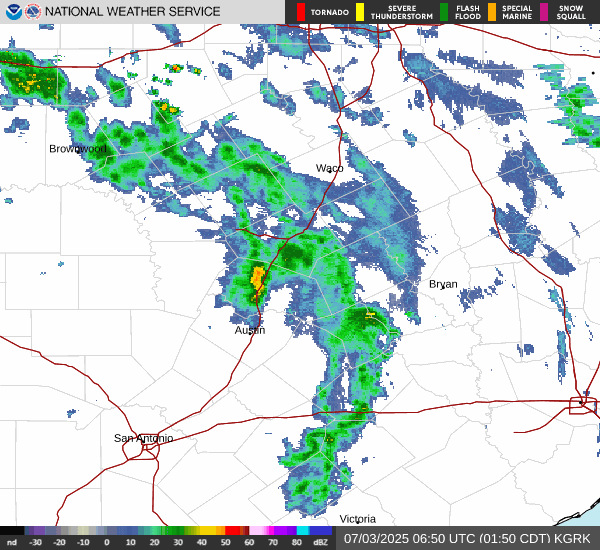
Don't look now, but we have a shortwave surprise in store for today.....rain chances are high today for a good portion of the area. Fingers crossed.
-
jasons2k
- Posts: 6201
- Joined: Thu Feb 04, 2010 12:54 pm
- Location: Imperial Oaks
- Contact:
It’s pretty hot out there cutting 3 weeks worth of thick green grass. I’m glad it’s 87 not 97 

-
Rip76

- Posts: 2151
- Joined: Mon Feb 15, 2010 12:38 am
- Location: The Woodlands
- Contact:
Seeing some towers out there.
-
tireman4
- Global Moderator
- Posts: 7161
- Joined: Wed Feb 03, 2010 9:24 pm
- Location: Humble, Texas
- Contact:
Thundering in the Gulfgate area.....
- Attachments
-
- Screenshot 2025-07-03 132533.png (120.88 KiB) Viewed 157959 times