
May 2025
-
jasons2k

- Posts: 6193
- Joined: Thu Feb 04, 2010 12:54 pm
- Location: Imperial Oaks
- Contact:
Sad state of affairs when you see a dewpoint gradient like that in May, at peak heating, right over us, and no storms.
-
tireman4

- Global Moderator

- Posts: 7127
- Joined: Wed Feb 03, 2010 9:24 pm
- Location: Humble, Texas
- Contact:
838
FXUS64 KHGX 201131
AFDHGX
Area Forecast Discussion
National Weather Service Houston/Galveston TX
631 AM CDT Tue May 20 2025
...New AVIATION...
.SHORT TERM...
(Today through Wednesday Night)
Issued at 203 AM CDT Tue May 20 2025
Hot weather continues to be the main story through the short term,
but less humid weather is expected to begin to filter into the
region today following the passage of a weak boundary from the
north. This boundary will be fairly diffuse, so the exact timing
of its passage will be unknown, but the generally timing is
through the Piney Woods/Brazos Valley region between 10am and
Noon, through the Houston Metro between 2-5pm, and then not off
the coast until sometime tonight. This boundary will bring dew
points down into the 50s-60s behind it, but only areas north of
I-10 will get to experience these drier conditions today. Areas
along and south of I-10 will likely see hotter and muggier weather
than the last couple of days. High temperatures today will be in
low to mid 90s north of Harris County and along the coast, while
temperatures along the I-10 corridor and down through northern
Jackson County will rise into the upper 90s. The difference in dew
points today will lead to a rather drastic gradient in heat
indicies across the region with max HI`s near the max temperature
(low 90s) in the Piney Woods and Brazos Valley, but then into the
100-105 degree range along and south of the I-10 corridor with
even seeing a few spots climbing above 105 degrees. Have decided
against the issuance of any Heat Advisories, for now, as partly
cloudy skies and occasional wind gusts to 10-15mph should limit
heat indicies from climbing much higher than 105 degrees.
Nevertheless, please continue to practice heat safety today.
An isolated shower or thunderstorms may develop along the boundary
this afternoon/evening as it moves through the I-10 corridor,
especially east of I-45. SPC does include the eastern parts of
Liberty and Polk counties in a Marginal Risk (level 1 of 5) of
strong to severe thunderstorms capable of producing strong wind
gusts this afternoon/evening, but the greatest risk of any severe
weather will be well to our northeast.
Wednesday will see the continuation of the hot weather across SE
Texas with highs in the low to mid 90s for most of the area, with
a few spots near the Houston Metro approaching the upper 90s.
However, the drier conditions will be felt across the entire
region limiting heat indices to near or just about the actual
temperature. So while it will be hot, it will feel better than
today for most of the area.
&&
.LONG TERM...
(Thursday through Monday)
Issued at 1228 AM CDT Tue May 20 2025
The southern edge of a weak upper level trough will move overhead
on Thursday. As it does so, mid-level moisture increases across
Southeast TX and a few vort maxes will be pass overhead. While
this would give us a better chances for rain development, we will
need to see if the lower levels have recovered enough moisture and
instability for showers to develop or if we will end up fighting
the cap. As of now, PWs may range between 1.1" to 1.3" for areas
north of I-10 and 1.3" to 1.6" for areas south of I-10, which may
be sufficient to support the development of afternoon/evening
showers and isolated thunderstorms if no capping is present. That
being said, models are keeping Thursday on the dry side, but I
believe we have a chance for some development Thursday afternoon.
Thus, I`m comfortable with keeping the inherited ~20% PoPs for
that timeframe. The high temperatures on Thursday are expected to
be 5-10 deg F above normal for that day, ranging between the mid
to upper 90s for most inland areas and the upper 80s to lower 90s
along the coasts.
Sunny to partly cloudy skies and highs generally in the lower to
mid 90s are expected Friday into Saturday as the upper level ridge
returns to Southeast TX. Sunday is a bit of a toss up for me at
the moment. Low level moisture increases to 1.5" to 1.8" Sunday
afternoon, and models are hinting at some sort of boundary (maybe
an outflow boundary from a nearby storm or weak front) around the
Piney Woods and Brazos Valley region. They also show fairly good
sfc CAPE values of around 3,000 J/kg in and around this area. So
naturally, it`s where we could be expecting the better chances
for rain to occur. However, I dont know if this will be enough to
fight off the persistent upper to mid-level ridge overhead. Will
keep the current NBM PoPs for Sunday afternoon/evening, carrying
around 20-30% PoPs for areas north of I-10 and 15- 20% PoPs
elsewhere.
A better set up for rain may occur on Monday (Memorial Day) as
the ridge weakens and a few disturbances pass overhead throughout
the day. We could also have storms developing to our north and
northwest move into Southeast TX Monday afternoon or evening.
Models hint at some cooling on Monday as well, with highs possibly
in the upper 80s for much of Southeast TX.
Cotto - 24
&&
.AVIATION...
(12Z TAF Issuance)
Issued at 603 AM CDT Tue May 20 2025
MVFR conditions will continue through the mid morning along and
south of I-10 with CIGs near 2000ft, while VFR conditions have
already returned for CXO northwards this morning as low cloud
scatter out.
A slow moving boundary will slide through the area today through
this evening bringing a gradual wind shift from the southwest to
the north. Because of the slow moving, diffuse nature of this
boundary the exact wind shift may vary by a few hours but
generally should occur at CLL around 22-02z, IAH between 02-04z,
and then through GLS late tonight. Because the boundary will not
move through the coast until late tonight, MVFR conditions may
return overnight at GLS.
Isolated showers and thunderstorms may develop along the boundary
this afternoon/evening, but coverage and likelihood of these
impacting any one terminal is too low to put in the TAFs.
Fowler
&&
.MARINE...
Issued at 1228 AM CDT Tue May 20 2025
Seas will gradually subside late tonight into early Tuesday as
onshore winds decrease. Caution flags and Advisories will
continue in effect through early Tuesday. Winds will turn east
northeast late Tuesday into Wednesday as a weak front moves into
Southeast TX. The frontal boundary shifts north-northeastward on
Wednesday, bringing back the onshore winds, and this persistent
flow could result in strong rip current along the Gulf facing
beaches for a few days.
Cotto - 24
&&
.CLIMATE...
Issued at 255 AM CDT Mon May 19 2025
Here`s a look at the daily high maximum and daily high minimum
temperature records through Tuesday (May 20th).
May 20th High Maximum Temperature Records
-----------------------------------------
- College Station: 96F (2022)
- Houston/IAH: 95F (2020)
- Houston/Hobby: 95F (2008)
- Palacios: 95F (1943)
- Galveston: 91F (2022)
May 20th High Minimum Temperature Records
-----------------------------------------
- College Station: 76F (2022)
- Houston/IAH: 79F (2011)
- Houston/Hobby: 79F (2011)
- Palacios: 80F (2022)
- Galveston: 81F (2022)
Batiste
&&
.PRELIMINARY POINT TEMPS/POPS...
College Station (CLL) 93 64 94 71 / 10 0 0 0
Houston (IAH) 96 71 94 74 / 20 10 0 0
Galveston (GLS) 89 77 88 78 / 20 0 0 0
&&
.HGX WATCHES/WARNINGS/ADVISORIES...
TX...High Rip Current Risk through this evening for TXZ436>439.
GM...Small Craft Should Exercise Caution until 9 AM CDT this morning
for GMZ330-335-350-355.
Small Craft Advisory until 9 AM CDT this morning for GMZ370-375.
&&
$$
SHORT TERM...Fowler
LONG TERM....Cotto /24/
AVIATION...Fowler
MARINE...Cotto /24/
-
jasons2k
- Posts: 6193
- Joined: Thu Feb 04, 2010 12:54 pm
- Location: Imperial Oaks
- Contact:
The midlevel cap is pretty stout. Just look at the satellite presentation….you don’t see that look on those streamers very often. Mass decapitation.
-
Stratton20
- Posts: 5818
- Joined: Tue Feb 09, 2021 11:35 pm
- Location: College Station, Texas
- Contact:
you love to see this!!

- Attachments
-
- IMG_3679.png
- (619.01 KiB) Downloaded 1790 times
-
- IMG_3678.png
- (633.76 KiB) Downloaded 1790 times
-
tireman4
- Global Moderator
- Posts: 7127
- Joined: Wed Feb 03, 2010 9:24 pm
- Location: Humble, Texas
- Contact:
879
FXUS64 KHGX 202003
AFDHGX
Area Forecast Discussion
National Weather Service Houston/Galveston TX
303 PM CDT Tue May 20 2025
...New SHORT TERM, LONG TERM, MARINE...
.SHORT TERM...
(This evening through Wednesday Night)
Issued at 216 PM CDT Tue May 20 2025
A weak boundary is pushing southward across the CWA this
afternoon. Much drier air is filtering southward in the front`s
wake, while onshore flow ahead of the boundary is keeping the
atmosphere quite soupy ahead of the front. Most areas have warmed
into the low 90s. Heat index values are generally 100-105 ahead
of the front, falling to the mid 90s in the less humid air behind
the front. Temperatures and heat index values are likely to inch
upwards a little more, but will likely remain below Heat Advisory
criteria in most locations.
A mid-level cap has limited convective development thus far today.
However, the cap should break as the low levels continue to warm.
Therefore, isolated to scattered showers/thunderstorms are
expected this afternoon for areas along and ahead of the
boundary. The environment is somewhat favorable for a stronger
thunderstorm or two. The primary concern would be hail and
damaging wind gusts IF strong thunderstorms develop.
The aforementioned frontal boundary is expected to stall along the
coast or offshore. It could provide enough LL convergence to spark
showers and thunderstorms near the coast and/or offshore on
Wednesday, especially in the morning and early afternoon. So we
do have ~20 PoPs for Wednesday morning / early afternoon for the
coast and Gulf. Hi-res models aren`t exicted about it but
something to watch. Low humidity is expected to linger into
Wednesday from the I-10 corridor points north. Afternoon
temperatures are expected to be in the low/mid 90s. Closer to the
coast, temps will not be as hot but the humidity will be much
higher.
Self
&&
.LONG TERM...
(Thursday through next Monday)
Issued at 216 PM CDT Tue May 20 2025
As mentioned in previous discussions, Thursday / Thursday night`s
pattern looked suspicious due to the prospect of a potential 500
mb NW flow pattern coupled with vort maxes embedded in the flow.
But guidance has continued to back off on Thursday`s PoPs. Is this
another example of models underestimating deep convective
development in a NW flow pattern? Or are the models on to
something? Yesterday, I thought it was the former. But today, I`m
actually leaning towards the later. If guidance is to be believed,
it appears the window of opportunity for a favorable NW-flow set
up is shrinking. As the Gulf ridge retrogrades westward and
amplifies over Mexico and SW/south-central CONUS, the mid/upper flow
pattern aloft will shift. But it may not shift into the NW-flow
pattern (or at least not do so for very long) that previous
guidance suggested. ECMWF only shows this synoptic pattern
occurring 0Z and 09Z Friday (Thursday evening/night and early
Friday morning) while the GFS doesn`t show us switching into the
pattern at all. So the signal that we were concerned about is not
showing up as much in the guidance. Given the short window shown
by the EC, I opted for 10-15 PoPs as opposed to the zero PoPs
suggested by most of the guidance. Other than the diminishing
thunderstorm threat, the main story on Thursday will be the heat
and humidity. Hope y`all enjoy summer weather.
Southeast Texas continues to scorch as we head into the end of the
week with afternoon temps primarily in the 90s and dew points in
the 70s. We may receive some relief from the heat in the form of
higher rain chances on Sunday/Monday. Global guidance continues to
suggest the presence of shortwaves early next week. It still
looks hot and humid. But some extra clouds along with potential
showers/thunderstorms could take a bite out of the heat. Early
next week may also be breezier as well.
Self
&&
.AVIATION...
(18Z TAF Issuance)
Issued at 1220 PM CDT Tue May 20 2025
Weak boundary is pushing through the region today. South of the
boundary, winds are from the south to southeast. North of the
boundary, winds are lighter and more northerly. Isolated to widely
scattered shra/tsra activity expected along the boundary this
afternoon. Confidence is very low regarding exact location of
TSRA. This low confidence is communicated via the PROB30s in the
some of the TAFs. Tonight should feature mostly VFR conditions.
However, the flight conditions forecast is more complicated at the
coast where the front stalls. It`s possible that areas near the
coast could have mostly MVFR conditions overnight. However, if the
front pushes a little farther offshore, then even the coast will
be VFR.
&&
.MARINE...
Issued at 216 PM CDT Tue May 20 2025
A frontal boundary will push southward towards the coast and
adjacent Gulf this evening, bringing a chance of isolated to
scattered showers and thunderstorms this evening through early
Wednesday afternoon. Seas will continue to decrease due to the
weaker onshore flow we have experienced today. However, locally
higher winds and waves cannot be ruled out near and within
thunderstorms. A period of east to northeast winds is expected
Wednesday morning before veering southeast in the afternoon.
Relatively light onshore flow and low seas are expected to
continue through Saturday. Winds and seas may increase somewhat
early next week.
&&
.PRELIMINARY POINT TEMPS/POPS...
College Station (CLL) 63 93 69 96 / 0 0 0 10
Houston (IAH) 70 93 72 95 / 20 10 0 10
Galveston (GLS) 76 85 78 86 / 10 20 0 10
&&
.HGX WATCHES/WARNINGS/ADVISORIES...
TX...High Rip Current Risk until 8 PM CDT this evening for TXZ436>439.
GM...None.
&&
$$
SHORT TERM...Self
LONG TERM....Self
AVIATION...Self
MARINE...Self
-
jasons2k
- Posts: 6193
- Joined: Thu Feb 04, 2010 12:54 pm
- Location: Imperial Oaks
- Contact:
Close no cigar
- Attachments
-
- IMG_1148.jpeg
- (2.65 MiB) Downloaded 1769 times
-
TexasBreeze
- Posts: 1026
- Joined: Sun Sep 26, 2010 4:46 pm
- Location: NW Houston, TX
- Contact:
Same clouds are so close to my place too!
- Attachments
-
- 20250520_194705.jpg
- (1.07 MiB) Downloaded 1766 times
-
Cpv17
- Posts: 7091
- Joined: Fri Aug 31, 2018 1:58 pm
- Location: El Campo/Wharton
- Contact:
Yeah, I’m still not sold.
-
jasons2k
- Posts: 6193
- Joined: Thu Feb 04, 2010 12:54 pm
- Location: Imperial Oaks
- Contact:
Pretty
- Attachments
-
- IMG_1151.jpeg
- (2.92 MiB) Downloaded 1761 times
-
jasons2k
- Posts: 6193
- Joined: Thu Feb 04, 2010 12:54 pm
- Location: Imperial Oaks
- Contact:
Doesn’t do it justice…
- Attachments
-
- IMG_1158.jpeg
- (1.44 MiB) Downloaded 1760 times
-
Stratton20
- Posts: 5818
- Joined: Tue Feb 09, 2021 11:35 pm
- Location: College Station, Texas
- Contact:
Cpv17 i mean its definitely not going to be bone dry and upper 90’s next week, even ABC13 has good rain chsnces and highs in the low 80’s next weekend- weekend, WPC QPF has been slowly going up each update, now about 1-2 inches for se texas, nothing impressive, but ill take whatever we can get just to tet a break from this heat
-
Cpv17
- Posts: 7091
- Joined: Fri Aug 31, 2018 1:58 pm
- Location: El Campo/Wharton
- Contact:
Last time it looked promising too and look what happened. Plus, the GFS looks mid.Stratton20 wrote: ↑Tue May 20, 2025 9:14 pm Cpv17 i mean its definitely not going to be bone dry and upper 90’s next week, even ABC13 has good rain chsnces and highs in the low 80’s next weekend- weekend, WPC QPF has been slowly going up each update, now about 1-2 inches for se texas, nothing impressive, but ill take whatever we can get just to tet a break from this heat
-
tireman4
- Global Moderator
- Posts: 7127
- Joined: Wed Feb 03, 2010 9:24 pm
- Location: Humble, Texas
- Contact:
Outllook and Heat Safety
- Attachments
-
- small2.png (197.35 KiB) Viewed 2865 times
-
- small3.jpeg (58.48 KiB) Viewed 2865 times
-
Cpv17
- Posts: 7091
- Joined: Fri Aug 31, 2018 1:58 pm
- Location: El Campo/Wharton
- Contact:
Well the 6z GFS this morning was a step in the right direction, but the GEFS doesn’t align with it. The 0z Euro and EPS look great. I just wish we could get those to match up with each other before I feel more confident.
-
DoctorMu

- Posts: 8030
- Joined: Sun Jun 28, 2015 11:58 am
- Location: College Station
- Contact:
Next week's FROPA on 18z models and Ensembles is showing potential.
-
Ptarmigan

- Statistical Specialist

- Posts: 4521
- Joined: Wed Feb 03, 2010 7:20 pm
- Contact:
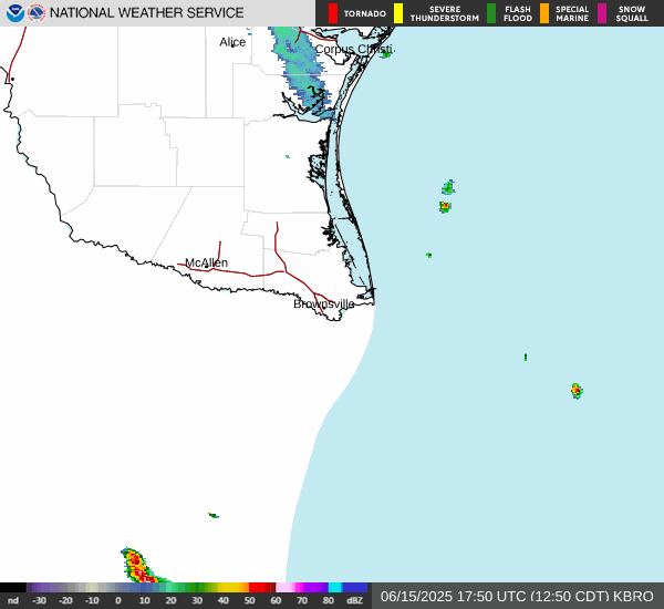
There are thunderstorms over Mexico heading to Deep South Texas.
-
Cpv17
- Posts: 7091
- Joined: Fri Aug 31, 2018 1:58 pm
- Location: El Campo/Wharton
- Contact:
Fog was pretty bad down here in Wharton County this morning.
The GFS and Euro continue to disagree about next weeks rain potential. As of now, I doubt we’ll get anything widespread. Probably more of the same from what we had in April.
The GFS and Euro continue to disagree about next weeks rain potential. As of now, I doubt we’ll get anything widespread. Probably more of the same from what we had in April.
-
tireman4
- Global Moderator
- Posts: 7127
- Joined: Wed Feb 03, 2010 9:24 pm
- Location: Humble, Texas
- Contact:
001
FXUS64 KHGX 221059
AFDHGX
Area Forecast Discussion
National Weather Service Houston/Galveston TX
559 AM CDT Thu May 22 2025
...New AVIATION...
.SHORT TERM...
(Today through Friday Night)
Issued at 250 AM CDT Thu May 22 2025
Continued hot and muggy weather is expected through Friday as a
building upper-level ridge brings the increased temperatures and
onshore flow brings the humidity. Temperatures this afternoon will
rise into the low to mid 90s for most of the region with heat
indices rising into the upper 90s to low triple digits. There will
be a chance of some isolated showers or storms along and south of
I-10 this afternoon during peak heating. Overnight lows tonight
will be in the low 70s north and west of the Houston Metro, and
then mid to upper 70s in the Metro and along the coast.
Friday will be pretty similar to today temperature-wise, but the
ridge aloft will be stronger limiting the potential for any
afternoon shower or thunderstorm activity.
Fowler
&&
.LONG TERM...
(Saturday through Wednesday)
Issued at 1218 AM CDT Thu May 22 2025
Quiet weather will prevail through the weekend with a surface high
becoming stationed to the east of SE Texas. This will continue the
onshore flow pattern. An upper-level ridge will move overhead;
however, it does not appear to be as amplified as what previous
ridges have been. Late on Sunday a shortwave trough will move
through and bring the potential for isolated showers and
thunderstorms. Similar to the ridge this trough is not very
amplified and will likely not amount to much on its own; however, it
will set the stage for unsettled weather going into the work week.
Multiple low-amplitude shortwave troughs will move through the area
during the week. Tuesday in particular features a medium chance of
measurable rainfall across most of the area. This is due in part to
a weak front that is expected to pass through the region and trigger
convection as it does so. Ensembles continue to show PW values in
the 90th percentile for Tuesday...will need to monitor over the next
few days to see how this forecast evolves as far as the potential
for a heavy rain event over the Piney Woods region.
Otherwise, for the week expect seasonable temperatures with highs in
the upper 80s to around 90 degrees. Afternoon cloud cover and
several opportunities for scattered showers and thunderstorms may
make temperatures locally cooler, but overall expect it to remain
typical to spring/summer.
Adams
&&
.AVIATION...
(12Z TAF Issuance)
Issued at 539 AM CDT Thu May 22 2025
MVFR conditions with CIGs around 1200-2500ft will continue through
mid-morning hours before scattering out giving way to VFR
conditions for the rest of the day. Southeasterly winds around
6-10kt will prevail today before becoming light and variable
tonight. Some isolated showers are possible this afternoon south
of I-10, but confidence is not high enough on exactly where they
will pop-up to put into any TAFs. Some periods of MVFR conditions
with CIGs around 1500ft and patchy fog will be possible late
tonight into early Friday morning, but overall VFR conditions are
expected to persist through the night.
Fowler
&&
.MARINE...
Issued at 1218 AM CDT Thu May 22 2025
Generally moderate onshore winds and seas of 4 to 6 feet are
expected during the next few days. Caution flags will prevail
through at least early Tuesday. Winds may reach 20 knots at times
and seas may briefly rise to 7 feet over the offshore waters Monday
into Tuesday and may required an Advisory. Winds relax Tuesday and
become easterly late Tuesday night into Wednesday as a weak cold
front moves into SE TX and stalls. Onshore winds return late
Wednesday as the front moves northeastward as a warm front. Light to
occasionally moderate onshore winds are expected to persist into the
upcoming weekend. Persistent onshore winds may lead to strong rip
currents along the Gulf facing beaches throughout the week and
weekend.
Cotto - 24
&&
.PRELIMINARY POINT TEMPS/POPS...
College Station (CLL) 96 73 94 74 / 10 0 0 0
Houston (IAH) 95 75 93 76 / 20 0 10 0
Galveston (GLS) 87 80 87 81 / 10 0 10 0
&&
.HGX WATCHES/WARNINGS/ADVISORIES...
TX...None.
GM...None.
&&
$$
SHORT TERM...Fowler
LONG TERM....Adams
AVIATION...Fowler
MARINE...Cotto /24/
-
Pas_Bon
- Posts: 950
- Joined: Tue Sep 11, 2018 7:58 am
- Location: League City, TX
- Contact:
Andddddd just like that, forecasted rain totals and rain percentages for next week have dropped like an anvil on my Weather apps. 

-
Cpv17
- Posts: 7091
- Joined: Fri Aug 31, 2018 1:58 pm
- Location: El Campo/Wharton
- Contact: