
December 2024
-
tireman4

- Global Moderator

- Posts: 7161
- Joined: Wed Feb 03, 2010 9:24 pm
- Location: Humble, Texas
- Contact:
This storm has been Tornado warned for awhile. Be careful up there. It will come really close to me in Humble
- Attachments
-
- KHGX_loop-2.gif (638.66 KiB) Viewed 16591 times
-
Cromagnum
- Posts: 3076
- Joined: Thu Feb 03, 2011 10:42 pm
- Location: Georgetown
- Contact:
It's gonna be a real bad day east of here this afternoon. Our cajun cousins need to pay attention.
-
tireman4
- Global Moderator
- Posts: 7161
- Joined: Wed Feb 03, 2010 9:24 pm
- Location: Humble, Texas
- Contact:
Just a heads up, this tornado warned storm has been moving near Jason and I. Fortunately, it is moving fast. It has serious spin to it and a nice hail core. This is just the start of a long day. Be safe up there Jason. Coming your way.
-
tireman4
- Global Moderator
- Posts: 7161
- Joined: Wed Feb 03, 2010 9:24 pm
- Location: Humble, Texas
- Contact:
Look behind that Rip, this will be a long day for points Houston Metro and eastward. There is a Severe Thunderstorm Warned storm to the north of the Tornado Warned storm. It is still warned.
-
Rip76

- Posts: 2151
- Joined: Mon Feb 15, 2010 12:38 am
- Location: The Woodlands
- Contact:
Checking that out now.
-
jasons2k

- Posts: 6201
- Joined: Thu Feb 04, 2010 12:54 pm
- Location: Imperial Oaks
- Contact:
All is OK here. Didn’t even hail.
-
tireman4
- Global Moderator
- Posts: 7161
- Joined: Wed Feb 03, 2010 9:24 pm
- Location: Humble, Texas
- Contact:
-
tireman4
- Global Moderator
- Posts: 7161
- Joined: Wed Feb 03, 2010 9:24 pm
- Location: Humble, Texas
- Contact:
Severe Thunderstorm Warned storm headed my way. Will we lose power?
- Attachments
-
- KHGX_loop-3.gif (695.61 KiB) Viewed 16541 times
-
869MB
- Posts: 206
- Joined: Fri Oct 30, 2015 8:44 am
- Location: Katy, TX
- Contact:
- IMG_0026.png (624.53 KiB) Viewed 16536 times
Mesoscale Discussion 2301
NWS Storm Prediction Center Norman OK
1147 AM CST Sat Dec 28 2024
Areas affected...portions of eastern Texas into far western
Louisiana
Concerning...Tornado Watch 718...719...
Valid 281747Z - 281915Z
The severe weather threat for Tornado Watch 718, 719 continues.
SUMMARY...The severe threat continues across Tornado Watches
718-719. All severe hazards remain possible. The best chance for
tornadoes will exist with supercells embedded in confluence bands.
DISCUSSION...Multiple storms along a confluence band, including a
supercell with a history of producing at least one tornado, persist
along a Walker to Matagorda County, TX line while a QLCS is
developing farther to the west amid an increase in synoptic forcing.
Storms in both regimes are overspreading a destabilized boundary
layer, characterized by 70s F surface temperatures and dewpoints,
yielding over 2000 J/kg MLCAPE with minimal MLCINH per 17Z
mesoanalysis. Latest regional VADs show hodographs with elongation,
but modest low-level curvature, indicating an environment favorable
for damaging gusts, large hail, and perhaps a few tornadoes.
Latest mesoanalysis shows an 80+ kt 500 mb speed max pivoting the
base of the mid-level trough, and is poised to overspread the TX/LA
border over the next few hours. A low-level mass response is
expected, with intensification of the low-level jet to well over 40
kts likely. As this occurs, enlargement of the hodographs should
occur, especially closer to LA. Subsequently, the potential for
damaging gusts and tornadoes (including the risk of a strong
tornado) should increase later this afternoon. The best chance for
any strong tornadoes will likely be with any sustained supercell
structures associated with the confluence band, especially if a
supercell can avoid detrimental interference from nearby storms.
Otherwise, the damaging gust/tornado threat will also increase with
an approaching/intensifying QLCS, which will eventually overtake
preceding warm-sector confluence bands/storms.
Convection continues to oscillate in intensity farther east in the
free warm sector. Confidence is not overly high in robust severe
thunderstorms developing in this corridor. However, any storm that
manages to develop could become supercellular, posing a threat for
all severe hazards.
..Squitieri.. 12/28/2024
...Please see www.spc.noaa.gov for graphic product...
ATTN...WFO...LCH...SHV...HGX...FWD...EWX...
LAT...LON 30059718 31629636 32019506 31999418 31679325 31109274
30649256 30099298 29789413 29749556 30059718
-
tireman4
- Global Moderator
- Posts: 7161
- Joined: Wed Feb 03, 2010 9:24 pm
- Location: Humble, Texas
- Contact:
Update
- Attachments
-
- Gf56HsAWYAAsLQK.jpeg
- (225.7 KiB) Downloaded 11725 times
-
DoctorMu

- Posts: 8089
- Joined: Sun Jun 28, 2015 11:58 am
- Location: College Station
- Contact:
Tornado Warning
12/28/2024 12:14 CST through 12/28/2024 12:45 CST
Tornado Warning issued December 28 at 12:14PM CST until December 28 at 12:45PM CST by NWS Houston/Galveston TX
At 1213 PM CST, a confirmed large and extremely dangerous tornado was
located near Woodbranch, or 12 miles north of Kingwood, moving
northeast at 35 mph.
This is a PARTICULARLY DANGEROUS SITUATION. TAKE COVER NOW!
HAZARD...Damaging tornado.
SOURCE...Radar confirmed tornado.
IMPACT...You are in a life-threatening situation. Flying debris may
be deadly to those caught without shelter. Mobile homes
will be destroyed. Considerable damage to homes,
businesses, and vehicles is likely and complete destruction
is possible.
The tornado will be near...
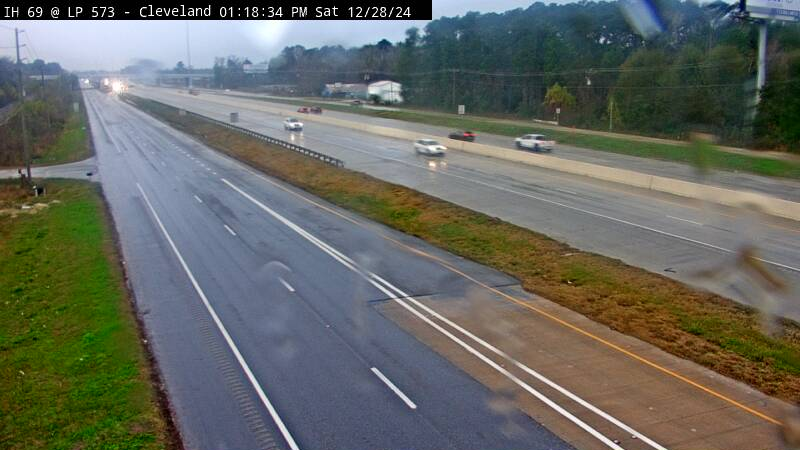
Cleveland, Splendora, Patton Village, Roman Forest, Plum Grove,
and North Cleveland around 1220 PM CST.
Other locations impacted by this tornadic thunderstorm include New
Caney.
Instructions
To repeat, a large, extremely dangerous and potentially deadly
tornado is on the ground. To protect your life, TAKE COVER NOW! Move
to a basement or an interior room on the lowest floor of a sturdy
building. Avoid windows. If you are outdoors, in a mobile home, or in
a vehicle, move to the closest substantial shelter and protect
yourself from flying debris.
12/28/2024 12:14 CST through 12/28/2024 12:45 CST
Tornado Warning issued December 28 at 12:14PM CST until December 28 at 12:45PM CST by NWS Houston/Galveston TX
At 1213 PM CST, a confirmed large and extremely dangerous tornado was
located near Woodbranch, or 12 miles north of Kingwood, moving
northeast at 35 mph.
This is a PARTICULARLY DANGEROUS SITUATION. TAKE COVER NOW!
HAZARD...Damaging tornado.
SOURCE...Radar confirmed tornado.
IMPACT...You are in a life-threatening situation. Flying debris may
be deadly to those caught without shelter. Mobile homes
will be destroyed. Considerable damage to homes,
businesses, and vehicles is likely and complete destruction
is possible.
The tornado will be near...
Cleveland, Splendora, Patton Village, Roman Forest, Plum Grove,
and North Cleveland around 1220 PM CST.
Other locations impacted by this tornadic thunderstorm include New
Caney.
Instructions
To repeat, a large, extremely dangerous and potentially deadly
tornado is on the ground. To protect your life, TAKE COVER NOW! Move
to a basement or an interior room on the lowest floor of a sturdy
building. Avoid windows. If you are outdoors, in a mobile home, or in
a vehicle, move to the closest substantial shelter and protect
yourself from flying debris.
-
Cromagnum
- Posts: 3076
- Joined: Thu Feb 03, 2011 10:42 pm
- Location: Georgetown
- Contact:
Large tornado headed towards north side of Splendora from looks of things.
-
tireman4
- Global Moderator
- Posts: 7161
- Joined: Wed Feb 03, 2010 9:24 pm
- Location: Humble, Texas
- Contact:
Tornado still on the ground
- Attachments
-
- KHGX_loop-4.gif (711.43 KiB) Viewed 16498 times
-
dp6
- Posts: 116
- Joined: Sun May 24, 2020 5:32 pm
- Contact:
-
DoctorMu
- Posts: 8089
- Joined: Sun Jun 28, 2015 11:58 am
- Location: College Station
- Contact:
A severe T-storm is heading our way. Just felt and impressive outflow from the core.
Severe Thunderstorm Warning
12/28/2024 12:29 CST through 12/28/2024 12:45 CST
Severe Thunderstorm Warning issued December 28 at 12:29PM CST until December 28 at 12:45PM CST by NWS Houston/Galveston TX
At 1229 PM CST, severe thunderstorms were located along a line
extending from near Bryan Utilities Lake to near Snook to Lake
Somerville State Park & Trailway, moving east at 30 mph.
HAZARD...60 mph wind gusts and penny size hail.
SOURCE...Radar indicated.
IMPACT...Expect damage to roofs, siding, and trees.
Locations impacted include...
College Station, Bryan, Somerville, Snook, Kurten, Wixon Valley,
Millican, Lake Somerville Dam, Kyle Field, Bryan Utilities Lake,
Lyons, Deanville, and Wellborn.
Instructions
A Tornado Watch remains in effect until 500 PM CST for southeastern
Texas.
For your protection move to an interior room on the lowest floor of a
building.
If on or near Lake Somerville, get away from the water and move
indoors or inside a vehicle. Remember, lightning can strike out to
15 miles from the parent thunderstorm. If you can hear thunder, you
are close enough to be struck by lightning. Move to safe shelter
now! Do not be caught on the water in a thunderstorm.
Sender NWS Houston/Galveston TX
Sent 12/28/2024 12:29 CST
Updates
urn:oid:2.49.0.1.840.0.4ac322c3da13906bc08611e880c039e39622bdae.001.1
Brazos, TX; Burleson, TX; Grimes, TX; Washington, TX
-
DoctorMu
- Posts: 8089
- Joined: Sun Jun 28, 2015 11:58 am
- Location: College Station
- Contact:
There's a bit of shear up there. No reports of tornado formation though.
- Attachments
-
- IMG_7209.jpeg
- (761.29 KiB) Downloaded 11673 times
-
tireman4
- Global Moderator
- Posts: 7161
- Joined: Wed Feb 03, 2010 9:24 pm
- Location: Humble, Texas
- Contact:
Doc,
Be careful. The updrafts are really stout. This and any of these storms can pulse tornadic.
Be careful. The updrafts are really stout. This and any of these storms can pulse tornadic.
-
tireman4
- Global Moderator
- Posts: 7161
- Joined: Wed Feb 03, 2010 9:24 pm
- Location: Humble, Texas
- Contact:
Tornadic thunderstorm
- Attachments
-
- KHGX_loop-5.gif (719.36 KiB) Viewed 16452 times
-
tireman4
- Global Moderator
- Posts: 7161
- Joined: Wed Feb 03, 2010 9:24 pm
- Location: Humble, Texas
- Contact:
Severe Weather Statement
National Weather Service Houston/Galveston TX
1258 PM CST Sat Dec 28 2024
TXC039-167-281930-
/O.CON.KHGX.TO.W.0058.000000T0000Z-241228T1930Z/
Galveston TX-Brazoria TX-
1258 PM CST Sat Dec 28 2024
...A TORNADO WARNING REMAINS IN EFFECT UNTIL 130 PM CST FOR WEST
CENTRAL GALVESTON AND NORTHEASTERN BRAZORIA COUNTIES...
At 1258 PM CST, a confirmed tornado was located near Liverpool, or
near Alvin, moving northeast at 30 mph.
HAZARD...Damaging tornado and quarter size hail.
SOURCE...Radar confirmed tornado.
IMPACT...Flying debris will be dangerous to those caught without
shelter. Mobile homes will be damaged or destroyed. Damage
to roofs, windows, and vehicles will occur. Tree damage is
likely.
This tornado will be near...
Southwestern League City, southern Friendswood, Alvin, Santa Fe,
and Hillcrest around 105 PM CST.
PRECAUTIONARY/PREPAREDNESS ACTIONS...
To repeat, a tornado is on the ground. TAKE COVER NOW! Move to a
basement or an interior room on the lowest floor of a sturdy
building. Avoid windows. If you are outdoors, in a mobile home, or in
a vehicle, move to the closest substantial shelter and protect
yourself from flying debris.
&&
LAT...LON 2930 9532 2934 9536 2951 9518 2940 9509
TIME...MOT...LOC 1858Z 235DEG 25KT 2935 9530
TORNADO...OBSERVED
MAX HAIL SIZE...1.00 IN
$$
03
- Attachments
-
- KHGX_loop-6.gif (725.89 KiB) Viewed 16426 times