

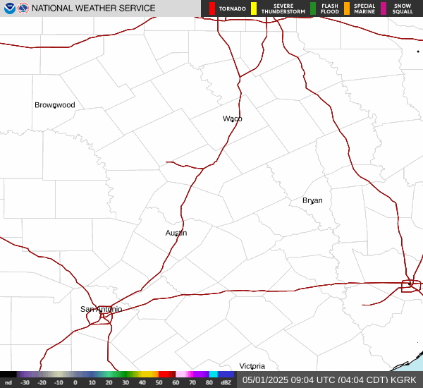
SPC upgraded my area to an enhanced risk for damaging winds.
November 2024
-
Cpv17
- Posts: 7109
- Joined: Fri Aug 31, 2018 1:58 pm
- Location: El Campo/Wharton
- Contact:
Yeah, it hasn’t rained as much over here. We could still use several inches out here.Stratton20 wrote: ↑Sun Nov 17, 2024 2:08 pm Cpv17 yeah, as soon as i step outside im already getting bitten, backyard is wet so that definitely doesnt help me lol
-
kyzsl51
- Posts: 67
- Joined: Thu Feb 03, 2011 1:10 pm
- Contact:
This has been a ridiculously warm and depressing fall lolCpv17 wrote: ↑Sun Nov 17, 2024 4:00 pmYeah, it hasn’t rained as much over here. We could still use several inches out here.Stratton20 wrote: ↑Sun Nov 17, 2024 2:08 pm Cpv17 yeah, as soon as i step outside im already getting bitten, backyard is wet so that definitely doesnt help me lol
-
DoctorMu

- Posts: 8089
- Joined: Sun Jun 28, 2015 11:58 am
- Location: College Station
- Contact:
Canadian, FTW. Make my lawn all brown instead of brown patchy brown.
- Attachments
-
- gem_T2m_us_17.png
- (205.97 KiB) Downloaded 21548 times
-
DoctorMu
- Posts: 8089
- Joined: Sun Jun 28, 2015 11:58 am
- Location: College Station
- Contact:
Worst Fall yet. We had something close to real Fall last year.kyzsl51 wrote: ↑Sun Nov 17, 2024 5:28 pmThis has been a ridiculously warm and depressing fall lolCpv17 wrote: ↑Sun Nov 17, 2024 4:00 pmYeah, it hasn’t rained as much over here. We could still use several inches out here.Stratton20 wrote: ↑Sun Nov 17, 2024 2:08 pm Cpv17 yeah, as soon as i step outside im already getting bitten, backyard is wet so that definitely doesnt help me lol
-
DoctorMu
- Posts: 8089
- Joined: Sun Jun 28, 2015 11:58 am
- Location: College Station
- Contact:
-
Cromagnum
- Posts: 3076
- Joined: Thu Feb 03, 2011 10:42 pm
- Location: Georgetown
- Contact:
I'm smacking the first person that complains about any cold we get this year. It's been hot since April.
-
tireman4

- Global Moderator

- Posts: 7161
- Joined: Wed Feb 03, 2010 9:24 pm
- Location: Humble, Texas
- Contact:
187
FXUS64 KHGX 181154
AFDHGX
Area Forecast Discussion
National Weather Service Houston/Galveston TX
554 AM CST Mon Nov 18 2024
...New AVIATION...
.SHORT TERM...
(Today through Tuesday Night)
Issued at 210 AM CST Mon Nov 18 2024
The end of this warm and humid November weather is in sight as a
cold front will move through the area later today ushering in more
fall-like weather for the remainder of the week. Deep onshore
flow at the surface and southwesterly flow aloft will make this
morning unseasonably warm (about 20-25 degrees above normal) and
muggy. There could be some patchy fog developing near daybreak,
but breezy winds should help limit fog potential. There will be
wind gusts of 25-30mph down along the coast this morning which is
borderline Wind Advisory criteria. Don`t currently have plans on
issuing a Wind Advisory, but if those gusts become frequent enough
then there may be a short-lived advisory later this morning.
That aforementioned cold front is currently out towards
west/central Texas, but it will quickly be moving towards our
region by the late morning to afternoon. There will be a few hours
of daytime heating, especially near the coast, to bring us back
into the low to mid 80s for much of the area today - but cooler
weather is on the way. FROPA is expected for the Brazos Valley
between 11am and 1pm, reach the I- 45 corridor between 1-3pm, and
the exiting to LA by 4 or 5pm. There will be an uptick in showers
and thunderstorms out ahead of and along the cold front as it
moves through the region. Most of the activity with be light to
moderate rainfall and general thunderstorms, but there is a
limited threat of some isolated strong to severe thunderstorms
this morning/afternoon. SPC maintains the Marginal Risk (level 1
of 5) for the area with the primary hazard strong wind gusts, but
cannot out rule any severe thunderstorm hazard. Again this is a
very conditional threat as the strong storms may not be able to
even initialize in this environment. Rain totals through this
evening will be around 0.2-0.6", but there could be isolated
higher amounts if those strong thunderstorms materialize. All rain
and severe weather threats will end once that cold front moves
through the area with clearing skies expected shortly after FROPA.
The airmass behind this front is more Pacific-based than Artic-
based, so while there will be a cool down tonight and Tuesday the
real cool down will come front the cold front coming through
Wednesday morning (but more on that in the Long Term below). Low
temperatures tonight will be in the upper 40s in the Piney Woods,
low to mid 50s north and west of the Houston Metro, and then upper
50s to low 60s in the Metro and along the coast. High
temperatures on Tuesday will be mid to upper 70s for most of the
area with even some areas west of the Brazos River getting into
the low 80s. Tuesday night will be similar to tonight, but
subtract 3-5 degrees.
Fowler
&&
.LONG TERM...
(Wednesday through Sunday)
Issued at 210 AM CST Mon Nov 18 2024
Breezy conditions are expected on Wednesday along with cooler and
drier air moving into Southeast Texas in the wake of the dry
reinforcing cold front. This will finally bring us near seasonal
temperatures throughout the second half of the work week. That
being said, Wednesday`s highs will be in the mid to upper 60s
north of I-10 and in the upper 60s to low 70s along and south of
I-10. Winds will decrease Wednesday night as high pressure builds
across Texas. Tranquil weather and clear skies are on tap for
Wednesday night along with lows in the upper 30s to low 40s over
areas north of I-10, the low to mid 40s over areas along and
south of I-10, and the low to mid 50s over the coastal locations.
Benign conditions are expected to prevail through the upcoming
weekend. Temperatures will begin a steady rise on Friday and
continue into the weekend as the high pressure shifts to our east
and southerly flow returns, bringing warm moist air from the
Gulf.
24
&&
.AVIATION...
(12Z TAF Issuance)
Issued at 519 AM CST Mon Nov 18 2024
Today`s main forecast concern will be the passage of a cold front
through the region during the mid morning through the afternoon.
There will be scattered light showers across the area ahead of the
front this morning, then there will be a line of showers and
thunderstorms along and ahead of the cold front itself. Higher
coverage of the thunderstorms is expected east of I-45 this
afternoon, but isolated storms will be possible at all terminals -
so have went with a PROB30 TS with the FROPA. The front is
expected to move through CLL around 17-19z, IAH around 19-21z, and
then out of the area by 22-00z this evening. There will be periods
of VFR to MVFR CIGs of around 2500ft as clouds bounce back and
forth from SCT to BKN this morning through the area out ahead of
the front. Once the front is through there will be rapid clearing
leading to VFR conditions returning to the region. South-
southeasterly winds of 10-15kt with gusts to 25kt will also
continue through the morning ahead of the front, then become
west-northwesterly around 4-8kt after FROPA.
Fowler
&&
.MARINE...
Issued at 210 AM CST Mon Nov 18 2024
Onshore winds of 20-30 kts and seas of 7-10 ft are expected to
continue today ahead of the next cold front. The front along with
its associated line of showers and thunderstorms, will move into
the coastal waters later this afternoon to early evening and usher
in light offshore winds in its wake. Although the winds should
decrease fairly quickly as the front passes through, the wave
heights will take a little longer to subside. Thus, the Small
Craft Advisory will continue in effect for the bays and nearshore
waters through 3 PM today and for the offshore waters through this
evening. The Coastal Flood Advisory and Strong Rip Current
Statement will continue in effect through 6 PM today, but may be
extended a few more hours to account for this evening`s high tide
cycle.
A reinforcing dry cold front will pass through Tuesday night into
Wednesday morning and will result in strong gusty offshore winds
and elevated seas in its wake. Additional Advisories will likely
be needed through Wednesday night. Winds and seas subside
Thursday. Onshore flow is expected to return during the upcoming
weekend.
24
&&
.PRELIMINARY POINT TEMPS/POPS...
College Station (CLL) 80 50 79 49 / 80 10 0 0
Houston (IAH) 83 57 79 53 / 90 20 0 0
Galveston (GLS) 81 65 78 59 / 80 50 0 0
&&
.HGX WATCHES/WARNINGS/ADVISORIES...
TX...Coastal Flood Advisory until 6 PM CST this evening for TXZ214-
313-335>338-436>439.
High Rip Current Risk through this afternoon for TXZ436>439.
GM...Small Craft Advisory until 3 PM CST this afternoon for GMZ330-
335-350-355.
Small Craft Advisory until 9 PM CST this evening for GMZ370-375.
&&
$$
SHORT TERM...Fowler
LONG TERM....Cotto (24)
AVIATION...Fowler
MARINE...Cotto (24)
-
DoctorMu
- Posts: 8089
- Joined: Sun Jun 28, 2015 11:58 am
- Location: College Station
- Contact:
More summer for Thanksgiving?

-
kyzsl51
- Posts: 67
- Joined: Thu Feb 03, 2011 1:10 pm
- Contact:
-
Stratton20
- Posts: 5870
- Joined: Tue Feb 09, 2021 11:35 pm
- Location: College Station, Texas
- Contact:
DoctorMu dont think so, arctic air is going to be building in NW canada, its spilling south, whether that occurs on thanksgiving or just after remains to be seen
-
jasons2k

- Posts: 6201
- Joined: Thu Feb 04, 2010 12:54 pm
- Location: Imperial Oaks
- Contact:
Looks mostly warm and dry after this front. Maybe some decent rain chances again as we get into December.
- Attachments
-
- IMG_6330.gif
- (655.02 KiB) Downloaded 21380 times
-
DoctorMu
- Posts: 8089
- Joined: Sun Jun 28, 2015 11:58 am
- Location: College Station
- Contact:
You better talk to NWS on this.Stratton20 wrote: ↑Mon Nov 18, 2024 10:33 am DoctorMu dont think so, arctic air is going to be building in NW canada, its spilling south, whether that occurs on thanksgiving or just after remains to be seen
-
DoctorMu
- Posts: 8089
- Joined: Sun Jun 28, 2015 11:58 am
- Location: College Station
- Contact:
Thar she blows!
Actual sighting of what the Eldars called "rain" in the Brazos Valley:
Actual sighting of what the Eldars called "rain" in the Brazos Valley:
-
brazoriatx
- Posts: 415
- Joined: Tue Nov 08, 2011 12:09 pm
- Contact:
Ya, I don't see anything that is going to move that cold air out of Canada anytime soon. The heat continues
-
Stratton20
- Posts: 5870
- Joined: Tue Feb 09, 2021 11:35 pm
- Location: College Station, Texas
- Contact:
Brazoriatx disagree, the cold air is going to take time to build up, but their is a mechanism for it to get dislodged into the US, exactly when that occurs remains to be seen, so for now we just keep watching the trends, the 500 mb height blocking pattern is definitely great for building up the cold air though
-
DoctorMu
- Posts: 8089
- Joined: Sun Jun 28, 2015 11:58 am
- Location: College Station
- Contact:
Wednesday morning will be the coldest temps we'll see for the next 2 weeks in CLL: about 37°Fbrazoriatx wrote: ↑Mon Nov 18, 2024 11:33 am Ya, I don't see anything that is going to move that cold air out of Canada anytime soon. The heat continues
There could be a FROPA (per 12z Euro) around T-Giving, but I'm seeing Zonal flow, so temps behind it would be seasonal for a couple of days. No big freeze, or any freeze, until at least Dec. 3.
-
DoctorMu
- Posts: 8089
- Joined: Sun Jun 28, 2015 11:58 am
- Location: College Station
- Contact:
Yeah - the Ensembles are pretty consistent about the QPF being mostly east of here.
- Attachments
-
- gem-ens_apcpn_us_55.png
- (114.6 KiB) Downloaded 21311 times
-
tireman4
- Global Moderator
- Posts: 7161
- Joined: Wed Feb 03, 2010 9:24 pm
- Location: Humble, Texas
- Contact:
.AVIATION...
(18Z TAF Issuance)
Issued at 1139 AM CST Mon Nov 18 2024
Showers continue to advance along a cold front that wil push to
the southeast this afternoon. Thunderstorm development will be
possible over the next few hours as this line of storms approaches
Metro Houston, but overall prospects remain fairly low and as such
have maintained PROB30 wording for thunderstorms in this TAF
package. A few gusty winds are possible with any stronger storms.
Cigs around 2500ft, along with MVFR/potentially IFR visibilities
associated with any rainfall will accompany the frontal passage.
Conditions will generally improve by late afternoon, with
overnight clearing and a shift to NW winds around 5-10 knots
expected. Continued NW winds and clear skies are expected for
Tuesday.
Cady
-
jasons2k
- Posts: 6201
- Joined: Thu Feb 04, 2010 12:54 pm
- Location: Imperial Oaks
- Contact:
Well the main action is going to miss me by 5 miles to the east. Figures.