
HGX AFD this morning.
Stay tuned, because much cooler temperatures might be entering our area
toward the end of next week.
October 2024
-
tireman4

- Global Moderator

- Posts: 7125
- Joined: Wed Feb 03, 2010 9:24 pm
- Location: Humble, Texas
- Contact:
-
tireman4
- Global Moderator
- Posts: 7125
- Joined: Wed Feb 03, 2010 9:24 pm
- Location: Humble, Texas
- Contact:
I think the Elders referred to this as rain...
- Attachments
-
- Radar 10 30 24.jpg (82.27 KiB) Viewed 32369 times
-
DoctorMu

- Posts: 8019
- Joined: Sun Jun 28, 2015 11:58 am
- Location: College Station
- Contact:
-
don

- Posts: 3148
- Joined: Wed Feb 03, 2010 3:33 pm
- Location: Wichita Falls
- Contact:
The pattern looks to be very active over here over the next 7 Days with multiple trough ejections over the area back to back. There may be multiple severe weather outbreaks starting this weekend and into next week. A very spring like pattern as a battle zone sets up between the SE ridge and large trough in the west.SPC already has NW Texas Oklahoma and Kansas in a Day 5 risk…
-
Rip76

- Posts: 2126
- Joined: Mon Feb 15, 2010 12:38 am
- Location: The Woodlands
- Contact:
What in THE hell is falling from the sky?
-
Pas_Bon
- Posts: 949
- Joined: Tue Sep 11, 2018 7:58 am
- Location: League City, TX
- Contact:
-
Cpv17
- Posts: 7091
- Joined: Fri Aug 31, 2018 1:58 pm
- Location: El Campo/Wharton
- Contact:
-
jasons2k

- Posts: 6192
- Joined: Thu Feb 04, 2010 12:54 pm
- Location: Imperial Oaks
- Contact:
Got a couple of showers here today. Up to .22” so far.
The forecast is a mess. After consistently pegging tomorrow for the highest rain chances (was up to 80% in this morning’s update) the NWS has suddenly had second thoughts at the altar and lowered chances down to 50/50 on tomorrow.
There’s still hope (or a Lucy) though as Friday’s chances have been bumped to 60% now and the extended maintains a solid 30-50% chance depending on the day.
-
tireman4
- Global Moderator
- Posts: 7125
- Joined: Wed Feb 03, 2010 9:24 pm
- Location: Humble, Texas
- Contact:
We have a good soaking in Humble. Not CWA wide, but some folks are getting beneficial rains
-
Cpv17
- Posts: 7091
- Joined: Fri Aug 31, 2018 1:58 pm
- Location: El Campo/Wharton
- Contact:
-
DoctorMu
- Posts: 8019
- Joined: Sun Jun 28, 2015 11:58 am
- Location: College Station
- Contact:
Exactly. It's been feeling like April severe season. We continue to Pump up the Moisture.don wrote: ↑Wed Oct 30, 2024 12:33 pm The pattern looks to be very active over here over the next 7 Days with multiple trough ejections over the area back to back. There may be multiple severe weather outbreaks starting this weekend and into next week. A very spring like pattern as a battle zone sets up between the SE ridge and large trough in the west.SPC already has NW Texas Oklahoma and Kansas in a Day 5 risk…
Normally this battle would take place a few weeks earlier.
-
DoctorMu
- Posts: 8019
- Joined: Sun Jun 28, 2015 11:58 am
- Location: College Station
- Contact:
A dry line/line of storms is setting up for this evening from Wichita Falls to KC and Des Moines.
-
jasons2k
- Posts: 6192
- Joined: Thu Feb 04, 2010 12:54 pm
- Location: Imperial Oaks
- Contact:
FWIW the models didn’t show much, if anything today west of the I-45 corridor. Pretty much what happened. Chances look a little better tomorrow but the best chances are still the further north and east you go.
-
DoctorMu
- Posts: 8019
- Joined: Sun Jun 28, 2015 11:58 am
- Location: College Station
- Contact:
That's what the models had days ago. The next storm system during the weekend will have its energy largely north of us.
It's possible the (dry) line of storms snaking up through OK could head through Dallas and SE late tonight, but I mostly see more weaksauce streamer showers for us. The setup is like so many Lucy-style April busts.
-
DoctorMu
- Posts: 8019
- Joined: Sun Jun 28, 2015 11:58 am
- Location: College Station
- Contact:
Something that is showing up on GFS and CMC progs is a tropical system in the Gulf in a 7-10 day timeframe. The Caribbean incubation center remains prime. Any system would likely head towards Florida, Louisiana at the furthermost west.
-
tireman4
- Global Moderator
- Posts: 7125
- Joined: Wed Feb 03, 2010 9:24 pm
- Location: Humble, Texas
- Contact:
372
FXUS64 KHGX 311125
AFDHGX
Area Forecast Discussion
National Weather Service Houston/Galveston TX
625 AM CDT Thu Oct 31 2024
...New AVIATION...
.SHORT TERM...
(Today through Friday Night)
Issued at 300 AM CDT Thu Oct 31 2024
Double, double toil and...puddle? There will indeed be puddles today
thanks to scattered showers and isolated thunderstorms. A deep
mid/upper trough and associated sfc low pressure system will push
towards the Great Lakes today. The sfc low`s associated trailing
cold front will drift southeastward across the Lone Star State,
becoming weaker and increasingly diffused as it enters our region.
Ahead of the front, the air is thicker than a Witches` Brew thanks
to deep S to SE LL flow. Within this surge of moisture, scattered
showers and a few thunderstorms are pushing into our coastal
counties. Latest CAMs guidance suggest these scattered showers
/isolated storms will continue to push inland this morning. The
aforementioned front reaches our northern and central CWA by the
afternoon, providing added lift and additional shower/thunderstorm
activity. Highs are expected to be in the low/mid 80s, though our
western / southwestern counties could reach the upper 80s.
So what about our trick-or-treat weather?
Generally speaking, the chance of rain will decrease as the evening
progresses. Therefore, the highest chance of rain will be during
those early trick-or-treat hours (especially before sunset).
However, hi-res guidance is suggesting that showers and isolated
thunderstorms could linger 2-3 hours after sunset near where the
weakening frontal boundary stalls. At this time, most of the hi-res
data suggest the boundary will stall north of Houston, perhaps near
the Highway 105 corridor. If that`s the case, then the best chance
of rain lingering deeper into the Witching Hour would be from
Brenham to Navasota to Conroe to Cleveland. HOWEVER, there will
always be a margin of error with these pesky frontal boundaries. So
we couldn`t rule out the front stalling a little to the south/north
of where the guidance suggests. Checking the radar before your
evening of spooky gallivanting is probably not a bad idea. Regarding
temperatures, expect to slowly fall through mid/upper 70s this
evening with very humid conditions (dew points in the 70s). Dew
points are expected fall into the 60s north of the front. So not as
humid for our friends in the Brazos Valley.
If you like the weather today, then you should enjoy the weather as
we ring in November. It will be warm. It will be muggy. The
increasingly diffused boundary is expected to once again provide
enough lift for shower/isolated thunderstorm development. Widely
scattered showers/ isolated thunderstorms are expected to continue
streaming off the Gulf. It will feel rather tropical for early
November.
Self
&&
.LONG TERM...
(Saturday through Wednesday)
Issued at 300 AM CDT Thu Oct 31 2024
At the surface, a strengthening onshore flow can be expected over the
weekend and on into the start of next week. The southwest flow aloft
will persist through this period, and any weak disturbances in this
flow in combination with the dep tropical surface moisture will allow
for periods of showers and possible thunderstorms. Look for the best
rain chances beginning Monday afternoon/evening and persisting on into
Wednesday as a weak and slow moving cold front moves across the area.
Current anticipated rainfall totals through this five-day period are
expected to average .50 to 1.50 inches with locally higher amounts possible.
For high temperatures, Saturday through Monday highs should be in the
80s for a majority of the area. The Tuesday and Wednesday highs will
be a little cooler with more 70s than 80s as the front moves into/across
the area. For low temperatures, mostly 70s on Monday morning will be
mostly 60s on Tuesday morning, and by Wednesday morning we will be seeing
more of a 50s/60s combo. 42
&&
.AVIATION...
(12Z TAF Issuance)
Issued at 616 AM CDT Thu Oct 31 2024
Confidence is high regarding continued scattered shra/tsra
activity throughout the day. Confidence is also high that a
weakening frontal boundary will move into the region, becoming a
focal for shra/tsra. We are also relatively confident in sub VFR
conditions tonight, especially near where the aforementioned
frontal boundary stalls. However, we are much less confident about
how far south the front pushes before stalling. This is important
since hi-res guidance suggests that there could be a late
afternoon to early evening round of shra/tsra along the boundary.
This forecast leans towards a scenario where the boundary stalls
north of IAH, placing the best chance of evening shra/tsra near
CXO. However, if the boundary pushes farther south like some of
the morning high-res model runs suggest, then IAH could have
another chance of TSRA in the 23-02 UTC time frame. For now, we
have opted to keep the best chance of TSRA at IAH/HOU during the
early afternoon. Could not rule out TSRA this morning at IAH if
the cluster of showers/storms near SGR holds together more than
expected.
Vis/cigs tonight into tomorrow morning are highly dependent on the
location of the front. North of front could still experience MVFR
cigs but unlikely to have BR/FG. Along and south of the front,
both vis and cigs could be reduced to MVFR or lower. Guidance less
bullish on sub VFR conditions near the coast.
&&
.MARINE...
Issued at 300 AM CDT Thu Oct 31 2024
As the pressure gradient relaxes through the end of the week, a downward
trend in both onshore winds and seas can be expected. Both will be on
the increase once again going into the weekend and on into the start
of next week in response to a tightening gradient. Caution flags and
advisories will likely be needed. There will also be a rising risk of
rip currents. Showers and maybe some thunderstorms will be possible
almost every day. 42
&&
.PRELIMINARY POINT TEMPS/POPS...
College Station (CLL) 85 68 83 70 / 60 20 50 40
Houston (IAH) 85 71 84 72 / 70 30 60 30
Galveston (GLS) 82 73 80 74 / 70 20 60 50
&&
.HGX WATCHES/WARNINGS/ADVISORIES...
TX...None.
GM...Small Craft Should Exercise Caution until 7 AM CDT this morning
for GMZ370-375.
&&
$$
SHORT TERM...Self
LONG TERM....42
AVIATION...Self
MARINE...42
-
DoctorMu
- Posts: 8019
- Joined: Sun Jun 28, 2015 11:58 am
- Location: College Station
- Contact:
Still, nothing. A weak line of showers is on its way. There also showers on the west side of HOU.
-
tireman4
- Global Moderator
- Posts: 7125
- Joined: Wed Feb 03, 2010 9:24 pm
- Location: Humble, Texas
- Contact:
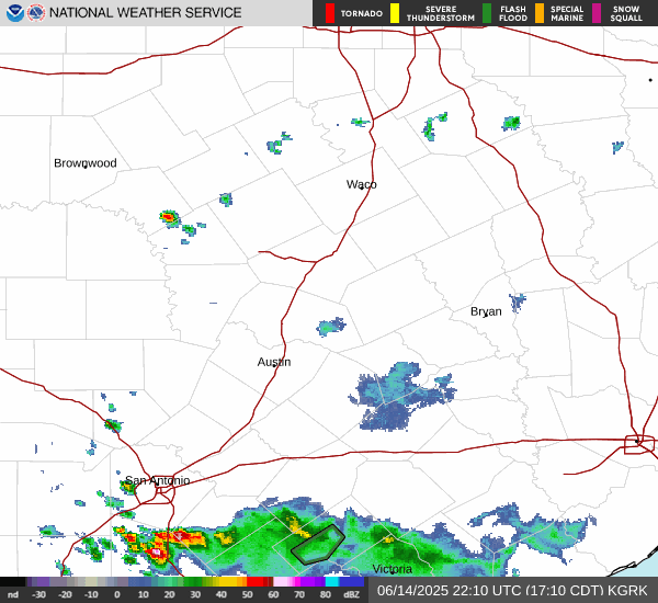
Radar
- Attachments
-
- Radar 10 31 24.jpg (118.2 KiB) Viewed 31808 times
-
davidiowx
- Posts: 1197
- Joined: Thu Jan 23, 2014 2:39 pm
- Location: Richmond, TX
- Contact:
Well after what felt like a lifetime, I have received over 3" of rain this morning. Hallelujah!