
063
FXUS64 KHGX 101123
AFDHGX
Area Forecast Discussion
National Weather Service Houston/Galveston TX
623 AM CDT Mon Jun 10 2024
...New AVIATION...
.SHORT TERM...
(Today through Tuesday Night)
Issued at 326 AM CDT Mon Jun 10 2024
The weather pattern for SE TX is expected to be an active one for
the start of the week. The increasingly NWly flow aloft will help to
bring a series of shortwaves down from the Southern Plains into the
area. This combined with a weak front stalling just north of the FA
as well as deepening PWs (up to 2"), the sea/bay breeze(s), as well
as abundant daytime heating is going to account for scattered acti-
vity through this afternoon...and again for tomorrow.
However, of note for the short-term, there`s a decent shot for some
strong storms heading into Tues night. Models continue to advertise
the possibility of storms forming in/around Central TX with the ar-
rival/passage of a fairly well-defined short-wave...which could then
lead to the development of an MCS. This system is progged to move E
and SE through Weds morning.
As for temperatures, highs will be somewhat tempered by the clouds/
diurnal storms, with readings likely in the lower 90s for today and
tomorrow. Overnight lows will range from the lower to mid 70s for a
good part of the CWA...near 80 at the beaches. 41
&&
.LONG TERM...
(Wednesday through Sunday)
Issued at 326 AM CDT Mon Jun 10 2024
Global deterministic models continue to show discrepancies in
their depiction of the approach of the next midlevel trough and
potential associated MCS, with GFS continuing to present the more
progressive solution which shows the system offshore by Wednesday
morning. Regardless of the system`s exact mesoscale evolution,
the potential complex of storms is likely to be at the very least
on a diminishing trend as we head into Wednesday with lingering
shower and storm activity associated with the passing shortwave
possible into the afternoon. With upper ridging building back into
the South Central CONUS as we head into the end of the week,
shower/storm chances will be limited by the presence of a
subsidence inversion. Any developing storms are likely to be
largely isolated in nature and tied to diurnal boundaries (sea
breeze, bay breeze, etc). As such, have maintained the low PoP
forecast for Thurs - Sat.
Things become quite a bit more uncertain heading into next weekend
as global models continue to show the development of a weak area
of low pressure near the Yucatan Peninsula/Bay of Campeche towards
the end of the weekend. The exact track of this potential system
is still hard to pinpoint and will depend heavily on its
genesis location and the exact positioning of the aforementioned
ridge as we head into the beginning of next week. Still, it`s
something to keep an eye on as we could see more widespread
rainfall as early as Sunday as the system potentially pushes into
the Central Gulf.
Temperatures will remain on a generally increasing trend over the
course of the remainder of the week as the return of stronger
ridging allows for daily high temperatures to approach the upper
90s. Still, with a weaker and more easterly prevailing surface
low, slight decreases to the surface dew point are likely to keep
heat indicies below advisory levels for the time being. Expect
some local variability in observed temperatures at times depending
on the exact development locations of scattered storms.
Cady
&&
.AVIATION...
(12Z TAF Issuance)
Issued at 601 AM CDT Mon Jun 10 2024
Another round of patchy fog/low clouds this morning should mix out
sooner than later...even with the light onshore winds in place. As
we head into this afternoon, look for scattered showers and storms
to develop initially along the bay/sea breezes (near to the coast)
late this morning. Activity should pick up along/near a stationary
front just north of the CWFA by this afternoon...with some of this
development moving near our northern terminals. So, will keeping a
mention of VCTS/VCSH in for most locations until sunset or so. The
bulk of things should weaken this evening, with patchy fog and low
clouds possible once again (especially for areas that do get rain).
As it currently stands, tomorrow looks a lot like today...but tom-
orrow night might be a different story. Stay tuned. 41
&&
.MARINE...
Issued at 326 AM CDT Mon Jun 10 2024
Relatively light winds and low seas prevail throughout the
duration of the week, with scattered showers and storms remaining
in the forecast through at least the first half of the week. A
brief shift to east winds is possible on Tuesday as a surface
boundary approaches the coast. There remains a great deal of
uncertainty surrounding the potential development of a low
pressure system in the Bay of Campeche over the upcoming weekend,
but for the time being it`s something to monitor as our next
source of more widespread rainfall.
Cady
&&
.PRELIMINARY POINT TEMPS/POPS...
College Station (CLL) 91 74 90 72 / 30 20 20 30
Houston (IAH) 92 75 91 73 / 40 30 30 20
Galveston (GLS) 88 79 87 79 / 30 10 20 10
&&
.HGX WATCHES/WARNINGS/ADVISORIES...
TX...None.
GM...None.
&&
$$
SHORT TERM...41
LONG TERM....Cady
AVIATION...41
MARINE...Cady
June 2024
-
tireman4

- Global Moderator

- Posts: 7161
- Joined: Wed Feb 03, 2010 9:24 pm
- Location: Humble, Texas
- Contact:
-
don

- Posts: 3148
- Joined: Wed Feb 03, 2010 3:33 pm
- Location: Wichita Falls
- Contact:
Thank you, I’ll still be here posting as always. LOLbrazoriatx wrote: ↑Mon Jun 10, 2024 5:11 am Don, once you leave houston are you still going to visit here and keep us up to date with you're excellent knowledge of weather
-
DoctorMu

- Posts: 8089
- Joined: Sun Jun 28, 2015 11:58 am
- Location: College Station
- Contact:
A juicy MCS is heading east on I-10 from San Antonio, but look like it's headed towards Corpus and Victoria
There should be additional shower this afternoon around the frontal boundary.
There should be additional shower this afternoon around the frontal boundary.
-
jasons2k

- Posts: 6201
- Joined: Thu Feb 04, 2010 12:54 pm
- Location: Imperial Oaks
- Contact:
Please stick around, we always appreciate your input.don wrote: ↑Mon Jun 10, 2024 9:17 amThank you, I’ll still be here posting as always. LOLbrazoriatx wrote: ↑Mon Jun 10, 2024 5:11 am Don, once you leave houston are you still going to visit here and keep us up to date with you're excellent knowledge of weather
You’ll definitely get your variety of weather up in Wichita Falls. It’s “hotter ‘n hell” up there (a race I’d never do - haha).
4/10/1979 has been seared in my brain since the early 80’s. It was one of the events that got me interested in the weather.
-
Pas_Bon
- Posts: 968
- Joined: Tue Sep 11, 2018 7:58 am
- Location: League City, TX
- Contact:
This is the type of Summer weather I grew up remembering in South Louisiana. I’m probably going to jinx it, but so far, this has been a much more tolerable go at things compared to last year. We have a had a few hot days, but all in all, it’s been relatively pleasant, thanks to the periodic rain. Of course, a hurricane and/or July/August/September can change all that.
-
tireman4
- Global Moderator
- Posts: 7161
- Joined: Wed Feb 03, 2010 9:24 pm
- Location: Humble, Texas
- Contact:
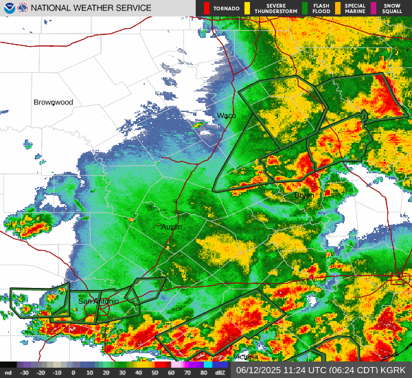
Late Noon Radar 06 10 24
- Attachments
-
- Late Noon Radar 06 10 24.jpg (111.19 KiB) Viewed 3193 times
-
cperk
- Posts: 858
- Joined: Sun Aug 19, 2012 12:09 pm
- Location: Richmond
- Contact:
Good luck Don on your move to Witchita Falls and please continue to post on WX infinity.

-
Stratton20
- Posts: 5870
- Joined: Tue Feb 09, 2021 11:35 pm
- Location: College Station, Texas
- Contact:
12z Euro shows a really heavy rainfall event setup for se texas as it moves the tropical wave very slowly inland, EPS likes the western gulf (mexico/texas) for development, lots to watch
-
don
- Posts: 3148
- Joined: Wed Feb 03, 2010 3:33 pm
- Location: Wichita Falls
- Contact:
Thank you! Yes I will still be here.One thing im not looking forward to though is heat and droughts.LOLjasons2k wrote: ↑Please stick around, we always appreciate your input.don wrote: ↑Thank you, I’ll still be here posting as always. LOLbrazoriatx wrote: ↑ Don, once you leave houston are you still going to visit here and keep us up to date with you're excellent knowledge of weather
You’ll definitely get your variety of weather up in Wichita Falls. It’s “hotter ‘n hell” up there (a race I’d never do - haha).
4/10/1979 has been seared in my brain since the early 80’s. It was one of the events that got me interested in the weather.
-
DoctorMu
- Posts: 8089
- Joined: Sun Jun 28, 2015 11:58 am
- Location: College Station
- Contact:
There's a lot more storm chasin' in the Spring as well. I remember driving back from Colorado in summer, hitting the dry line on Hwy 287 past Childress and rolling into Hell with extra hot sauce air in Wichita Fall. We were sweating buckets just walking in the parking lot.jasons2k wrote: ↑Mon Jun 10, 2024 10:11 amPlease stick around, we always appreciate your input.don wrote: ↑Mon Jun 10, 2024 9:17 amThank you, I’ll still be here posting as always. LOLbrazoriatx wrote: ↑Mon Jun 10, 2024 5:11 am Don, once you leave houston are you still going to visit here and keep us up to date with you're excellent knowledge of weather
You’ll definitely get your variety of weather up in Wichita Falls. It’s “hotter ‘n hell” up there (a race I’d never do - haha).
4/10/1979 has been seared in my brain since the early 80’s. It was one of the events that got me interested in the weather.
Of course last summer was Wichita Falls in CLL.
-
DoctorMu
- Posts: 8089
- Joined: Sun Jun 28, 2015 11:58 am
- Location: College Station
- Contact:
There's some easterly action up here...there's a cell that *could* find its way down Hwy 21/190 from Madisonville to College Station.
-
Stratton20
- Posts: 5870
- Joined: Tue Feb 09, 2021 11:35 pm
- Location: College Station, Texas
- Contact:
Noaa 6-10 and 8-14 day outlooks, and look where they have the highest probability of above normal precipitation! Texas is open for gulf mischief!
- Attachments
-
- IMG_3139.png
- (540.15 KiB) Downloaded 2135 times
-
- IMG_3138.png
- (805.71 KiB) Downloaded 2135 times
-
DoctorMu
- Posts: 8089
- Joined: Sun Jun 28, 2015 11:58 am
- Location: College Station
- Contact:
It was only a matter of time re: GFS long term outlook...but CMC and Euro say "wait, hold my boat drink."


-
Rip76

- Posts: 2151
- Joined: Mon Feb 15, 2010 12:38 am
- Location: The Woodlands
- Contact:
Nice rain here tonight in the Woodlands.
-
don
- Posts: 3148
- Joined: Wed Feb 03, 2010 3:33 pm
- Location: Wichita Falls
- Contact:
I'm at over 2 inches of rain now and its still pouring.My street is completely flooded for the second time in less than a month. (Tropical Rains)
I picked up 2 inches of rain in less than 30 minutes not bad. LOL
I picked up 2 inches of rain in less than 30 minutes not bad. LOL
- cahbnvas.png (164.99 KiB) Viewed 2871 times
-
MH5
- Posts: 65
- Joined: Mon Jun 22, 2020 2:20 pm
- Location: Timbergrove
- Contact:
Well that was certainly unexpected. These “calm” tropical rains are always so efficient. Might end up with close to 3” here in the heights/timbergrove.
-
Ptarmigan

- Statistical Specialist

- Posts: 4536
- Joined: Wed Feb 03, 2010 7:20 pm
- Contact:
-
jasons2k
- Posts: 6201
- Joined: Thu Feb 04, 2010 12:54 pm
- Location: Imperial Oaks
- Contact:
0.57” here with the evening showers.
-
Stratton20
- Posts: 5870
- Joined: Tue Feb 09, 2021 11:35 pm
- Location: College Station, Texas
- Contact:
00z CMC has a strong tropical storm approaching the middle texas coast, i dont like the sight of that upper level steering pattern on the CMC , almost looks like a ridge is building out to its west , potentially trapping it in place with a ridge to its east, yikes, has some eye popping totals