Might want to hold off on the non-severe part. Looks like some of these cells got some juice.Stratton20 wrote: ↑Wed May 29, 2024 4:56 pm Yep, thats what i expect to see more frequently this summer, nice cooling, non-severe thunderstorms
May 2024
-
Cromagnum
- Posts: 3076
- Joined: Thu Feb 03, 2011 10:42 pm
- Location: Georgetown
- Contact:
-
Cromagnum
- Posts: 3076
- Joined: Thu Feb 03, 2011 10:42 pm
- Location: Georgetown
- Contact:
Suspect this one is gonna get tornado warned soon.

-
Stratton20
- Posts: 5870
- Joined: Tue Feb 09, 2021 11:35 pm
- Location: College Station, Texas
- Contact:
And I jinxed it lol
-
tireman4

- Global Moderator

- Posts: 7161
- Joined: Wed Feb 03, 2010 9:24 pm
- Location: Humble, Texas
- Contact:
Things to know during power outages
- Attachments
-
- GOwcUuYWoAEH12S.png (191.51 KiB) Viewed 33332 times
-
Cromagnum
- Posts: 3076
- Joined: Thu Feb 03, 2011 10:42 pm
- Location: Georgetown
- Contact:
Looks like that nasty cell died out.
-
Cpv17
- Posts: 7109
- Joined: Fri Aug 31, 2018 1:58 pm
- Location: El Campo/Wharton
- Contact:
I got .90” today. I have nothing to complain about lol biggest rain I’ve had in over a month.
-
Cromagnum
- Posts: 3076
- Joined: Thu Feb 03, 2011 10:42 pm
- Location: Georgetown
- Contact:
Very weird issue with Directv right now. I can't get signal on any local channels, but all the cable channels are fine. Is there some local broadcast out of our area that they use that's boogered up by the recent power issues?
-
Ptarmigan

- Statistical Specialist

- Posts: 4536
- Joined: Wed Feb 03, 2010 7:20 pm
- Contact:
Flash Flood Warning for East Texas. Some areas have a lot of rain.
https://forecast.weather.gov/wwamap/wwa ... %20warning
https://forecast.weather.gov/wwamap/wwa ... %20warning
Code: Select all
Flash Flood Warning
LAC011-TXC199-241-351-457-300330-
/O.NEW.KLCH.FF.W.0082.240530T0028Z-240530T0330Z/
/00000.0.ER.000000T0000Z.000000T0000Z.000000T0000Z.OO/

BULLETIN - EAS ACTIVATION REQUESTED
Flash Flood Warning
National Weather Service Lake Charles LA
728 PM CDT Wed May 29 2024

The National Weather Service in Lake Charles has issued a

* Flash Flood Warning for...
  Western Beauregard Parish in southwestern Louisiana...
  Northeastern Hardin County in southeastern Texas...
  East Central Jasper County in southeastern Texas...
  West Central Newton County in southeastern Texas...
  Southern Tyler County in southeastern Texas...

* Until 1030 PM CDT.

* At 728 PM CDT, Doppler radar indicated thunderstorms producing
  heavy rain across the warned area. Between 1 and 3 inches of rain
  have fallen. The expected rainfall rate is 1 to 2 inches in 1
  hour. Additional rainfall amounts of 1 to 2 inches are possible in
  the warned area. Flash flooding is ongoing or expected to begin
  shortly.

  HAZARD...Flash flooding caused by thunderstorms.

  SOURCE...Radar.

  IMPACT...Flash flooding of small creeks and streams, urban
           areas, highways, streets and underpasses as well as
           other poor drainage and low-lying areas.

* Some locations that will experience flash flooding include...
  Fred, Warren, Wildwood, Call, Caney Head, Village Mills and Old
  Salem.

PRECAUTIONARY/PREPAREDNESS ACTIONS...

Turn around, don`t drown when encountering flooded roads. Most flood
deaths occur in vehicles.

In hilly terrain there are hundreds of low water crossings which are
potentially dangerous in heavy rain. Do not attempt to cross flooded
roads. Find an alternate route.

&&

LAT...LON 3069 9450 3062 9442 3060 9419 3062 9387
      3057 9373 3057 9370 3052 9371 3051 9371
      3049 9371 3048 9371 3049 9380 3046 9395
      3047 9410 3048 9429 3050 9454 3052 9454
      3069 9458

FLASH FLOOD...RADAR INDICATED
EXPECTED RAINFALL RATE...1-2 INCHES IN 1 HOUR

$$

78
-
TexasBreeze
- Posts: 1029
- Joined: Sun Sep 26, 2010 4:46 pm
- Location: NW Houston, TX
- Contact:
For those around the Beaumont area, looks like a flash flooding threat is developing with very slow moving storms firing and sitting over there.
It will be interesting to see if they back build into the Houston area overnight since the Atascosita area has showers now.
It will be interesting to see if they back build into the Houston area overnight since the Atascosita area has showers now.
-
Ptarmigan
- Statistical Specialist
- Posts: 4536
- Joined: Wed Feb 03, 2010 7:20 pm
- Contact:
I would not be surprised if that happened.TexasBreeze wrote: ↑Wed May 29, 2024 9:20 pm For those around the Beaumont area, looks like a flash flooding threat is developing with very slow moving storms firing and sitting over there.
It will be interesting to see if they back build into the Houston area overnight since the Atascosita area has showers now.
-
jasons2k

- Posts: 6201
- Joined: Thu Feb 04, 2010 12:54 pm
- Location: Imperial Oaks
- Contact:
Had the same issue. Ruined the Willie Nelson birthday showing. I’m gonna look for a recorded option to stream.
-
tireman4
- Global Moderator
- Posts: 7161
- Joined: Wed Feb 03, 2010 9:24 pm
- Location: Humble, Texas
- Contact:
381
FXUS64 KHGX 301050
AFDHGX
Area Forecast Discussion
National Weather Service Houston/Galveston TX
550 AM CDT Thu May 30 2024
...New AVIATION...
.SHORT TERM...
(Today through Friday Night)
Issued at 322 AM CDT Thu May 30 2024
Another day, another shortwave...the pattern of active weather
continue today and Friday with multiple rounds of showers and
thunderstorms expected. Expect a similar setup to yesterday with
scattered convection in the afternoon, mainly associated with
diurnal heating and the sea breeze. We remain under an unstable
tropical airmass, so storms will once again have the potential to
reach severe criteria today. Main hazards will be wind and hail. SPC
does have the majority of the area in a Marginal (level 1 of 5) risk
for severe weather today.
Later in the day an MCS is expected to develop out towards New
Mexico and the Panhandle, and will make an eastward progression
during the overnight hours. 500mb quasi-zonal flow over the western
half of the state will become NW flow over SE Texas, allowing the
MCS structure to go from an eastward progression to a SE progression
through our CWA Friday morning.
Clarity on the timing and intensity has been difficult to come
by...the evolution of this system will likely be dependent on
mesoscale features that Hi-res models have yet to catch onto...When
the MCS reaches our CWA Friday morning, we will still be in an
unstable environment, and as it pushes through there will be the
potential for damaging winds and hail. Ahead of the MCS we may see a
few showers and thunderstorms pop up. With the MCS pushing through
in the morning, there may be time for the atmosphere to rebound with
diurnal heating. This could allow for redevelopment later in the day
behind the initial MCS.
Daytime temperatures will continue to be in the 80s to near 90 area
wide through the short-term period. Nighttime lows will cool into
the 70s to near 80.
Adams
&&
.LONG TERM...
(Saturday through Wednesday)
Issued at 322 AM CDT Thu May 30 2024
The parade of shortwaves continue into the start of June. The first
shortwave within the long term will be moving through Saturday
morning/afternoon bringing showers and thunderstorms to much of the
region - though likely better coverage north of I-10. PWATs remain
fairly high, around 1.8 to 2.2", so any strong storm the develops
may produce locally heavy rainfall. WPC has placed most of SE Texas
in a Marginal Risk (level 1 of 4) for Excessive Rainfall on
Saturday. SPC has also placed areas generally north of I-10 in a
Marginal Risk (level 1 of 5) for Severe Thunderstorms on Saturday.
Like the previous few events, *if* these severe storms materialize,
then they may produce strong winds and hail. Another disturbance
will quickly follow suit, moving through the SE Texas Sunday
morning/afternoon bringing us another round of showers and
thunderstorms.
Upper-level ridging does begin to build Monday into Tuesday over
south Texas pushing the passing shortwaves further north towards the
RRV. Still depending on the strength of this ridge, portions of the
Piney Woods region may still get the occasionally shower or
thunderstorm through midweek next week.
The start of climatological Summer (June-July-August) will be
starting out near to slightly below normal with high temperatures
over the weekend expected to be in the upper 80s to near 90 degrees.
The overnight lows will not be near normal, but well above normal
with minimum temperatures expected in the mid to upper 70s (and even
low 80s for along the immediate coast). The ridging that begins to
build in next week will cause temperatures to creep up with high
temperatures in the low 90s on Monday, and then low to mid 90s by
Wednesday. High moisture will stick around thanks to southerly flow
at the surface, so heat indices near 100 to 105 degrees will return
next week.
Fowler
&&
.AVIATION...
(12Z TAF Issuance)
Issued at 540 AM CDT Thu May 30 2024
Several sites at MVFR, IFR CIGs ongoing at CLL. Expect CIGs to
lift to VFR and scatter out this afternoon. VCSH possible this
morning with a few streamer showers. Scattered thunderstorms this
afternoon with gusts to 20 kts possible through the afternoon
hours. Another round of showers and thunderstorms expected to move
through overnight into morning hours Friday. A few lingering
showers/storms possible through Friday afternoon. Storms could
produce large hail and damaging winds. MVFR CIGs return overnight
into Friday morning.
&&
.MARINE...
Issued at 322 AM CDT Thu May 30 2024
Light to occasionally moderate onshore flow will persist through the
middle of next week with seas around 3 to 5ft. Small craft may need to
exercise caution at times, especially during the overnight hours as
wind gusts to near 20kt. There will be continued chances for showers
and thunderstorms through the weekend. Some storms may become strong
to severe producing locally gusty winds and elevated seas. The
persistent onshore flow will also lead to a high risk of strong rip
currents through the weekend.
Fowler
&&
.PRELIMINARY POINT TEMPS/POPS...
College Station (CLL) 87 74 86 72 / 40 30 70 40
Houston (IAH) 87 76 88 75 / 50 20 60 40
Galveston (GLS) 85 80 85 79 / 20 20 40 40
&&
.HGX WATCHES/WARNINGS/ADVISORIES...
TX...None.
GM...None.
&&
$$
SHORT TERM...Adams
LONG TERM....Fowler
AVIATION...Adams
MARINE...Fowler
-
Pas_Bon
- Posts: 968
- Joined: Tue Sep 11, 2018 7:58 am
- Location: League City, TX
- Contact:
Well, the forecasted rain chances through Saturday just fell off a cliff here for League City.
-
Stratton20
- Posts: 5870
- Joined: Tue Feb 09, 2021 11:35 pm
- Location: College Station, Texas
- Contact:
Overall I can’t complain about the 6-10 and 8-14 day outlooks from NOAA, heat ridge remains centered over the western to NW US, still favored normal to above normal precipitation across the state through the next few weeks, Euro even a little bullish on a very late season cold front making it all the way through se texas next week, overall not a pattern that i will argue against thats for sure!
-
tireman4
- Global Moderator
- Posts: 7161
- Joined: Wed Feb 03, 2010 9:24 pm
- Location: Humble, Texas
- Contact:
We are still at 60 percent in Humble
- Attachments
-
- Humble Saturday 06 01 24.jpg (8.51 KiB) Viewed 32915 times
-
Cpv17
- Posts: 7109
- Joined: Fri Aug 31, 2018 1:58 pm
- Location: El Campo/Wharton
- Contact:
Unfortunately I don’t see much rain on the models in my area. Thank goodness I got almost an inch yesterday.
-
tireman4
- Global Moderator
- Posts: 7161
- Joined: Wed Feb 03, 2010 9:24 pm
- Location: Humble, Texas
- Contact:
This might be in our future .
- Attachments
-
- GO2sX37W4AEMVGO.jpeg
- (412.15 KiB) Downloaded 27957 times
-
869MB
- Posts: 206
- Joined: Fri Oct 30, 2015 8:44 am
- Location: Katy, TX
- Contact:
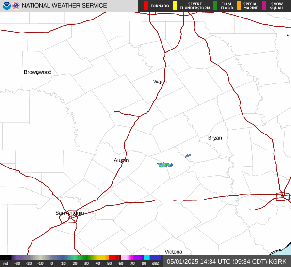
Not so fast with that assumption because there's still a chance you could still receive a good downpour or two later this evening and/or tomorrow morning. That 18Z HRRR run does not capture the intensity of the current activity we're seeing moving through Waco now. Right now it appears that complex will miss the SW portions of the viewing area. However, even if it misses you, storms may be strong enough to produce an outflow boundary that may initiate additional storms tonight or in the morning towards your area. Plus the parameters over our area still look sufficient to support storms as of now. We shall see though.
- Surface CAPE: 4,500 - 5,000 J/Kg
Mixed Layer CAPE: 2,500 - 3,500 J/Kg
Bulk Shear: 35 - 40knots
Mid-Layer Laspe Rates: 7.0 - 7.5 C/km
Precipitable Water: 1.7 - 1.9in
-
DoctorMu

- Posts: 8089
- Joined: Sun Jun 28, 2015 11:58 am
- Location: College Station
- Contact:
-
DoctorMu
- Posts: 8089
- Joined: Sun Jun 28, 2015 11:58 am
- Location: College Station
- Contact: