
Looks like it’s going tornadic now. Hope the farm is OK!!captainbarbossa19 wrote: ↑Sun May 12, 2024 12:44 pm Hi everyone. The severe storm is Jefferson County is awful. We had baseball sized hail at our farm. Never has happened before. Unfortunately, I don't have any pictures as I am still in Mississippi.
May 2024
-
jasons2k

- Posts: 6201
- Joined: Thu Feb 04, 2010 12:54 pm
- Location: Imperial Oaks
- Contact:
-
DoctorMu

- Posts: 8091
- Joined: Sun Jun 28, 2015 11:58 am
- Location: College Station
- Contact:
ULL + SJT = more impulses...potentially severe up here if the warm front passes through as expected. Usually the nighttime severe stuff is saved for LA, MS, AL, TN, AR with extra Gulf moisture and lift. Even more instability is expected tomorrow after the warm front - could be a lot of action.
Area Forecast Discussion
National Weather Service Houston/Galveston TX
108 PM CDT Sun May 12 2024
...New UPDATE, AVIATION...
.UPDATE...
Issued at 1235 PM CDT Sun May 12 2024
A Tornado Watch has been issued for along the I-10 corridor
starting in Waller County eastwards and up through Polk County
through 7pm. While most of the storms have been elevated this
morning, they will begin to creep down towards the surface as the
warm front moves through from south to north. So, *if* any severe
storms develop, there is a greater chance for a brief tornado now
than earlier this morning. The front is currently somewhere in
northern Harris County and will continue to push northwards
through the afternoon.
Fowler
&&
.SYNOPSIS...
Issued at 402 AM CDT Sun May 12 2024
It is Mother`s Day, and the atmosphere over Southeast Texas has
decided to celebrate it with opportunities for natural fireworks
at times today and tomorrow - it`s so enthusiastic about it, that
unfortunately we are indeed on the lookout again for storms
capable of produce excessive rain and severe weather. Here are
some main points from our latest analysis of the situation:
- We`ve expanded the flood watch for today and tonight slightly
southward. Brazos, Grimes, Montgomery, and northern Liberty
counties are now included in the watch area.
- Though the current watch is only in place until tomorrow
morning, that does not necessarily mean the flooding threat ends
then. We`ll be monitoring how rainfall evolves later today and
tonight, and use that help inform a decision on where...if any
watch is needed for Monday. A potential for severe storms is
also anticipated today and tomorrow, particularly tomorrow when
the entire area is in a slight risk (threat level 2 of 5) for
severe storms.
- Tuesday looks to provide a brief break, but the unsettled
pattern continues through the week, and we`re expecting another
window that could bring us heavy rain and severe weather later
Wednesday into Thursday. Keep checking in with us for the latest
on this potential as we push deeper into the week.
&&
.SHORT TERM...
(Today through Monday Night)
Issued at 402 AM CDT Sun May 12 2024
Happy Mother`s Day southeast Texas friends! Sadly, this discussion
will not feature beautiful weather for your Mother`s Day due to the
risk of heavy showers and thunderstorms. A mid/upper low continues
to slowly crawl eastward over SW CONUS this morning. The low is
enhancing a mid/upper W to WSW jet over central, south, east, and
coastal Texas today. Winds at the 500MB level are expected to
increase to 50-60kts by late this afternoon. Low pressure will
develop in the lower levels over W Kansas and the TX/OK panhandles
today, then move eastward. Deep, moist, S to SE LL flow ahead of the
low will result in a PWAT surge across the CWA. HREF PWAT means for
this afternoon show most locations peaking above 2 inches. In
addition to increasing PWATs, large scale ascent will also be on the
uptick as PVA is introduced over SE Texas thanks to the approaching
larger mid/upper system as well as smaller vort maxes embedded in
the jet. The PVA induced lift will be further enhanced by increasing
LL convergence thanks to a warm front pushing northward from the
Gulf. In addition to synoptic and mesoscale lift, the general
buoyancy of the atmosphere will be on the rise as well. Hi-res
forecast soundings are showing no shortage of LL instability by
afternoon with ML lapse rates on the rise as well. So what does all
this mean for you Mother`s Day?
Generally speaking, the aforementioned parameters are favorable for
the development of showers and thunderstorms, with locally very
heavy rainfall and isolated strong to severe thunderstorms possible.
WPC has placed our Piney Woods counties under a Moderate Risk (Level
4 of 5) of excessive rainfall for today. Most of the rest of our CWA
is under a Slight Risk (Level 2 of 4). The exception is our SW
counties where there is a Marginal Risk (Level 1 of 4) of excessive
rainfall. SPC has kept our northern CWA in a Slight Risk (Level 2 of
5) for severe thunderstorms, with areas farther south in a Marginal
Risk (Level 1 of 5). The primary threat will be damaging wind gusts
and hail. The best chance of heavy rainfall capable of producing
flooding will be north of I-10. That being said, pretty much all
regions in our CWA have a chance of seeing a heavy shower or
thunderstorm. Timing wise, widely scattered showers and isolated
thunderstorms will be possible as early as this morning. However,
the best chance of deeper convection will be this afternoon and
evening. Forecast soundings indicate increased capping around 750MB
after 03Z, suggesting a tapering of shower and thunderstorm activity
overnight. High temperatures today are expected to range from the
mid/upper 70s in our northern counties to low 80s over our southern
counties.
The active weather setup continues into Monday. Instability and ML
shear parameters are expected to become more favorable for strong to
severe thunderstorms. Therefore, it is no surprise that SPC has the
entire CWA in a Slight Risk (Level 2 of 5) on Monday. Once again,
damaging wind gusts and large hail will be the primary concerns.
Monday`s higher instability will be felt in the form of hotter
temperatures along with humidity. Afternoon highs temperatures could
approach 90 degrees with dew points in the low/mid 70s. General heat
index values are expected to peak in the upper 90s. The thunderstorm
threat will also come with an excessive rainfall risk. WPC has most
of the eastern half of our CWA in a Slight Risk (Level 2 of 4) while
the rest of our region is in a Marginal Risk (Level 1 of 4).
So how much rainfall can we expect through Monday? Widespread totals
north of I-10 are expected to be 2-4 inches, with totals dropping
off as one approaches the coast. However, locally much heavier
totals are likely. HREF ensemble max values indicate locally up to 7-
10 inches of rainfall is possible. Where these potential higher
amounts occur is basically anyone`s guess. However, the parameters
do suggest that the most favored region to receive locally much
heavier amounts will be north of I-10, particularly across our
northern Piney Woods counties. Unfortunately, these counties are
among the hardest hit from recent heavy rainfall events.
If you encounter water covered roads, please turn your car around.
Most flood related deaths occur in vehicles. Stay weather aware
today and tomorrow. Have multiple ways to receive warnings.
&&
.LONG TERM...
(Tuesday through Saturday)
Issued at 402 AM CDT Sun May 12 2024
Tuesday, at least, looks like a glass half full kind of day, and
that`s what we start the long term forecast with. Rain chances are
slim to none Tuesday and Tuesday night, and another late spring
"cold" front will get us a short bit with more sun and...let`s
call it a little less humidity. Enough to be a nice changeup. Of
course, this is also likely to erase any tangible "cold" effect of
the front, and the should be just as, and probably even slightly
warmer than both days framing it. Tuesday night may give us a bit
more help, with lows managing to fall below 70 for a single night
for all but those very close to the Gulf coast.
Of course, this impact looks to be very limited as at least
partial onshore flow returns Tuesday night, and becomes more
firmly established across the area on Wednesday. Since this isn`t
going to *immediately* bring precipitable water values back up,
and we look to see at least a little shortwave ridging sliding
through, most of the day Wednesday should be a process of noticing
increasing humidity and cloud cover. At some point, we`ll be
looking at precipitable water increasing back to around or above
the 90th percentile, while whatever weak ridging aloft we can
manage moves off, and we end up back under broadly cyclonic flow
aloft...and that`s when PoPs are going to start increasing again.
For now, I`ve got that holding off until late Wednesday night, and
really focusing on Thursday and Thursday evening for our best
chance at more significant rainfall and storms.
As for the intensity of this second window...confidence beyond the
broad strokes is still not as high as with the expectations for
this first window today/tomorrow. However, the Euro ensemble
Extreme Forecast Index shows a pretty decent signal in the 0.7 to
0.9 range for a higher-end CAPE/Shear parameter space on Thursday.
The NBM median CAPE values are in the 500-1000 J/Kg range on
Wednesday, and 1000-2000+ J/Kg on Thursday. Even though
the instability levels are less impressive Wednesday, it could be
sufficient for at least some isolated strong to severe storms,
and Thursday is much more obvious. The main thing precluding us
from getting more aggressive with severe threat is that the main
upper trough looks to be a little on the late side, which means we
may be dependent on less predictable shortwave troughs to help
support vertical motion. Given our pre-existing saturated
conditions, there`s a little more confidence in discussing a
locally heavy rain threat in this window. Both the NAEFS and EPS
means suggest precipitable water back up above the 90th percentile
Wednesday night or early Thursday morning, and both also peak out
above the 99.5th percentile, with PWATs pushing 2 inches near the
coast. The EPS even indicates a small area of PWAT outside of its
18Z climatology Thursday afternoon. Perhaps unsurprisingly, we
have a slight risk area (threat level 2 of 4) for part to most of
the area each day in the excessive rain outlook from WPC.
Late Thursday night, a cold front attached to a low over the Great
Lakes will make its way through the area, and at least put an end
to this window for heavier rain and stronger storms.
Unfortunately, it will be another one of those weak, late spring
fronts, that will be fairly ineffective at significantly scouring
out moisture or introducing noticeably cooler air. So on the
downside, temperatures will actually begin to drift their way back
up through the 80s towards 90 degrees Friday and Saturday. And at
this point, it`s not necessarily looking good to knock dewpoints
down far enough to really get a lot of relief at night, either. In
short...welcome to summer, y`all.
-
jasons2k
- Posts: 6201
- Joined: Thu Feb 04, 2010 12:54 pm
- Location: Imperial Oaks
- Contact:
Mesoscale Discussion 0759
NWS Storm Prediction Center Norman OK
0204 PM CDT Sun May 12 2024
Areas affected...Far East Texas and Southwest Louisiana
Concerning...Tornado Watch 233...
Valid 121904Z - 122100Z
The severe weather threat for Tornado Watch 233 continues.
SUMMARY...Large to hail to 2 inches will be possible with storms in
WW 233. The tornado risk will focus along the Louisiana coast as a
storm tracks along and just south of the warm front.
DISCUSSION...Storms north of the warm front will continue to pose
primarily a threat for large hail up to 2 inches as these storms
will remain elevated. Farther south, a storm in far southwest
Louisiana has produced 2 inch hail and a 49 kt wind gust in the
Beaumont, TX vicinity. This storm, which appears to be along or just
south of the warm front, will also pose the greatest risk for a
tornado over the next 1-2 hours. This storm has shown varying
degrees of low-level organization over the past hour.
..Wendt.. 05/12/2024
...Please see www.spc.noaa.gov for graphic product...
-
don

- Posts: 3148
- Joined: Wed Feb 03, 2010 3:33 pm
- Location: Wichita Falls
- Contact:
Tomorrow looks "fun"... LOL  As supercells congeal into a potent MCS and move through our area. SPC mentions an enhanced risk may be coming.
 As supercells congeal into a potent MCS and move through our area. SPC mentions an enhanced risk may be coming.
- Screenshot 2024-05-12 at 14-30-42 Models HRRR - Pivotal Weather.png (493.83 KiB) Viewed 3359 times
- Screenshot 2024-05-12 at 14-30-55 Models HRRR - Pivotal Weather.png (486.34 KiB) Viewed 3359 times
- Screenshot 2024-05-12 at 14-31-05 Models HRRR - Pivotal Weather.png (486.06 KiB) Viewed 3359 times
...Eastern TX into western GA...
A complex forecast exists for Monday, with multiple areas of
potential within a broad zone, and at various times of the day.
While significant wind and hail will clearly be possible,
predictability is low regarding the precise corridors of enhanced
risk potential.
Early on Monday, storms are expected to be ongoing from MS into AL
and the FL Panhandle, related to warm/moist advection near and north
of a warm front. Some of this activity immediately near the warm
front may have a hail and tornado risk, as instability rapidly
increases in proximity to stronger low-level effective SRH centered
over southern AL.
To the west, early-day storms are also anticipated from the ArkLaTex
into east-central TX, beneath cooler temperatures aloft and where
mid 70s F dewpoints will be in place. This activity may produce
large hail, and eventually grow upscale into larger clusters or an
MCS across eastern TX, LA and western MS through 00Z. Forecast
soundings show ample instability, and moderate mid to high level
winds, but with weak flow below 700 mb, suggesting MCS potential.
Depending on the track of that activity, and the position of any
outflows from the earlier storms farther east, the severe wind and
hail risk may overspread additional areas extending again into AL
and GA. As previously mentioned, potential air mass overturning and
condition of the unstable boundary layer are the main uncertainties,
and therefore the entire region remains in 15% Slight Risk category.
However, corridor(s) of Enhanced Risk may be considered into the day
1 period.
-
brazoriatx
- Posts: 415
- Joined: Tue Nov 08, 2011 12:09 pm
- Contact:
Are areas south of I10 suppose to get any rain today or tomorrow?
-
Stratton20
- Posts: 5870
- Joined: Tue Feb 09, 2021 11:35 pm
- Location: College Station, Texas
- Contact:
Not really any today, tommorow looks better for se texas as a whole to see rain as Don mentioned about an MCS moving through, hopefully nothing crazy in the severe department though
-
don
- Posts: 3148
- Joined: Wed Feb 03, 2010 3:33 pm
- Location: Wichita Falls
- Contact:
0Z HRRR for tomorrow.
- Screenshot 2024-05-12 at 21-16-51 Models HRRR - Pivotal Weather.png (477.24 KiB) Viewed 3155 times
- Screenshot 2024-05-12 at 21-16-59 Models HRRR - Pivotal Weather.png (490.03 KiB) Viewed 3155 times
- Screenshot 2024-05-12 at 21-17-14 Models HRRR - Pivotal Weather.png (504.09 KiB) Viewed 3155 times
-
Cpv17
- Posts: 7109
- Joined: Fri Aug 31, 2018 1:58 pm
- Location: El Campo/Wharton
- Contact:
HRRR has been showing that since 0z yesterday. Looks good!
-
DoctorMu
- Posts: 8091
- Joined: Sun Jun 28, 2015 11:58 am
- Location: College Station
- Contact:
-
don
- Posts: 3148
- Joined: Wed Feb 03, 2010 3:33 pm
- Location: Wichita Falls
- Contact:
An ENHANCED risk has been issued for today....
NWS Storm Prediction Center Norman OK
0100 AM CDT Mon May 13 2024
Valid 131200Z - 141200Z
...THERE IS AN ENHANCED RISK OF SEVERE THUNDERSTORMS FOR PORTIONS OF
SOUTH-CENTRAL TX TO THE WESTERN GULF COAST REGION...
...SUMMARY...
Severe thunderstorms are expected today from central and east Texas
across parts of the Gulf Coast states. The potential may develop for
corridors of significant wind gusts, very large hail, and a few
tornadoes.
...Synopsis...
A mid-level trough will traverse the southeastern U.S. today, with
multiple embedded impulses poised to pivot around the trough an
support multiple rounds of thunderstorms this morning into later
tonight. Earlier rounds of convection will reinforce a surface
baroclinic boundary just north of the I-10 corridor, which may
either remain stationary or drift slowly north through the day.
Continued low-level warm-air and moisture advection ahead of the
mid-level trough will boost at least elevated buoyancy on both sides
of the baroclinic boundary, while cooler mid-level temperatures
overspreads the southern Plains into the Lower MS Valley. Stronger
mid-level flow accompanying the cooler temperatures aloft will
result in appreciable deep-layer shear coinciding the aforementioned
buoyancy, which will support multiple rounds of strong to severe
thunderstorms, spanning from parts of the southern Plains to the FL
peninsula through the forecast period.
...Portions of central into eastern TX...
Showers and thunderstorms should clear out of central TX through the
early to mid-morning hours, allowing for 8+ C/km mid-level lapse
rates to overspread a moist boundary layer. Though diurnal heating
may be limited by cloud cover to a degree, temperatures should rise
over 80 F, supporting 2000-4000 J/kg SBCAPE (perhaps locally higher
in spots) given the aforementioned dewpoints/lapse rates. A belt of
stronger mid-level flow will overspread the region, supporting
elongated, straight hodographs supporting splitting supercells as an
initial storm mode. Large hail will be the main threat with these
storms, with some of the largest stones potentially reaching 2-4
inches in diameter, especially of a more sustained supercell
structure can develop. With time though, storms should grow upscale
into an MCS later in the afternoon/evening as they interact more
favorably with the baroclinic boundary. By this point, severe gusts
become the primary threat, with a couple of QLCS tornadoes also
possible.
-
MH5
- Posts: 65
- Joined: Mon Jun 22, 2020 2:20 pm
- Location: Timbergrove
- Contact:
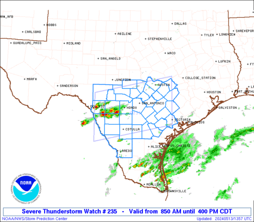
Already have a MD out for things popping out west of San Antonio with a watch incoming shortly. Today looks right on (or slightly ahead of) schedule.
-
MH5
- Posts: 65
- Joined: Mon Jun 22, 2020 2:20 pm
- Location: Timbergrove
- Contact:
-
Cpv17
- Posts: 7109
- Joined: Fri Aug 31, 2018 1:58 pm
- Location: El Campo/Wharton
- Contact:
don wrote: ↑Mon May 13, 2024 1:13 am An ENHANCED risk has been issued for today....
spcd1cat.us_sc (2).png
spcd1hail.us_sc (1).png
spcd1wind.us_sc (1).png
NWS Storm Prediction Center Norman OK
0100 AM CDT Mon May 13 2024
Valid 131200Z - 141200Z
...THERE IS AN ENHANCED RISK OF SEVERE THUNDERSTORMS FOR PORTIONS OF
SOUTH-CENTRAL TX TO THE WESTERN GULF COAST REGION...
...SUMMARY...
Severe thunderstorms are expected today from central and east Texas
across parts of the Gulf Coast states. The potential may develop for
corridors of significant wind gusts, very large hail, and a few
tornadoes.
...Synopsis...
A mid-level trough will traverse the southeastern U.S. today, with
multiple embedded impulses poised to pivot around the trough an
support multiple rounds of thunderstorms this morning into later
tonight. Earlier rounds of convection will reinforce a surface
baroclinic boundary just north of the I-10 corridor, which may
either remain stationary or drift slowly north through the day.
Continued low-level warm-air and moisture advection ahead of the
mid-level trough will boost at least elevated buoyancy on both sides
of the baroclinic boundary, while cooler mid-level temperatures
overspreads the southern Plains into the Lower MS Valley. Stronger
mid-level flow accompanying the cooler temperatures aloft will
result in appreciable deep-layer shear coinciding the aforementioned
buoyancy, which will support multiple rounds of strong to severe
thunderstorms, spanning from parts of the southern Plains to the FL
peninsula through the forecast period.
...Portions of central into eastern TX...
Showers and thunderstorms should clear out of central TX through the
early to mid-morning hours, allowing for 8+ C/km mid-level lapse
rates to overspread a moist boundary layer. Though diurnal heating
may be limited by cloud cover to a degree, temperatures should rise
over 80 F, supporting 2000-4000 J/kg SBCAPE (perhaps locally higher
in spots) given the aforementioned dewpoints/lapse rates. A belt of
stronger mid-level flow will overspread the region, supporting
elongated, straight hodographs supporting splitting supercells as an
initial storm mode. Large hail will be the main threat with these
storms, with some of the largest stones potentially reaching 2-4
inches in diameter, especially of a more sustained supercell
structure can develop. With time though, storms should grow upscale
into an MCS later in the afternoon/evening as they interact more
favorably with the baroclinic boundary. By this point, severe gusts
become the primary threat, with a couple of QLCS tornadoes also
possible.
The enhanced risk has been expanded to include all of southeast Texas now.
-
Cromagnum
- Posts: 3076
- Joined: Thu Feb 03, 2011 10:42 pm
- Location: Georgetown
- Contact:
Atmosphere is juiced out here. Very humid. I suspect it might get ugly in places later.


-
Cpv17
- Posts: 7109
- Joined: Fri Aug 31, 2018 1:58 pm
- Location: El Campo/Wharton
- Contact:
Looks like things should start to get cranking around 3pm. Literally the worst time for storms to come in. One of those rare days across southeast Texas where we actually get storms during the mid/late afternoon and early evening hours.
-
djmike

- Posts: 1883
- Joined: Fri Jan 07, 2011 12:19 pm
- Location: BEAUMONT, TX
- Contact:
Getting a little concerned for SETX. My anxiety is activated. Lol. LOVE severe weather but the “not knowing” eats me alive. Stay safe everyone!
Mike
Beaumont, TX
(IH-10 & College Street)
Beaumont, TX
(IH-10 & College Street)
-
djmike
- Posts: 1883
- Joined: Fri Jan 07, 2011 12:19 pm
- Location: BEAUMONT, TX
- Contact:
By the way, full sunshine right now, which means…well… storms will have plenty of energy .
Mike
Beaumont, TX
(IH-10 & College Street)
Beaumont, TX
(IH-10 & College Street)
-
jasons2k
- Posts: 6201
- Joined: Thu Feb 04, 2010 12:54 pm
- Location: Imperial Oaks
- Contact:
Get ready folks. This one is for real.
-
DoctorMu
- Posts: 8091
- Joined: Sun Jun 28, 2015 11:58 am
- Location: College Station
- Contact:
Those cells are poppin with bad intentions! Unusual to see severe storms that far SW - usually capped or not enough energy.