
February Weather Discussion. Wild Winter Storms?
-
TxLady

- Posts: 111
- Joined: Thu Feb 04, 2010 8:39 am
- Location: New Waverly, Walker Co., TX
- Contact:
We are trying so hard to plan a trip for March 5-12, to Tombstone, AZ then to South Rim of Grand Canyon, and finally to Sequoia Natl. Park. This crazy weather is driving me nuts! I've told the family (and we're talking LARGE group) that we will really just have to wait and see, as far as weather, for most of our travel plans. Although everyone thinks that southern Arizona will be a piece o' cake...I keep telling everyone that we may not be able to get beyond Southeast Texas, this time of year. I'll be watching closely...
-
wxdata

- Site Admin

- Posts: 1059
- Joined: Wed Feb 03, 2010 3:04 pm
- Location: Houston, TX
- Contact:
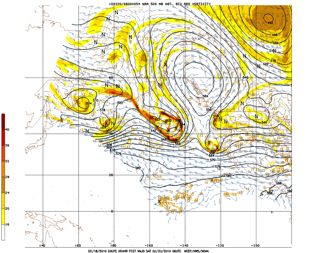
Noticed HGX calling for possible severe threat here Sunday, SPC less sure at this time.
-
Ptarmigan

- Statistical Specialist

- Posts: 4520
- Joined: Wed Feb 03, 2010 7:20 pm
- Contact:
According to Tim Heller, if winter was to end today, this winter would be the fourth coldest on record. It would be the coldest since 1983-4.
-
srainhoutx

- Site Admin
- Posts: 19700
- Joined: Tue Feb 02, 2010 2:32 pm
- Location: Maggie Valley, NC
- Contact:
Well if the 18Z GFS (yes, I know it's the 18Z) verifies, things would get mighty interesting across TX. Let's see what the 00Z's offer and perhaps we will know a bit more concerning next week.
Carla/Alicia/Jerry(In The Eye)/Michelle/Charley/Ivan/Dennis/Katrina/Rita/Wilma/Humberto/Ike/Harvey
Member: National Weather Association
Facebook.com/Weather Infinity
Twitter @WeatherInfinity
Member: National Weather Association
Facebook.com/Weather Infinity
Twitter @WeatherInfinity
-
srainhoutx
- Site Admin
- Posts: 19700
- Joined: Tue Feb 02, 2010 2:32 pm
- Location: Maggie Valley, NC
- Contact:
00'z have started. Another "pull on the lever" as wxman57 would say... 
Carla/Alicia/Jerry(In The Eye)/Michelle/Charley/Ivan/Dennis/Katrina/Rita/Wilma/Humberto/Ike/Harvey
Member: National Weather Association
Facebook.com/Weather Infinity
Twitter @WeatherInfinity
Member: National Weather Association
Facebook.com/Weather Infinity
Twitter @WeatherInfinity
-
wxman57

- Global Moderator

- Posts: 2621
- Joined: Thu Feb 04, 2010 5:34 am
- Location: Southwest Houston (Westbury)
- Contact:
I posted this at S2K, but it's a good reminder of how to read the model maps. Those maps with the green precip areas behind the freezing lines can be a bit deceiving, as the precip is occurring up to 12 hours prior to the valid time of the map at 192 hrs. I made a couple meteograms for Dallas from that 18Z GFS to show you what I mean.
Here's the 0-180hr part. Nothing significant except lots of cold rain toward the end:

Now the 180-384hr part that got everyone's attention. Look closely. It's 42F at 12AM Friday (26th) and down to 29F by 12PM Friday (12 hours later). That green bar below the 29F at 12PM represents 0.28" liquid precip that falls during the PREVIOUS 12 hours. That means that the heaviest precip was falling when the 18Z GFS was predicting the temperature to be 42F. It's quite possible that the 0.28" precip ended before the temperature dropped to freezing.
Now I'm not saying that there won't be a significant winter precip event across TX/OK next week, just that the 18Z GFS isn't really showing a big storm for Dallas. I'm always a bit wary of a model that first shows a storm this coming Friday, then Mon/Tue then Wed then the NEXT Friday. Always farther along. I don't think the GFS has the right idea yet. We'll have to wait a few more days. There is a lot of cold air coming down next week, we just don't know the details of what will happen and who'll be hit hardest yet.
Here's the 180-384hr GFS meteogram from 18Z:

Here's the 0-180hr part. Nothing significant except lots of cold rain toward the end:
Now the 180-384hr part that got everyone's attention. Look closely. It's 42F at 12AM Friday (26th) and down to 29F by 12PM Friday (12 hours later). That green bar below the 29F at 12PM represents 0.28" liquid precip that falls during the PREVIOUS 12 hours. That means that the heaviest precip was falling when the 18Z GFS was predicting the temperature to be 42F. It's quite possible that the 0.28" precip ended before the temperature dropped to freezing.
Now I'm not saying that there won't be a significant winter precip event across TX/OK next week, just that the 18Z GFS isn't really showing a big storm for Dallas. I'm always a bit wary of a model that first shows a storm this coming Friday, then Mon/Tue then Wed then the NEXT Friday. Always farther along. I don't think the GFS has the right idea yet. We'll have to wait a few more days. There is a lot of cold air coming down next week, we just don't know the details of what will happen and who'll be hit hardest yet.
Here's the 180-384hr GFS meteogram from 18Z:
-
wxdata
- Site Admin
- Posts: 1059
- Joined: Wed Feb 03, 2010 3:04 pm
- Location: Houston, TX
- Contact:
Then that would mean east of here...JB mentioned I-10 and BTR for winter fun, but I'll believe it when I see it.
-
wxman57
- Global Moderator
- Posts: 2621
- Joined: Thu Feb 04, 2010 5:34 am
- Location: Southwest Houston (Westbury)
- Contact:
That's because from 180 hours on, the time interval switches to 12 hours.Ed Mahmoud wrote:I can't get 3 hour stuff from the GFS beyond tau 180.
-
don

- Posts: 3148
- Joined: Wed Feb 03, 2010 3:33 pm
- Location: Wichita Falls
- Contact:
The European looks nice if you want a little frozen precip over SOUTH CENTRAL and SOUTHEAST Texas...

-
srainhoutx
- Site Admin
- Posts: 19700
- Joined: Tue Feb 02, 2010 2:32 pm
- Location: Maggie Valley, NC
- Contact:
This is almost comical...30 this morning at my location with yet another heavy frost...
PRELIMINARY EXTENDED FORECAST DISCUSSION
NWS HYDROMETEOROLOGICAL PREDICTION CENTER CAMP SPRINGS MD
329 AM EST THU FEB 18 2010
VALID 12Z MON FEB 22 2010 - 12Z THU FEB 25 2010
USED AN EVEN BLEND OF THE 00Z/18 ECMWF AND 00Z/18 GEFS MEAN FOR
THE PRELIMINARY FRONTS AND PRESSURES FOR DAY 3...WITH MOSTLY GEFS
MEAN THEREAFTER. THE 00Z/17 GFS AND GEM GLOBAL WERE NORTH WITH
THE MAJOR WAVE CROSSING THE EAST DURING THE FIRST HALF OF THE
PERIOD...AND ARE NOW SOUTH...WHILE THE 00Z/17 ECMWF AND UKMET WERE
SOUTH AND ARE NOW NORTH WITH THE SAME FEATURE. THIS FLIP-FLOPPING
ARGUES FOR A MIDDLE OF THE ROAD SOLUTION...WHICH THE HEAVY
EMPHASIS ON THE GEFS MEAN AFFORDS THIS PACKAGE. THE BLOCK OVER
THE WEST IS NO CLEARER...WITH THE POSITION OF THE COLD MID LEVEL
CORES A BIT LIKE THE SHELL SHUFFLE GAME. HOPEFULLY...THE LIBERAL
USE OF THE MEAN WILL MITIGATE ANY LARGE ERRORS THIS PERIOD.
CISCO
Carla/Alicia/Jerry(In The Eye)/Michelle/Charley/Ivan/Dennis/Katrina/Rita/Wilma/Humberto/Ike/Harvey
Member: National Weather Association
Facebook.com/Weather Infinity
Twitter @WeatherInfinity
Member: National Weather Association
Facebook.com/Weather Infinity
Twitter @WeatherInfinity
-
Portastorm

- Posts: 800
- Joined: Wed Feb 03, 2010 3:04 pm
- Location: Southwest Austin/Oak Hill, TX
- Contact:
Yeah srainhoutx, we had upper 20s to near 30 degrees in the general Austin metro area this morning. The downtown core only got down to about 35 but I attribute that to the urban heat island effect. Based on LCRA hydromet data all reporting locations outside the immediate downtown area were below freezing. Again!
-
txsnowmaker
- Posts: 733
- Joined: Wed Feb 03, 2010 4:07 pm
- Location: SW Houston (Galleria area)
- Contact:
If you want to see winter weather again this season, it is encouraging that the Euro is still showing frozen precip for our area next week. The Canadian is apparently showing a major winter storm for Texas later next week, but I am not sure how it would impact SE Texas IF it verified (I don't have the link and even if I did I am not sure that I would be able to interpret the model well enough to determine its forecast!).
-
srainhoutx
- Site Admin
- Posts: 19700
- Joined: Tue Feb 02, 2010 2:32 pm
- Location: Maggie Valley, NC
- Contact:
Morning e-mail from Jeff...
Cold but at least sunny weather of this week will be replaced by warmer and wetter weather over the weekend before more cold arrives early next week.
Discussion:
High level moisture is on the increase as old polar high moves eastward allowing the sub-tropical jet stream to spill into the region. Most areas have had a freeze the last 4 mornings. SE surface winds will return today allowing a very slow increase in moisture at the low levels into the weekend ahead of the next front penciled in for Sunday evening. A heavily suppressed short wave will move mainly south of the region Friday. Guidance does not produce much QPF with this system over the land areas of SE TX with most of the activity over the NW Gulf and beyond. Best chances for rain will be along the coast and offshore Friday.
This wave moves eastward Friday night with no air mass change. SE winds will increase over the weekend allowing at least upper 50 to near 60 degree dewpoints to arrive into the area for the first time in a while. Next storm system will approach on Sunday with a strong cold front. Area looks to get into the warm sector for a change on Sunday as Gulf opens up. Forecast soundings for IAH and VCT becoming increasingly unstable during the day as moisture increases and temperatures warm into the lower 70’s. Strong cold front will arrive into this air mass Sunday evening. Forecasted CAPE values of 500-1000 J/kg does support some strong to severe storms Sunday afternoon/evening. Will be watching this period fairly closely as cells may attempt to get going in the warm sector prior to the front and have a severe threat. With that said…the Gulf has been worked over hard this winter with several cold air intrusions, and the models may be overdoing the progged instability. Plenty of time to watch between now and Saturday evening.
Next forecast concern is how cold behind the Sunday front and if there will be any precipitation next week in the cold air. Models are in horrible disagreement with the upper air and surface features. Developing high latitude omega block off the W Canada coast would allow some bitter cold air the move southward….however the GFS breaking this pattern down quickly and transitions into a fast split zonal flow over the US which would support the cold air heading southward to get deflected eastward. The EURO model is more aggressive with a cold air plunge due south and much more amplified southern stream trough Tues/Wed next week with lots of cold air and precip over TX. GFS does have some support from the CMC and several of the ensemble members, but I am not sure it is handling the cold air well…as this model usually does not handle cold arctic domes well.
Given all the uncertainty, will go with a colder solution than the GFS with highs back into the 50’s on Monday and possibly the 40’s on Tues/Wed. Will bring a slight rain chance into the forecast starting Tuesday and keep P-type all liquid for now. If the models start trending toward the more stable EURO…then much colder for next week with highs in the 30’s and 40’s and we would have to entertain the idea of P-type issues Tues/Wed. Not really needing to be said…the forecast beyond Sunday is extremely low confidence.
Climo:
So how cold has this cold winter been? Per the NWS the average Dec 1-Feb 15 temp. for KIAH has been 49.1 degrees or the 7th coldest on record and currently the first 15 days of Feb are the 8th coldest on record. More astounding is the fact that Galveston is currently running an impressive 8.0 degrees below average for the month of Feb. By far this has been one of the coldest winters of the past decade and likely for many since the late 1980’s.
Spring Outlook:
The outlook for the March-May period for TX will continue to favor the wetter and colder pattern of this winter. El Nino indicators have shown a gradual cooling of the current ENSO in progress with conditions heading toward neutral by early summer. This corresponds well with above average rainfall and continued cooler conditions. One interesting aspect is all this cold air affects on the Gulf water temps. Temperatures are running above 2.0 degrees colder than last year at this time over the Gulf. With all the cold and stable air in place it has been hard to get severe weather going along the Gulf coast this winter. During such El Nino winter severe threats and tornadoes are fairly common along the US Gulf coast. The combination of poor moisture quality over the Gulf and a very suppressed sub-tropical jet has resulted in all the “action” being out over the central Gulf of Mexico. This activity in this very active pattern should begin to lift northward over the next month, but the colder than average water temperatures may help mitigate much of a severe weather season until the Gulf warms a bit and the cold air intrusions abate.
Carla/Alicia/Jerry(In The Eye)/Michelle/Charley/Ivan/Dennis/Katrina/Rita/Wilma/Humberto/Ike/Harvey
Member: National Weather Association
Facebook.com/Weather Infinity
Twitter @WeatherInfinity
Member: National Weather Association
Facebook.com/Weather Infinity
Twitter @WeatherInfinity
-
C2G

- Posts: 236
- Joined: Wed Feb 03, 2010 8:55 pm
- Location: NW Galveston County
- Contact:
Maybe a little more snow at the 130-140 mark for the Dallas area. Sorry, no snow depicted for the Houston area in the next seven days.
-
wxman57
- Global Moderator
- Posts: 2621
- Joined: Thu Feb 04, 2010 5:34 am
- Location: Southwest Houston (Westbury)
- Contact:
12Z GFS raw data meteogram for the Dallas area. It indicates surface temps above freezing but colder air aloft. I still think the GFS hasn't got it right for next week's system.

-
txsnowmaker
- Posts: 733
- Joined: Wed Feb 03, 2010 4:07 pm
- Location: SW Houston (Galleria area)
- Contact:
Like wxman57 and others have said, at this time, it would seem to be better to pay closer attention to the Euro model for next week.
-
tireman4

- Global Moderator
- Posts: 7126
- Joined: Wed Feb 03, 2010 9:24 pm
- Location: Humble, Texas
- Contact:
I do trust you Wxman57 and thank you for all of your imput this winter ( and past seasons). If you say the GFS still does not have it right, then it does not.  For the Olympics, let us think Canadian!!
-
kayci

- Posts: 358
- Joined: Thu Feb 04, 2010 10:30 am
- Location: Alvin
- Contact:
The Ocean?Ed Mahmoud wrote:RE: cold air intrustions.
Popo (my wife's grandpa) has not rebuilt on his lot in Galveston yet, but we went down there last year, sort of like day camping, and BBQ'd, drank beer, and caught fish. Good gawking, as some partially destroyed homes, and lightly damaged but clearly beyond the new vegetation line homes hadn't been demolished yet.
OK, rest room facilities aren't on Popo's lot, but there is a Port-a-Let for the truly desparate a block down, and the ocean is full of warm salt water. I'll say no more.
-
txsnowmaker
- Posts: 733
- Joined: Wed Feb 03, 2010 4:07 pm
- Location: SW Houston (Galleria area)
- Contact:
The latest UKMET run is apparently showing a snow event in Texas next Tuesday, according to a pro met on another site. However, I am not clear as to whether this includes the Houston area.
-
snowman65

- Posts: 1415
- Joined: Thu Feb 04, 2010 6:39 am
- Location: Orange, Tx
- Contact:
txsnowmaker wrote:The latest UKMET run is apparently showing a snow event in Texas next Tuesday, according to a pro met on another site. However, I am not clear as to whether this includes the Houston area.
It won't be us..maybe Dallas area again.