March 2022
-
redneckweather
- Posts: 1063
- Joined: Mon Feb 08, 2010 7:29 pm
- Location: Montgomery, Texas
- Contact:
Kinda coolish outside with heavy overcast and light rain which should be ongoing for the remainder of the day. I'm hoping this will help keep a lid a bit on the severe threat.
- djmike
- Posts: 1856
- Joined: Fri Jan 07, 2011 12:19 pm
- Location: BEAUMONT, TX
- Contact:
That wind sure picked up in Beaumont. 30-40mph gusts according to NWS.
Mike
Beaumont, TX
(IH-10 & College Street)
Beaumont, TX
(IH-10 & College Street)
-
Cpv17
- Posts: 7021
- Joined: Fri Aug 31, 2018 1:58 pm
- Location: El Campo/Wharton
- Contact:
Montgomery County is pretty far north. I still feel like you guys up there are gonna get hit pretty good.redneckweather wrote: ↑Mon Mar 21, 2022 11:05 am Kinda coolish outside with heavy overcast and light rain which should be ongoing for the remainder of the day. I'm hoping this will help keep a lid a bit on the severe threat.
- DoctorMu
- Posts: 7911
- Joined: Sun Jun 28, 2015 11:58 am
- Location: College Station
- Contact:
There's a lot of thick clouds here in CLL as well. Don't see or can't see much shear up there. We might be able to get to nightfall without a supercell. We'll see. Looks more like a late winter than severe season event. But that's now. Things could change for the worse.
Having said that, I would not be surprised if Louisiana bears the brunt of nature's wrath.
Having said that, I would not be surprised if Louisiana bears the brunt of nature's wrath.
-
Cromagnum
- Posts: 3060
- Joined: Thu Feb 03, 2011 10:42 pm
- Location: Georgetown
- Contact:
With the thick overcast I can't see supercells getting a chance. The squall line on the other hand...
-
Stratton20
- Posts: 5755
- Joined: Tue Feb 09, 2021 11:35 pm
- Location: College Station, Texas
- Contact:
I expect some renegade supercells to form in the afternoon ahead of tonights line, do not be fooled by this cloud cover, i unfortunately suspect it will start to break up as we provress through the afternoon, as we know mother nature does what she wants, prepare for the worst but hope for the best
- tireman4
- Global Moderator

- Posts: 7028
- Joined: Wed Feb 03, 2010 9:24 pm
- Location: Humble, Texas
- Contact:
- tireman4
- Global Moderator

- Posts: 7028
- Joined: Wed Feb 03, 2010 9:24 pm
- Location: Humble, Texas
- Contact:
- DoctorMu
- Posts: 7911
- Joined: Sun Jun 28, 2015 11:58 am
- Location: College Station
- Contact:
Squall line is the problem. And timing.
Even though I've never see tornadic action at night in College Station in 30 years, it doesn't mean that can't happen. I've seen it in Arkansas. Louisiana. And MS, AL, TN are ripe for those evening tornados.
-
Cromagnum
- Posts: 3060
- Joined: Thu Feb 03, 2011 10:42 pm
- Location: Georgetown
- Contact:
My neighbor has been renovating and has crap all over his driveway. Guarantee its going to be all over my yard tomorrow.
- DoctorMu
- Posts: 7911
- Joined: Sun Jun 28, 2015 11:58 am
- Location: College Station
- Contact:
There are currently no severe weather watches for Brazos Co. A little surprising, but it still is before noon.
- tireman4
- Global Moderator

- Posts: 7028
- Joined: Wed Feb 03, 2010 9:24 pm
- Location: Humble, Texas
- Contact:
In the AFD..they mentioned the mid afternoon. I assume they will wait until then..
AVIATION [12Z TAF Issuance]...
MVFR to IFR CIGS will continue across SE Texas this morning
and into Tuesday. Could see some improvement in CIGS in the
afternoon from daytime heating, though decided stay more
pessimistic given the inclement weather. Gusty winds this morning
will strengthen through the afternoon as the pressure gradient
tightens. SHRA this morning will evolve into TSRA late this
morning, becoming strong to severe in late afternoon/early evening
as a line of storms moves through SE Texas. After this line
passes, conditions will begin to improve, with winds relaxing and
CIGS lifting.
-
sau27
- Posts: 415
- Joined: Sat Apr 24, 2010 12:04 am
- Location: Bellaire
- Contact:
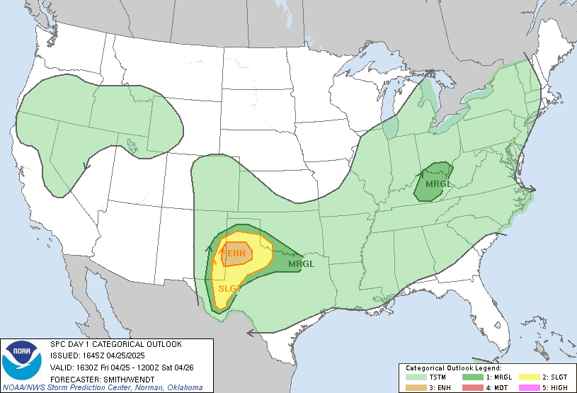
Upgrade to a Moderate risk now to our NW
-
Cromagnum
- Posts: 3060
- Joined: Thu Feb 03, 2011 10:42 pm
- Location: Georgetown
- Contact:
- tireman4
- Global Moderator

- Posts: 7028
- Joined: Wed Feb 03, 2010 9:24 pm
- Location: Humble, Texas
- Contact:
- don
- Posts: 3147
- Joined: Wed Feb 03, 2010 3:33 pm
- Location: Wichita Falls
- Contact:
No surprise there.Mesoscale models have been very consistent on supercells developing along the I-35 corridor and moving east later today.With a secondary wave of development refiring in southeast Texas as a jet streak moves in mainly after 9 pm tonight.The secondary wave of storms will consist of a quasi linear MCS.With embedded supercells which look to be be semi discreet.
Last edited by don on Mon Mar 21, 2022 12:36 pm, edited 2 times in total.
- don
- Posts: 3147
- Joined: Wed Feb 03, 2010 3:33 pm
- Location: Wichita Falls
- Contact:
-
cureduchenne
- Posts: 14
- Joined: Wed Apr 03, 2013 8:24 am
- Location: Vanderbilt, TX
- Contact:
We are in Dallas currently and need to get to Edna, southwest of Houston. We have 3 ways we could get home - Austin, Cameron, Houston - which of the ways would you suggest in traveling. We will be leaving by 1 pm. I was thinking Austin route but then saw I-35 is a possible hot spot. I appreciate your thoughts on this.
- DoctorMu
- Posts: 7911
- Joined: Sun Jun 28, 2015 11:58 am
- Location: College Station
- Contact:
Welp. That escalated quickly!don wrote: ↑Mon Mar 21, 2022 12:31 pm No surprise there.Mesoscale models have been very consistent on supercells developing along the I-35 corridor and moving east later today.With a secondary wave of development refiring in southeast Texas as a jet streak moves in mainly after 9 pm tonight.The secondary wave of storms will consist of a quasi linear MCS.With embedded supercells which look to be be semi discreet.


