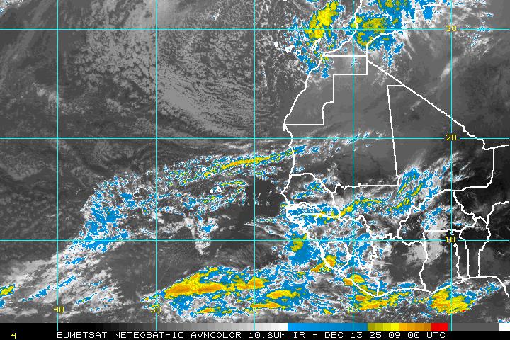
Invest 92L Eastern Atlantic: Off Africa
Posted: Sun Aug 07, 2011 5:47 am
by srainhoutx
BEGIN
NHC_ATCF
invest_al922011.invest
FSTDA
R
U
040
010
0000
201108070855
NONE
NOTIFY=ATRP
END
INVEST, AL, L, , , , , 92, 2011, DB, O, 2011080706, 9999999999, , , , , , METWATCH, , AL922011
AL, 92, 2011080706, , BEST, 0, 115N, 191W, 25, 0, DB, 0, , 0, 0, 0, 0,

06Z GFS...
Re: Invest 92L Eastern Atlantic: Off Africa
Posted: Sun Aug 07, 2011 1:26 pm
by srainhoutx
SYNOPSIS 2011080700
P14L
12N, 19W
700 hPa
ECMWF: Gradually weakens the entire forecast period.
GFS: Consistent story: Large, distinct pouch the entire five days. Slow at first, then accelerates, but also slowly weakens after Day 2.
UKMET: Similar to GFS, but it does not intensify much during the first couple of days.
NOGAPS: Continues its erratic track, especially at the beginning and end of the 5-day forecast.
HWRF-GEN: Depicts the largest pouch of all five models.
ECMWF -5.5 v700 108h
GFS -6.2 v700 120h
UKMET -6.0 v700 120h
NOGAPS -5.5 v700 120h
HWGEN -6.4 v700 120h
Re: Invest 92L Eastern Atlantic: Off Africa
Posted: Mon Aug 08, 2011 9:32 am
by srainhoutx
SYNOPSIS 2011080800
P14L
12N, 21W
700 hPa
The story of a single, easily-tracked pouch is gone!
ECMWF: P14L is stationary just off the coast of Africa as another weak wave approaches from the east. P14L and the other wave/pouch (I have never tracked this eastern wave/pouch) merge during Day 2. Then this merged pouch, which I continue to call P14L, initially moves northwestward, but then it moves southwestward and dissipates after 96 hours. Meanwhile, two other pouches are depicted later in the forecast period. (1) An area of elevated and OW values to the southeast of P14L, and (2) A small 700-hPa pouch moves from the subtropics toward the southwest ahead of/west of P14L. This pouch develops and then moves westward toward the Caribbean. (I have always thought that 2010's Matthew had similar origins, so this potential pouch needs monitoring.)
GFS: Similar to ECMWF, except that after the merger, P14L moves northwestward into the subtropical ridge and dissipates. GFS also depicts the eventual tropical pouch to the southeast as well as the subtropical pouch that moves into the Caribbean.
UKMET: Similar to GFS, with an early merger, motion into and dissipation in the subtropical ridge, and even the development of another 700-hPa subtropical development to the west.
NOGAPS: Outlier!! Like other models, NOGAPS hints at an early merger, although the presence of the other wave/pouch is not so obvious in the fields. However, NOGAPS does not move P14L northwestward, but rather, moves westward, but with a somewhat erratic track. Other pouches are eventually depicted, so P14L in NOGAPS appears to be just one pouch in a zonal string of ITCZ vortices.
HWRF-GEN: (No data)
ECMWF -5.0 v700 & RH 96h
GFS -5.8 v700 84h
UKMET -5.8 v700 & RH 96h
NOGAPS -4.3 v700 120h
HWGEN ---- v700 ---h
Re: Invest 92L Eastern Atlantic: Off Africa
Posted: Mon Aug 08, 2011 12:45 pm
by srainhoutx
BEGIN
NHC_ATCF
invest_DEACTIVATE_al922011.ren
FSTDA
R
U
040
010
0000
201108081731
NONE
NOTIFY=ATRP
END
INVEST, AL, L, , , , , 92, 2011, DB, O, 2011080706, 9999999999, , , , , , METWATCH, , AL922011
AL, 92, 2011080612, , BEST, 0, 108N, 160W, 20, 1011, DB, 0, , 0, 0, 0, 0, 1011, 180, 90, 0, 0,
AL, 92, 2011080618, , BEST, 0, 109N, 175W, 20, 1010, DB, 0, , 0, 0, 0, 0, 1011, 180, 90, 0, 0,
AL, 92, 2011080700, , BEST, 0, 110N, 188W, 20, 1010, LO, 0, , 0, 0, 0, 0, 1011, 180, 90, 0, 0,
AL, 92, 2011080706, , BEST, 0, 110N, 200W, 25, 1009, LO, 0, , 0, 0, 0, 0, 1011, 180, 90, 0, 0,
AL, 92, 2011080712, , BEST, 0, 110N, 209W, 25, 1009, LO, 0, , 0, 0, 0, 0, 1011, 180, 90, 0, 0,
AL, 92, 2011080718, , BEST, 0, 110N, 217W, 25, 1009, LO, 0, , 0, 0, 0, 0, 1011, 180, 90, 0, 0, L, 0, , 0, 0, INVEST, S,
AL, 92, 2011080800, , BEST, 0, 111N, 226W, 25, 1009, LO, 0, , 0, 0, 0, 0,

