2011 ATL Hurricane Season: Coming to an End
- wxman57
- Global Moderator

- Posts: 2621
- Joined: Thu Feb 04, 2010 5:34 am
- Location: Southwest Houston (Westbury)
- Contact:
Yes, I think we may need to keep an eye on the NW Caribbean by early October. It would be quite unlikely that such a storm would come to Texas, though. Could do something like 2002's Lily.
-
weatherguy425
- Pro Met

- Posts: 830
- Joined: Wed Feb 03, 2010 7:45 pm
- Location: Atlanta, Georgia
- Contact:
So, is hurricane season over for us? Personally, I'm ready for Fall and Winter. Bring on some cold weather!
-
Andrew
- Site Admin

- Posts: 3440
- Joined: Wed Feb 03, 2010 9:46 pm
- Location: North-West Houston
- Contact:
Lets just say that the odds are very low that we will get a storm this year. You never know what can happen but with the troughs coming in stronger and the season getting so late, it will be hard for anything to track this way. Only real possibility is a home grown storm.sambucol wrote:So, is hurricane season over for us? Personally, I'm ready for Fall and Winter. Bring on some cold weather!
For Your Infinite Source For All Things Weather Visit Our Facebook
As we enter October, it should not be written off. Some of the deadliest hurricanes occurred in October.
Great Hurricane of 1780 22,000
Mitch 1998 19,000
Flora 1963 8,000
Also, some of the most intense as well.
Wilma 2005 882 mb 185 mph
Mitch 1998 905 mb 180 mph
1924 Cuba Hurricane 910 mb 165 mph
2005 peaked in October with 7 storms.
Great Hurricane of 1780 22,000
Mitch 1998 19,000
Flora 1963 8,000
Also, some of the most intense as well.
Wilma 2005 882 mb 185 mph
Mitch 1998 905 mb 180 mph
1924 Cuba Hurricane 910 mb 165 mph
2005 peaked in October with 7 storms.
What are the glamorous models saying about the next 10-14 days? Anyone developing a system?
- srainhoutx
- Site Admin

- Posts: 19616
- Joined: Tue Feb 02, 2010 2:32 pm
- Location: Maggie Valley, NC
- Contact:
The models are in rather good agreement of a disturbance forming near Cuba and heading into the Eastern Gulf early next week. There is also good agreement that a EPAC Hurricane recurving NE and making landfall near Mazatlan next week.as well. The MJO is returning...texoz wrote:What are the glamorous models saying about the next 10-14 days? Anyone developing a system?
Carla/Alicia/Jerry(In The Eye)/Michelle/Charley/Ivan/Dennis/Katrina/Rita/Wilma/Humberto/Ike/Harvey
Member: National Weather Association
Facebook.com/Weather Infinity
Twitter @WeatherInfinity
Member: National Weather Association
Facebook.com/Weather Infinity
Twitter @WeatherInfinity
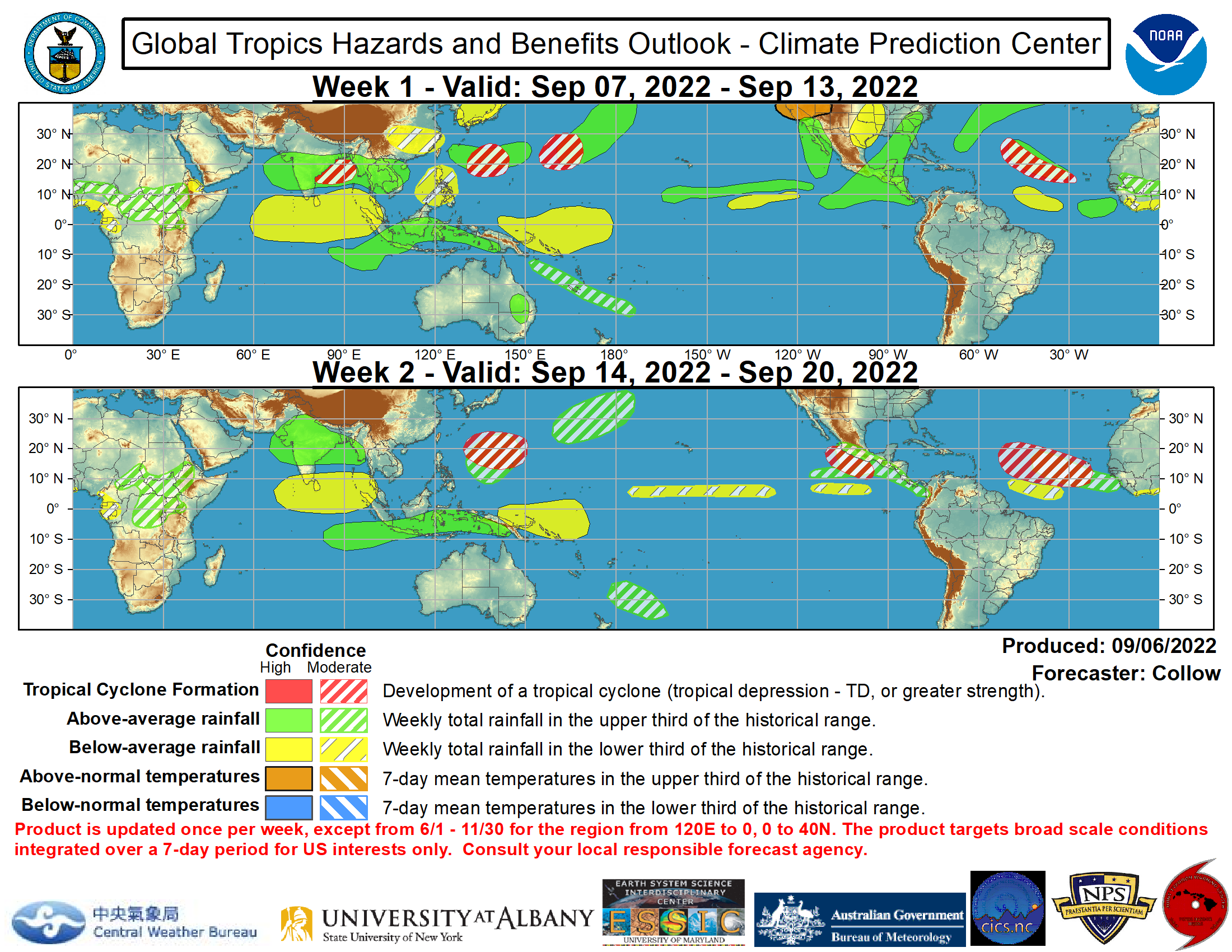
updated today: http://www.cpc.ncep.noaa.gov/products/p ... /index.php
(wish this would auto-size - open image in new tab or click the link above)

(wish this would auto-size - open image in new tab or click the link above)

Tropical Storm Philippe has the highest ACE for a tropical storm. The previous highest was Tropical Storm Laura in 1971.
http://en.wikipedia.org/wiki/1971_Atlan ... torm_Laura
http://en.wikipedia.org/wiki/1971_Atlan ... torm_Laura
-
Andrew
- Site Admin

- Posts: 3440
- Joined: Wed Feb 03, 2010 9:46 pm
- Location: North-West Houston
- Contact:
Very interesting to note that the GFS has been hinting at a possible BOC storm sometime next week:
http://mag.ncep.noaa.gov/NCOMAGWEB/appc ... mageSize=M
http://mag.ncep.noaa.gov/NCOMAGWEB/appc ... mageSize=M
For Your Infinite Source For All Things Weather Visit Our Facebook
- srainhoutx
- Site Admin

- Posts: 19616
- Joined: Tue Feb 02, 2010 2:32 pm
- Location: Maggie Valley, NC
- Contact:
TROPICAL WEATHER OUTLOOK
NWS NATIONAL HURRICANE CENTER MIAMI FL
800 AM EDT THU OCT 13 2011
FOR THE NORTH ATLANTIC...CARIBBEAN SEA AND THE GULF OF MEXICO...
A BROAD AREA OF LOW PRESSURE...INCLUDING THE REMNANTS OF EAST
PACIFIC TROPICAL DEPRESSION TWELVE-E...EXTENDS FROM SOUTHEASTERN
MEXICO EASTWARD INTO THE NORTHWESTERN CARIBBEAN SEA AND IS
PRODUCING AN AREA OF DISORGANIZED SHOWER AND THUNDERSTORM ACTIVITY.
WHILE TROPICAL CYCLONE DEVELOPMENT IS NOT EXPECTED DUE TO LAND
INTERACTION...LOCALLY HEAVY RAINFALL IS LIKELY DURING THE NEXT
COUPLE OF DAYS OVER PORTIONS OF SOUTHEASTERN MEXICO...THE YUCATAN
PENINSULA...BELIZE...AND GUATEMALA AS THIS SYSTEM REMAINS NEARLY
STATIONARY. THIS SYSTEM HAS A LOW CHANCE...NEAR 0 PERCENT...OF
BECOMING A TROPICAL CYCLONE DURING THE NEXT 48 HOURS.
ELSEWHERE...TROPICAL CYCLONE FORMATION IS NOT EXPECTED DURING THE
NEXT 48 HOURS.
$$
FORECASTER BRENNAN
Carla/Alicia/Jerry(In The Eye)/Michelle/Charley/Ivan/Dennis/Katrina/Rita/Wilma/Humberto/Ike/Harvey
Member: National Weather Association
Facebook.com/Weather Infinity
Twitter @WeatherInfinity
Member: National Weather Association
Facebook.com/Weather Infinity
Twitter @WeatherInfinity
- wxman57
- Global Moderator

- Posts: 2621
- Joined: Thu Feb 04, 2010 5:34 am
- Location: Southwest Houston (Westbury)
- Contact:
Texas is done with any TC threat for 2011. Jet stream is already dipping south into the Gulf. Anything developing by the Yucatan will either track westward into Mexico or get picked up by an approaching front and driven NE toward Cuba and/or the Bahamas.
- srainhoutx
- Site Admin

- Posts: 19616
- Joined: Tue Feb 02, 2010 2:32 pm
- Location: Maggie Valley, NC
- Contact:
While there is not a lot of model support for the SW Caribbean disturbance, the Canadian, UKMET and Euro Ensembles are suggesting there may be some credence lending to development in this region over the next several days. Michelle (2001) comes to mind and with Fantasy Fest next week in Key West, it may be something to watch in the days ahead. HPC makes mention as well:
CMC AND UKMET ALONG WITH A CONSIDERABLE NUMBER OF ECMWF ENS
MEMBERS INDICATE THE POTENTIAL OF TROPICAL DEVELOPMENT IN THE NWRN
CARRIBEAN NEXT WEEK.
CMC AND UKMET ALONG WITH A CONSIDERABLE NUMBER OF ECMWF ENS
MEMBERS INDICATE THE POTENTIAL OF TROPICAL DEVELOPMENT IN THE NWRN
CARRIBEAN NEXT WEEK.
Carla/Alicia/Jerry(In The Eye)/Michelle/Charley/Ivan/Dennis/Katrina/Rita/Wilma/Humberto/Ike/Harvey
Member: National Weather Association
Facebook.com/Weather Infinity
Twitter @WeatherInfinity
Member: National Weather Association
Facebook.com/Weather Infinity
Twitter @WeatherInfinity
I looked at the specific humidity and air temperature anomaly at the 300 millibar level for 2011 from August to September and compared it to 1995, 2005, and 2010 August to October. I noticed that the air is drier at the 300 millibar level in 2011, while it is wetter in 1995, 2005, and 2010. As for air temperature at the 300 millibar level, it is warmer than normal in 1995, 2005, 2010, and 2011.
300 Millibar Specific Humidity Anomaly


300 Millibar Air Temperature Anomaly


300 Millibar Specific Humidity Anomaly


300 Millibar Air Temperature Anomaly


August to September
1990
Air Temperature Anomaly 700 mb

Specific Humidity Anomaly 700 mb

The air temperature at 700 mb level or 10,000 feet is normal to cooler than normal for the most part, but not unusually cold. The air is drier than normal at 10,000 feet especially over the Caribbean and Gulf of Mexico.
Active Season (1995, 2005, and 2010)
Air Temperature Anomaly 700 mb

Specific Humidity Anomaly 700 mb

The air temperature and specific humidity is higher than normal over most of the basin. It is not abnormally warm at 10,000 feet. The level of humidity is abnormally high at 700 mb, which makes it more conducive for tropical development.
2011
Air Temperature Anomaly 700 mb

Specific Humidity Anomaly 700 mb

The air temperature in 2011 is warm at 10,000 feet, but again not unusually warm. However, the specific humidity is higher than normal in the Atlantic and parts of the Caribbean. Those areas saw most of the development. However, Gulf of Mexico is drier, which is no surprise from the ongoing drought. Gulf of Mexico has been hostile in 2011.
1990
Air Temperature Anomaly 700 mb

Specific Humidity Anomaly 700 mb

The air temperature at 700 mb level or 10,000 feet is normal to cooler than normal for the most part, but not unusually cold. The air is drier than normal at 10,000 feet especially over the Caribbean and Gulf of Mexico.
Active Season (1995, 2005, and 2010)
Air Temperature Anomaly 700 mb

Specific Humidity Anomaly 700 mb

The air temperature and specific humidity is higher than normal over most of the basin. It is not abnormally warm at 10,000 feet. The level of humidity is abnormally high at 700 mb, which makes it more conducive for tropical development.
2011
Air Temperature Anomaly 700 mb

Specific Humidity Anomaly 700 mb

The air temperature in 2011 is warm at 10,000 feet, but again not unusually warm. However, the specific humidity is higher than normal in the Atlantic and parts of the Caribbean. Those areas saw most of the development. However, Gulf of Mexico is drier, which is no surprise from the ongoing drought. Gulf of Mexico has been hostile in 2011.
- srainhoutx
- Site Admin

- Posts: 19616
- Joined: Tue Feb 02, 2010 2:32 pm
- Location: Maggie Valley, NC
- Contact:
The 2011 NATL Hurricane Season via satellite in review from NOAA...
http://www.nnvl.noaa.gov/MediaDetail.ph ... iaTypeID=2
http://www.nnvl.noaa.gov/MediaDetail.ph ... iaTypeID=2
Carla/Alicia/Jerry(In The Eye)/Michelle/Charley/Ivan/Dennis/Katrina/Rita/Wilma/Humberto/Ike/Harvey
Member: National Weather Association
Facebook.com/Weather Infinity
Twitter @WeatherInfinity
Member: National Weather Association
Facebook.com/Weather Infinity
Twitter @WeatherInfinity
Active 2011 hurricane season breaks 'Hurricane Amnesia'
http://www.noaanews.noaa.gov/stories201 ... _2011.html
Irene broke the "Hurricane Amnesia". The last hurricane to hit America was Ike on September 13, 2008.
http://www.noaanews.noaa.gov/stories201 ... _2011.html
Irene broke the "Hurricane Amnesia". The last hurricane to hit America was Ike on September 13, 2008.
