

Tornado Warning
4/28/2024 19:03 CDT through 4/28/2024 19:15 CDT
Tornado Warning issued April 28 at 7:03PM CDT until April 28 at 7:15PM CDT by NWS Houston/Galveston TX
At 703 PM CDT, a severe thunderstorm capable of producing a tornado
was located near Madisonville, moving northeast at 25 mph.
HAZARD...Tornado and quarter size hail.
SOURCE...Radar indicated rotation.
IMPACT...Flying debris will be dangerous to those caught without
shelter. Mobile homes will be damaged or destroyed. Damage
to roofs, windows, and vehicles will occur. Tree damage is
likely.
This tornadic thunderstorm will remain over mainly rural areas of
northeastern Madison County.
Instructions
TAKE COVER NOW! Move to a basement or an interior room on the lowest
floor of a sturdy building. Avoid windows. If you are outdoors, in a
mobile home, or in a vehicle, move to the closest substantial shelter
and protect yourself from flying debris.
April 2024


Another image of the Madisonville tornado:
- Attachments
-
- wedge tornado.jpg (286.79 KiB) Viewed 294 times

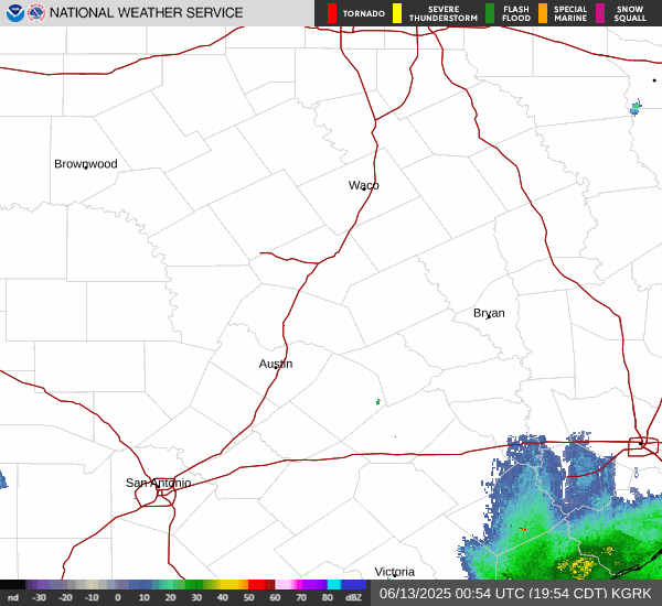
Latest HRRR
- refcmp.us_sc (6).png (300.32 KiB) Viewed 285 times
- Attachments
-
- refcmp.us_sc (7).png (297.27 KiB) Viewed 285 times
-
- refcmp.us_sc (8).png (294.27 KiB) Viewed 285 times
HRRR rainfall amounts.
- qpf_acc-imp.us_sc (2).png (238.47 KiB) Viewed 284 times
Those cells north of Huntsville are serious.
Crazy stuff here - entraining cells are forming right over us and continue to become severe hail/rotating cores over Grimes Co.
We're spawning another one... lightning strikes are ramping up.
Crazy stuff here - entraining cells are forming right over us and continue to become severe hail/rotating cores over Grimes Co.
We're spawning another one... lightning strikes are ramping up.
Details
XML
Flash Flood Warning
4/28/2024 20:19 CDT through 4/28/2024 20:45 CDT
Flash Flood Warning issued April 28 at 8:19PM CDT until April 28 at 8:45PM CDT by NWS Houston/Galveston TX
At 819 PM CDT, local law enforcement reported thunderstorms
producing heavy rain in Madison County. Between 2 and 4 inches of
rain have fallen. Additional rainfall amounts of 1 to 3 inches are
possible in the warned area, especially with any training storms.
Flash flooding is already occurring.
HAZARD...Flash flooding caused by thunderstorms.
SOURCE...Law enforcement reported.
IMPACT...Flash flooding of small creeks and streams, urban areas,
highways, streets and underpasses as well as other poor
drainage and low-lying areas.
Some locations that will experience flash flooding include...
Madisonville and North Zulch.
This includes the following Low Water Crossings...
Democrat Road at Navasota River , Democrat Road at Sand Creek , Farm
to Market 978 at Mustang Creek and FM 978 (Woodrow Ave).
County dispatch reported numerous road closers and flash flooding
ongoing across Madison county.
Instructions
Turn around, don't drown when encountering flooded roads. Most flood
deaths occur in vehicles.
Be especially cautious at night when it is harder to recognize the
dangers of flooding.
Be aware of your surroundings and do not drive on flooded roads.
Severe Thunderstorm Warning issued April 28 at 8:16PM CDT until April 28 at 8:45PM CDT by NWS Houston/Galveston TX
SVRHGX
The National Weather Service in League City has issued a
* Severe Thunderstorm Warning for...
Northeastern Grimes County in southeastern Texas...
Southern Houston County in southeastern Texas...
Southeastern Madison County in southeastern Texas...
Central Walker County in southeastern Texas...
* Until 845 PM CDT.
* At 816 PM CDT, a severe thunderstorm was located 10 miles east of
Bedias, or 13 miles southeast of Madisonville, moving northeast at
30 mph.
HAZARD...Golf ball size hail and 70 mph wind gusts.
SOURCE...Radar indicated.
IMPACT...People and animals outdoors will be injured. Expect hail
damage to roofs, siding, windows, and vehicles. Expect
considerable tree damage. Wind damage is also likely to
mobile homes, roofs, and outbuildings.
* Locations impacted include...
Northern Huntsville and Crabbs Prairie.
Instructions
Remain alert for a possible tornado! Tornadoes can develop quickly
from severe thunderstorms. If you spot a tornado go at once into the
basement or small central room in a sturdy structure.
For your protection move to an interior room on the lowest floor of a
building.
A Tornado Watch remains in effect until 900 PM CDT for southeastern
Texas.

Some serious training is happening with the storms up north from College Station over towards Madisonville and beyond. Some pretty bad cells too, still...


I looked at NWS Houston Doppler radar. The rainfall totals are 7 inches so far. I would not be surprised if some areas see a foot of rain once it is all over.
Here is the Personal Weather Station (PWS) near College Station.
https://www.wunderground.com/dashboard/pws/KTXBRYAN147
They got over 7 inches of rain so far. They had rainfall rates of nearly 6 inches per hour.

Here is the Personal Weather Station (PWS) near College Station.
https://www.wunderground.com/dashboard/pws/KTXBRYAN147
They got over 7 inches of rain so far. They had rainfall rates of nearly 6 inches per hour.
Last edited by Ptarmigan on Sun Apr 28, 2024 8:54 pm, edited 2 times in total.
Just got added to the watch. A little over 2 hours to go:
Watch County Notification for Watch 158
National Weather Service Houston/Galveston TX
845 PM CDT Sun Apr 28 2024
TXC339-290400-
/O.EXB.KHGX.TO.A.0158.000000T0000Z-240429T0400Z/
The National Weather Service has extended Tornado Watch 158 to
include the following areas until 11 PM CDT this evening
In Texas this watch includes 1 county
In southeast Texas
Montgomery
This includes the cities of Conroe and The Woodlands.
$$
Another Severe Thunderstorm Warning issued.
https://forecast.weather.gov/wwamap/wwa ... %20warning
https://forecast.weather.gov/wwamap/wwa ... %20warning
Code: Select all
Severe Thunderstorm Warning
TXC225-313-471-290230-
/O.NEW.KHGX.SV.W.0073.240429T0142Z-240429T0230Z/

BULLETIN - IMMEDIATE BROADCAST REQUESTED
Severe Thunderstorm Warning
National Weather Service Houston/Galveston TX
842 PM CDT Sun Apr 28 2024

The National Weather Service in League City has issued a

* Severe Thunderstorm Warning for...
  Southern Houston County in southeastern Texas...
  Southeastern Madison County in southeastern Texas...
  Central Walker County in southeastern Texas...

* Until 930 PM CDT.

* At 842 PM CDT, a severe thunderstorm was located 11 miles northwest
  of Huntsville, moving northeast at 25 mph.

  HAZARD...Golf ball size hail and 60 mph wind gusts.

  SOURCE...Radar indicated.

  IMPACT...People and animals outdoors will be injured. Expect hail
           damage to roofs, siding, windows, and vehicles. Expect
           wind damage to roofs, siding, and trees.

* Locations impacted include...
  Northwestern Huntsville, Riverside, and Crabbs Prairie.

PRECAUTIONARY/PREPAREDNESS ACTIONS...

Remain alert for a possible tornado! Tornadoes can develop quickly
from severe thunderstorms. If you spot a tornado go at once into the
basement or small central room in a sturdy structure.

For your protection move to an interior room on the lowest floor of a
building.

A Tornado Watch remains in effect until 900 PM CDT for southeastern
Texas.

&&

LAT...LON 3071 9582 3089 9586 3102 9549 3077 9538
TIME...MOT...LOC 0142Z 243DEG 23KT 3082 9568

TORNADO...POSSIBLE
THUNDERSTORM DAMAGE THREAT...CONSIDERABLE
HAIL THREAT...RADAR INDICATED
MAX HAIL SIZE...1.75 IN
WIND THREAT...RADAR INDICATED
MAX WIND GUST...60 MPH

$$

SelfI hope no students are trying to drive on Hwy 21. An absolute mess.Ptarmigan wrote: ↑Sun Apr 28, 2024 8:43 pm I looked at NWS Houston Doppler radar. The rainfall totals are 7 inches so far. I would not be surprised if some areas see a foot of rain once it is all over.
Here is the Personal Weather Station (PWS) near College Station.
https://www.wunderground.com/dashboard/pws/KTXBRYAN147
They got over 7 inches of rain so far. They had rainfall rates of nearly 6 inches per hour.
We're on the southern end of the training. The rain gauge currently has 2.90 inches. It seems like 5 inches!
Apr 29, 2024 0100 UTC Day 1 Convective Outlook
https://www.spc.noaa.gov/products/outlook/day1otlk.html
Houston area has Enhanced Risk for severe thunderstorms.
https://www.spc.noaa.gov/products/outlook/day1otlk.html
Houston area has Enhanced Risk for severe thunderstorms.
Code: Select all
SPC AC 290112

   Day 1 Convective Outlook
   NWS Storm Prediction Center Norman OK
   0812 PM CDT Sun Apr 28 2024

   Valid 290100Z - 291200Z

   ...THERE IS AN ENHANCED RISK OF SEVERE THUNDERSTORMS ACROSS PART OF
   EAST TEXAS...WESTERN TO NORTHERN LOUISIANA...AND SOUTHERN
   ARKANSAS...

   ...SUMMARY...
   Severe storms, capable of wind damage, a couple tornadoes and
   isolated large hail are likely this evening across parts of east
   Texas, northern/central Louisiana and southern Arkansas. A few
   severe storms, associated with wind damage and hail will also be
   possible in a broader area from the southern Plains and Lower
   Mississippi Valley northward to the Ozarks and Lower Missouri
   Valley.

   ...Sabine River Valley/Ark-La-Tex/Southern Plains/Ozarks...
   The latest water vapor imagery shows a mid-level trough over the
   southern Plains, with southwesterly flow over the Ark-Latex and
   lower Mississippi Valley. A shortwave trough, and an associated 50
   to 60 knot mid-level jet, appear to be moving through the
   Ark-La-Tex. A large cluster of strong to severe storms is ongoing
   near this shortwave trough, and to the east of the jet streak, from
   east Texas into far northwest Louisiana. This cluster is expected to
   move eastward across the remainder of east Texas, and into northern
   and western Louisiana this evening, where linear MCS development
   will be possible.

   The latest surface analysis shows the moist sector, with backed
   southeasterly flow, across the Sabine and Lower Mississippi Valleys.
   A mesolow is located in the Ark-La-Tex. Surface dewpoints across the
   moist sector are in the mid to upper 60s F, with the RAP/observed
   RAOBS estimating MLCAPE generally in the 1500 to 2000 J/kg range.
   The instability will sustain a large cluster of storms, as it moves
   toward the Mississippi Valley this evening. In addition, regional
   WSR-88D VWPs at Fort Polk and Shreveport, Louisiana have 0-6 km
   shear around 40 knots, with a lot directional shear from the surface
   to 4 km above ground level. This will continue to be favorable for a
   severe bowing line segment for several more hours this evening. Wind
   damage will be likely along the leading edge of the line. If a cold
   pool can become organized, then the wind damage threat could become
   more widespread. The Fort Polk, Louisiana WSR-88D VWP also has 0-3
   km storm-relative helicity around 225 m2/s2 suggesting a tornado
   threat will exist with the line, and with the more intense cells
   further to the southwest. The more intense semi-discrete storms in
   east Texas should be supercellular, having a large hail and isolated
   tornado threat. The severe threat is expected to continue for
   several more hours, but should become marginal in the late evening
   and overnight period. A severe threat will also be possible further
   to the north into the Ozarks and lower Missouri Valley, but should
   be isolated due to the airmass largely being overturned.

   Further to the north and west into central and eastern Oklahoma,
   north-central Texas, RAP analysis show moderate instability in
   place, with MLCAPE generally from the 1000 to 2000 J/kg. In
   addition, the observed sounding at Oklahoma City, and forecast
   soundings further to the east have 0-6 km shear generally in the 30
   to 45 knot range. This, combined with steep mid-level lapse rates
   should support a severe threat early this evening. Hail and isolated
   strong wind gusts will be the primary threats. Large-scale
   subsidence behind the exiting shortwave trough should keep any
   severe threat marginal this evening.

   ..Broyles.. 04/29/2024

   CLICK TO GET WUUS01 PTSDY1 PRODUCT

   NOTE: THE NEXT DAY 1 OUTLOOK IS SCHEDULED BY 0600Z
CURRENT UTC TIME: 0202Z (9:02PM), RELOAD THIS PAGE TO UPDATE THE TIMEFlash Flood Warning issued April 28 at 8:41PM CDT until April 28 at 11:45PM CDT by NWS Houston/Galveston TX
FFWHGX
The National Weather Service in League City has issued a
* Flash Flood Warning for...
Central Brazos County in southeastern Texas...
East Central Burleson County in southeastern Texas...
Northern Grimes County in southeastern Texas...
Central Madison County in southeastern Texas...
West Central Walker County in southeastern Texas...
* Until 1145 PM CDT.
* At 841 PM CDT, local law enforcement reported thunderstorms
producing heavy rain across the warned area. Between 2 and 4
inches of rain have fallen. Additional rainfall amounts of 1 to 3
inches are possible in the warned area. Flash flooding is ongoing
or expected to begin shortly.
HAZARD...Flash flooding caused by thunderstorms.
SOURCE...Law enforcement reported.
IMPACT...Flash flooding of small creeks and streams, urban
areas, highways, streets and underpasses as well as
other poor drainage and low-lying areas.
* Some locations that will experience flash flooding include...
College Station, Bryan, Madisonville, Bedias, Kurten, Kyle Field,
Iola, North Zulch and Wellborn.
This includes the following Low Water Crossings...
Brid Pond Road at Carter Creek , Elmo Weedon Road at Hunter's Creek
Subdivision, Old Reliance Road at Mathis Creek , Democrat Road at
Navasota River , Long Trussel Road at Navasota River , Democrat Road
at Sand Creek , Elmo Weedon Road at Wickson Creek, Grassbur Road and
Mize Road at Wickson Creek, Farm to Market 1179 at Wickson Creek,
Old Reliance Road at Wickson Creek , Old Reliance Road and Carrabba
Road, Farm to Market 978 at Mustang Creek, Interstate 45 E Frontage
Road at S Bedias Creek, Weedon Loop at Wickson Creek , Old Reliance
Road at Bowman Creek, Old Reliance tween Reliance Church Rd and FM
2038, Saxon Road at Bowman Creek , Hardy Weedon Road (0.5 mile W of
Dyess Road) , Weedon Loop at Wickson Creek , Merka Rd between Old
Reliance Rd and FM 1179 , Southwood Drive at Bee Creek, Hollemon
Drive at Bee Creek Tributary, Welsh Avenue at Bee Creek Tributary,
Avondals Drive at Burton Creek, Pine Grove Drive at Benson Bayou,
Ester Boulevard at Burton Creek, FM 1179 near Villa Maria Rd, State
Highway 30 at Carters Creek, Farm to Market 60 at Carters Creek
Relief, MLK Jr Street at Carters Creek , Waco Street at Carters
Creek, Broadmoor Drive at Draw, State Highway 30 at Carters Creek
tributary, Villa Maria Road at Sewer Creek, Milliff Road at Wolf Pen
Creek, Glade Street at Bee Creek, Thomas St at Bee Creek, Old
Reliance Road at Austins Creek, Old Reliance Road at Carters Creek,
Crestridge Road at Cottonwood Creek Tributary, Palasota Drive at
Cottonwood Creek Tributary, Avondals Drive at Burton Creek, Frost
Drive at Foxfire Creek, Longmire Drive at Lick Creek, University
Oaks Drive at Wolf Pen Creek Tributary, South Dowling Rd at bridge
near Capstone Dr, South Dowling Rd at bridge near Wellborn Rd, Ethan
Ln at Steep Hollow Rd, Jones Road at Turkey Creek bridge , FM 978
(Woodrow Ave), North Freeway Service Rd near Bedias Creek, Rosemary
Drive, Tanglewood Drive at Burton Creek, Cavitt Avenue at Burton
Creek Tributary, Maloney Rd at Burton Creek Tributary, Dumas Drive
at Carters Creek, Elmo Weedon Rd at Wickson Creek, Grassbur Road at
Wickson Creek, Redmond Drive at Wolf Pen Creek, Anderson Street at
Bee Creek, Dexter Drive at Bee Creek, Houston Street at Bee Creek,
Old Jersey St at Bee Creek, Williamson Drive at Burton Creek
Tributary, Alexandria Avenue at Lick Creek Tributary, Eagle Avenue
at Lick Creek Tributary, East William J Bryan Parkway at Sewer
Creek, Eagle Avenue at Wolf Pen Creek, Harvey Rd at Wolf Pen Creek
Tributary, Stallings Drive at Wolf Pen Creek Tributary, Rosemary
Drive at Burton Creek, Moss Street at Carters Creek, Custer Road at
Cottonwood Creek Tributary, Westchester Drive at Cottonwood Creek
Tributary, Grassbur Rd at Wickson Creek Relief, Mize Road and
Grassbur Road at Wickson Creek and Elmo Weedon Rd at Wickson Creek.
Heavy rainfall has resulted in road closures and flash flooding in
Madison county. Training storms over the area may bring more
widespread flash flooding over neighboring counties to the south and
southeast over the next several hours.
Instructions
Turn around, don't drown when encountering flooded roads. Most flood
deaths occur in vehicles.
Be especially cautious at night when it is harder to recognize the
dangers of flooding.
Be aware of your surroundings and do not drive on flooded roads.
Please report observed flooding to local emergency services or law
enforcement and request they pass this information to the National
Weather Service when you can do so safely.
Sender NWS Houston/Galveston TX
Sent 4/28/2024 20:41 CDT
Brazos, TX; Burleson, TX; Grimes, TX; Madison, TX; Walker, TX

I do not a good feeling about this. When there is severe weather, it ends up being a heavy rain event for Houston area.
We just finished some 3.90 inch/hour training. The firehose is heading toward Houston slowly.
-
- Information
-
Who is online
Users browsing this forum: Ahrefs [Bot], Bing [Bot], Texashawk, TXWeatherMan and 262 guests