Page 15 of 41
Re: 2023 Hurricane Season Discussion
Posted: Tue Aug 15, 2023 3:08 pm
by user:null
As long as there is good upper moisture, SE Texas will still get rains even if any cyclone goes farther south: even Hanna-type situations still brought good rain bands through Houston.
Re: 2023 Hurricane Season Discussion
Posted: Tue Aug 15, 2023 3:18 pm
by weatherguy425
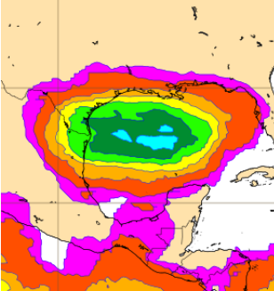
12Z EPS Tracks….
Re: 2023 Hurricane Season Discussion
Posted: Tue Aug 15, 2023 3:27 pm
by brazoriatx
Nothing has formed or even in the area yet so I wouldn't put stock in tracks yet
Re: 2023 Hurricane Season Discussion
Posted: Tue Aug 15, 2023 3:35 pm
by don
12Z EURO TC probabilities now up to 60%.
- Caswepture.PNG (71.51 KiB) Viewed 672 times
Re: 2023 Hurricane Season Discussion
Posted: Tue Aug 15, 2023 5:39 pm
by Cpv17
The ensembles are mainly a snooze fest with a a bunch of fish storms outside of our possible threat next week.
Re: 2023 Hurricane Season Discussion
Posted: Tue Aug 15, 2023 5:50 pm
by Stratton20
18z GFS is further north with a slightly more organized system, last run had the system going into brownsville, this run south padre island
Re: 2023 Hurricane Season Discussion
Posted: Tue Aug 15, 2023 5:54 pm
by Scott747
18z gfs is at least a little similar to the 6z run. Still behaves more like an axis/disturbance as it tries to develop as it approaches the lower and middle texas coast where it would at least give them some relief. More likely some overrunning clouds and a few sprinkle for coastal counties s of 10.
Far enough out for widespread changes but to this point the models have been fairly consistent.
Re: 2023 Hurricane Season Discussion
Posted: Tue Aug 15, 2023 6:09 pm
by weatherguy425
Scott747 wrote: ↑Tue Aug 15, 2023 5:54 pm
18z gfs is at least a little similar to the 6z run. Still behaves more like an axis/disturbance as it tries to develop as it approaches the lower and middle texas coast where it would at least give them some relief. More likely some overrunning clouds and a few sprinkle for coastal counties s of 10.
Far enough out for widespread changes but to this point the models have been fairly consistent.
Not a solid signal for anything impressive, but enough of a range in ensemble solutions and a favorable-enough environment across the Gulf to keep interest.

Weeklies, longer range data continue with lower pressures across the western Gulf, BOC & Western Caribbean over the next few weeks. We may have a few things to watch.
Re: 2023 Hurricane Season Discussion
Posted: Tue Aug 15, 2023 6:24 pm
by Cpv17
Unusual pattern on the models with an east coast trough in late August. Looks more like late September or October.
Re: 2023 Hurricane Season Discussion
Posted: Tue Aug 15, 2023 7:00 pm
by srainhoutx
Cpv17 wrote: ↑Tue Aug 15, 2023 6:24 pm
Unusual pattern on the models with an east coast trough in late August. Looks more like late September or October.
We've had a persistent trough overhead all summer here in WNC. Other than a few brief episodes where the upper ridge attempted to anchor, the main theme has been troughiness along the Appalachian Chain.
Re: 2023 Hurricane Season Discussion
Posted: Tue Aug 15, 2023 7:13 pm
by srainhoutx
Latest update from the NHC...
Re: 2023 Hurricane Season Discussion
Posted: Tue Aug 15, 2023 7:21 pm
by Dls2010r
We’ll ****!!!!!$
Re: 2023 Hurricane Season Discussion
Posted: Tue Aug 15, 2023 7:24 pm
by Stratton20
thats a pretty large development zone
Re: 2023 Hurricane Season Discussion
Posted: Tue Aug 15, 2023 7:34 pm
by Scott747
Stratton20 wrote: ↑Tue Aug 15, 2023 7:24 pm
thats a pretty large development zone
Well of course it is. That's exactly what the modeling has been showing so far with different focal points up and down the axis as it enters the GoM.
Until today Euro was on the northern end and the gfs and canadian on the southern end.
Steering as of now seems pretty straightforward to the w.
Re: 2023 Hurricane Season Discussion
Posted: Tue Aug 15, 2023 7:35 pm
by Cpv17
Stratton20 wrote: ↑Tue Aug 15, 2023 7:24 pm
thats a pretty large development zone
Whatever comes our way, I sure hope it comes in just south of Matagorda.
Re: 2023 Hurricane Season Discussion
Posted: Tue Aug 15, 2023 7:50 pm
by Scott747
They typically won't make this an invest this early but it would sure be nice if they would. I'm very curious on what the new HAFS (which became the operational hurricane model in late June) shows.
I touched on it last year....
Re: 2023 Hurricane Season Discussion
Posted: Tue Aug 15, 2023 8:00 pm
by Stratton20
Scott747 is the HAFS pretty good with tropical systems?
Re: 2023 Hurricane Season Discussion
Posted: Tue Aug 15, 2023 8:04 pm
by weatherguy425
Stratton20 wrote: ↑Tue Aug 15, 2023 8:00 pm
Scott747 is the HAFS pretty good with tropical systems?
It’s designed specifically for this purpose.
Re: 2023 Hurricane Season Discussion
Posted: Tue Aug 15, 2023 8:13 pm
by Scott747
https://www.noaa.gov/news-release/noaa- ... rts-strong
Running the experimental version of HAFS from 2019 to 2022 showed a 10-15% improvement in track predictions compared to NOAA’s existing hurricane models.
HAFS is as good as NOAA’s existing hurricane models when forecasting storm intensity — but is better at predicting rapid intensification. HAFS was the first model last year to accurately predict that Hurricane Ian would undergo secondary rapid intensification as the storm moved off the coast of Cuba and barreled toward southwest Florida.
If I remember correctly it was the earliest one predicting the RI cycle for Laura.
Re: 2023 Hurricane Season Discussion
Posted: Tue Aug 15, 2023 9:12 pm
by Cpv17
I might be becoming more interested in the second system the models have been showing but it looks like it comes from a CAG so I’m questioning it. Pretty decent signal on the 18z GEFS but I suppose we’ll see what this first potential one has in store for us first and see if anything even develops for the other system.
 Weeklies, longer range data continue with lower pressures across the western Gulf, BOC & Western Caribbean over the next few weeks. We may have a few things to watch.