Page 3 of 32
Re: Long range model discussion
Posted: Thu May 19, 2022 9:04 pm
by Stratton20
Cpv17 yep looks like the environment might be more favorable, will have to watch and “sea”

Re: Long range model discussion
Posted: Fri May 20, 2022 1:07 pm
by Stratton20
12z GEFS, the 29th-1st time period we may need to watch for a potential spin up
Re: Long range model discussion
Posted: Mon May 23, 2022 2:23 am
by Stratton20
00z Euro tries to spin up some tropical mischief around day 10, we will see
Re: Long range model discussion
Posted: Mon May 23, 2022 2:45 pm
by Stratton20
12z Euro has a weak depression/storm in the BOC late next weekend, 12z EPS starting to sniff out as well
Re: Long range model discussion
Posted: Fri Jun 03, 2022 4:50 pm
by Cpv17
Mid to late June we may need to watch the tropics.
Re: Long range model discussion
Posted: Fri Jun 03, 2022 6:07 pm
by Stratton20
Cpv17 yep GEFS and GEPS agree with that
Re: Long range model discussion
Posted: Fri Jun 03, 2022 8:02 pm
by Cpv17
Stratton20 wrote: ↑Fri Jun 03, 2022 6:07 pm
Cpv17 yep GEFS and GEPS agree with that
It’s appearing to me that the western Gulf may be open for business in about 2 weeks from now.
Re: Long range model discussion
Posted: Fri Jun 03, 2022 8:08 pm
by Stratton20
Cpv17 what are you seeing that may indicate that?
Re: Long range model discussion
Posted: Fri Jun 03, 2022 8:18 pm
by Cpv17
Stratton20 wrote: ↑Fri Jun 03, 2022 8:08 pm
Cpv17 what are you seeing that may indicate that?
Long range ensembles are hinting at possible ridging developing over the southeast which would push any tc towards the western Gulf. Latest CPC 3-4 week forecast agrees with this as well.
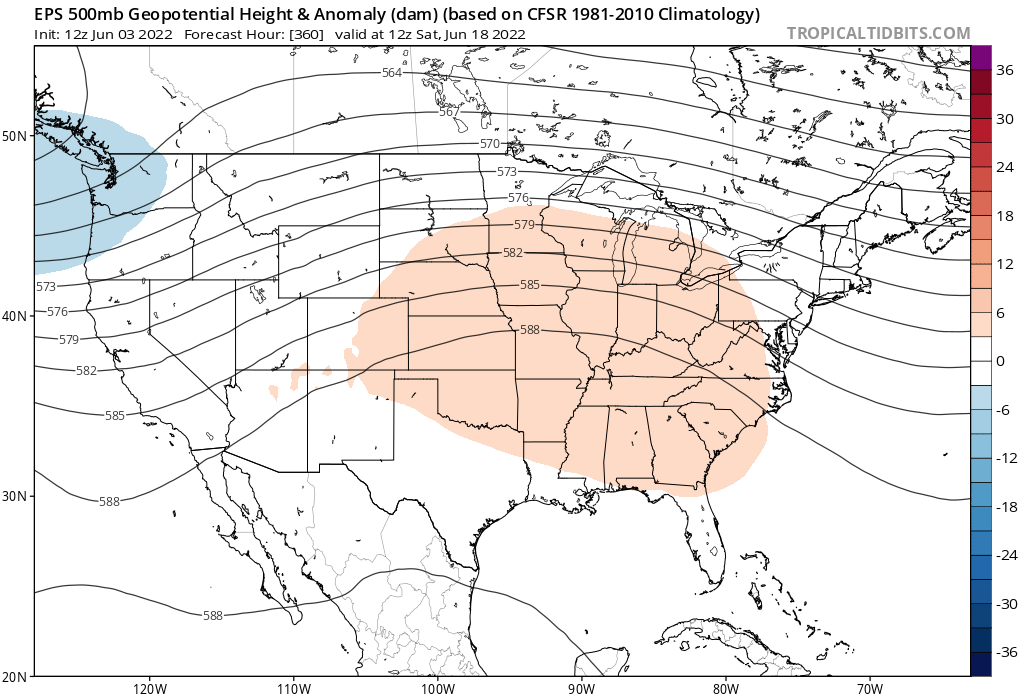
At the same timeframe the GEFS is showing this:
Re: Long range model discussion
Posted: Fri Jun 03, 2022 8:29 pm
by Stratton20
Interesting! Guess we will see how this evolves over the next 10-12 days
Re: Long range model discussion
Posted: Sat Jun 04, 2022 12:53 pm
by Stratton20
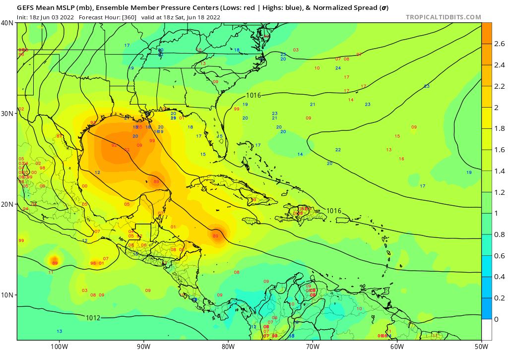
12z GEFS now inside of 10 days, definitely a growing signal, could be another CAG setup
Re: Long range model discussion
Posted: Sat Jun 04, 2022 2:24 pm
by Cpv17
Stratton20 wrote: ↑Sat Jun 04, 2022 12:53 pm
12z GEFS now inside of 10 days, definitely a growing signal, could be another CAG setup
Re: Long range model discussion
Posted: Sat Jun 04, 2022 2:29 pm
by Stratton20
Cpv17 even the latest operational GFS is starting to show something
Re: Long range model discussion
Posted: Sun Jun 05, 2022 1:06 pm
by Stratton20
Even the operational 12z CMC is starting to show. hints at development in the gulf on days 8/9
Re: Long range model discussion
Posted: Sun Jun 05, 2022 1:09 pm
by Cpv17
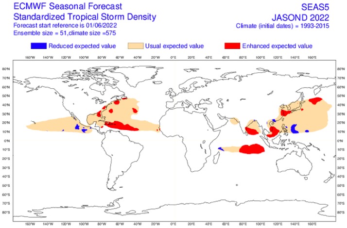
Latest ECMWF seasonal forecast shows an ACE of 225 but it looks much more active for the eastern Gulf than the western Gulf which pretty much agrees with other forecasts I’ve seen as well. I’m not really high on Texas this year having any major tropical impacts if I’m being completely honest but long range seasonal forecasts can often be wrong so we’ll see what happens.
Re: Long range model discussion
Posted: Sun Jun 05, 2022 1:34 pm
by don
Stratton20 wrote: ↑Sun Jun 05, 2022 1:06 pm
Even the operational 12z CMC is starting to show. hints at development in the gulf on days 8/9
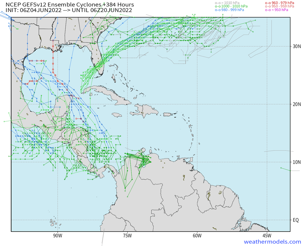
12z CMC actually shows a tropical storm heading towards the middle or upper Texas coast fwiw.GEFS have also been fairly consistent on showing something around that time frame.Middle to late month may be interesting in the gulf, something to watch over the next week will be to see if models start to trend more or not towards TC development.
Re: Long range model discussion
Posted: Sun Jun 05, 2022 1:36 pm
by Stratton20
Don definitely, will say though thats pretty sheared TC on the CMC run, whatever may try to form could be lopsided
Re: Long range model discussion
Posted: Sun Jun 05, 2022 1:41 pm
by don
Stratton20 wrote: ↑Sun Jun 05, 2022 1:36 pm
Don definitely, will say though thats pretty sheared TC on the CMC run, whatever may try to form could be lopsided
That's normal and expected though, most storms developing in June will be weak and sheared lopsided storms.Usually you need to be on the right side of the storm to get decent rain from these kind of systems.The western half of the storm will be completely dry sometimes. (Nicholas last year as an example)
Re: Long range model discussion
Posted: Sun Jun 05, 2022 1:47 pm
by Stratton20
Don true I didnt get much from Nicholas , will see if models trend toward this, though will say the operational GFS has been a but wonky to start the hurricane season, with the GEFS being aggressive somewhat, euro should be interesting, talk about a strong signal on the 12 z EPS
Re: Long range model discussion
Posted: Sun Jun 05, 2022 3:36 pm
by Cpv17
Usually the Euro/EPS is fairly conservative especially in the long range so if it’s even hinting at anything that should at least raise an eyebrow.
The GFS/GEFS does a better job usually in the longer range of sniffing things out but sometimes it’s too aggressive.
