
September 2019 - Warm End of September

Wow, it’s really booking now.
-
Katdaddy

- Global Moderator

- Posts: 2502
- Joined: Thu Feb 04, 2010 8:18 am
- Location: League City, Tx
- Contact:
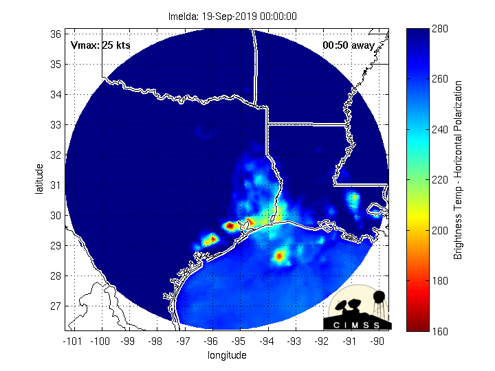
So far 2.56" in W League City as several feeder bands swept through the backyard with some strong gusty winds up to 35MPH. The radar has been quite amazing this evening as the center of Imelda has passed through Brazoria County. I am so glad this wrap up did not occur 12-24 hours offshore.
- Attachments
-

Center is almost on top of WxMan 57's house now...
Over the last few hours, loops included, seems to be moving a tick west of due north.
Over the last few hours, loops included, seems to be moving a tick west of due north.
I am directly under the center in Bellaire. Not often I get to be in the center of a tropical cyclone.
Crud, now a jog West?
Yep, wow, it's over BW8 now, in Westchase.
West jogs aren’t good.

The center appears parked SW of Sugarland.

Its really windy outside right now. Don't let yall guards down, the latest HRRR is very aggressive with rainfall amounts.
I still can't believe there hasn't been a single flood warning yet...
-
srainhoutx

- Site Admin

- Posts: 19616
- Joined: Tue Feb 02, 2010 2:32 pm
- Location: Maggie Valley, NC
- Contact:
HCFCD reports Turkey Creek @ FM 1959 is nearing top of bank. Long night ahead folks. Very breezy with constant light rain in NW Harris County. We'll see you all in the morning!
https://www.harriscountyfws.org/GageDet ... 40?span=24 Hours&v=rainfall
https://www.harriscountyfws.org/GageDet ... 40?span=24 Hours&v=rainfall
Carla/Alicia/Jerry(In The Eye)/Michelle/Charley/Ivan/Dennis/Katrina/Rita/Wilma/Humberto/Ike/Harvey
Member: National Weather Association
Facebook.com/Weather Infinity
Twitter @WeatherInfinity
Member: National Weather Association
Facebook.com/Weather Infinity
Twitter @WeatherInfinity
-
stormlover
- Posts: 439
- Joined: Wed Dec 04, 2013 10:21 am
- Location: Lumberton TX
- Contact:
There should be, it’s been pouring in Friendswood for 2 hours.
Not good.stormlover wrote: ↑Tue Sep 17, 2019 9:31 pm Hrr model run 00 is dangerous
https://www.tropicaltidbits.com/analysi ... 1800&fh=12
Looks to me like it’s just east of Sugar Land.
-
stormlover
- Posts: 439
- Joined: Wed Dec 04, 2013 10:21 am
- Location: Lumberton TX
- Contact:
Nam basically on board with hrr, long day tomorrow and Thursday morning
The center (what's left of it) is now crossing into NW Fort Bend county. These loops are just crazy!!
It seems to be unraveling a bit now, but still, this shift to the west is not good for the Houston area. It's gonna put more of the metro area into the moist inflow later tonight.
It seems to be unraveling a bit now, but still, this shift to the west is not good for the Houston area. It's gonna put more of the metro area into the moist inflow later tonight.
Last edited by jasons2k on Tue Sep 17, 2019 9:47 pm, edited 1 time in total.
-
srainhoutx
- Site Admin
- Posts: 19616
- Joined: Tue Feb 02, 2010 2:32 pm
- Location: Maggie Valley, NC
- Contact:
The 00Z 12km NAM puts 25 inches at Jason's house!1!stormlover wrote: ↑Tue Sep 17, 2019 9:44 pm Nam basically on board with hrr, long day tomorrow and Thursday morning
- Attachments
-
Carla/Alicia/Jerry(In The Eye)/Michelle/Charley/Ivan/Dennis/Katrina/Rita/Wilma/Humberto/Ike/Harvey
Member: National Weather Association
Facebook.com/Weather Infinity
Twitter @WeatherInfinity
Member: National Weather Association
Facebook.com/Weather Infinity
Twitter @WeatherInfinity
-
- Information
-
Who is online
Users browsing this forum: Ahrefs [Bot], Amazon [Bot], Bing [Bot], Cromagnum and 74 guests