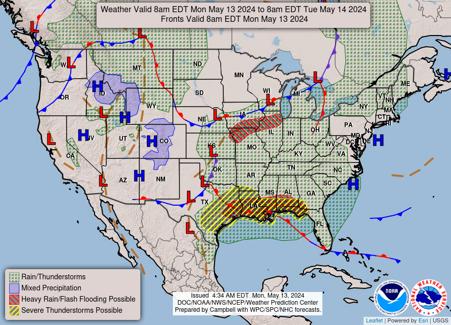
Cap holding strong along and S of the I-10 Corridor. The SPC dropped the Slight Risk S of I-10 with their latest Update. Strong to Severe Thunderstorms still look possible for the Hill Country into College Station and on N and E.
Mesoscale Discussion 0669
NWS Storm Prediction Center Norman OK
1211 PM CDT Sat May 18 2019
Areas affected...Parts of central through northeast Texas into
southeastern Oklahoma and adjacent southwest Arkansas
Concerning...Tornado Watch 181...
Valid 181711Z - 181815Z
The severe weather threat for Tornado Watch 181 continues.
SUMMARY...The risk for severe winds may increase across parts of the
Red River Valley, toward the Ark-La-Tex, through 1-3 PM CDT, while
potential for severe hail and a couple of tornadoes increases in a
possible corridor of developing supercells across the Texas Hill
Country through northeastern Texas.
DISCUSSION...The southern flank of the extensive ongoing mesoscale
convective system is maintaining strength, with additional storms
forming to the south of the primary cold pool, east of the dryline
into portions of the Edwards Plateau. Activity is largely oriented
parallel to 30-40 kt southwesterly deep layer ambient mean flow,
resulting in only a modest general eastward progression. However,
as the environment continues to warm ahead of the strengthening cold
pool, the risk for potentially damaging winds may increase along
east-northeastward surging segments of the gust front.
Furthermore, as stronger upper support for large-scale ascent
continues to gradually pivot across/northeast of the Red River
Valley, toward the lower Missouri Valley, the primary convective
mode across the Texas Hill country into northeast Texas may trend
discrete/supercellular through 18-20Z. Residual mid-level capping
associated with warm elevated mixed-layer air may suppress the
development of widespread convection, but strong deep layer shear in
the presence of moderate to large mixed-layer CAPE (2000-3000+ J/kg)
will provide a favorable environment for supercells. It appears
that southerly 850 mb flow will remain strong enough to contribute
to low-level hodographs supportive of a risk for tornadoes, in
addition to severe hail.
..Kerr.. 05/18/2019
...Please see www.spc.noaa.gov for graphic product...
ATTN...WFO...LZK...SHV...TSA...HGX...FWD...OUN...EWX...SJT...
MAY 2019: Wednesday Storm Complex/Scattered Showers To End May
- srainhoutx
- Site Admin

- Posts: 19616
- Joined: Tue Feb 02, 2010 2:32 pm
- Location: Maggie Valley, NC
- Contact:
Carla/Alicia/Jerry(In The Eye)/Michelle/Charley/Ivan/Dennis/Katrina/Rita/Wilma/Humberto/Ike/Harvey
Member: National Weather Association
Facebook.com/Weather Infinity
Twitter @WeatherInfinity
Member: National Weather Association
Facebook.com/Weather Infinity
Twitter @WeatherInfinity
Wind is quite fierce with very humid air blowing through. Amazed that we are always capped down here.
Yea it really is! Is there a reason the areas S of I-10 have been having the cap so frequently lately? I assume the GoM has something to do with it, but you would think the moist air and wind convergence would lead to some type of development when it gets closer to our area later this afternoon/evening.
- srainhoutx
- Site Admin

- Posts: 19616
- Joined: Tue Feb 02, 2010 2:32 pm
- Location: Maggie Valley, NC
- Contact:
The cap has more to do with warm air being blown in from higher elevations from Mexico. With a persistent southwesterly upper level flow that warm air gets streamed in here at the upper levels. That is on top of the fact that our more southern latitude keeps the cold upper level cores (which would erode the cap) of these storm systems further north.davidiowx wrote: ↑Sat May 18, 2019 12:50 pmYea it really is! Is there a reason the areas S of I-10 have been having the cap so frequently lately? I assume the GoM has something to do with it, but you would think the moist air and wind convergence would lead to some type of development when it gets closer to our area later this afternoon/evening.
Looks like one last round of severe weather - it's been a weekly event in the NW counties.
Rotating cells possible in the evening. Maybe 1/2 to 1 inch of rain.

Rotating cells possible in the evening. Maybe 1/2 to 1 inch of rain.

Yep. The gradient of the cap effect is pretty steep between Hearne and Navasota. The GoM reduces the cap effect for Mississippi and Alabama, and thus they have a higher risk of tornadoes than Houston on average.sau27 wrote: ↑Sat May 18, 2019 1:45 pmThe cap has more to do with warm air being blown in from higher elevations from Mexico. With a persistent southwesterly upper level flow that warm air gets streamed in here at the upper levels. That is on top of the fact that our more southern latitude keeps the cold upper level cores (which would erode the cap) of these storm systems further north.davidiowx wrote: ↑Sat May 18, 2019 12:50 pmYea it really is! Is there a reason the areas S of I-10 have been having the cap so frequently lately? I assume the GoM has something to do with it, but you would think the moist air and wind convergence would lead to some type of development when it gets closer to our area later this afternoon/evening.
I've been enjoying the rain, have not had to water the lawn, except in spots, since last fall - can do without the severe stuff though. Hope y'all stay safe, has been nasty today in parts of TX
- srainhoutx
- Site Admin

- Posts: 19616
- Joined: Tue Feb 02, 2010 2:32 pm
- Location: Maggie Valley, NC
- Contact:
Folks in Grimes, NW Harris, Montgomery, Waller & Walker Counties may see a shot at a strong storm this evening. The last couple of runs from the HRRR (High Resolution Rapid Refresh) model does suggest a couple of stronger cells may develop as the line of storms to our West pushes closer.
Carla/Alicia/Jerry(In The Eye)/Michelle/Charley/Ivan/Dennis/Katrina/Rita/Wilma/Humberto/Ike/Harvey
Member: National Weather Association
Facebook.com/Weather Infinity
Twitter @WeatherInfinity
Member: National Weather Association
Facebook.com/Weather Infinity
Twitter @WeatherInfinity
The weather south of 10 is pretty boring most of the time. It seems like areas north of 10 get more frequent rains and storms. Areas south of 10 are just too far away from the center of the lows to see any action. That’s basically how it’s pretty much always been for as long as I can remember.
Really need to adjust the forecast down to "not going to rain"
thanks for the heads-up srain, appreciate thatsrainhoutx wrote: ↑Sat May 18, 2019 3:41 pm Folks in Grimes, NW Harris, Montgomery, Waller & Walker Counties may see a shot at a strong storm this evening. The last couple of runs from the HRRR (High Resolution Rapid Refresh) model does suggest a couple of stronger cells may develop as the line of storms to our West pushes closer.
- srainhoutx
- Site Admin

- Posts: 19616
- Joined: Tue Feb 02, 2010 2:32 pm
- Location: Maggie Valley, NC
- Contact:
Still off to the north. We’ll see what happens...
- srainhoutx
- Site Admin

- Posts: 19616
- Joined: Tue Feb 02, 2010 2:32 pm
- Location: Maggie Valley, NC
- Contact:
Showers and possible strong to severe thunderstorms showing signs of developing to our West. New Mesoscale Discussion issued by Storm Prediction Center...extension or new Watch possible...
Carla/Alicia/Jerry(In The Eye)/Michelle/Charley/Ivan/Dennis/Katrina/Rita/Wilma/Humberto/Ike/Harvey
Member: National Weather Association
Facebook.com/Weather Infinity
Twitter @WeatherInfinity
Member: National Weather Association
Facebook.com/Weather Infinity
Twitter @WeatherInfinity
We were out in the back putting up garden fencing 20 min ago and my wife looked up at the sky said "It's fixin' to rain" 10 min before radar returns. Sometimes wifecasting > nowcasting > forecasting. 
There's a thin line forming and heading toward NW Harris co.
There's a thin line forming and heading toward NW Harris co.
lol - "wifecasting" - I am SO stealing that & making my husband use it !DoctorMu wrote: ↑Sat May 18, 2019 7:44 pm We were out in the back putting up garden fencing 20 min ago and my wife looked up at the sky said "It's fixin' to rain" 10 min before radar returns. Sometimes wifecasting > nowcasting > forecasting.
There's a thin line forming and heading toward NW Harris co.
I read the MCD. And the latest aviation AFD from the NWS.
To sum them both up: wait and see.
They have no idea. If the radar lights up, they will extend the watch. If it doesn’t, they won’t. But they cannot answer the $64,000 question: will it happen or not? Nobody knows for sure.
Wait and see...
To sum them both up: wait and see.
They have no idea. If the radar lights up, they will extend the watch. If it doesn’t, they won’t. But they cannot answer the $64,000 question: will it happen or not? Nobody knows for sure.
Wait and see...