
I see. For some reason I thought data like that was only possible where balloons were launched.wxman57 wrote:These are model soundings, made off the latest GFS, RUC or NAM. They're not extrapolated between LCH-CRP, they're forecast soundings for any time up to 16 days from now.Candy Cane wrote:Wow, that's good for Conroe. How are they getting this data? Is it extrapolated from KLCH and KCPS?
February Weather Discussion. Wild Winter Storms?
-
TexasMetBlake
- Pro Met

- Posts: 839
- Joined: Wed Feb 03, 2010 7:03 pm
- Location: Spring/Woodlands
- Contact:
-
txsnowmaker
- Posts: 632
- Joined: Wed Feb 03, 2010 4:07 pm
- Location: SW Houston (Galleria area)
- Contact:
FYI--For Houston on Tuesday evening, NWS has increased the chances to 50% for "rain and snow, mainly before midnight."
Regarding Conroe, they say:
Tuesday: A chance of rain before noon, then rain and snow likely. Cloudy, with a high near 44. North wind between 10 and 15 mph. Chance of precipitation is 60%.
Tuesday Night: A chance of rain and snow before midnight, then a slight chance of snow. Mostly cloudy, with a low around 33. Chance of precipitation is 50%.
I have noticed that leading up to possible winter weather events for Southeast Texas that the general consensus is that the locations north of I-10 have the best opportunity of recieving snow accumulations and areas south of I-10 will possibly see a flake or two in the sky if they really look for it. Then recently after the event transpires, many locations south of I-10 actually recieve snowfall accumulations. Examples of this in recent memory, 2004 Christmas Eve snow, 2008 snow, and 2009 December 4 snow event.

Sure seems that way doesn't it Rich.
Not getting my hopes up for this possible event, but the kid in me will be looking for that stray flake nonetheless.
Not getting my hopes up for this possible event, but the kid in me will be looking for that stray flake nonetheless.
-
txsnowmaker
- Posts: 632
- Joined: Wed Feb 03, 2010 4:07 pm
- Location: SW Houston (Galleria area)
- Contact:
I know that we are all focused on this Tuesday, but I did notice a discussion on another forum about the latest Euro run picking up another potential winter weather event for Texas around day 10. 
-
Andrew
- Site Admin

- Posts: 3441
- Joined: Wed Feb 03, 2010 9:46 pm
- Location: North-West Houston
- Contact:
It is going to be a close call on Tuesday for the wintry stuff. I think the one thing that is a huge advantage is we won't have any of those mid level to upper level "warm spots" like we did last time. That is a huge advantage as if we get some moisture to cool the atmosphere, we could be lucky and get some "fun". We are right on the border for wintry precip, (as the soundings show) lets hope that the border shifts a little farther south.
For Your Infinite Source For All Things Weather Visit Our Facebook
-
Andrew
- Site Admin
- Posts: 3441
- Joined: Wed Feb 03, 2010 9:46 pm
- Location: North-West Houston
- Contact:
The 18z NAM is more or less the same as the 12z. Only thing is that the 18Z seems to have a tiny bit more moisture over SE Texas.
http://www.nco.ncep.noaa.gov/pmb/nwprod ... p_060l.gif
http://www.nco.ncep.noaa.gov/pmb/nwprod ... p_060l.gif
For Your Infinite Source For All Things Weather Visit Our Facebook
-
srainhoutx

- Site Admin
- Posts: 19622
- Joined: Tue Feb 02, 2010 2:32 pm
- Location: Maggie Valley, NC
- Contact:
Andrew wrote:It is going to be a close call on Tuesday for the wintry stuff. I think the one thing that is a huge advantage is we won't have any of those mid level to upper level "warm spots" like we did last time. That is a huge advantage as if we get some moisture to cool the atmosphere, we could be lucky and get some "fun". We are right on the border for wintry precip, (as the soundings show) lets hope that the border shifts a little farther south.
FYI: HGX dropped a hint with the Aviation Update for IAH and HOU.
Carla/Alicia/Jerry(In The Eye)/Michelle/Charley/Ivan/Dennis/Katrina/Rita/Wilma/Humberto/Ike/Harvey
Member: National Weather Association
Facebook.com/Weather Infinity
Twitter @WeatherInfinity
Member: National Weather Association
Facebook.com/Weather Infinity
Twitter @WeatherInfinity
-
Andrew
- Site Admin
- Posts: 3441
- Joined: Wed Feb 03, 2010 9:46 pm
- Location: North-West Houston
- Contact:
srainhoutx wrote:Andrew wrote:It is going to be a close call on Tuesday for the wintry stuff. I think the one thing that is a huge advantage is we won't have any of those mid level to upper level "warm spots" like we did last time. That is a huge advantage as if we get some moisture to cool the atmosphere, we could be lucky and get some "fun". We are right on the border for wintry precip, (as the soundings show) lets hope that the border shifts a little farther south.
FYI: HGX dropped a hint with the Aviation Update for IAH and HOU.
Srain you have been kinda quite lately what is your input on what will happen?
For Your Infinite Source For All Things Weather Visit Our Facebook
-
srainhoutx
- Site Admin
- Posts: 19622
- Joined: Tue Feb 02, 2010 2:32 pm
- Location: Maggie Valley, NC
- Contact:
Busy Andrew. Let's see what the overnight runs bring. I do like the trends though for folks N of I-10.
Carla/Alicia/Jerry(In The Eye)/Michelle/Charley/Ivan/Dennis/Katrina/Rita/Wilma/Humberto/Ike/Harvey
Member: National Weather Association
Facebook.com/Weather Infinity
Twitter @WeatherInfinity
Member: National Weather Association
Facebook.com/Weather Infinity
Twitter @WeatherInfinity
-
Andrew
- Site Admin
- Posts: 3441
- Joined: Wed Feb 03, 2010 9:46 pm
- Location: North-West Houston
- Contact:
Haha I feel you. Yea I do too and like in the past I am hoping the trend is a little farther south as time goes on. I am right outside the loop so i might be a little to far south for any wintry precip but we shall see.Busy Andrew. Let's see what the overnight runs bring. I do like the trends though for folks N of I-10.
I think NWS has the line a little to far north for snow accumulations.
http://www.srh.noaa.gov/images/fxc/hgx/ ... _full5.gif
For Your Infinite Source For All Things Weather Visit Our Facebook
-
TexasMetBlake
- Pro Met
- Posts: 839
- Joined: Wed Feb 03, 2010 7:03 pm
- Location: Spring/Woodlands
- Contact:
I see the Winter Storm Watches are starting to be issued. I bet watches are issued for some of the Houston area tonight or tomorrow. If I had to guess a watch will be needed for Brazos, Burleson, Grimes, Walker, Madison, Houston, Trinity and San Jacinto counties. It's possible that Montgomery County may also be issued. No guarantees on that.

Snipit from HGX afternoon discussion
THE MAIN FORECAST ISSUE IS THE WINTER WEATHER EXPECTED TUE AFT AND
NIGHT ACROSS THE N/NW PORTIONS OF THE AREA. THE LATEST GFS IS
INDICATING THAT WE COULD SEE ACCUMULATIONS OF GREATER THAN AN INCH
ALONG AND NORTH OF A CALDWELL TO TRINITY LINE. MAY SEE
ACCUMULATIONS OF GREATER THAN 2 INCHES A LITTLE FURTHER NORTH THAN
THIS LINE. IT IS ALL GOING TO DEPEND ON WHERE MESOSCALE BANDING
SETS UP. WE HAVE THE LUXURY OF A LITTLE MORE TIME BEFORE DECIDING
ON A WINTER STORM WATCH...BUT THIS IS A POSSIBILITY FOR A FEW OF
OUR N/NW COUNTIES. STAY TUNED. FURTHER SOUTH...WE COULD BE IN AN
ADVISORY SITUATION FOR A MIX OF SNOW AND RAIN. HARD TO DRAW THIS
LINE ATTM.
-
srainhoutx
- Site Admin
- Posts: 19622
- Joined: Tue Feb 02, 2010 2:32 pm
- Location: Maggie Valley, NC
- Contact:
Carla/Alicia/Jerry(In The Eye)/Michelle/Charley/Ivan/Dennis/Katrina/Rita/Wilma/Humberto/Ike/Harvey
Member: National Weather Association
Facebook.com/Weather Infinity
Twitter @WeatherInfinity
Member: National Weather Association
Facebook.com/Weather Infinity
Twitter @WeatherInfinity
Interesting...18z GFS develops a Coastal trough....(Notice the re surge of moisture along the coast at hour 66)


-
TexasMetBlake
- Pro Met
- Posts: 839
- Joined: Wed Feb 03, 2010 7:03 pm
- Location: Spring/Woodlands
- Contact:
I just got off the phone with a reliable source and here is what was said:
Forecasting winter weather for Houston is challenging to say the least. Drawing lines is arbitrary. The snow line could fall anywhere from Downtown Houston to Huntsville at this time. It is likely that watches will be issued during the overnight hours on the midnight shift.
When looking at the models, a good way to interpret them is like this:
NAM: The NAM is favored by the NWS for short term weather. That's between the present and 48 hours.
GFS: The GFS is favored by the NWS between days 2-5. It seems to have the best handle on things in this time frame.
Euro: The Euro is the love child beyond day 5.
With that said, thankfully the 18z NAM paints a happy picture for Houston--at least the northern half. While it is my belief snow WILL FALL across most of the area, it is difficult to determine accumulations at this time. Surface temps are warm. Winter Storm Watches and Winter Weather Advisories are only issued when TRAVEL DIFFICULTIES are expected--not just because it is snowing. That is why the watches have been held off. Now if the precip falls heavy enough, temps will fall to near freezing. I'd advise keeping a close watch to the soundings that are posted on here. This could be the first time since 1985 that Houston has had two measurable snowfalls in one season!
You can see the effects of the coastal trough it tries to develop (some snow accumulations along the coast) FWIW

-
Andrew
- Site Admin
- Posts: 3441
- Joined: Wed Feb 03, 2010 9:46 pm
- Location: North-West Houston
- Contact:
Too bad though that it is the 18z lets see what the 00z has to say and if the same thing pops up, we have a ball game.don wrote:Interesting...18z GFS develops a Coastal trough....(Notice the re surge of moisture along the coast at hour 66)
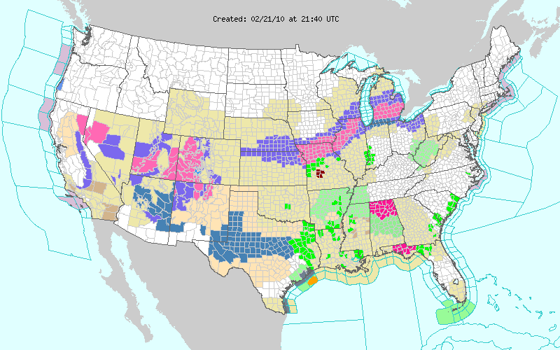
The gfs does paint around a inch or so for some of our southern counties.
It also paints it colder:

For Your Infinite Source For All Things Weather Visit Our Facebook
-
Portastorm

- Posts: 800
- Joined: Wed Feb 03, 2010 3:04 pm
- Location: Southwest Austin/Oak Hill, TX
- Contact:
NWSFO Austin/San Antonio continues to downplay the event ... 1/2 inch for AUS metro.
-------------------
SPECIAL WEATHER STATEMENT
NATIONAL WEATHER SERVICE AUSTIN/SAN ANTONIO TX
326 PM CST SUN FEB 21 2010
TXZ171>173-183>194-202>209-217>225-228-220300-
LLANO-BURNET-WILLIAMSON-VAL VERDE-EDWARDS-REAL-KERR-BANDERA-
GILLESPIE-KENDALL-BLANCO-HAYS-TRAVIS-BASTROP-LEE-KINNEY-UVALDE-
MEDINA-BEXAR-COMAL-GUADALUPE-CALDWELL-FAYETTE-MAVERICK-ZAVALA-
FRIO-ATASCOSA-WILSON-KARNES-GONZALES-DE WITT-LAVACA-DIMMIT-
INCLUDING THE CITIES OF...LLANO...BURNET...GEORGETOWN...DEL RIO...
ROCKSPRINGS...LEAKEY...KERRVILLE...BANDERA...FREDERICKSBURG...
BOERNE...BLANCO...SAN MARCOS...AUSTIN...BASTROP...GIDDINGS...
BRACKETTVILLE...UVALDE...HONDO...SAN ANTONIO...NEW BRAUNFELS...
SEGUIN...LOCKHART...LA GRANGE...EAGLE PASS...CRYSTAL CITY...
PEARSALL...PLEASANTON...FLORESVILLE...KARNES CITY...GONZALES...
CUERO...HALLETTSVILLE...CARRIZO SPRINGS
326 PM CST SUN FEB 21 2010
...WINTRY WEATHER TUESDAY...
AN UPPER LEVEL LOW PRESSURE SYSTEM OVER IDAHO WILL DIP INTO SOUTH
CENTRAL TEXAS ON TUESDAY. THIS SYSTEM WILL BRING COLDER TEMPERATURES
AND A CHANCE OF WINTRY PRECIPITATION AS AN OVERRUNNING PATTERN
DEVELOPS. THE INITIAL PRECIPITATION TYPE TUESDAY MORNING WILL BE
RAIN WITH A MIX OF RAIN AND SNOW POSSIBLE IN THE NORTHERN HILL
COUNTRY AND EDWARDS PLATEAU. THE RAIN AND SNOW MIX WILL DRIFT
SOUTHWARD THROUGHOUT THE DAY ON TUESDAY REACHING ITS SOUTHERN MOST
EXTENT NEAR HIGHWAY 90 BY LATE TUESDAY AFTERNOON.
ACCUMULATIONS OF 1 TO 2 INCHES ARE POSSIBLE IN LLANO...BURNET AND
WILLIAMSON COUNTIES. ACCUMULATIONS WILL DECREASE SOUTHWARD FROM AN
INCH POSSIBLE ACROSS NORTHERN TRAVIS COUNTY TO ONE-HALF INCH OVER
NORTHWEST BEXAR COUNTY. PRECIPITATION WILL END FROM WEST TO EAST BY
WEDNESDAY MORNING AS THE UPPER LEVEL LOW PRESSURE SYSTEM QUICKLY
MOVES EASTWARD.
-
txsnowmaker
- Posts: 632
- Joined: Wed Feb 03, 2010 4:07 pm
- Location: SW Houston (Galleria area)
- Contact:
I sure do like the 18z GFS run. If this verifies, there is precip lingering around all the way through hour 72 (6 pm Wednesday!), with the freezing line well into the Gulf. To me, that would indicate that everyone in the city would see snow falling at some point with this system. Hopefully the overnight runs will continue with this scenario. Imagine what we could see if in addition to a coastal trough developing, that the system shifts even further southward...
-
- Information
-
Who is online
Users browsing this forum: Ahrefs [Bot], Bing [Bot], Cpv17, TexasBreeze and 7 guests