
OCTOBER 2018 - Stormy Halloween
I’ve been watching weather channel since last night. I was surprised to hear their “experts” say it wouldn’t strengthen anymore while pressures were still falling. Now Michael is stronger today and pressures are still dropping. It’s crazy’s to think that based on the wind chart above some structures will not survive.
I keep losing my usernames. Formerly vertigoss/seanatsk.
Survived Ike in Katy, Harvey in Dickinson and Allison in my car.
Survived Ike in Katy, Harvey in Dickinson and Allison in my car.
-
Katdaddy

- Global Moderator

- Posts: 2502
- Joined: Thu Feb 04, 2010 8:18 am
- Location: League City, Tx
- Contact:
Hurricane Michael continues to strengthen just offshore. Up to 150MPH
Hurricane Michael Tropical Cyclone Update
NWS National Hurricane Center Miami FL AL142018
1030 AM CDT Wed Oct 10 2018
...MICHAEL STILL STRENGTHENING AS THE EYE NEARS THE COAST OF
THE FLORIDA PANHANDLE...
Data from an Air Force Reserve Hurricane Hunter aircraft indicate
that the maximum sustained winds have increased to near 150 mph
(240 km/h) with higher gusts. The aircraft also reported that the
minimum pressure has fallen to 923 mb (27.26 inches).
The Apalachicola airport recently reported a wind gust of 72 mph
(101 km/h).
Water levels continue to rise quickly along the coast of the Florida
Panhandle. A National Ocean Service water level station at
Apalachicola recently reported over 5 feet of inundation above
ground level.
SUMMARY OF 1030 AM CDT...1530 UTC...INFORMATION
-----------------------------------------------
LOCATION...29.5N 85.9W
ABOUT 50 MI...80 KM SSW OF PANAMA CITY FLORIDA
ABOUT 55 MI...90 KM WSW OF APALACHICOLA FLORIDA
MAXIMUM SUSTAINED WINDS...150 MPH...240 KM/H
PRESENT MOVEMENT...NNE OR 15 DEGREES AT 14 MPH...22 KM/H
MINIMUM CENTRAL PRESSURE...923 MB...27.26 INCHES
-
Texaspirate11

- Posts: 1278
- Joined: Tue Dec 31, 2013 12:24 am
- Contact:
Prayers to all who are in the path of this strong CAT 4 cane
Wont be surprised if he goes Cat 5 for a blip or two not that it matters
Panama City will be wracked - much like our Rockport and other cities by Harvey.
that some people are STILL there is always so mind numbing to me.
They've never experienced a Cat 4 before in this area and you can bet
responders will have to put their lives at risk to same some of them.
And in the end we will hear:
"I didn't think it would be this bad" or "I'll never do that again."
or "I stayed because of my pets"
So over it.
Michael will then go into Georgia as a Cat 2.
I wish all well.
Just because you're disabled, you don't have to be a victim
Be Weather Aware & Prepared!
Barbara Jordan Winner in Media
Disability Integration Consultant
Be Weather Aware & Prepared!
Barbara Jordan Winner in Media
Disability Integration Consultant
Good chance it's a cat 5 now with the pressures sub 920. Lots of folks didn't leave because they expected this to be "just a cat 2 or 3"


1 mph short of a CAT 5 (155 mph). Mexico Beach with devastating surge and damage.Texaspirate11 wrote:Prayers to all who are in the path of this strong CAT 4 cane
Wont be surprised if he goes Cat 5 for a blip or two not that it matters
Panama City will be wracked - much like our Rockport and other cities by Harvey.
that some people are STILL there is always so mind numbing to me.
They've never experienced a Cat 4 before in this area and you can bet
responders will have to put their lives at risk to same some of them.
And in the end we will hear:
"I didn't think it would be this bad" or "I'll never do that again."
or "I stayed because of my pets"
So over it.
Michael will then go into Georgia as a Cat 2.
I wish all well.
This upcoming front doesn’t really appear to be cooling off SETX very much according to the Euro. It has us at near normal or slightly above normal temps for next week.

-
Texaspirate11
- Posts: 1278
- Joined: Tue Dec 31, 2013 12:24 am
- Contact:
Devastating disaster - Mexico Beach.
One fatality so far.
I'm sure there will be more when all is said and done.
Very sad situation over there.
One fatality so far.
I'm sure there will be more when all is said and done.
Very sad situation over there.
Just because you're disabled, you don't have to be a victim
Be Weather Aware & Prepared!
Barbara Jordan Winner in Media
Disability Integration Consultant
Be Weather Aware & Prepared!
Barbara Jordan Winner in Media
Disability Integration Consultant


Michael is more intense than the most intense Texas hurricane, the 1886 Indianola Hurricane. It had a central pressure of 925 millibars. 

I thought the wind and damage at Lockport was bad. Storm surge with Michael was higher than expected and rose violently, rising to roof level in Mexico Beach. The winds more blustery than Harvey. Panama Beach, Tyndal AFB, Mexico Beach, St Joe's were absolutely nuked. Anyone who saw Brett Adair's video should have a much healthier respect for Mother Nature.Ptarmigan wrote:Michael is more intense than the most intense Texas hurricane, the 1886 Indianola Hurricane. It had a central pressure of 925 millibars.
There was too much complacency...while Florence's flooding was catastrophic it's weakening to a CAT 1 on landfall reduced public's attention span on wind damage, surge.
Michael was the real deal.
Last edited by DoctorMu on Thu Oct 11, 2018 11:41 pm, edited 1 time in total.
Very true. I've spoken to many folks who live on or near the coast who said they will never evacuate for "just a cat 2 or 3", even though we are talking about winds over 100 mph. It blows my mind.
Michael came in so strong that it was still a cat 3 100+ miles inland. How would folks in Conroe on up towards College Station like to be dealing with that if such a strong one hit us?
Michael came in so strong that it was still a cat 3 100+ miles inland. How would folks in Conroe on up towards College Station like to be dealing with that if such a strong one hit us?
-
srainhoutx

- Site Admin

- Posts: 19616
- Joined: Tue Feb 02, 2010 2:32 pm
- Location: Maggie Valley, NC
- Contact:
Clearly we will see heartbreaking devastation across the Panama City to Apalachicola Region and inland where it is heavily forested through Tallahassee in to SW Georgia. Sadly it appears almost half the folks near the Coast did not evacuate. David Paul had a graphic up yesterday of a CAT 3 inland 114 miles in SE Texas as Michael did. Sobering to say the least and why we 'preach' to heed warnings!
Our weekend and early next week weather looks to remain active after a very pleasant morning with cool and dry Northerly breezes. Sergio will move very quickly ENE and be over the Texas Panhandle Saturday spreading heavy rain and storms. In is wake a very strong Fall Cold Front will race S and E with some snow in the Panhandle Sunday night into Monday morning. It does appear we will not clear out behind the front as a very noisy sub tropical jet will be overhead with damp/chilly rain and drizzle continuing into Tuesday hold temperature in check across the Region. Night time lows are held in check by cloud cover, but high temperatures may struggle to reach the low 60's...if not the low 50's for areas NW/N/NE of Metro Houston.
Our weekend and early next week weather looks to remain active after a very pleasant morning with cool and dry Northerly breezes. Sergio will move very quickly ENE and be over the Texas Panhandle Saturday spreading heavy rain and storms. In is wake a very strong Fall Cold Front will race S and E with some snow in the Panhandle Sunday night into Monday morning. It does appear we will not clear out behind the front as a very noisy sub tropical jet will be overhead with damp/chilly rain and drizzle continuing into Tuesday hold temperature in check across the Region. Night time lows are held in check by cloud cover, but high temperatures may struggle to reach the low 60's...if not the low 50's for areas NW/N/NE of Metro Houston.
- Attachments
-
-
-
Carla/Alicia/Jerry(In The Eye)/Michelle/Charley/Ivan/Dennis/Katrina/Rita/Wilma/Humberto/Ike/Harvey
Member: National Weather Association
Facebook.com/Weather Infinity
Twitter @WeatherInfinity
Member: National Weather Association
Facebook.com/Weather Infinity
Twitter @WeatherInfinity
-
MontgomeryCoWx

- Posts: 2356
- Joined: Wed Dec 14, 2011 4:31 pm
- Location: Weimar, TX
- Contact:
Beautiful! Die Summer you ornery slug!srainhoutx wrote:Clearly we will see heartbreaking devastation across the Panama City to Apalachicola Region and inland where it is heavily forested through Tallahassee in to SW Georgia. Sadly it appears almost half the folks near the Coast did not evacuate. David Paul had a graphic up yesterday of a CAT 3 inland 114 miles in SE Texas as Michael did. Sobering to say the least and why we 'preach' to heed warnings!
Our weekend and early next week weather looks to remain active after a very pleasant morning with cool and dry Northerly breezes. Sergio will move very quickly ENE and be over the Texas Panhandle Saturday spreading heavy rain and storms. In is wake a very strong Fall Cold Front will race S and E with some snow in the Panhandle Sunday night into Monday morning. It does appear we will not clear out behind the front as a very noisy sub tropical jet will be overhead with damp/chilly rain and drizzle continuing into Tuesday hold temperature in check across the Region. Night time lows are held in check by cloud cover, but high temperatures may struggle to reach the low 60's...if not the low 50's for areas NW/N/NE of Metro Houston.
Team #NeverSummer
very well stated, Dr Shepherd: https://www.forbes.com/sites/marshallsh ... on-michael
- The staff at the National Hurricane Center work tirelessly providing life-saving information to the public. During disasters like Hurricane Michael, we rightfully thank first responders, emergency managers, and volunteers. They do critical work on the front lines of storm recovery and assistance. However, I am not sure people realize the mental stress meteorologists deal with as conveying life-altering information.
Has everyone had a chance to step outside this morning??? OMG......THIS is the day I look forward to more than any other...that first day you can actually feel the difference. Like the changing of the guard......
-
srainhoutx
- Site Admin
- Posts: 19616
- Joined: Tue Feb 02, 2010 2:32 pm
- Location: Maggie Valley, NC
- Contact:
Thursday morning briefing from Jeff:
Early images of the damage by one of the strongest hurricanes to ever strike the US coast indicate that a large majority of the damage was contained to the eyewall area of the hurricane. The heaviest of the damage extends from Downtown Panama City (not Panama City Beach) to Tyndall AFB and then Mexico Beach. Downtown Panama City was within the western eyewall of the hurricane, while Panama City Beach was not within the eyewall. Extreme damage occurred from both surge and wind in the eastern eyewall at Mexico Beach.
The majority of the damage over a large section of Panama City and Tyndall AFB looks to be similar to an EF 1 or EF 2 tornado with streaks of EF 3 damage. Michael showed extensive meso vortex imagery during landfall in its eyewall and these small vortices likely accelerated the wind speeds 20-30mph over the background wind in very small streaks. This produces small almost tornado like damage patterns within the overall hurricane eyewall damage pattern.
There has been little information from both Mexico Beach and Port St Joe which took the direct impact of the eastern eyewall.
Comparison of Harvey to Michael:
Wind damage potential increases at an exponential rate on a power scale of 2^8. For example a 100 mph wind produces 10 times more damage than a 75mph wind however a 125mph wind produces 60 times more damage potential than a 75mph wind.
Harvey made landfall at Port Aransas with sustained winds of 130mph and Michael made landfall with sustained winds of 155mph. While the wind speed at landfall of Michael was only 25mph stronger than Harvey, Michael’s damage potential was 251 times greater than Harvey and 333 times greater than a 75mph hurricane. Even a very slight increase in wind between 155mph and 160mph produce a damage potential of 96 times greater damage. Radar data yesterday was showing wind speeds of 175-177mph just above the surface as Michael was making landfall and some of that energy was likely brought to the surface in gusts. A 170mph wind would produce a damage potential of 615 times more than a 130mph wind.
As bad as the damage was at Rockport and Port Aransas, you can clearly see that the wind damage potential from Michael was exceptional. Even with extremely strict building codes across FL, many of the structures could not withstand that type of wind load in the eyewall area of Michael.
The good news is that Michael was moving fairly fast which limited the sustained eyewall winds to about 30-40 minutes unlike Harvey which battered areas for 6-8 hours with very strong winds. This fast forward motion also resulted in Michael maintaining category 3 intensity well inland into southwest Georgia where a 115mph wind gust was reported.
Mexico Beach:
Panama City:
St. George Island:
Port St Joe:
Early images of the damage by one of the strongest hurricanes to ever strike the US coast indicate that a large majority of the damage was contained to the eyewall area of the hurricane. The heaviest of the damage extends from Downtown Panama City (not Panama City Beach) to Tyndall AFB and then Mexico Beach. Downtown Panama City was within the western eyewall of the hurricane, while Panama City Beach was not within the eyewall. Extreme damage occurred from both surge and wind in the eastern eyewall at Mexico Beach.
The majority of the damage over a large section of Panama City and Tyndall AFB looks to be similar to an EF 1 or EF 2 tornado with streaks of EF 3 damage. Michael showed extensive meso vortex imagery during landfall in its eyewall and these small vortices likely accelerated the wind speeds 20-30mph over the background wind in very small streaks. This produces small almost tornado like damage patterns within the overall hurricane eyewall damage pattern.
There has been little information from both Mexico Beach and Port St Joe which took the direct impact of the eastern eyewall.
Comparison of Harvey to Michael:
Wind damage potential increases at an exponential rate on a power scale of 2^8. For example a 100 mph wind produces 10 times more damage than a 75mph wind however a 125mph wind produces 60 times more damage potential than a 75mph wind.
Harvey made landfall at Port Aransas with sustained winds of 130mph and Michael made landfall with sustained winds of 155mph. While the wind speed at landfall of Michael was only 25mph stronger than Harvey, Michael’s damage potential was 251 times greater than Harvey and 333 times greater than a 75mph hurricane. Even a very slight increase in wind between 155mph and 160mph produce a damage potential of 96 times greater damage. Radar data yesterday was showing wind speeds of 175-177mph just above the surface as Michael was making landfall and some of that energy was likely brought to the surface in gusts. A 170mph wind would produce a damage potential of 615 times more than a 130mph wind.
As bad as the damage was at Rockport and Port Aransas, you can clearly see that the wind damage potential from Michael was exceptional. Even with extremely strict building codes across FL, many of the structures could not withstand that type of wind load in the eyewall area of Michael.
The good news is that Michael was moving fairly fast which limited the sustained eyewall winds to about 30-40 minutes unlike Harvey which battered areas for 6-8 hours with very strong winds. This fast forward motion also resulted in Michael maintaining category 3 intensity well inland into southwest Georgia where a 115mph wind gust was reported.
Mexico Beach:
- 10112018 Jeff 3 untitled.png (138.09 KiB) Viewed 4133 times
- 10112018 Jeff 5 untitled.png (414.32 KiB) Viewed 4133 times
- 10112018 Jeff 6 untitled.png (110.44 KiB) Viewed 4133 times
- 10112018 Jeff 19 untitled.png (222.66 KiB) Viewed 4133 times
Carla/Alicia/Jerry(In The Eye)/Michelle/Charley/Ivan/Dennis/Katrina/Rita/Wilma/Humberto/Ike/Harvey
Member: National Weather Association
Facebook.com/Weather Infinity
Twitter @WeatherInfinity
Member: National Weather Association
Facebook.com/Weather Infinity
Twitter @WeatherInfinity
If Michael had been moving a few miles per hour slower in the 24hrs prior to landfall the wind field would have grown significantly, storm surge would have been higher and the extreme damage more widespread. Would be interesting to see modeling done for such a scenario.
-
srainhoutx
- Site Admin
- Posts: 19616
- Joined: Tue Feb 02, 2010 2:32 pm
- Location: Maggie Valley, NC
- Contact:
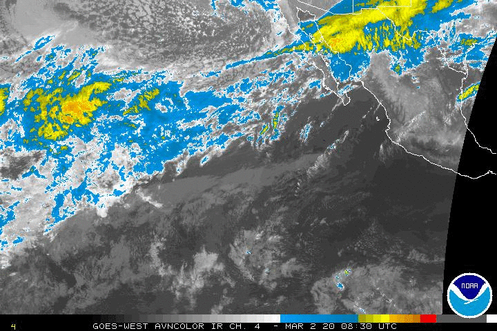
Mid and high level clouds are streaming in from the West this afternoon ahead of TS Sergio rapidly closing in on the Central Baja Peninsula. Sergio appears to keep some of its tropical characteristics as it exits Northern Mexico into Southern New Mexico/Texas Panhandle Friday evening/Saturday morning as a Tropical Depression. I deep trough is digging S across the Great Basin that should keep Sergio trekking ENE as a strong low pressure system develops across portions of the Central/Southern Rockies Saturday night into Sunday ushering in our strong Fall Cold Front. A pesky coastal trough of low pressure looks likely after the front clears the Coast and potentially a deeper area of low pressure could develop along the Frontal Boundary in the Bay of Campeche/Western Gulf the first half of next week keeping our sensible weather unsettled. The upper trough should build over the Eastern United States with a Ridge in the West keeping a NW flow in the upper levels. A secondary surge of very shallow colder air may arrive later next week keeping temperatures well below climatology for this time of year.
- Attachments
-
-
Carla/Alicia/Jerry(In The Eye)/Michelle/Charley/Ivan/Dennis/Katrina/Rita/Wilma/Humberto/Ike/Harvey
Member: National Weather Association
Facebook.com/Weather Infinity
Twitter @WeatherInfinity
Member: National Weather Association
Facebook.com/Weather Infinity
Twitter @WeatherInfinity
Category 3 far inland would be really bad anywhere. The area looks like a nuke went off.srainhoutx wrote:Clearly we will see heartbreaking devastation across the Panama City to Apalachicola Region and inland where it is heavily forested through Tallahassee in to SW Georgia. Sadly it appears almost half the folks near the Coast did not evacuate. David Paul had a graphic up yesterday of a CAT 3 inland 114 miles in SE Texas as Michael did. Sobering to say the least and why we 'preach' to heed warnings!
Our weekend and early next week weather looks to remain active after a very pleasant morning with cool and dry Northerly breezes. Sergio will move very quickly ENE and be over the Texas Panhandle Saturday spreading heavy rain and storms. In is wake a very strong Fall Cold Front will race S and E with some snow in the Panhandle Sunday night into Monday morning. It does appear we will not clear out behind the front as a very noisy sub tropical jet will be overhead with damp/chilly rain and drizzle continuing into Tuesday hold temperature in check across the Region. Night time lows are held in check by cloud cover, but high temperatures may struggle to reach the low 60's...if not the low 50's for areas NW/N/NE of Metro Houston.
The death toll is something I do not want to even think about.
-
- Information
-
Who is online
Users browsing this forum: Ahrefs [Bot], Amazon [Bot], Bing [Bot], Semrush [Bot] and 61 guests