
I was just looking at that. Hopefully it just blows out.Texaspirate11 wrote:ANYONE WANNA comment on that blob in the carib with 20% chance of development?
Looks like going westward so it could be a CA hit? Belize?
OCTOBER 2018 - Stormy Halloween
-
CrashTestDummy
- Posts: 187
- Joined: Mon Jul 25, 2016 3:44 pm
- Location: Pearland, Texas
- Contact:
Gene Beaird,
Pearland, Texas
"You can learn a lot from a Dummy."
Pearland, Texas
"You can learn a lot from a Dummy."
-
CrashTestDummy
- Posts: 187
- Joined: Mon Jul 25, 2016 3:44 pm
- Location: Pearland, Texas
- Contact:
It may have enough local energy to do that, but there’s a some pretty high wind shear around it and shoreward. Hopefully that limits any additional strengthening before landfall.Texaspirate11 wrote:just kept thinking it may go 4TexasBreeze wrote:This system is producing some extremely cold cloud tops and recon flight level readings of 130kts. Maybe a high end cat 4 or more at landfall if it keeps strengthening???
Gene Beaird,
Pearland, Texas
"You can learn a lot from a Dummy."
Pearland, Texas
"You can learn a lot from a Dummy."
10:00 PM CDT Tue Oct 9
Location: 27.1°N 86.5°W
Moving: N at 12 mph
Min pressure: 947 mb
Max sustained: 125 mph
https://www.nhc.noaa.gov/#Michael
https://www.nhc.noaa.gov/nhc_at4.xml
https://www.nhc.noaa.gov/refresh/graphi ... k#contents
https://www.nhc.noaa.gov/satellite.php

Location: 27.1°N 86.5°W
Moving: N at 12 mph
Min pressure: 947 mb
Max sustained: 125 mph
https://www.nhc.noaa.gov/#Michael
https://www.nhc.noaa.gov/nhc_at4.xml
https://www.nhc.noaa.gov/refresh/graphi ... k#contents
https://www.nhc.noaa.gov/satellite.php
Code: Select all
Hurricane Michael Discussion Number  14
NWS National Hurricane Center Miami FL       AL142018
1000 PM CDT Tue Oct 09 2018

Data from Air Force Reserve and NOAA Hurricane Hunter aircraft this
afternoon and evening indicate that Michael has been undergoing a
rapid deepening phase with the pressure having dropped to 947 mb, a
decrease of 20 mb between 1800Z and 0200Z with most of those
pressures falls occurring during the past few hours. Michael's eye
has become more distinct in GOES-16 high-resolution infrared
satellite imagery, with a solid ring of cloud top temperatures
colder than -75 deg C surrounding the warming eye. Some cloud tops
in the eyewall have been as cold as -88C, which is very impressive
for a Gulf system. The peak 8000-ft flight-level winds measured by
the NOAA aircraft thus far has been 130 kt and the strongest SFMR
surface wind speed observed has been 110 kt in the same location as
the peak flight-level winds. Based on these wind data, along with a
central pressure of 947 mb, Michael's intensity has been increased
to 110 kt. Satellite intensity estimates from TAFB and SAB, along
with objective estimates from UW-CIMSS ADT and NHC, support an
intensity of 115-127 kt. However, those also estimates also would
support a central pressure of about 935 mb, which the aircraft has
not measured thus far.

The initial motion estimate is due north, or 360/10 kt. Michael is
essentially on the previous advisory track, and there is no
significant change to the previous track forecast discussion. The
models have settled in a stable forecast pattern, which calls for
Michael to remain embedded within deep southerly flow for the next
24 hours between a  substantial ridge to the east and a highly
amplified mid-latitude trough moving eastward across the western and
central U.S. and northern Mexico. As a result, the dangerous
hurricane is expected to move northward to north-northeastward and
make landfall along the coast of the central panhandle of Florida by
late Wednesday afternoon. After landfall, increasing southwesterly
flow ahead of the approaching deep-layer trough is expected to
accelerate Michael toward the northeast through 48 h, with the
cyclone moving across the southeastern U.S. late Wednesday and
Thursday, and emerging over the western Atlantic by early Friday. A
continued northeastward motion at forward speeds of 30-40 kt is
forecast at 72-120 h when Michael is expected to be an extratropical
cyclone. The new NHC forecast track is essentially just an update of
the previous advisory track, and lies close to the tightly packed
consensus models TVCN, TVCX, TCON, and NOAA-HCCA.

Similar to the previous advisory, the environment ahead of Michael
is expected to remain conducive for additional strengthening until
landfall occurs due to SSTs of at least 85 deg F beneath the
hurricane, combined with decreasing vertical wind shear along with
the shear vector shifting from current west-northwesterly to a less
hostile southwesterly component, which will be more along Michael's
forecast track. As a result, Michael is now explicitly forecast to
become a category 4 hurricane before landfall occurs. After
landfall, significant weakening is expected while Michael moves over
the southeastern United States, but the cyclone is forecast to
re-strengthen over the western Atlantic due to baroclinic forcing
after it merges with a front and becomes extratropical on Friday.
The new intensity forecast closely follows a blend of the IVCN,
HCCA, and FSSE consensus models throughout the 120-h period.

Tropical storm conditions are expected to reach the hurricane
warning area by Wednesday morning, so all preparations should be
rushed to completion.

Key Messages:

1. Life-threatening storm surge is likely along portions of the
coasts of the Florida Panhandle, Big Bend, and Nature Coast, where
a storm surge warning is in effect. The worst storm surge is
expected between Mexico Beach and Keaton Beach, where 9 to 13 feet
of inundation is possible. Water levels will rise well in advance of
the center of Michael, and residents within the storm surge warning
area should finish preparations to protect life and property today.

2. Everyone in the hurricane warning area along the Florida Gulf
Coast should prepare for life-threatening major hurricane winds
associated with the core of Michael. Hurricane force winds will also
extend well inland across portions of the Florida Panhandle,
southern Georgia, and southeast Alabama as Michael moves inland.

3. Heavy rainfall from Michael could produce life-threatening flash
flooding from the Florida Panhandle and Big Bend region into
portions of Georgia, the Carolinas, and southeast Virginia.

4. Tropical storm conditions will likely affect portions of the
southeast U.S. coast from northeast Florida through North Carolina,
and tropical storm watches and warnings are in effect for these
areas.


FORECAST POSITIONS AND MAX WINDS

INIT  10/0300Z 27.1N  86.5W  110 KT 125 MPH
 12H  10/1200Z 28.7N  86.2W  115 KT 130 MPH
 24H  11/0000Z 30.8N  84.9W   70 KT  80 MPH...INLAND
 36H  11/1200Z 33.0N  82.4W   40 KT  45 MPH...INLAND
 48H  12/0000Z 35.2N  78.6W   40 KT  45 MPH...INLAND
 72H  13/0000Z 40.8N  65.1W   50 KT  60 MPH...POST-TROP/EXTRATROP
 96H  14/0000Z 47.2N  44.8W   55 KT  65 MPH...POST-TROP/EXTRATROP
120H  15/0000Z 51.2N  24.9W   45 KT  50 MPH...POST-TROP/EXTRATROP

$$
Forecaster Stewart
Code: Select all
BULLETIN
Hurricane Michael Advisory Number  14
NWS National Hurricane Center Miami FL       AL142018
1000 PM CDT Tue Oct 09 2018

...DANGEROUS HURRICANE MICHAEL CONTINUES TO STRENGTHEN...
...LIFE-THREATENING STORM SURGE...HURRICANE FORCE WINDS...AND HEAVY
RAINFALL EXPECTED ALONG THE NORTHEASTERN GULF COAST...


SUMMARY OF 1000 PM CDT...0300 UTC...INFORMATION
-----------------------------------------------
LOCATION...27.1N 86.5W
ABOUT 220 MI...355 KM SSW OF PANAMA CITY FLORIDA
ABOUT 200 MI...325 KM SSW OF APALACHICOLA FLORIDA
MAXIMUM SUSTAINED WINDS...125 MPH...205 KM/H
PRESENT MOVEMENT...N OR 355 DEGREES AT 12 MPH...19 KM/H
MINIMUM CENTRAL PRESSURE...947 MB...27.97 INCHES


WATCHES AND WARNINGS
--------------------
CHANGES WITH THIS ADVISORY:

None.

SUMMARY OF WATCHES AND WARNINGS IN EFFECT:

A Storm Surge Warning is in effect for...
* Okaloosa/Walton County Line Florida to Anclote River Florida

A Storm Surge Watch is in effect for...
* Anclote River Florida to Anna Maria Island Florida, including
Tampa Bay
* Alabama/Florida border to Okaloosa/Walton County Line Florida

A Hurricane Warning is in effect for...
* Alabama/Florida border to Suwannee River Florida

A Tropical Storm Warning is in effect for...
* Alabama/Florida border to the Mississippi/Alabama border
* Suwanee River Florida to Chassahowitzka Florida
* north of Fernandina Beach Florida to South Santee River South
Carolina

A Tropical Storm Watch is in effect for...
* Chassahowitzka to Anna Maria Island Florida, including Tampa Bay
* Mississippi/Alabama border to the Mouth of the Pearl River
* South Santee River South Carolina to Duck North Carolina
* Pamlico and Albemarle Sounds

A Storm Surge Warning means there is a danger of life-threatening
inundation, from rising water moving inland from the coastline,
during the next 36 hours in the indicated locations. For a depiction
of areas at risk, please see the National Weather Service Storm
Surge Watch/Warning Graphic, available at hurricanes.gov.  This is
a life-threatening situation.  Persons located within these areas
should take all necessary actions to protect life and property from
rising water and the potential for other dangerous conditions.
Promptly follow evacuation and other instructions from local
officials.

A Hurricane Warning means that hurricane conditions are expected
somewhere within the warning area, in this case within the next
24 hours.  Preparations to protect life and property should be
rushed to completion.

A Tropical Storm Warning means that tropical storm conditions are
expected somewhere within the warning area, in this case during the
next 12 hours.

A Storm Surge Watch means there is a possibility of life-
threatening inundation, from rising water moving inland from the
coastline.

A Tropical Storm Watch means that tropical storm conditions are
possible within the watch area.

Interests elsewhere across the southeastern United States should
monitor the progress of Michael.

For storm information specific to your area, including possible
inland watches and warnings, please monitor products issued by your
local National Weather Service forecast office.


DISCUSSION AND OUTLOOK
----------------------
At 1000 PM CDT (0300 UTC), the center of Hurricane Michael was
located near latitude 27.1 North, longitude 86.5 West. Michael is
moving toward the north near 12 mph (19 km/h).  A northward motion
is expected through tonight, followed by a northeastward motion on
Wednesday and Thursday. On the forecast track, the center of Michael
will move across the eastern Gulf of Mexico through tonight. The
center of Michael's eye is then expected to move inland over the
Florida Panhandle or Florida Big Bend area on Wednesday, and then
move northeastward across the southeastern United States Wednesday
night and Thursday, and move off the Mid-Atlantic coast away from
the United States on Friday.

Data from a NOAA Hurricane Hunter aircraft indicate that maximum
sustained winds have increased to near 125 mph (205 km/h) with
higher gusts.  Michael is now a strong category 3 hurricane on the
Saffir-Simpson Hurricane Wind Scale. Some further strengthening is
expected overnight and on Wednesday, and Michael is forecast to
become a category 4 hurricane before it makes landfall in the
Florida Panhandle or the Florida Big Bend area. Weakening is
expected after landfall as Michael moves across the southeastern
United States.

Hurricane-force winds extend outward up to 45 miles (75 km) from the
center and tropical-storm-force winds extend outward up to 175 miles
(280 km).

The minimum central pressure recently measured by the reconnaissance
aircraft was 947 mb (27.97 inches).


HAZARDS AFFECTING LAND
----------------------
STORM SURGE:  The combination of a dangerous storm surge and the
tide will cause normally dry areas near the coast to be flooded by
rising waters moving inland from the shoreline. The water has the
potential to reach the following heights above ground if peak surge
occurs at the time of high tide...

Mexico Beach FL to Keaton Beach FL...9-13 ft
Okaloosa/Walton County Line FL to Mexico Beach FL...6-9 ft
Keaton Beach FL to Cedar Key FL...6-9 ft
Cedar Key FL to Chassahowitzka FL...4-6 ft
Chassahowitzka to Anna Maria Island FL including Tampa Bay...2-4 ft
Alabama/Florida border to Okaloosa/Walton County Line FL...2-4 ft

WIND:  Hurricane conditions are expected within the hurricane
warning area along the U.S. Gulf Coast by Wednesday, with tropical
storm conditions expected by tonight or early Wednesday.  Hurricane
conditions will also spread well inland across portions of the
Florida Panhandle, southeastern Alabama and southwestern Georgia.

Tropical storm conditions are expected in the tropical storm warning
area by tonight or early Wednesday, and are possible within the
tropical storm watch area by that time.  Hurricane conditions are
possible within the hurricane watch area by Wednesday.

Tropical storm conditions are expected in the warning area along
the southeast U.S. coast by Wednesday, and possible in the watch
area by late Wednesday.

RAINFALL:  Michael is expected to produce the following rainfall
amounts through Friday...

Florida Panhandle and Big Bend, southeast Alabama, and portions of
southwest and central Georgia...4 to 8 inches, with isolated maximum
amounts of 12 inches. This rainfall could lead to life threatening
flash floods.

The remainder of Georgia, the Carolinas, and southern Virginia...3
to 6 inches, with isolated maximum amounts of 8 inches. This
rainfall could lead to life-threatening flash floods.

Florida Peninsula, eastern Mid Atlantic, southern New England
coast...1-3 inches.

SURF:  Swells generated by Michael are affecting the coasts of the
eastern and northern Gulf of Mexico, and will spread to portions of
the northwestern and western Gulf of Mexico coast during the next
day or so.  These swells are likely to cause life-threatening surf
and rip current conditions.  Please consult products from your local
weather office.

TORNADOES:  The threat for tornadoes will increase late tonight into
Wednesday over parts of the Florida Panhandle, the northern Florida
Peninsula, and southern Georgia.


NEXT ADVISORY
-------------
Next intermediate advisory at 100 AM CDT.
Next complete advisory at 400 AM CDT.

$$
Forecaster Stewart
God help them 
7:00 AM CDT Wed Oct 10
Location: 29.0°N 86.3°W
Moving: N at 13 mph
Min pressure: 933 mb
Max sustained: 145 mph
https://www.nhc.noaa.gov/#Michael
https://www.nhc.noaa.gov/nhc_at4.xml
https://www.nhc.noaa.gov/refresh/graphi ... k#contents
https://www.nhc.noaa.gov/satellite.php

7:00 AM CDT Wed Oct 10
Location: 29.0°N 86.3°W
Moving: N at 13 mph
Min pressure: 933 mb
Max sustained: 145 mph
https://www.nhc.noaa.gov/#Michael
https://www.nhc.noaa.gov/nhc_at4.xml
https://www.nhc.noaa.gov/refresh/graphi ... k#contents
https://www.nhc.noaa.gov/satellite.php
Code: Select all
BULLETIN
Hurricane Michael Intermediate Advisory Number 15A
NWS National Hurricane Center Miami FL       AL142018
700 AM CDT Wed Oct 10 2018

...POTENTIALLY CATASTROPHIC HURRICANE MICHAEL HEADING TOWARD THE
FLORIDA PANHANDLE...
...LIFE-THREATENING STORM SURGE...HURRICANE FORCE WINDS...AND HEAVY
RAINFALL IMMINENT...


SUMMARY OF 700 AM CDT...1200 UTC...INFORMATION
----------------------------------------------
LOCATION...29.0N 86.3W
ABOUT 90 MI...145 KM SW OF PANAMA CITY FLORIDA
ABOUT 90 MI...145 KM WSW OF APALACHICOLA FLORIDA
MAXIMUM SUSTAINED WINDS...145 MPH...230 KM/H
PRESENT MOVEMENT...N OR 10 DEGREES AT 13 MPH...20 KM/H
MINIMUM CENTRAL PRESSURE...933 MB...27.55 INCHES


WATCHES AND WARNINGS
--------------------
CHANGES WITH THIS ADVISORY:

None

SUMMARY OF WATCHES AND WARNINGS IN EFFECT:

A Storm Surge Warning is in effect for...
* Okaloosa/Walton County Line Florida to Anclote River Florida

A Storm Surge Watch is in effect for...
* Anclote River Florida to Anna Maria Island Florida, including
Tampa Bay

A Hurricane Warning is in effect for...
* Alabama/Florida border to Suwannee River Florida

A Tropical Storm Warning is in effect for...
* Alabama/Florida border to the Mississippi/Alabama border
* Suwanee River Florida to Chassahowitzka Florida
* North of Fernandina Beach Florida to Surf City North Carolina

A Tropical Storm Watch is in effect for...
* Chassahowitzka to Anna Maria Island Florida, including Tampa Bay
* Mississippi/Alabama border to the Mouth of the Pearl River
* Surf City North Carolina to Duck North Carolina
* Pamlico and Albemarle Sounds

A Storm Surge Warning means there is a danger of life-threatening
inundation, from rising water moving inland from the coastline. For
a depiction of areas at risk, please see the National Weather
Service Storm Surge Watch/Warning Graphic, available at
hurricanes.gov.

A Hurricane Warning means that hurricane conditions are expected
somewhere within the warning area.

A Tropical Storm Warning means that tropical storm conditions are
expected somewhere within the warning area.

A Storm Surge Watch means there is a possibility of life-
threatening inundation, from rising water moving inland from the
coastline.

A Tropical Storm Watch means that tropical storm conditions are
possible within the watch area.

Interests elsewhere across the southeastern United States should
monitor the progress of Michael.

For storm information specific to your area, including possible
inland watches and warnings, please monitor products issued by your
local National Weather Service forecast office.


DISCUSSION AND OUTLOOK
----------------------
At 700 AM CDT (1200 UTC), the eye of Hurricane Michael was located
near latitude 29.0 North, longitude 86.3 West. Michael is moving
toward the north near 13 mph (20 km/h). A turn toward the north-
northeast is expected later this morning, with a turn toward the
northeast expected this afternoon or tonight. A motion toward the
northeast at a faster forward speed is forecast on Thursday and
Friday. On the forecast track, the eye of Michael is expected to
move ashore over the Florida Panhandle later today, move
northeastward across the southeastern United States tonight and
Thursday, and then move off the Mid-Atlantic coast away from the
United States on Friday.

Reports from an Air Force Reserve Hurricane Hunter aircraft
indicate that maximum sustained winds have increased to near 145 mph
(230 km/h) with higher gusts. Michael is an extremely dangerous
category 4 hurricane on the Saffir-Simpson Hurricane Wind Scale.
Some additional strengthening is possible before landfall. After
landfall, Michael should weaken as it crosses the southeastern
United States.

Hurricane-force winds extend outward up to 45 miles (75 km) from
the center and tropical-storm-force winds extend outward up to 185
miles (295 km). A wind gust to 56 mph (91 km/h) was recently
reported at Apalachicola Regional Airport.

The estimated minimum central pressure based on NOAA and Air Force
Reserve Hunter aircraft data is 933 mb (27.55 inches).


HAZARDS AFFECTING LAND
----------------------
STORM SURGE:  The combination of a dangerous storm surge and the
tide will cause normally dry areas near the coast to be flooded by
rising waters moving inland from the shoreline. The water has the
potential to reach the following heights above ground if peak surge
occurs at the time of high tide...

Tyndall Air Force Base FL to Aucilla River FL...9-14 ft
Okaloosa/Walton County Line FL to Tyndall Air Force Base FL...6-9 ft
Aucilla River FL to Cedar Key FL...6-9 ft
Cedar Key FL to Chassahowitzka FL...4-6 ft
Chassahowitzka to Anna Maria Island FL including Tampa Bay...2-4 ft

WIND:  Tropical storm conditions are spreading onshore along the
U.S. Gulf Coast within the warning area, with hurricane conditions
spreading onshore later this morning within the hurricane warning
area.  Hurricane conditions will also spread well inland across
portions of the Florida Panhandle, southeastern Alabama and
southwestern Georgia later today and tonight.

Tropical storm conditions are expected to spread northward within
the warning area along the southeast U.S. coast beginning tonight,
and are possible in the watch area by late Thursday and Thursday
night.

RAINFALL:  Michael is expected to produce the following rainfall
amounts through Friday...

Florida Panhandle and Big Bend, southeast Alabama, and portions of
southwest and central Georgia...4 to 8 inches, with isolated maximum
amounts of 12 inches. This rainfall could lead to life-threatening
flash floods.

The remainder of Georgia, the Carolinas, and southern Virginia...3
to 6 inches, with isolated maximum amounts of 8 inches. This
rainfall could lead to life-threatening flash floods.

Florida Peninsula, eastern Mid Atlantic, southern New England
coast...1-3 inches.

SURF:  Swells generated by Michael will affect the coasts of the
eastern, northern, and western Gulf of Mexico during the next day
or so.  These swells are likely to cause life-threatening surf
and rip current conditions.  Please consult products from your local
weather office.

TORNADOES:  A few tornadoes will be possible across parts of the
Florida Panhandle and the northern Florida Peninsula through this
afternoon.  This risk will spread into parts of central and southern
Georgia and southern South Carolina this afternoon and tonight.


NEXT ADVISORY
-------------
Next complete advisory at 1000 AM CDT.

$$
Forecaster Brown-
srainhoutx

- Site Admin

- Posts: 19616
- Joined: Tue Feb 02, 2010 2:32 pm
- Location: Maggie Valley, NC
- Contact:
Just sickening...

Carla/Alicia/Jerry(In The Eye)/Michelle/Charley/Ivan/Dennis/Katrina/Rita/Wilma/Humberto/Ike/Harvey
Member: National Weather Association
Facebook.com/Weather Infinity
Twitter @WeatherInfinity
Member: National Weather Association
Facebook.com/Weather Infinity
Twitter @WeatherInfinity
8:00 AM CDT Wed Oct 10
Location: 29.1°N 86.2°W
Moving: N at 13 mph
Min pressure: 933 mb
Max sustained: 145 mph
Location: 29.1°N 86.2°W
Moving: N at 13 mph
Min pressure: 933 mb
Max sustained: 145 mph
unome wrote:God help them
7:00 AM CDT Wed Oct 10
Location: 29.0°N 86.3°W
Moving: N at 13 mph
Min pressure: 933 mb
Max sustained: 145 mph
https://www.nhc.noaa.gov/#Michael
https://www.nhc.noaa.gov/nhc_at4.xml
https://www.nhc.noaa.gov/refresh/graphi ... k#contents
https://www.nhc.noaa.gov/satellite.php
Code: Select all
BULLETIN
Hurricane Michael Intermediate Advisory Number 15A
NWS National Hurricane Center Miami FL       AL142018
700 AM CDT Wed Oct 10 2018

...POTENTIALLY CATASTROPHIC HURRICANE MICHAEL HEADING TOWARD THE
FLORIDA PANHANDLE...
...LIFE-THREATENING STORM SURGE...HURRICANE FORCE WINDS...AND HEAVY
RAINFALL IMMINENT...


SUMMARY OF 700 AM CDT...1200 UTC...INFORMATION
----------------------------------------------
LOCATION...29.0N 86.3W
ABOUT 90 MI...145 KM SW OF PANAMA CITY FLORIDA
ABOUT 90 MI...145 KM WSW OF APALACHICOLA FLORIDA
MAXIMUM SUSTAINED WINDS...145 MPH...230 KM/H
PRESENT MOVEMENT...N OR 10 DEGREES AT 13 MPH...20 KM/H
MINIMUM CENTRAL PRESSURE...933 MB...27.55 INCHES


WATCHES AND WARNINGS
--------------------
CHANGES WITH THIS ADVISORY:

None

SUMMARY OF WATCHES AND WARNINGS IN EFFECT:

A Storm Surge Warning is in effect for...
* Okaloosa/Walton County Line Florida to Anclote River Florida

A Storm Surge Watch is in effect for...
* Anclote River Florida to Anna Maria Island Florida, including
Tampa Bay

A Hurricane Warning is in effect for...
* Alabama/Florida border to Suwannee River Florida

A Tropical Storm Warning is in effect for...
* Alabama/Florida border to the Mississippi/Alabama border
* Suwanee River Florida to Chassahowitzka Florida
* North of Fernandina Beach Florida to Surf City North Carolina

A Tropical Storm Watch is in effect for...
* Chassahowitzka to Anna Maria Island Florida, including Tampa Bay
* Mississippi/Alabama border to the Mouth of the Pearl River
* Surf City North Carolina to Duck North Carolina
* Pamlico and Albemarle Sounds

A Storm Surge Warning means there is a danger of life-threatening
inundation, from rising water moving inland from the coastline. For
a depiction of areas at risk, please see the National Weather
Service Storm Surge Watch/Warning Graphic, available at
hurricanes.gov.

A Hurricane Warning means that hurricane conditions are expected
somewhere within the warning area.

A Tropical Storm Warning means that tropical storm conditions are
expected somewhere within the warning area.

A Storm Surge Watch means there is a possibility of life-
threatening inundation, from rising water moving inland from the
coastline.

A Tropical Storm Watch means that tropical storm conditions are
possible within the watch area.

Interests elsewhere across the southeastern United States should
monitor the progress of Michael.

For storm information specific to your area, including possible
inland watches and warnings, please monitor products issued by your
local National Weather Service forecast office.


DISCUSSION AND OUTLOOK
----------------------
At 700 AM CDT (1200 UTC), the eye of Hurricane Michael was located
near latitude 29.0 North, longitude 86.3 West. Michael is moving
toward the north near 13 mph (20 km/h). A turn toward the north-
northeast is expected later this morning, with a turn toward the
northeast expected this afternoon or tonight. A motion toward the
northeast at a faster forward speed is forecast on Thursday and
Friday. On the forecast track, the eye of Michael is expected to
move ashore over the Florida Panhandle later today, move
northeastward across the southeastern United States tonight and
Thursday, and then move off the Mid-Atlantic coast away from the
United States on Friday.

Reports from an Air Force Reserve Hurricane Hunter aircraft
indicate that maximum sustained winds have increased to near 145 mph
(230 km/h) with higher gusts. Michael is an extremely dangerous
category 4 hurricane on the Saffir-Simpson Hurricane Wind Scale.
Some additional strengthening is possible before landfall. After
landfall, Michael should weaken as it crosses the southeastern
United States.

Hurricane-force winds extend outward up to 45 miles (75 km) from
the center and tropical-storm-force winds extend outward up to 185
miles (295 km). A wind gust to 56 mph (91 km/h) was recently
reported at Apalachicola Regional Airport.

The estimated minimum central pressure based on NOAA and Air Force
Reserve Hunter aircraft data is 933 mb (27.55 inches).


HAZARDS AFFECTING LAND
----------------------
STORM SURGE:  The combination of a dangerous storm surge and the
tide will cause normally dry areas near the coast to be flooded by
rising waters moving inland from the shoreline. The water has the
potential to reach the following heights above ground if peak surge
occurs at the time of high tide...

Tyndall Air Force Base FL to Aucilla River FL...9-14 ft
Okaloosa/Walton County Line FL to Tyndall Air Force Base FL...6-9 ft
Aucilla River FL to Cedar Key FL...6-9 ft
Cedar Key FL to Chassahowitzka FL...4-6 ft
Chassahowitzka to Anna Maria Island FL including Tampa Bay...2-4 ft

WIND:  Tropical storm conditions are spreading onshore along the
U.S. Gulf Coast within the warning area, with hurricane conditions
spreading onshore later this morning within the hurricane warning
area.  Hurricane conditions will also spread well inland across
portions of the Florida Panhandle, southeastern Alabama and
southwestern Georgia later today and tonight.

Tropical storm conditions are expected to spread northward within
the warning area along the southeast U.S. coast beginning tonight,
and are possible in the watch area by late Thursday and Thursday
night.

RAINFALL:  Michael is expected to produce the following rainfall
amounts through Friday...

Florida Panhandle and Big Bend, southeast Alabama, and portions of
southwest and central Georgia...4 to 8 inches, with isolated maximum
amounts of 12 inches. This rainfall could lead to life-threatening
flash floods.

The remainder of Georgia, the Carolinas, and southern Virginia...3
to 6 inches, with isolated maximum amounts of 8 inches. This
rainfall could lead to life-threatening flash floods.

Florida Peninsula, eastern Mid Atlantic, southern New England
coast...1-3 inches.

SURF:  Swells generated by Michael will affect the coasts of the
eastern, northern, and western Gulf of Mexico during the next day
or so.  These swells are likely to cause life-threatening surf
and rip current conditions.  Please consult products from your local
weather office.

TORNADOES:  A few tornadoes will be possible across parts of the
Florida Panhandle and the northern Florida Peninsula through this
afternoon.  This risk will spread into parts of central and southern
Georgia and southern South Carolina this afternoon and tonight.


NEXT ADVISORY
-------------
Next complete advisory at 1000 AM CDT.

$$
Forecaster Brown

srainhoutx wrote:Just sickening...
I hope everyone got out. 10+ foot storm surge and a sustained 40 mile wide EF-3 tornado, essentially.
Devastating.
-
srainhoutx
- Site Admin
- Posts: 19616
- Joined: Tue Feb 02, 2010 2:32 pm
- Location: Maggie Valley, NC
- Contact:
HURRICANE MICHAEL DISCUSSION NUMBER 16
NWS NATIONAL HURRICANE CENTER MIAMI FL AL142018
1000 AM CDT WED OCT 10 2018
MICHAEL IS AN EXTREMELY IMPRESSIVE HURRICANE IN VISIBLE AND INFRARED
SATELLITE IMAGERY THIS MORNING. THE EYE HAS CONTINUED TO WARM AND
BECOME EVEN MORE DISTINCT, WHILE REMAINING EMBEDDED WITHIN AN AREA
OF VERY COLD CLOUD TOPS. DATA FROM NOAA AND U.S. AIR FORCE HURRICANE
HUNTER AIRCRAFT INDICATE THAT THE PRESSURE HAS CONTINUED TO FALL
THIS MORNING AND IS NOW AROUND 928 MB. FLIGHT-LEVEL, SFMR, AND NWS
WSR-88D DOPPLER WIND DATA ALL SUPPORT AN INTENSITY OF 125 KT. THE
HURRICANE ONLY HAS A FEW HOURS LEFT OVER WATER DURING WHICH
ADDITIONAL INTENSIFICATION IS POSSIBLE. RECENT RADAR IMAGERY
SUGGEST THAT AN OUTER EYEWALL MAY BE TRYING TO FORM, AND THIS COULD
SLOW OR HALT THE INTENSIFICATION PROCESS. ALTHOUGH STEADY WEAKENING
IS PREDICTED ONCE THE HURRICANE MOVES INLAND, THE CORE OF MICHAEL
WILL BRING HURRICANE-FORCE WINDS WELL INLAND OVER THE FLORIDA
PANHANDLE, SOUTHEASTERN ALABAMA, AND SOUTHWEST GEORGIA. AS THE
CIRCULATION EMERGES OVER THE WESTERN ATLANTIC, INTENSIFICATION DUE
TO BAROCLINIC PROCESS IS EXPECTED, AND MICHAEL SHOULD COMPLETE ITS
TRANSITION TO AN EXTRATROPICAL LOW BY 48 HOURS WHEN IT IS OFF THE
U.S. MID-ATLANTIC COAST. THE SYSTEM IS PREDICTED TO REMAIN A
POWERFUL EXTRATROPICAL CYCLONE OVER THE NORTH ATLANTIC THROUGH AT
LEAST DAY 4.
AIRCRAFT AND RADAR FIXES SHOW THAT MICHAEL HAS MADE ITS MUCH
ANTICIPATED NORTH-NORTHEASTWARD TURN, AND THE HURRICANE IS EXPECTED
TO MAKE LANDFALL ALONG THE COAST OF THE FLORIDA PANHANDLE EARLY THIS
AFTERNOON. MICHAEL SHOULD TURN NORTHEASTWARD AND BEGIN TO ACCELERATE
AS IT BECOMES EMBEDDED WITHIN THE MID-LATITUDE FLOW WHILE MOVING
ACROSS THE SOUTHEAST U.S. THROUGH THURSDAY NIGHT. THE CYCLONE IS
FORECAST TO EMERGE OVER THE WESTERN ATLANTIC ON FRIDAY, AND MOVE
RAPIDLY EASTWARD-NORTHEASTWARD ACROSS THE NORTH ATLANTIC THIS
WEEKEND. THE TRACK GUIDANCE REMAINS IN EXCELLENT AGREEMENT, AND THE
UPDATED NHC TRACK FORECAST IS VERY CLOSE TO THE PREVIOUS ADVISORY.
TROPICAL STORM WARNINGS HAVE BEEN EXTENDED NORTHWARD ALONG THE U.S.
EAST COAST TO DUCK, NORTH CAROLINA. NON-TROPICAL WATCHES, WARNINGS,
AND ADVISORIES WILL BE ISSUED BY LOCAL NWS OFFICES FOR WIND HAZARDS
NORTH OF DUCK, NORTH CAROLINA, AS MICHAEL IS EXPECTED TO BE
POST-TROPICAL WHEN IT AFFECTS THOSE AREAS.
KEY MESSAGES:
1. LIFE-THREATENING STORM SURGE IS OCCURRING ALONG PORTIONS OF THE
FLORIDA PANHANDLE, BIG BEND, AND NATURE COAST. THE WORST STORM SURGE
IS EXPECTED LATER TODAY AND TONIGHT BETWEEN TYNDALL AIR FORCE BASE
AND KEATON BEACH, WHERE 9 TO 14 FEET OF INUNDATION IS POSSIBLE.
2. MICHAEL WILL PRODUCE POTENTIALLY CATASTROPHIC WIND DAMAGE
WHERE THE CORE OF THE HURRICANE MOVES ONSHORE LATER TODAY IN THE
FLORIDA PANHANDLE, WITH THE HIGHEST RISK BETWEEN APALACHICOLA AND
PANAMA CITY.
3. LIFE-THREATENING HURRICANE-FORCE WINDS WILL OCCUR WELL INLAND
ACROSS PORTIONS OF THE FLORIDA PANHANDLE, SOUTHEAST ALABAMA, AND
SOUTHWESTERN GEORGIA AS THE CORE OF THE HURRICANE MOVES INLAND
LATER TODAY AND THIS EVENING.
4. HEAVY RAINFALL FROM MICHAEL COULD PRODUCE LIFE-THREATENING FLASH
FLOODING FROM THE FLORIDA PANHANDLE AND BIG BEND REGION INTO
PORTIONS OF GEORGIA, THE CAROLINAS, AND SOUTHEAST VIRGINIA.
5. TROPICAL STORM CONDITIONS WILL AFFECT PORTIONS OF THE SOUTHEAST
U.S. COAST FROM NORTHEAST FLORIDA THROUGH NORTH CAROLINA, AND
TROPICAL STORM WARNINGS ARE IN EFFECT FOR THESE AREAS.
FORECAST POSITIONS AND MAX WINDS
INIT 10/1500Z 29.4N 86.0W 125 KT 145 MPH
12H 11/0000Z 31.3N 84.7W 85 KT 100 MPH...INLAND
24H 11/1200Z 33.6N 82.1W 40 KT 45 MPH...INLAND
36H 12/0000Z 35.8N 78.0W 45 KT 50 MPH...INLAND
48H 12/1200Z 38.7N 71.6W 55 KT 65 MPH...POST-TROP/EXTRATROP
72H 13/1200Z 45.5N 52.5W 60 KT 70 MPH...POST-TROP/EXTRATROP
96H 14/1200Z 49.0N 29.0W 60 KT 70 MPH...POST-TROP/EXTRATROP
120H 15/1200Z 50.0N 13.0W 35 KT 40 MPH...POST-TROP/EXTRATROP
$$
FORECASTER BROWN
- Attachments
-
Carla/Alicia/Jerry(In The Eye)/Michelle/Charley/Ivan/Dennis/Katrina/Rita/Wilma/Humberto/Ike/Harvey
Member: National Weather Association
Facebook.com/Weather Infinity
Twitter @WeatherInfinity
Member: National Weather Association
Facebook.com/Weather Infinity
Twitter @WeatherInfinity
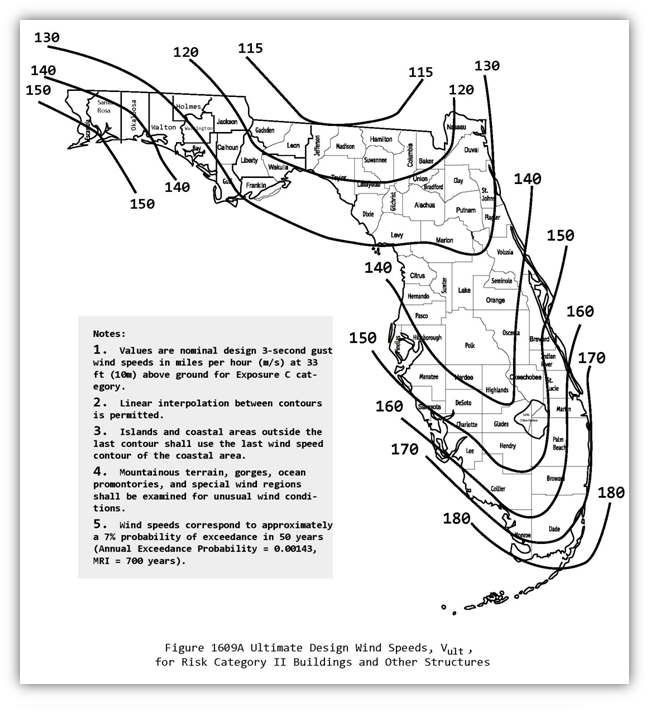
I’ve been watching weather channel since last night. I was surprised to hear their “experts” say it wouldn’t strengthen anymore while pressures were still falling. Now Michael is stronger today and pressures are still dropping. It’s crazy’s to think that based on the wind chart above some structures will not survive.
I keep losing my usernames. Formerly vertigoss/seanatsk.
Survived Ike in Katy, Harvey in Dickinson and Allison in my car.
Survived Ike in Katy, Harvey in Dickinson and Allison in my car.
-
Katdaddy

- Global Moderator

- Posts: 2502
- Joined: Thu Feb 04, 2010 8:18 am
- Location: League City, Tx
- Contact:
Hurricane Michael continues to strengthen just offshore. Up to 150MPH
Hurricane Michael Tropical Cyclone Update
NWS National Hurricane Center Miami FL AL142018
1030 AM CDT Wed Oct 10 2018
...MICHAEL STILL STRENGTHENING AS THE EYE NEARS THE COAST OF
THE FLORIDA PANHANDLE...
Data from an Air Force Reserve Hurricane Hunter aircraft indicate
that the maximum sustained winds have increased to near 150 mph
(240 km/h) with higher gusts. The aircraft also reported that the
minimum pressure has fallen to 923 mb (27.26 inches).
The Apalachicola airport recently reported a wind gust of 72 mph
(101 km/h).
Water levels continue to rise quickly along the coast of the Florida
Panhandle. A National Ocean Service water level station at
Apalachicola recently reported over 5 feet of inundation above
ground level.
SUMMARY OF 1030 AM CDT...1530 UTC...INFORMATION
-----------------------------------------------
LOCATION...29.5N 85.9W
ABOUT 50 MI...80 KM SSW OF PANAMA CITY FLORIDA
ABOUT 55 MI...90 KM WSW OF APALACHICOLA FLORIDA
MAXIMUM SUSTAINED WINDS...150 MPH...240 KM/H
PRESENT MOVEMENT...NNE OR 15 DEGREES AT 14 MPH...22 KM/H
MINIMUM CENTRAL PRESSURE...923 MB...27.26 INCHES
-
Texaspirate11

- Posts: 1278
- Joined: Tue Dec 31, 2013 12:24 am
- Contact:
Prayers to all who are in the path of this strong CAT 4 cane
Wont be surprised if he goes Cat 5 for a blip or two not that it matters
Panama City will be wracked - much like our Rockport and other cities by Harvey.
that some people are STILL there is always so mind numbing to me.
They've never experienced a Cat 4 before in this area and you can bet
responders will have to put their lives at risk to same some of them.
And in the end we will hear:
"I didn't think it would be this bad" or "I'll never do that again."
or "I stayed because of my pets"
So over it.
Michael will then go into Georgia as a Cat 2.
I wish all well.
Just because you're disabled, you don't have to be a victim
Be Weather Aware & Prepared!
Barbara Jordan Winner in Media
Disability Integration Consultant
Be Weather Aware & Prepared!
Barbara Jordan Winner in Media
Disability Integration Consultant
Good chance it's a cat 5 now with the pressures sub 920. Lots of folks didn't leave because they expected this to be "just a cat 2 or 3"
1 mph short of a CAT 5 (155 mph). Mexico Beach with devastating surge and damage.Texaspirate11 wrote:Prayers to all who are in the path of this strong CAT 4 cane
Wont be surprised if he goes Cat 5 for a blip or two not that it matters
Panama City will be wracked - much like our Rockport and other cities by Harvey.
that some people are STILL there is always so mind numbing to me.
They've never experienced a Cat 4 before in this area and you can bet
responders will have to put their lives at risk to same some of them.
And in the end we will hear:
"I didn't think it would be this bad" or "I'll never do that again."
or "I stayed because of my pets"
So over it.
Michael will then go into Georgia as a Cat 2.
I wish all well.
This upcoming front doesn’t really appear to be cooling off SETX very much according to the Euro. It has us at near normal or slightly above normal temps for next week.

-
Texaspirate11
- Posts: 1278
- Joined: Tue Dec 31, 2013 12:24 am
- Contact:
Devastating disaster - Mexico Beach.
One fatality so far.
I'm sure there will be more when all is said and done.
Very sad situation over there.
One fatality so far.
I'm sure there will be more when all is said and done.
Very sad situation over there.
Just because you're disabled, you don't have to be a victim
Be Weather Aware & Prepared!
Barbara Jordan Winner in Media
Disability Integration Consultant
Be Weather Aware & Prepared!
Barbara Jordan Winner in Media
Disability Integration Consultant


Michael is more intense than the most intense Texas hurricane, the 1886 Indianola Hurricane. It had a central pressure of 925 millibars. 
