
JUNE 2018: Drying Trend & Summer Heat Returns


Yeah, and looks like the convergence wall offshore has finally collapsed, and a new zone may be setting up along the Galveston Bay area. Needs to be monitored closely.
beaumont and now corpus. skipped Houston!

Looks like the “L” is near Laredo.
Could still see some rain tonight and tomorrow with some heating.
Could still see some rain tonight and tomorrow with some heating.
Don't speak too soon. Radar is trying to form-up another band on the east side...ticka1 wrote:beaumont and now corpus. skipped Houston!
Lightning strikes showing-up SE of Corpus...this is going to get really bad for them.
-
srainhoutx

- Site Admin

- Posts: 19616
- Joined: Tue Feb 02, 2010 2:32 pm
- Location: Maggie Valley, NC
- Contact:
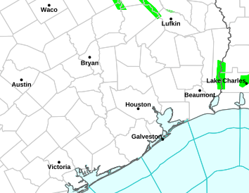
Watching the band nearing Bolivar this evening...

- Attachments
-
Carla/Alicia/Jerry(In The Eye)/Michelle/Charley/Ivan/Dennis/Katrina/Rita/Wilma/Humberto/Ike/Harvey
Member: National Weather Association
Facebook.com/Weather Infinity
Twitter @WeatherInfinity
Member: National Weather Association
Facebook.com/Weather Infinity
Twitter @WeatherInfinity
That eastern band over the Gulf really saved us today. It's terrible for the Golden triangle area, but it cutoff inflow and kept us in a dry moat of subsidence all day. There are really a few concerns to monitor overnight however:
* The convection out of over the Gulf is gone. It's wide open again for bands to form near the coast and move inland.
* The LLJ may get established over SE Texas tonight, setting-up a training band(s) beneath it.
* As the low/circulation has pivoted a bit to the W/SW today, it will change the orientation of the bands as they move onshore to stretch a little more SE to NW, instead of SSW to NNW. Basically, it will determine training patterns for any bands that setup. This small detail will become very important where any bands intersect the LLJ, as it will draw-out a lot of moisture in isolated locations, potentially like an open fire hydrant.
- 6-19-2018 11-13-15 PM.jpg (81.06 KiB) Viewed 3795 times
-
Andrew
- Site Admin
- Posts: 3440
- Joined: Wed Feb 03, 2010 9:46 pm
- Location: North-West Houston
- Contact:
Getting good low level moisture transport across a lot of SE Texas but not much lift currently. Might be hard to get much going until early morning at earliest.
For Your Infinite Source For All Things Weather Visit Our Facebook
waking up with hot coffee & the sound of cool rain on the roof - Dr, might you get some rain from the north ?

http://weather.cod.edu/satrad/exper/?pa ... colorbars=

http://weather.cod.edu/satrad/exper/?pa ... colorbars=
Area Forecast Discussion
National Weather Service Houston/Galveston TX
442 AM CDT Wed Jun 20 2018
.DISCUSSION...
The bulk of the rain this morning is focused west of the Interstate 45 corridor, with a line of showers associated with a leading edge of higher 850 MB moisture/speed convergence zone crossing the Interstate 10 corridor as of this writing. Will have to keep an eye on this initial round for a minor or street flooding threat through the morning commute as it moves across an area that experienced anywhere from 2 to nearly 5 inches of rain yesterday. Infrared satellite imagery trends have shown cloud tops warming since 4 AM CDT and expect rain rates to begin tapering off within this activity... but have noted backbuilding on the KHGX radar and this second round will bring additional rainfall to this area and aggravate minor flooding concerns.
Farther down the coast towards Corpus Christi, an expansive rain shield continues to bring periods of heavy rainfall to the Middle Texas coast. This second area of rain has already begun spreading into Jackson County early this morning as the parent mid-level low over the lower Texas coast wobbles early this morning. This will raise concerns for a secondary minor or potentially flash flood threat today as several rounds of rainfall wrap around the parent system and have issued a Flash Flood Watch for Jackson, Wharton, Matagorda, and Colorado counties for this potential. Widespread 1-2 inch rain amounts are expected in the watch area, but based on trends for this activity over the Gulf rainfall totals may approach or exceed 3-4 inches in a short period of time. Depending on trends with both the early morning activity along Interstate 10 and the rainfall expected to spread across the Matagorda Bay area, the Flash Flood Watch may need to be expanded eastward to capture any shifts in the flooding threat.
As an approaching mid/upper level trough crosses the Southern Plains later today, it is expected to begin to shear out the South Texas low and stretch it towards the northeast. While daytime heating will again contribute to scattered development through the day, this shearing of the low may result in a southwest to northeast oriented line of showers and thunderstorms to develop across the region and attempt to translate east as the northern stream system shifts towards the mid-Mississippi Valley. SPC HREF members, the HRRR, and TTU-WRF seems to be fairly consistent with at least some development consistent with the 500 MB shear axis, they differ in how quickly this band either moves out of the region or dissipates. Loss of forcing is expected to result in at least weakening of activity overnight tonight, but rain may exit or end sooner depending on the amplification of the Southern Plains trough later this afternoon and evening as it may be able to sweep this activity east. Similar to the watch area, forecast rain totals through the day are under 2 inches but locally higher totals nearing or exceeding 4 inches will be possible in heavier showers or thunderstorms.
A few showers or thunderstorms may linger into the morning hours on Thursday with rain chances Thursday afternoon through the end of the week centering around the potential for isolated showers and possibly a thunderstorm along the sea breeze. After a few days with highs in the 80s, temperatures are expected to rebound back into the lower 90s by this weekend.
Huffman
&&
.MARINE...
Will maintain the Small Craft Advisory beyond 20 nm offshore for winds early this morning and for elevated seas through early afternoon. The gradient will begin to weaken on this morning and onshore winds will begin to relax tonight into Friday night. Seas will be slower to diminish. Wind speeds are expected to increase again this weekend as low pressure develops in West Texas. Onshore winds will prevail into early next week.
Tides are still between 0.9 and 1.3 feet above astronomical levels and combined with rough surf will still cause some minor coastal flooding issues at high tide later this morning along the Bolivar Peninsula. Rip currents are likely to remain strong today as well. Will maintain the Beach Hazards Statement previously issued. 43
&&
.HYDROLOGY...
Impacts will be highly dependent on if/where any band(s) of training heavier rainfall set up. Some moderate rain fell over parts of the Lavaca-Navidad and Tres Palacios Rivers and these watersheds will need to be watched for potential flooding. 43
&&
.PRELIMINARY POINT TEMPS/POPS...
College Station (CLL) 87 74 91 75 96 / 70 50 50 10 10
Houston (IAH) 83 76 90 76 94 / 70 60 60 20 20
Galveston (GLS) 84 81 86 81 88 / 60 60 60 20 20
&&
.HGX WATCHES/WARNINGS/ADVISORIES...
TX... Flash Flood Watch through this evening for the following zones: Coastal Jackson... Coastal Matagorda... Colorado... Inland Jackson... Inland Matagorda... Matagorda Islands... Wharton.
GM... SMALL CRAFT SHOULD EXERCISE CAUTION through this evening for the following zones: Coastal waters from Freeport to Matagorda Ship Channel TX out 20 NM... Coastal waters from High Island to Freeport TX out 20 NM.
Small Craft Advisory until 10 AM CDT this morning for the following zones: Waters from Freeport to Matagorda Ship Channel TX from 20 to 60 NM... Waters from High Island to Freeport TX from 20 to 60 NM.
&&
$$
Discussion...14
Aviation/Marine/Hydrology...43

http://origin.wpc.ncep.noaa.gov/metwatc ... ch_mpd.php

MESOSCALE PRECIPITATION DISCUSSION 0333
NWS WEATHER PREDICTION CENTER COLLEGE PARK MD
331 AM EDT WED JUN 20 2018
AREAS AFFECTED...SOUTH-CENTRAL TX
CONCERNING... HEAVY RAINFALL... FLASH FLOODING LIKELY
VALID 200730Z - 201330Z
SUMMARY... ADDITIONAL HEAVY RAINFALL IS EXPECTED THIS MORNING WITH MORE FLASH FLOODING LIKELY.
DISCUSSION... THE LATEST 1-MINUTE GOES-16 CLEAN IR IMAGERY SHOWS SOME IMPRESSIVELY COLD CONVECTIVE TOPS OVER PORTIONS OF SOUTH-CENTRAL TO FAR SOUTH TX AND ALSO FOCUSED ALONG AND JUST OFFSHORE OF THE GULF COAST. RADAR CONFIRMS HEAVY RAINFALL WITH MOST OF THE ACTIVITY CURRENTLY SOUTH AND EAST OF THE GREATER CORPUS CHRISTIE AREA WHICH LOCALLY SAW VERY HEAVY RAINFALL TOTALS LAST EVENING.
THE HEAVY SHOWER AND THUNDERSTORM ACTIVITY HAS BEEN ATTEMPTING TO BECOME A BIT BETTER ORGANIZED AGAIN AROUND THE EASTERN FLANK OF THE PERSISTENT MID LEVEL LOW CENTER OVER SOUTH TX. THE CONVECTION HAS BEEN DEVELOPING ALONG A VERY FAVORABLE AXIS OF LOW LEVEL MOISTURE CONVERGENCE AND WITH PROXIMITY OF A NOSE OF 1000 TO 1500 J/KG OF MLCAPE JUST OFFSHORE.
THE PWATS ACROSS THE REGION AGAIN ARE VERY HIGH AND INDICATIVE OF A DEEP TROPICAL COLUMN WITH VALUES AS HIGH AS 2.5 INCHES. HIGHLY CONCENTRATED MOISTURE IS SEEN IN THE 500/300 MB LAYER AS PER CIRA-LPW DATA... AND THIS WILL FAVOR HIGHLY EFFICIENT RAINFALL PROCESSES FOR ENHANCED RAINFALL RATES THAT COULD EXCEED 3 INCHES/HR. THE DEEP CONVECTIVE ORGANIZATION WITH OCCASIONAL OVERSHOOTING TOPS WILL FURTHER ENCOURAGE EXTREMELY HEAVY RAINFALL RATE POTENTIAL.
THE LATEST RAP FORECASTS THE MID LEVEL LOW CENTER TO MOVE VERY LITTLE THROUGH MID MORNING WHICH WILL ALLOW MULTIPLE CYCLONIC CONVECTIVE BANDS TO TEND TO FOCUS OVER THE SAME AREA. CONSEQUENTLY... VERY HEAVY RAINFALL TOTALS ARE EXPECTED. IN FACT... THE LATEST HIRES GUIDANCE LED BY THE HRRR AND HRRRX SUGGEST AS MUCH AS AN ADDITIONAL 4 TO 6+ INCHES OF RAIN AT LEAST LOCALLY... WITH THE MAIN THREAT FOCUSED AROUND THE SOUTHERN AND EASTERN FLANKS OF THE CIRCULATION CENTER.
THESE ADDITIONAL RAINS WILL CAUSE FLASH FLOODING AND SOME OF IT MAY BE SIGNIFICANT GIVEN THE EARLIER HEAVY RAINFALL.
ORRISON
ATTN... WFO... BRO... CRP... EWX... HGX...
ATTN... RFC... WGRFC...
Last edited by unome on Wed Jun 20, 2018 5:36 am, edited 1 time in total.
our immediate area is between 2 MDT areas for Excessive Rainfall today
http://www.wpc.ncep.noaa.gov/#page=ero
(just our section)
...Texas to Louisiana...
The threat for flash flooding will continue, with the moderate risks where greater rainfall has occurred both in south Texas and near the TX/LA border. Between the moisture laden airmass (characterized by precipitable water values of 2.25 to 2.5 inches - three standard deviations above normal) and onshore low level flow on the order of 20 to 30 knots getting drawn underneath upper level divergence, pockets of heavy rain area are expected in coastal Texas and near the TX/LA border. A few high res runs still produce several inches of rain near or just north of the ongoing activity in south Texas.
The south Texas area is located just east of the 700-500 mb circulation inland over south Texas that is forecast to move little today into tonight. Strong boundary layer to 700 mb convergence focuses heavier rain in the coastal counties. The trough over the Plains is moving east so the approach of the trough advects the moisture north out of Texas across LA with widespread showers/storms developing in response. None of the models have multi-inch totals inland over LA so a slight risk is shown there.
-
srainhoutx
- Site Admin
- Posts: 19616
- Joined: Tue Feb 02, 2010 2:32 pm
- Location: Maggie Valley, NC
- Contact:
Flood Advisory
National Weather Service Houston/Galveston TX
730 AM CDT WED JUN 20 2018
Grimes TX-Montgomery TX-Houston TX-Madison TX-Waller TX-Walker TX-
Harris TX-
730 AM CDT WED JUN 20 2018
The National Weather Service in League City has issued a
* Flood Advisory for...
Eastern Grimes County in southeastern Texas...
Western Montgomery County in southeastern Texas...
Southwestern Houston County in southeastern Texas...
Eastern Madison County in southeastern Texas...
Northeastern Waller County in southeastern Texas...
Western Walker County in southeastern Texas...
Northwestern Harris County in southeastern Texas...
* Until 1030 AM CDT.
* At 729 AM CDT, Doppler radar and automated rain gauges indicated
heavy rain due to thunderstorms. This will cause minor flooding in
the advisory area. Up to three inches of rain have already fallen.
Additional rainfall is expected to move across portions of the
advisory area.
* Some locations that will experience flooding include...
Northwestern Huntsville, Tomball, Pinehurst, Hockley, Waller,
Magnolia, Montgomery, Stagecoach, Todd Mission, Crabbs Prairie,
Dobbin, Dacus, Plantersville and Richards.
Carla/Alicia/Jerry(In The Eye)/Michelle/Charley/Ivan/Dennis/Katrina/Rita/Wilma/Humberto/Ike/Harvey
Member: National Weather Association
Facebook.com/Weather Infinity
Twitter @WeatherInfinity
Member: National Weather Association
Facebook.com/Weather Infinity
Twitter @WeatherInfinity


-
srainhoutx
- Site Admin
- Posts: 19616
- Joined: Tue Feb 02, 2010 2:32 pm
- Location: Maggie Valley, NC
- Contact:
For our neighbors in Corpus and the Rio Grande Valley...Flash Flood Emergencies in Port Aransas and in S Texas from Mc Allen to Harlingen. Water Rescues underway in both of those areas. Weslaco in S Texas has been hit particularly hard.

Carla/Alicia/Jerry(In The Eye)/Michelle/Charley/Ivan/Dennis/Katrina/Rita/Wilma/Humberto/Ike/Harvey
Member: National Weather Association
Facebook.com/Weather Infinity
Twitter @WeatherInfinity
Member: National Weather Association
Facebook.com/Weather Infinity
Twitter @WeatherInfinity
-
- Information
-
Who is online
Users browsing this forum: Ahrefs [Bot], Bing [Bot], Semrush [Bot] and 9 guests