
JANUARY 2018 - Seasonal WX Week/Pacific Front Saturday
-
MontgomeryCoWx

- Posts: 2356
- Joined: Wed Dec 14, 2011 4:31 pm
- Location: Weimar, TX
- Contact:
Long range looks frigid if Pacific pattern and MJO hold... early february could be quite interesting.
Team #NeverSummer

Good!!MontgomeryCoWx wrote:Long range looks frigid if Pacific pattern and MJO hold... early february could be quite interesting.
-
Andrew
- Site Admin

- Posts: 3440
- Joined: Wed Feb 03, 2010 9:46 pm
- Location: North-West Houston
- Contact:
High level clouds are having trouble progressing eastward currently and you can really tell a difference. Temps from College Station southeastward have already dropped into the mid to upper 20s will west of there temps are still in the 30s. I suspect once clouds make it over the region in the next couple hours temps will stop falling but until then we could see a couple more degrees.
For Your Infinite Source For All Things Weather Visit Our Facebook

KHOU BLake wrote:College Station officially came in at 15° but according to the NWS, 1 mile south of College Station, the temperature dropped to 11°.
Wow - but I'm not entirely surprised - I don't have our temperature gauge intercede with a computer of recording equipment, but we were down to 16°F IMBY about 2:30 am. Some of the Wundermap contributors were recording lower temps by 2-3°F than the airport when I went to sleep.The airport is on raised ground at the edge of the Texas A&M campus, and can run a degree or two warmer than our house at night in the winter, which is on the outskirts of town, near woods and farms.
Much of the wild and grassy foliage is amazingly desiccated. Will have to keep this in mind if it warms and we're without significant rain.
However, our bushes lucked out as the thin layer of ice prevented damage during the frigid night. Not too thick to cause damage sure to weight, but not too thin.
Andrew wrote:High level clouds are having trouble progressing eastward currently and you can really tell a difference. Temps from College Station southeastward have already dropped into the mid to upper 20s will west of there temps are still in the 30s. I suspect once clouds make it over the region in the next couple hours temps will stop falling but until then we could see a couple more degrees.
Crystal clear skies here. If the clouds are thwarted, we're on our way to the mid-teens again. Dew point of 11°F and 21°F. currently. Ice remains on the roofs. A few indy weather stations reporting 17°F and 16°F out on the edges of town.
-
Andrew
- Site Admin
- Posts: 3440
- Joined: Wed Feb 03, 2010 9:46 pm
- Location: North-West Houston
- Contact:
TAMU MESONET already shows 19 degrees and it is dropping steadily. Boundary is still staying pretty well southwest of the region.DoctorMu wrote:Andrew wrote:High level clouds are having trouble progressing eastward currently and you can really tell a difference. Temps from College Station southeastward have already dropped into the mid to upper 20s will west of there temps are still in the 30s. I suspect once clouds make it over the region in the next couple hours temps will stop falling but until then we could see a couple more degrees.
Crystal clear skies here. If the clouds are thwarted, we're on our way to the mid-teens again. Dew point of 11°F and 21°F. currently. Ice remains on the roofs. A few indy weather stations reporting 17°F and 16°F out on the edges of town.
For Your Infinite Source For All Things Weather Visit Our Facebook
-
Katdaddy

- Global Moderator

- Posts: 2502
- Joined: Thu Feb 04, 2010 8:18 am
- Location: League City, Tx
- Contact:
Another cold morning across SE TX with temps in the 20s across most areas with some teens N of Houston metro and low 30s along the immediate coast. The warming trend begins today and we will be in the upper 60s to low 70s with showers and a few thunderstorms for the weekend.
TxDot shows only 4 areas of ice this morning N of downtown Houston. One area at 610 N and US-69 and 3 areas along the Beltway 8 N at US-69 and near I-45.
TxDot shows only 4 areas of ice this morning N of downtown Houston. One area at 610 N and US-69 and 3 areas along the Beltway 8 N at US-69 and near I-45.
- Attachments
-
- Screen Shot 2018-01-18 at 5.09.20 AM.png (177.58 KiB) Viewed 4223 times
ice locations changed already, be sure to check for the most recent info
exit ramp to Grand Parkway closed in both directions, per Message Signs on map
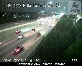
http://traffic.houstontranstar.org/road ... eonroadway
http://traffic.houstontranstar.org/laye ... e&nmd=true
exit ramp to Grand Parkway closed in both directions, per Message Signs on map
http://traffic.houstontranstar.org/road ... eonroadway
http://traffic.houstontranstar.org/laye ... e&nmd=true
I'm currently showing 18 degrees at my house which is colder than yesterday of 19...crazy brrrrr....

-
WWxHopeful
- Posts: 11
- Joined: Wed Dec 20, 2017 3:26 pm
- Contact:
Katdaddy wrote:Another cold morning across SE TX with temps in the 20s across most areas with some teens N of Houston metro and low 30s along the immediate coast. The warming trend begins today and we will be in the upper 60s to low 70s with showers and a few thunderstorms for the weekend.
TxDot shows only 4 areas of ice this morning N of downtown Houston. One area at 610 N and US-69 and 3 areas along the Beltway 8 N at US-69 and near I-45.
I drove to the Cypress Park and Ride this morning- the east side of the parking garage was leaking water so the side street (Skinner Rd.) was a skating rink.
The buses still cannot use the HOV lanes and my commute downtown was about 20 mins more than normal.
Downtown streets (most receive little to no direct sunlight) are salted and sanded, but still heavily iced over and horrible for pedestrians.
-
srainhoutx

- Site Admin
- Posts: 19616
- Joined: Tue Feb 02, 2010 2:32 pm
- Location: Maggie Valley, NC
- Contact:
Went from 23F at 1:00 to 28F at 7:00 AM with the blanket of clouds moving in earlier than expected in NW Harris County. Could see temperatures struggle to reach 40F today for some areas. Enjoy the warmth coming because it may be a distant memory come early February.
Carla/Alicia/Jerry(In The Eye)/Michelle/Charley/Ivan/Dennis/Katrina/Rita/Wilma/Humberto/Ike/Harvey
Member: National Weather Association
Facebook.com/Weather Infinity
Twitter @WeatherInfinity
Member: National Weather Association
Facebook.com/Weather Infinity
Twitter @WeatherInfinity
-
vci_guy2003
- Posts: 203
- Joined: Mon Jun 28, 2010 4:04 am
- Contact:
What do the models tell us for early Feb?
-
srainhoutx
- Site Admin
- Posts: 19616
- Joined: Tue Feb 02, 2010 2:32 pm
- Location: Maggie Valley, NC
- Contact:
Way too soon to know the finer details in a highly volatile pattern for the Global Models to resolve over the next 10+ Days. The Day 11 CPC GEFS Super Ensemble Blend suggests a huge blocking pattern across the Artic into the N Pacific with a trough in the West into the Plains and warm along the East Coast. The upcoming pattern looks very progressive with a couple of storm systems bringing quick shots of cold air around the 27th of January and just beyond. I believe that much of that very cold air currently over Siberia will begin to cross the Arctic Circle and build across Alaska and Canada in the next 10 days or so. We will look at things a bit closer next week and see what our sensible weather may bring toward the end of January and the first half of February.vci_guy2003 wrote:What do the models tell us for early Feb?
- Attachments
-
Carla/Alicia/Jerry(In The Eye)/Michelle/Charley/Ivan/Dennis/Katrina/Rita/Wilma/Humberto/Ike/Harvey
Member: National Weather Association
Facebook.com/Weather Infinity
Twitter @WeatherInfinity
Member: National Weather Association
Facebook.com/Weather Infinity
Twitter @WeatherInfinity
-
tireman4

- Global Moderator
- Posts: 4488
- Joined: Wed Feb 03, 2010 9:24 pm
- Location: Humble, Texas
- Contact:
Yep, I heard that too. Just like Dan Meador used to say, once that door is opened, it is just the prairie lands between Canada and us..LOLsrainhoutx wrote:Went from 23F at 1:00 to 28F at 7:00 AM with the blanket of clouds moving in earlier than expected in NW Harris County. Could see temperatures struggle to reach 40F today for some areas. Enjoy the warmth coming because it may be a distant memory come early February.
-
MontgomeryCoWx
- Posts: 2356
- Joined: Wed Dec 14, 2011 4:31 pm
- Location: Weimar, TX
- Contact:
Dirt, tumbleweeds and barbed wire....tireman4 wrote:Yep, I heard that too. Just like Dan Meador used to say, once that door is opened, it is just the prairie lands between Canada and us..LOLsrainhoutx wrote:Went from 23F at 1:00 to 28F at 7:00 AM with the blanket of clouds moving in earlier than expected in NW Harris County. Could see temperatures struggle to reach 40F today for some areas. Enjoy the warmth coming because it may be a distant memory come early February.
Team #NeverSummer
-
WWxHopeful
- Posts: 11
- Joined: Wed Dec 20, 2017 3:26 pm
- Contact:
anyone else see some precip across the near Eagle Pass starting to form?

WWxHopeful wrote:anyone else see some precip across the near Eagle Pass starting to form?
Haven't received any word whether precipitation is actually making it to the ground, but my hunch is that it is not. While the upper levels are more moist, the middle and lower levels look too dry for anything to make it all the way to the surface.
Blake
Boomer Sooner
Boomer Sooner
CIRA Slider has low, mid & upper level wv, bands 10, 9 & 8 http://rammb-slider.cira.colostate.edu
Area Forecast Discussion
National Weather Service Austin/San Antonio TX
1135 AM CST Thu Jan 18 2018
.MORNING UPDATE...(SEE BELOW FOR AVIATION DISCUSSION)
Some light echoes persist late this morning across the Rio Grande plains into the southern Edwards Plateau. Reports from earlier indicated a mixture of light rain and sleet near Del Rio. As temperatures continue to slowly warm this afternoon, suspect we will see only light sprinkles. While the mid- level cyclonic circulation centered over northern Coahuila will provide some lift, the atmosphere is very dry and we expect only sprinkles to reach the ground. Otherwise, we have adjusted the winds, dew points and cloud cover to account for recent observational trends.