April 2017 - MS 150 Forecast This Weekend
- tireman4
- Global Moderator

- Posts: 4500
- Joined: Wed Feb 03, 2010 9:24 pm
- Location: Humble, Texas
- Contact:
XUS64 KHGX 061730
AFDHGX
Area Forecast Discussion
National Weather Service Houston/Galveston TX
1230 PM CDT Thu Apr 6 2017
.AVIATION...
VFR.
Hathaway
&&
.PREV DISCUSSION... /ISSUED 926 AM CDT Thu Apr 6 2017/
UPDATE...
High pressure was ridging over SE Texas this morning. Did some
tweaks but the current forecast is on track.
40
PREV DISCUSSION... /ISSUED 315 AM CDT Thu Apr 6 2017/
DISCUSSION...
Chamber of Commerce weather through the weekend, but changes to
come early next week with a rain in the Monday-Tuesday timeframe.
Unsettled weather may continue deeper into the week, but
confidence is lower in that idea at this time.
SHORT and MEDIUM TERM [Today Through Sunday]...
Not much to say about the first half of the forecast as ridging
is in control. Clear skies, temperatures slowly warming into the
low 80s, and winds becoming onshore tomorrow as the surface high
drifts east of the area. The next night or two might be on the
slightly chillier than normal side thanks to the lack of humidity,
but even that will fade once moisture begins to return with the
onshore winds. While the low humidity might catch some fire
weather eyes, light winds should mitigate the threat (more on that
below). Looking to the end of the weekend, there might be enough
moisture return (precipitable water increasing above 1 inch) that
diurnal warming and coastal convergence might help us squeeze out
some showers late Sunday afternoon/early evening. Not really sure
if that`s a realistic possibility, or if I`m just stretching to
find something to discuss.
LONG TERM [Monday Through Thursday]...
Things finally begin to change Monday as an upper trough rolls
across the mid-continent, fueling a surface low far, far to our
north. However, despite the northward track of the main low, the
tail end of its cold front should drag down into Texas,
approaching our area Monday. Depending on your chosen model,
either the southernmost extent of the main upper trough or a
separate southern stream shortwave moving across Texas will help
power the front into Southeast Texas before washing out Tuesday as
the upper support moves on. Either way, rain looks like a solid
bet in this window. Given how much disagreement the GFS and Euro
had two days ago, they`re in surprising agreement tonight.
Though confidence in the big picture is increased, there are a
couple things that remain not quite so certain about early next
week. One question is how much rain will actually fall. The GFS is
now suddenly pretty gung ho on a good bit of rain on the front
(and is joined by a much wetter ensemble set from the GEFS). The
Euro, if anything, is drier than before, but not nearly as dry as
the GFS used to be. WPC QPF for this event ranges from about an
inch near the coast to over three inches on a College Station to
Crockett line. A little concerned that there might be some
feedback issues in the GFS may be spinning things up a bit too
hard, but we`ve got some time to nail this down yet. Additionally,
there`s considerable uncertainty about severe potential. As it`s
currently constituted, everything phases together enough that
there`d be some non-zero severe potential Monday afternoon, at
least way up at the northern end of our area of responsibility,
but with the main trough in the Upper Midwest heading
northeastward, everything would really have to come together just
perfectly to realize that. So, at this point, rain amounts in the
northwest would be a bigger concern than severe potential - but
this far out, the prudent move across the area is to monitor the
forecast for any changes in the coming days.
MARINE... Weakening north to northeast winds and lowering seas
today. All caution flags should be gone by noon. Onshore flow
resumes on Friday and strengthens over the weekend with caution
flags anticipated. 42
FIRE WEATHER...
Humidities are expected to drop into the 20s this afternoon, but winds
will be very light (around 5 mph or less). Winds on Friday increase a bit
(5 to 10 mph) as they swing back around to the southeast, and humidities
also increasing into the upper 20s to lower 30s. 42
&&
.PRELIMINARY POINT TEMPS/POPS...
College Station (CLL) 78 50 80 56 83 / 0 0 0 0 0
Houston (IAH) 80 52 79 57 81 / 0 0 0 0 0
Galveston (GLS) 75 63 74 67 76 / 0 0 0 0 0
&&
.HGX WATCHES/WARNINGS/ADVISORIES...
TX...NONE.
GM...NONE.
&&
$$
Aviation/Marine...08
The Colorado State University April 2017 Hurricane Forecast.
http://webcms.colostate.edu/tropical/me ... 017-04.pdf
Looks to be somewhat below normal to normal.
http://webcms.colostate.edu/tropical/me ... 017-04.pdf
Looks to be somewhat below normal to normal.
- srainhoutx
- Site Admin

- Posts: 19616
- Joined: Tue Feb 02, 2010 2:32 pm
- Location: Maggie Valley, NC
- Contact:
The overnight guidance suggests a stalling frontal boundary across the Hill Country combined with several upper air disturbances riding the Southern branch of a split flow across the United States and increasing mid/upper level moisture from a noisy sub tropical jet from the Eastern Pacific may bring rounds of showers and storms across portions of the Lone Star State beginning Monday afternoon possibly continuing throughout the coming work week.
A brief note about the information we are receiving at the 2017 National Tropical Weather Conference. While the early indications suggest a slightly less active Hurricane Season, it is also noteworthy that we along the Western and Northwestern Gulf Coast cannot let our guard down. The Western Atlantic Basin historically does not behave like the deep tropics. Our Western and NW Gulf of Mexico sea surface temperatures are unusually warm this year and there is always a possibility of tropical mischief spinning up closer to our backyard if the right atmospheric conditions develop. History has shown us that we can see tropical mischief spin up quickly, sometimes very close to our Coast with little warning and advance lead time to prepare. Dr. Phil Klotzbach stated that he believes 1957 may be a top analog year. Also those of us that remember Hurricane Alicia occurred in a very inactive Hurricane Season.
Many new products will be coming this season as part of the official National Hurricane Center Watch/Warning Products and an Experimental Watch/Warning Product of Tropical Disturbances that may develop close to the Coastal Areas that have not been Officially declared a Tropical Depression, Tropical Storm or Hurricane. In the days ahead we will begin to focus on all the new products/graphics that will officially begin this Hurricane Season and the Experimental Graphics coming from the NHC and our Local Coastal National Weather Service Offices.
Carla/Alicia/Jerry(In The Eye)/Michelle/Charley/Ivan/Dennis/Katrina/Rita/Wilma/Humberto/Ike/Harvey
Member: National Weather Association
Facebook.com/Weather Infinity
Twitter @WeatherInfinity
Member: National Weather Association
Facebook.com/Weather Infinity
Twitter @WeatherInfinity

.PREV DISCUSSION... /ISSUED 349 PM CDT Fri Apr 7 2017/
DISCUSSION...
As the high currently over SE TX moves off to the east, we should
start to see a more southeasterly low-level flow develop tonight/
tomorrow. This onshore flow is expected to persist on through the
weekend along with a slightly flattened upper ridge. This combination
should make for warmer temperatures/slowly increasing humidities
this weekend. No POPS expected as the airmass remains rather dry.
Looking ahead, models are continuing to indicate a more active
weather period starting Mon...then peaking early Tues with some
lingering stuff on Weds. All of this appears to be associated
with a slow moving cold front from the NW which is progged to
stall over SE TX/near the upper TX coast before moving back up
north/washing out. Best dynamics should be well north of the area
(near the main upper low) but the increased POPS (and clouds) may
help in cooling temps a few degrees during this timeframe. 41
- srainhoutx
- Site Admin

- Posts: 19616
- Joined: Tue Feb 02, 2010 2:32 pm
- Location: Maggie Valley, NC
- Contact:
Sunday afternoon briefing from Jeff:
An active upper level weather pattern will return to the southern plains this week.
Upper level winds will become increasingly WSW/SW this week ushering in several disturbances in this flow each of which will have the potential to produce a round of showers and thunderstorms. Low level moisture is increasing over the region, but thus far daily mixing out of the moisture has occurred and dewpoints have been slow to rise even though winds have been onshore since Friday. Should begin to see better quality moisture move into the region late tonight into Monday.
A surface cool front will move into C TX tonight and likely stall somewhere along a line from NW of Del Rio to N of Austin to N of Fort Polk, LA and this boundary as well as the air mass south of this boundary looks primed for convective development on Monday. Overall models are not in great agreement on how, when, and where showers and thunderstorms will develop on Monday with some showing showers lifting northward from the Matagorda Bay region early in the day and then growing into strong to even severe thunderstorms across C TX into our W/NW counties Monday afternoon and evening. Others show more development further NW across the Hill Country closer to the stalled frontal boundary. One item that appears clear is the potential for mesoscale processes to drive the convective evolution which makes the forecast moving forward difficult.
Will side with the drier models over SE TX for Monday keeping the development of showers and thunderstorms across C TX and then into our W/NW counties tomorrow afternoon into the overnight. We will have to closely watch for any sustained convective development that could result in a developing cold pool which would then force more organized convection deeper into SE TX late Monday night into Tuesday morning.
Showers and thunderstorms will be possible again on Tuesday and even Wednesday, but much will depend on the previous day’s developments and how that activity may impact the local air mass with any sort of outflow boundaries. Forecast confidence this week is lower than average.
For now will focus the heavy rainfall/flash flooding and severe threat across C TX. Could certainly see our W/NW Counties or roughly NW of a line from Columbus to Huntsville get into a heavy rainfall/sever threat Monday evening into the overnight hours especially if any sort of meso boundary is laid down in that area. Latest TX TECH WRF is suggesting something along those lines showing winds ENE at CLL Monday evening behind a possible outflow boundary.
Day 2 (Monday) Severe Weather Outlook: 72-hr Forecast Rainfall Amounts (QPF): [/i]
Carla/Alicia/Jerry(In The Eye)/Michelle/Charley/Ivan/Dennis/Katrina/Rita/Wilma/Humberto/Ike/Harvey
Member: National Weather Association
Facebook.com/Weather Infinity
Twitter @WeatherInfinity
Member: National Weather Association
Facebook.com/Weather Infinity
Twitter @WeatherInfinity
CAPE and shear are pretty low. Most of the action will be College Station and particularly Hearne and north. The front should clear CLL late Monday night. I'd take an inch+ of rain. We could use it.
GFS appears pretty locked in on rainfall and localization:

GFS appears pretty locked in on rainfall and localization:

- Katdaddy
- Global Moderator

- Posts: 2502
- Joined: Thu Feb 04, 2010 8:18 am
- Location: League City, Tx
- Contact:
After several days of calm beautiful SE TX weather the pattern becomes more active with thunderstorm chances increasing this afternoon through Tuesday. The SPC also has a large Slight Risk area from Central TX to NE TX for Tuesday.
- Attachments
-
- Screen Shot 2017-04-10 at 5.36.04 AM.png (14.36 KiB) Viewed 4081 times
- srainhoutx
- Site Admin

- Posts: 19616
- Joined: Tue Feb 02, 2010 2:32 pm
- Location: Maggie Valley, NC
- Contact:
Monday morning briefing from Jeff:
Ingredients appear to be coming together to produce a heavy rainfall and potential flash flood event across mainly C TX late today into Tuesday.
Moisture levels have certainly increased over the last 24 hours as a weak cool front has progressed into the northern TX Hill Country and is in the process of stalling. Aloft a trough of low pressure is approaching from the west which will help to activate the frontal boundary with convection later this morning.
While the general model consensus has been to develop and anchor deep convection with favorable heavy rainfall parameters across C TX this afternoon and tonight, some of the latest guidance is suggesting, as stated yesterday, that a cold pool may develop and progress the convection deeper into SE TX. In fact some of the models now even move slow moving convection all the way to the coast which is a large difference from 24 hours ago. Parameters certainly appear in place by late this afternoon to support the development of deep convection from C to NE TX and this development may occur across or move into our W/NW counties from Columbus to Huntsville early this evening. Low level moist inflow feed along with a very slow moving or possible stalled frontal boundary and very high PWS air mass supports a flash flood risk tonight from C into NE TX including our W/NW counties. Rainfall amounts of 1-3 inches with isolated totals of 5-7 inches will be possible and even higher amounts may occur where sustained cell training develops.
Main question this morning is how far south this activity will move overnight. Latest high resolution guidance suggests a greater potential for organized activity to move deeper into SE TX than expected yesterday which could bring the heavy rainfall and flash flooding threat further south across the area. The development of this new trend appears to be tied to the more organized nature of the convection this evening which promotes good cold pool formation and the forcing of convection southward on outflow boundaries overnight. Effectively the outflow boundaries are being driven southward and adding a surface focus for convective development. We have seen this many times before across SE TX where developments to our NW become our problems even when models want to keep the activity to our NW.
Given the mesoscale nature of how convection may unfold, the confidence of where and how much rain may fall across the area is low. Should sustained slow moving convection enter deeper into SE TX than currently forecast rainfall totals will need to be significantly increased and flash flooding would be possible.
Air mass will become fairly unstable by mid to late afternoon with 2000 J/kg of CAPE across the region and expect that a few storms especially early this afternoon into the evening hours could become severe before the threat transitions to a heavy rainfall event overnight. The severe threat area is general in the same region as the heavy rainfall potential currently or along and NW of a line from Columbus to Huntsville.
Hydro:
Forecast QPF through Tuesday is fairly high across the middle Brazos, middle Trinity, and middle Colorado basins and the entire Navasota basin. Rainfall of this magnitude will likely result in rises to near flood stage on the mainstem rivers if it verifies and isolated higher amounts over certain basins could push levels above flood stage. The position of the heavy rainfall axis just N/NW of SE TX is cause for concern as run-off will move downstream.
72 hr QPF: Day 1 (Today) Severe Weather Outlook: [/i]
Carla/Alicia/Jerry(In The Eye)/Michelle/Charley/Ivan/Dennis/Katrina/Rita/Wilma/Humberto/Ike/Harvey
Member: National Weather Association
Facebook.com/Weather Infinity
Twitter @WeatherInfinity
Member: National Weather Association
Facebook.com/Weather Infinity
Twitter @WeatherInfinity
Yep. The 06Z GPS has slid the heavy precip. band SE and CAPE is much higher than predicted yesterday. Feast or famine in Texas. Be prepared for either at all times around here!


- srainhoutx
- Site Admin

- Posts: 19616
- Joined: Tue Feb 02, 2010 2:32 pm
- Location: Maggie Valley, NC
- Contact:
URGENT - IMMEDIATE BROADCAST REQUESTED
Flood Watch
National Weather Service Houston/Galveston TX
244 PM CDT Mon Apr 10 2017
Brazos-Burleson-Grimes-Houston-Madison-Trinity-Walker-Washington-
Including the cities of Brenham, Bryan, Caldwell,
College Station, Crockett, Groveton, Huntsville, Lake Somerville,
Madisonville, Navasota, and Trinity
244 PM CDT Mon Apr 10 2017
...FLASH FLOOD WATCH IN EFFECT THROUGH TUESDAY MORNING...
The National Weather Service in Houston/Galveston has issued a
* Flash Flood Watch for a portion of southeast Texas...including
the following counties...Brazos...Burleson...Grimes...
Houston...Madison...Trinity...Walker and Washington.
* Through Tuesday morning
* A line of storms may develop along a slow moving cold front this
evening and tonight. Storm motions will be slow and combined
with high moisture in the atmosphere storms will be capable of
producing heavy rainfall in a short periods of time. Rainfall
amounts of 2 to 3 inches will be possible in the watch area with
the potential for higher amounts of 4 to 6 inches. These higher
rainfall amounts could lead to flash flooding.
* Flash flooding will be possible from any storms that produce
heavy rainfall. This includes water rapidly rising in roads with
poor drainage, rising waters on area creeks, bayous and rivers
due to runoff. Flood waters could damage bridges over streams
impeding travel. Flooding could impact homes in low lying areas.
Flooding will likely be at night in which visibility will be
restricted. Do not drive into any water at night.
PRECAUTIONARY/PREPAREDNESS ACTIONS...
A Flash Flood Watch means that conditions may develop that lead
to flash flooding. Flash flooding is a very dangerous situation.
You should monitor later forecasts and be prepared to take action
should Flash Flood Warnings be issued.
Carla/Alicia/Jerry(In The Eye)/Michelle/Charley/Ivan/Dennis/Katrina/Rita/Wilma/Humberto/Ike/Harvey
Member: National Weather Association
Facebook.com/Weather Infinity
Twitter @WeatherInfinity
Member: National Weather Association
Facebook.com/Weather Infinity
Twitter @WeatherInfinity
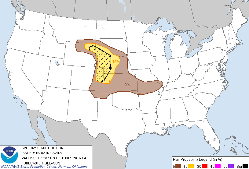
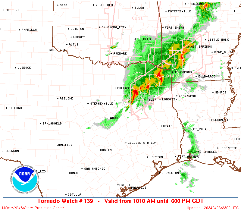
Slight chance of severe storms expanded and flood watch as Jason and rain posted in effect for NW counties...skies look threatening - plenty of moisture


I hope this can form into a MCS with a nice cold pool so it can push this way...it's about time for some more rain.
We need it too, Jason. Supposedly, that action will start around 8 pm around a Bastrop to CLL to Madisonville line...we'll see.jasons wrote:I hope this can form into a MCS with a nice cold pool so it can push this way...it's about time for some more rain.
A broken line of storms lurks around Killeen and Waco. Expected contact more like 3 am than earlier as originally thought. I'm becoming more suspicious...

Area Forecast Discussion
National Weather Service Houston/Galveston TX
1022 PM CDT Mon Apr 10 2017
.UPDATE...
A challenging forecast continues to unfold for Southeast Texas
this evening with surface analysis showing a nearly stationary
cold front draped north and west of the region (roughly along a
Dryden- Lampasas- Mount Pleasant line). Regional radar mosaic
shows thunderstorms continuing to develop and intensify along this
line, possibly aided by upper level lift from a disturbance
lifting into West Texas from New Mexico. With these aforementioned
features remaining well removed from the region and aircraft
soundings out of Houston showing a persistent capping inversion
around 700 mb, shower and thunderstorm activity near the region
diminished with loss of heating earlier this evening and has
remained minimal. Have lowered rain chances and rain totals
through the remainder of the evening as a result. Other changes to
the forecast include updating temperatures and dew points based on
hourly trends with overnight lows in the 60s to near 70 under
mostly cloudy skies.
Convective evolution for the overnight period and through most of
the day Tuesday still contains considerable uncertainty. High
resolution guidance has been indicating that the disturbance over
West Texas may provide enough lift to allow thunderstorms along
the front to grow upscale and generate a strong enough cold pool
to allow this complex to propagate away from the front and into
Central or Southeast Texas tonight and into tomorrow morning.
However, this guidance continues to struggle with placement and
timing of this feature... likely owing to the presence of the
strong cap in place across Southeast Texas. Were this system to
develop, anticipate it to lose much of its intensity during the
early morning hours as it approaches the Interstate 10 corridor
as a result of the cap in place.
The frontal boundary north of the region is not expected to make
much southward progress overnight, but maintaining the Flash Flood
Watch in place across the northern two tiers of counties given the
potential for activity along the stalled frontal boundary to move
off of the boundary. Environmental conditions still remain very
favorable for a flash flood threat to materialize across these
areas (SPC Mesoanalysis showing precipitable water values across
the Flash Flood Watch area 1.5-1.7 inches), but the focusing
mechanism for thunderstorms capable of heavy rain development is
still uncertain at this time with the front still north of the
region and any potential thunderstorm complexes having not yet
developed.
With the disturbance over West Texas reaching East Texas sometime
during the day tomorrow (possibly as late as tomorrow afternoon),
the stalled frontal boundary should receive enough of a push to
move into the region. This would result in another round of shower
and thunderstorm development (especially if the front were able to
move through late enough in the day to take advantage of any
destabilization from diurnal heating) but timing for this
potential round remains uncertain at best... sometime Tuesday
morning or later, depending on the speed of the disturbance.
Drenching now is uncertain. Hope this is not be a bust.
-
- Information
-
Who is online
Users browsing this forum: Ahrefs [Bot], Cpv17, Semrush [Bot] and 7 guests

