
February 2017- Spring Like Weather Returns
-
srainhoutx

- Site Admin

- Posts: 19616
- Joined: Tue Feb 02, 2010 2:32 pm
- Location: Maggie Valley, NC
- Contact:
We will need to monitor the trends beginning late this weekend into early next week for the potential of a potent closed upper low to our WSW over Northern Mexico. Typically in a warm air pattern unsettled and potentially stormy weather may be possible for many across Texas.
- Attachments
-
-
-
Carla/Alicia/Jerry(In The Eye)/Michelle/Charley/Ivan/Dennis/Katrina/Rita/Wilma/Humberto/Ike/Harvey
Member: National Weather Association
Facebook.com/Weather Infinity
Twitter @WeatherInfinity
Member: National Weather Association
Facebook.com/Weather Infinity
Twitter @WeatherInfinity
-
srainhoutx
- Site Admin
- Posts: 19616
- Joined: Tue Feb 02, 2010 2:32 pm
- Location: Maggie Valley, NC
- Contact:
Tuesday morning briefing from Jeff:
Record warmth will encompass the region over the next 2 days.
It has been hot and it will continue to be well above normal. Current temperature at IAH is 72 which is about 8 degrees warmer than the average high temperature. Weak dry line feature will progress across SE TX later this morning helping to scour out low level moisture and veer winds to the SW and WSW which is a very warm wind for the area. Once skies begin to scattered out and given the already very warm start, expect temperatures to rise easily into the low or even mid 80’s which would set new records at many stations.
Will go even warmer on Wednesday with a longer duration of SW winds helping to accelerate the warm up. GFS is showing 86 for IAH and 87 for Victoria Wednesday which seem reasonable and will shatter daily records.
Weak cool front will pass across the region Wednesday evening helping to knock temperatures at least below record values, but it will remain warm and above average into early next week with highs in the 70’s and lows in the 50’s. Strong return flow establishes this weekend as the central US ridging begins to break down ahead of a deepening trough off the US west coast. This trough looks to dig into the SW US allowing a prolonged period of moist SW flow aloft across TX late this weekend into the middle of next week. Showers and thunderstorms will return to the forecast as early as Sunday and likely linger into potentially Tuesday or Wednesday of next week.
GFS is hinting at a fairly strong frontal passage with this system toward the middle of next week with much colder air moving southward into the state.
Carla/Alicia/Jerry(In The Eye)/Michelle/Charley/Ivan/Dennis/Katrina/Rita/Wilma/Humberto/Ike/Harvey
Member: National Weather Association
Facebook.com/Weather Infinity
Twitter @WeatherInfinity
Member: National Weather Association
Facebook.com/Weather Infinity
Twitter @WeatherInfinity
Personally, I think the groundhog is on crack....lol
Speaking of the groundhog, here is a good article showing just how accurate (and inaccurate) he is.snowman65 wrote:Personally, I think the groundhog is on crack....lol
http://www.livescience.com/49665-ground ... tions.html
I just cant begin to describe my excitement of mid 80s in February leading up to months of 90-100 degree blast furnace weather. Im hoping things get their act together and keep us unseasonally cool/cold in March and April.
-
jojotheidiotclown
- Posts: 46
- Joined: Wed Apr 25, 2012 4:01 pm
- Contact:
For all that is holy...... please continue this glorious warm weather!! I wouldn't mind hotter stuff. 90's in Feb? Sweet baby jesus!

Some nice dry air filtered into CLL about 9:30 am and we've had a pleasant, if warm day. Cool tonight before a southerly return flow begins again. A rapid warm-up tomorrow before a wind shift about 2 pm...then more seasonable.
Lookout for the weekend unfortunately has flipped to very warm and potentially rainy. Back to April weather!
Lookout for the weekend unfortunately has flipped to very warm and potentially rainy. Back to April weather!
-
Katdaddy

- Global Moderator

- Posts: 2502
- Joined: Thu Feb 04, 2010 8:18 am
- Location: League City, Tx
- Contact:
Another day of record high temps across SE TX with mid to upper 80s. Expect daily record highs to be surpassed today and could approach all time February highs at Intercontinental and Hobby this afternoon.
IAH all time Feb high is 91F set in 1986
HOU all time Feb high is 89 set in 1940
Areas of dense fog along the Upper TX Coast will lift later this morning. Tonight's cool front will drop high temps down a little into the low to mid 70s for the rest of the week but remain above normal. Temps warm again for the weekend with increasing moisture off the GOM leading to some showers.
-
redneckweather
- Posts: 1023
- Joined: Mon Feb 08, 2010 7:29 pm
- Location: Montgomery, Texas
- Contact:
Weeds are sprouting, birds are chirping, jasmine is in full bloom and no decent cold air in sight. Folks, Spring has definitely sprung. I will be wearing flip flops and shorts into the office today. Winter is GONE.
-
srainhoutx
- Site Admin
- Posts: 19616
- Joined: Tue Feb 02, 2010 2:32 pm
- Location: Maggie Valley, NC
- Contact:
Wednesday morning briefing from Jeff:
Another day of record heat across the region.
Record highs fell yesterday at each of the four major climate sites across SE TX as well as Victoria, Corpus, and Austin. The temperature at BUSH IAH rose to 86 and Corpus to 92 shattering the previous daily records. Galveston reached 80 degrees yesterday which is the earliest 80 degrees day on record…previous record was Feb 21, 1993.
Starting out about 3 degrees warmer this morning and with similar conditions expected today as boundary layer SW winds develop over the area, expect temperatures to soar into the mid to upper 80’s. Would not be surprised to see a few 90 degree readings especially across Jackson, Wharton, and Colorado Counties. Coastal counties may end up staying in the mid 70’s depending on how quickly the sea fog retreats…it is odd to have dense sea fog with a SW wind profile, but the air mass is humid enough and the shelf waters cold enough to perform.
Cold front will cross the region tonight ending the record heat, but above average temperatures will continue into the weekend as southerly winds quickly return on Friday. Will only knock down highs into the 70’s post front with lows in the 40’s and 50’s tomorrow morning…then as southerly winds return will be back into the 60’s for lows and highs near 80 this weekend.
A storm system will drop into the SW US over the weekend and cut-off from the main flow aloft before opening and crossing the southern plains early to mid next week. Moisture levels will deepen ahead of this feature over the weekend and by Sunday expect to have enough moisture in place to produce a few showers moving inland off the Gulf of Mexico. Rain chances greatly increase Monday and Tuesday as a cool front will combine with plentiful moisture and increasing lift from the US SW storm system to produce numerous showers and thunderstorms. Still some timing differences on exactly when the best rain chances will be…but the system looks wet and there is some potential for some strong storms.
SE Louisiana Tornado Outbreak:
A swarm of supercells produced at least 7 tornadoes yesterday across SE LA and the eastern portion of the City of New Orleans. The most damaging of the tornadoes moved inland from Lake Ponchartrain and tracked across the highly populated New Orleans East and lower 9th ward areas producing significant damage. Early estimates from both video and initial damage assessments indicate the tornado was likely a high end EF2 (winds around 150mph) and at times nearly ½ mile wide with a track length of at least 2 miles. 30 persons were injured, but surprisingly there were no fatalities given the intensity of such a tornado across a large urban landscape.
It is fairly rare to see a tornado of this size and magnitude this far south in the US.
Carla/Alicia/Jerry(In The Eye)/Michelle/Charley/Ivan/Dennis/Katrina/Rita/Wilma/Humberto/Ike/Harvey
Member: National Weather Association
Facebook.com/Weather Infinity
Twitter @WeatherInfinity
Member: National Weather Association
Facebook.com/Weather Infinity
Twitter @WeatherInfinity
Today a clone of yesterday. Humid, followed by tanking dew point and drier, warm air with NW wind.
More seasonable for couple days, then a rain mode for a few days. Warm weekend, then seasonable early next week.
More seasonable for couple days, then a rain mode for a few days. Warm weekend, then seasonable early next week.

-
srainhoutx
- Site Admin
- Posts: 19616
- Joined: Tue Feb 02, 2010 2:32 pm
- Location: Maggie Valley, NC
- Contact:
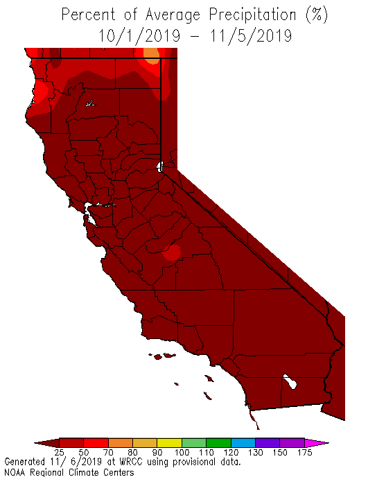
Starting to see some strong signals that a favorable MJO and Convectively Coupled Kelvin Wave will bring unsettled weather across drought parched California as well as Texas over the next 7 days.
- Attachments
-
Carla/Alicia/Jerry(In The Eye)/Michelle/Charley/Ivan/Dennis/Katrina/Rita/Wilma/Humberto/Ike/Harvey
Member: National Weather Association
Facebook.com/Weather Infinity
Twitter @WeatherInfinity
Member: National Weather Association
Facebook.com/Weather Infinity
Twitter @WeatherInfinity
Fortunately, this winter has been very good to Cali. Hoping to squeeze out as much precip as possible as climb catches up with the rainy season. LA area colleagues tell me it's rained more than in many a year...srainhoutx wrote:Starting to see some strong signals that a favorable MJO and Convectively Coupled Kelvin Wave will bring unsettled weather across drought parched California as well as Texas over the next 7 days.
-
Katdaddy
- Global Moderator
- Posts: 2502
- Joined: Thu Feb 04, 2010 8:18 am
- Location: League City, Tx
- Contact:
Last night's cool front has led to a much cooler morning across SE TX with temps mostly in the 50s under fair skies. It will feel a little more like February today but be ready for the warmth to return beginning tomorrow with highs in the upper 70s to near 80 again by Saturday. In addition, an unsettled weather pattern arrives this weekend into the first half of next week with increasing rain chances.
Katdaddy wrote:Last night's cool front has led to a much cooler morning across SE TX with temps mostly in the 50s under fair skies. It will feel a little more like February today but be ready for the warmth to return beginning tomorrow with highs in the upper 70s to near 80 again by Saturday. In addition, an unsettled weather pattern arrives this weekend into the first half of next week with increasing rain chances.
Low of 42°F IMBY.
haha - that's just average. Take what you can get this "winter."
-
Katdaddy
- Global Moderator
- Posts: 2502
- Joined: Thu Feb 04, 2010 8:18 am
- Location: League City, Tx
- Contact:
Spring-like weather returns again to SE TX. The warming trend is ongoing this morning across the Upper TX Coast. It was 51F in Pearland at 3AM and it is now up to 58F at 5AM. Expect highs into the the mid 70s this afternoon with some increasing clouds. Upper 70s to low 80s with partly to mostly cloudy skies for the weekend as well as increasing rain chances by Sunday. The first part of next week is looking very wet for SE TX with some areas of heavy rainfall Tuesday resulting in 1-3" totals and locally higher amounts.
Since Winter has vanished for now; here is a light snow photo from December 4, 2009 here in League City.
Since Winter has vanished for now; here is a light snow photo from December 4, 2009 here in League City.
- Attachments
-
-
srainhoutx
- Site Admin
- Posts: 19616
- Joined: Tue Feb 02, 2010 2:32 pm
- Location: Maggie Valley, NC
- Contact:
We will need to monitor the trends over the weekend for next Tuesday into Tuesday night for the possibility of some strong to severe thunderstorms as a potent 500mb upper low moves out of Mexico into Texas. The GFS indicates dewpoints in the low 60's mainly S and W of Metro Houston and rather impressive dynamics at multiple levels suggesting the potential for rotating updrafts if storm do form. We are several day away from this potential, but with warmer air at the surface and much colder air aloft to our West, the trends will need to be watch rather closely.
Carla/Alicia/Jerry(In The Eye)/Michelle/Charley/Ivan/Dennis/Katrina/Rita/Wilma/Humberto/Ike/Harvey
Member: National Weather Association
Facebook.com/Weather Infinity
Twitter @WeatherInfinity
Member: National Weather Association
Facebook.com/Weather Infinity
Twitter @WeatherInfinity
-
srainhoutx
- Site Admin
- Posts: 19616
- Joined: Tue Feb 02, 2010 2:32 pm
- Location: Maggie Valley, NC
- Contact:
Friday morning briefing from Jeff:
Powerful storm system will arrive into TX early next week
After one day of only slightly above normal temperatures…well above normal temperatures will return for the weekend as southerly winds bring moisture back into the region. A strong upper level storm system currently off the CA coast will move into the SW US this weekend and then slowly move into and across TX early next week. A cold front will move southward ahead of this storm system likely crossing the area sometime Sunday evening into Monday morning allowing a cooler air mass to filter southward. There are questions as to where this front will stall, but the latest thinking is that it will progress to near the coast by Monday.
Rain chances will start to increase late Sunday as the front moves into the region and moisture increases. Expect showers and possibly a few thunderstorms to develop as the front crosses the region along with some support from an approaching short wave.
Potent CA system will begin to eject toward TX late Monday with increasing jet dynamics aloft, increasing lift as a low level jet develops atop the surface cool pool and increasing moisture from both the Pacific and Gulf. I am starting to become concerned that the frontal boundary may attempt to lift northward as a warm front early on Tuesday although this is fairly uncertain at this range. This would produce a surface focus for slow moving thunderstorms and heavy rainfall and we have been burned many times before with these surface boundaries in such setups. Main threat time period looks to be from about midday Tuesday into early Wednesday where a large swath of thunderstorms will slowly move across SE TX from WSW to ENE. Wild card will be any surface warm front that would help to focus, sustain, and train convection. PWS do rise toward 1.5 inches and with a 25-30kt low level jet feed of moisture toward any SW/NE line of convection points toward a heavy rainfall setup for SE TX.
Widespread rainfall amounts of 1-3 inches are looking likely with isolated totals of up to 5 inches possible. While grounds have dried since the nearly foot of rainfall in mid January over portions of SE TX, vegetation is still fairly dormant and run-off will be maximized especially with any decent wetting rainfall on Sunday and Monday.
Might have to take a look at the severe threat if the warm front is able to progress inland.
7 Day Forecasted Rainfall Amounts:
Carla/Alicia/Jerry(In The Eye)/Michelle/Charley/Ivan/Dennis/Katrina/Rita/Wilma/Humberto/Ike/Harvey
Member: National Weather Association
Facebook.com/Weather Infinity
Twitter @WeatherInfinity
Member: National Weather Association
Facebook.com/Weather Infinity
Twitter @WeatherInfinity
Ah the ol' front + low level jet combo. They make quite the team as we saw last month.