The heavy action should remain north of Harris Co, but expect rain later tonight. Flash Flood for NW counties.
http://www.goes.noaa.gov/GSSLOOPS/ecwv.html
Area Forecast Discussion
National Weather Service Houston/Galveston TX
634 PM CDT Sat Aug 20 2016
.AVIATION...
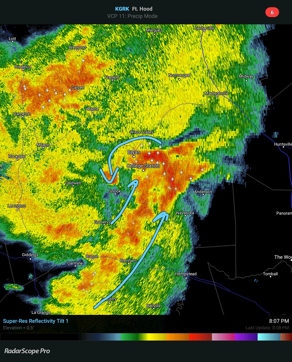
Not a lot of confidence with the 21/00Z TAFs. A northeast to southwest
oriented line of showers and thunderstorms is moving into the CLL area
early this evening with the best coverage currently in line with the
coldest cloud tops on IR satellite imagery. Cloud tops are cooling with
the activity off to the southwest,
and these storms are in line to eventually
move into the CLL and UTS areas this evening. Through tomorrow morning,
generally have VCTS/TSRA for CLL and UTS, and VCSH/-RA for locations
further to the south. During the day tomorrow, going with SHRA to the
north and TSRA to the south. There are most likely going to be lots
of amendments tonight and tomorrow as this storm system evolves. Mainly
MVFR/IFR ceilings and visibilities are anticipated to develop as storms
move into the area. 42
&&
.PREV DISCUSSION... /ISSUED /
DISCUSSION...
A series of upper level shortwave troughs will move through the
central and eastern portions of the state tonight and Sunday. With
a moisture tap off of the Pacific in the mid and upper levels, and
low-level moisture form the Gulf of Mexico, widespread showers and
thunderstorms will be possible over portions of the forecast area
both periods.
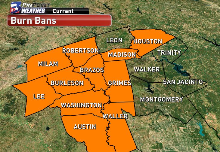
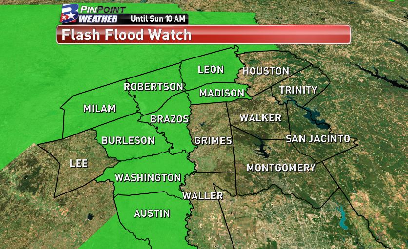
Issuing a flash flood watch for the far northern and western
counties through mid morning on Sunday: Houston, Madison, Brazos,
Burleson, Washington, Austin, and Colorado. The main event for
heavy rainfall tonight and Sunday will most likely be west of the
CWA over the Hill Country.
An MCV currently moving northeastward
across the Hill Country should bring more widespread chances for
showers and thunderstorms into the western and northern portions
of the forecast area. Water Vapor showed another shortwave trough
moving across northern Mexico which should help trigger additional
thunderstorms later tonight. Model rainfall amounts for Southeast
Texas for tonight through Sunday range from 1 to 3 inches with
isolated higher amounts generally along and west of a line from
Crockett to College Station to Columbus. The most likely time
period for locally heavy rainfall will be this evening through mid
Sunday morning.
Good chances for rainfall continue into Monday with the corridor
of deep layer moisture finally moving away from the area by Monday
night as the mid and upper level ridge build into the state from
the east. This will in turn mean lower rain chances and warmer
temperatures during the mid and latter parts of the upcoming week.