May 2016: Shower/Storm Chances To End May
- Texaspirate11
- Posts: 1278
- Joined: Tue Dec 31, 2013 12:24 am
- Contact:
Highway 6 at Addicks Reservoir is closed....again.
Just because you're disabled, you don't have to be a victim
Be Weather Aware & Prepared!
Barbara Jordan Winner in Media
Disability Integration Consultant
Be Weather Aware & Prepared!
Barbara Jordan Winner in Media
Disability Integration Consultant
The rainfall forecast was off this time around. It shows rainfall forecast can be hit and miss.srainhoutx wrote:The overnight guidance continues to indicate that the heaviest rainfall will occur mainly N and W of Metro Houston with lesser amounts near the Coast throughout the Memorial Day Holiday Weekend. Strong to possibly severe thunderstorm development is expected across Central Texas and the Hill Country Lakes and Rivers. Will need to monitor any mesoscale features that cannot be determined beyond 6 or so hours closer to Metro Houston particularly Thursday afternoon through Saturday morning as a neutral to negative tilted trough advances E into the Plains along with any left over cold pool boundaries and an extremely tropical airmass with PW's around 2+ inches in place. If the capping inversion erodes, heavy rainfall rates are possible where training storms develop.
A rain cooled low of 61 in CLL.
Since then the dew point and temp have risen sharply, with a swift transition to a typical late spring day... with cumulus clouds and the off chance of a popcorn shower at a 20% probability.
Although the GFS and Euro were a little light (although 6+ inch predictions point to trouble) with the amount of rain, they were fairly accurate with the swath that was most at risk for heavy precip in our recent event:


9.37 in of rain IMBY
HGX forecast - outlook
.PREV DISCUSSION... /ISSUED /
DISCUSSION...
Clouds continue to clear out of Southeast Texas early this morning as
yesterday`s MCS moves off to the east. Some low clouds and fog (some
dense) will have a chance to develop across the area before sunrise.
Daytime heating could provide an opportunity for some shower/thunderstorm
development today, but think the majority of the area will stay dry
as upper level heights rise a little in response to ridging building
into the area from the south. If anything does develop during peak heating,
some model soundings indicate that they could become strong or severe.
But again, think the majority of us will be rain free. With wet grounds
and light winds, parts of Southeast Texas could see some fog development
again later tonight through early Sunday morning. Will continue to carry
low rain chances on Sunday as possible activity moves into the area
from the west and southwest. Look for a similar forecast (low rain chances)
for Memorial Day. It will be warm and muggy over the holiday weekend
with heat index values peaking in the afternoon in the mid to upper
90s. Better rain chances come back into the forecast beginning on Tuesday
as the holiday weekend ridging begins to break down and the next mid/upper
level trough organizes out west. This slow eastward moving system will
bring periods of showers and thunderstorms to the state with better
rain chances probably across our western/northern counties on Tuesday
and Wednesday working their way eastward for the rest of our area on
Thursday and maybe Friday. At this time, the end of next week and next
weekend are looking quiet as a developing eastern U.S. trough aloft
sets up a drier northwest flow across our area. 42
At this point the next trough might dump a moderate amount of rain next Wednesday and Thursday, but unfortunately over the same ground which will remain saturated and creeks and rivers subsiding...not sure we'll get the same kind of amplification from a split jet, but stay tuned.

Since then the dew point and temp have risen sharply, with a swift transition to a typical late spring day... with cumulus clouds and the off chance of a popcorn shower at a 20% probability.
Although the GFS and Euro were a little light (although 6+ inch predictions point to trouble) with the amount of rain, they were fairly accurate with the swath that was most at risk for heavy precip in our recent event:

9.37 in of rain IMBY
HGX forecast - outlook
.PREV DISCUSSION... /ISSUED /
DISCUSSION...
Clouds continue to clear out of Southeast Texas early this morning as
yesterday`s MCS moves off to the east. Some low clouds and fog (some
dense) will have a chance to develop across the area before sunrise.
Daytime heating could provide an opportunity for some shower/thunderstorm
development today, but think the majority of the area will stay dry
as upper level heights rise a little in response to ridging building
into the area from the south. If anything does develop during peak heating,
some model soundings indicate that they could become strong or severe.
But again, think the majority of us will be rain free. With wet grounds
and light winds, parts of Southeast Texas could see some fog development
again later tonight through early Sunday morning. Will continue to carry
low rain chances on Sunday as possible activity moves into the area
from the west and southwest. Look for a similar forecast (low rain chances)
for Memorial Day. It will be warm and muggy over the holiday weekend
with heat index values peaking in the afternoon in the mid to upper
90s. Better rain chances come back into the forecast beginning on Tuesday
as the holiday weekend ridging begins to break down and the next mid/upper
level trough organizes out west. This slow eastward moving system will
bring periods of showers and thunderstorms to the state with better
rain chances probably across our western/northern counties on Tuesday
and Wednesday working their way eastward for the rest of our area on
Thursday and maybe Friday. At this time, the end of next week and next
weekend are looking quiet as a developing eastern U.S. trough aloft
sets up a drier northwest flow across our area. 42
At this point the next trough might dump a moderate amount of rain next Wednesday and Thursday, but unfortunately over the same ground which will remain saturated and creeks and rivers subsiding...not sure we'll get the same kind of amplification from a split jet, but stay tuned.

some pretty good storms in the middle of our state
loop: http://www.ssd.noaa.gov/goes/east/sc/h5-loop-ft.html

loop: http://www.ssd.noaa.gov/goes/east/sc/h5-loop-ft.html

Impressive Hill Country storms. Softball sized hail in Hondo. A finger is reaching out towards Bryan.
still going on & a soggy forecast...unome wrote:some pretty good storms in the middle of our state
loop: http://www.ssd.noaa.gov/goes/east/sc/h5-loop-ft.html
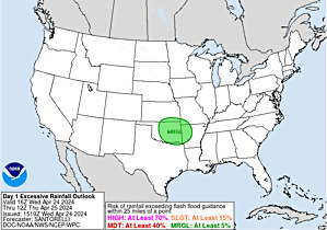
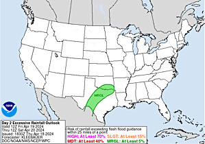
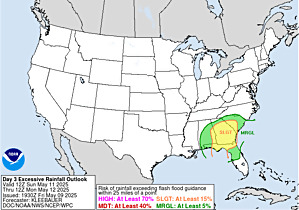
guess where the tropical system is
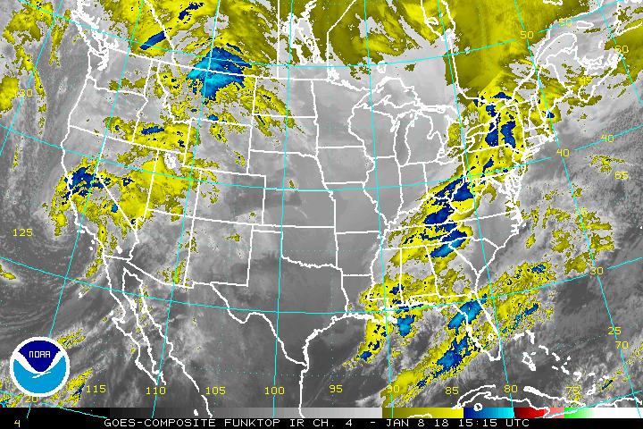
Self-Calibrating Multivariate Precipitation Retrieval (SCaMPR) - Contiguous United States
24 Hour Estimated Rainfall back to Apr 10 as of today, check out Apr 18 vs May 27 images
24 Hour Estimated Rainfall back to Apr 10 as of today, check out Apr 18 vs May 27 images
- srainhoutx
- Site Admin

- Posts: 19621
- Joined: Tue Feb 02, 2010 2:32 pm
- Location: Maggie Valley, NC
- Contact:
Morning briefing from Jeff:
Major flooding continues on Spring Creek and San Jacinto River Basin.
Spring Creek at I-45:
The creek crested yesterday evening at 108.3ft and is falling. This is the second highest crest ever recorded at this location (only Oct 1994 is higher). The water level exceeded the 1% flood level at this location by over 2.0 ft. Numerous homes have been flooded on both sides of the creek.
Water should be back below the toe of the Northgate levee by late this afternoon or early this evening.
West Fork San Jacinto River:
Significant major flood event in progress.
River continues to rise and will crest near 60.9ft this afternoon which is (5ft below the historical record crest of 66.7 ft in 1994). Massive low land flooding is in progress with many homes cut-off and houses flooding in areas that have not flooded since 1994 in parts of Kingwood and Forest Cove. The river is below the 2% (50-yr level), but over 4 ft higher than Tax Day.
River will remain above flood stage all week as there is a very large amount of water to pass downstream still. Many areas cut-off will remain cut-off through at least Wednesday.
East Fork San Jacinto River:
Massive flooding is in progress with FM 1485 under many feet of water and homes threatened downstream of FM 1485.
River has gone above the current forecast as shown below, but should begin a flat crest and very slow recession. River will remain in major flood through much of the early to mid part of the week.
San Jacinto River at Sheldon (HWY 90):
Significant flooding is in progress as large upstream flows move downstream through Lake Houston.
Rio Villa, Banana Bend, and parts of Highlands are cut-off. Water levels at Rio Villa are nearly to the storm surge levels of Hurricane Ike and expect this flood to match very close to the October and November 1998 floods, but 4-5 ft lower than the record Oct 1994 flood on the lower San Jacinto River. The current level at Hwy 90 is 1.5ft below the 50-yr level and the crest will be about .5ft below the 50-yr level.
At Rio Villa levels are close to destroying our gage site and currently below the 10-yr level. Crest near 12.0ft would be .3ft higher than November 1998 and over .5ft higher than Hurricane Ike.
Addicks Reservoir:
Pool has risen to 96.50 ft with water covering HWY 6 and Eldridge Pkwy. Expect these roads to remain closed for the next few days depending on releases and continued inflow.
Barker Reservoir:
Reservoir pool is at 92.37 ft this morning with S Barker Cypress Rd under water. Not expecting the pool to flood Westheimer Parkway at this time.
Releases are ongoing at both Reservoirs at this time.
Other watersheds remain high across the NW part of Harris County, but are falling with water receding from roadways and subdivision streets.
Brazos River at Richmond:
Massive and potential historic river flood event for Fort Bend County.
Mandatory evacuations in effect for Simonton and Valley Lodge. Evacuations for Rosenberg north of the Brazos River to the Pecan Grove levee. Massive flooding of the floodplain across Fort Bend and Brazoria Counties is expected with flow breeching the watershed divide south of Sugar Land and pouring into Oyster Creek. Significant back water flooding along tributaries in Fort Bend and Brazoria Counties in likely.
River is forecast to rise to 53.5 ft early next week which is 3.5 ft above the modern record of 50.ft in Oct 1994.
Evacuation Area for Rosenberg: Fort Bend County OEM Brazos River Flood Page:
http://www.fbcoem.org/go/doc/1528/2616214/
Weather:
Dry weather today and Monday, but a significant storm system looks to bring a prolonged period of wet weather starting late Tuesday into next weekend. High moisture levels and slow moving disturbances aloft certainly are concerning given our current hydo situation and incredibly wet grounds. Many locations on area rivers will still be in moderate flood by the middle of next week and additional rainfall will not be good.
[/i]
Carla/Alicia/Jerry(In The Eye)/Michelle/Charley/Ivan/Dennis/Katrina/Rita/Wilma/Humberto/Ike/Harvey
Member: National Weather Association
Facebook.com/Weather Infinity
Twitter @WeatherInfinity
Member: National Weather Association
Facebook.com/Weather Infinity
Twitter @WeatherInfinity
http://www.srh.noaa.gov/wgrfc/
https://twitter.com/NWSWGRFC
https://www.facebook.com/NWSWestGulf
overnight rain in the Hill Country did nothing to help river levels
large image, latest briefing graphic from their website: the video on their Facebook page should be mandatory watching for anyone thinking it's safe to drive through flooded roads - incredible, powerful, drives the point home clearly
The Brazos river is out of it's banks under Hwy 59 IN Richmond.
I can report firsthand horrible flooding in and near Kings Harbor in Kingwood. The roads are not accessible getting to my place, so I had to park at a grocery store parking lot and walk 2 miles (3/4 of a mile in deep flood water) to get home. It is a mess and it will likely stay that way thru tomorrow. People were also trying to drive through it, which is ridiculous. They all made it, so lucky them, I guess.
A transplant from Houston to Lincoln, Nebraska.
Hope your house isnt flooded Stormone - stay safe and dry
- srainhoutx
- Site Admin

- Posts: 19621
- Joined: Tue Feb 02, 2010 2:32 pm
- Location: Maggie Valley, NC
- Contact:
NWS Austin/San Antonio will be issuing a Flash Flood Watch for the Hill Country and Edwards Plateau shortly valid until tomorrow afternoon.
Carla/Alicia/Jerry(In The Eye)/Michelle/Charley/Ivan/Dennis/Katrina/Rita/Wilma/Humberto/Ike/Harvey
Member: National Weather Association
Facebook.com/Weather Infinity
Twitter @WeatherInfinity
Member: National Weather Association
Facebook.com/Weather Infinity
Twitter @WeatherInfinity
there must be something wrong with the Lake Conroe sensor here:
http://www.harriscountyfws.org/GageDetail/Index/2500
USGS still shows it above 203' http://waterdata.usgs.gov/tx/nwis/uv?cb ... 2016-05-29
http://www.harriscountyfws.org/GageDetail/Index/2500
USGS still shows it above 203' http://waterdata.usgs.gov/tx/nwis/uv?cb ... 2016-05-29
- srainhoutx
- Site Admin

- Posts: 19621
- Joined: Tue Feb 02, 2010 2:32 pm
- Location: Maggie Valley, NC
- Contact:
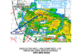
MESOSCALE PRECIPITATION DISCUSSION 0268
NWS WEATHER PREDICTION CENTER COLLEGE PARK MD
402 AM EDT MON MAY 30 2016
AREAS AFFECTED...NORTHERN AND CENTRAL TX...FAR SOUTHERN OK
CONCERNING...HEAVY RAINFALL...FLASH FLOODING POSSIBLE
VALID 300801Z - 301245Z
SUMMARY...CONTINUED HEAVY RAINFALL RATES ARE EXPECTED TO CONTINUE
INTO THE EARLY MORNING HOURS IN ASSOCIATION WITH A SQUALL LINE
MAKING ITS WAY SOUTH AND EAST ACROSS PARTS OF FAR SOUTHERN
OK...NORTHERN AND CENTRAL TX...WITH THE POTENTIAL FOR ADDITIONAL
HEAVY ACCUMULATIONS AND FLASH FLOODING.
DISCUSSION...SURFACE OBSERVATIONS AND RADAR IMAGERY THROUGH 0745Z
SHOWED CONVECTION HAD BECOME ORGANIZED IN A LINEAR MODE AND WAS
MAKING ITS WAY SOUTH AND EAST. 88D VAD WIND PROFILERS WERE
SHOWING 30 TO 35 KT WINDS WHICH WERE FEEDING THE STORMS WITH
PRECIPITABLE WATER VALUES APPROACHING 1.75 INCHES. AREA RADARS
HAVE BEEN CONSISTENTLY SHOWING RAINFALL RATES OF 1.5 TO 2.5 INCHES
PER HOUR DESPITE THE FACT THAT THE LINE OF STORMS WAS MOVING
STEADILY. SOME OF THE AREAS IMMEDIATELY DOWNSTREAM HAVE BEEN
SOAKED IN RECENT DAYS...SO THE RISK OF FLASH FLOODING CONTINUES
ESPECIALLY ALONG THE SOUTH END OF THE STORMS.
ACROSS AREAS NEAR THE RED RIVER...STORMS ARE LESS ORGANIZED BUT
STILL CAPABLE OF PRODUCING SOME 1 TO 2 INCH PER HOUR RAINFALL
RATES.
THE HIGH RES MODELS CONTINUE TO STRUGGLE IN THIS PART OF THE
COUNTRY WITH THE 00Z RUN OF THE NSSL WRF LOOKING TO BE WAY TOO
SLOW. THE 00Z RUN OF THE WRF/ARW SEEMED TO BE DOING BEST AT
SHOWING THE SOUTHERN/EASTERN EXTENT OF HEAVY RAINFALL THROUGH 12Z.
ADDITIONAL ACCUMULATIONS OF 1-2 INCHES OF RAIN WITHIN THE OUTLOOK
AREA THROUGH 13Z
BANN
ATTN...WFO...EWX...FWD...OUN...SJT...TSA...
Carla/Alicia/Jerry(In The Eye)/Michelle/Charley/Ivan/Dennis/Katrina/Rita/Wilma/Humberto/Ike/Harvey
Member: National Weather Association
Facebook.com/Weather Infinity
Twitter @WeatherInfinity
Member: National Weather Association
Facebook.com/Weather Infinity
Twitter @WeatherInfinity
- srainhoutx
- Site Admin

- Posts: 19621
- Joined: Tue Feb 02, 2010 2:32 pm
- Location: Maggie Valley, NC
- Contact:
Monday morning Watershed Update from Jeff:
Major flooding continues.
San Jacinto River Basin:
Major flooding continues across the entire basin, but the river has crested at all points and is starting a very slow fall, but will remain well above flood levels for much of this week.
West Fork of the San Jacinto River:
The river crested yesterday afternoon at 61.9ft which appears to be the second highest crest only behind the Oct. 1994 flood. The river has fallen overnight to around 60.2 ft. Flood stage is 49.3ft. Major flooding will continue today into Tuesday with many subdivisions cut-off and water in areas where flooding does not occur often including portions of Humble and Kingwood. Improvement will be slow.
East Fork of the San Jacinto River at FM 1485:
The river crested yesterday afternoon around 26.6 ft which is the 3rd highest crest on record at this location. The river is falling and should return within its banks early Wednesday. Significant flooding continues with several feet of flow over FM 1485 west of the river and in the subdivisions downstream of FM 1485
Lake Houston:
Flow over the spillway peaked at 47.82 ft yesterday afternoon which is estimated to be about 150,000cfs of 4 billion gallons of water per minute. This amount of flow would fill the Houston Astrodome every 5 minutes. Flow over the spillway in October 1994 was around 300,000 cfs.
San Jacinto River at HWY 90:
The river crested overnight at 19.3ft and is starting to fall. This is the second highest crest at this location behind Oct 1994. The river will remain above flood levels into Thursday.
Backwater has spread into tributaries including Gum Gully.
San Jacinto River at Rio Villa:
The river crested near 12.0 ft overnight. The HCFCD gage stopped reporting at around 12:00 am this morning as water flooded the electronics of the gage. This is the second highest crest at this location.
Significant flow and scour will continue especially along the lower San Jacinto basin for the next 1-2 days as high flows continues to translate downstream. These high flows and debris impacts can result in infrastructure damage to bridges and pipelines crossing the river as well as surface roads that will be under water for several days.
Cypress Creek:
Flooding continues along the upper end of the creek west of Huffmiester Rd where water from Waller County is moving downstream. The creek remains overbanks at Sharp Rd and Katy Hockley Rd.
Overflow into Bear Creek continues with the Bear Creek gage at FM 529 still over banks and this flow is translating downstream to Addicks Reservoir. While overflow of the basin should end today, a large amount of water within the overflow zone will continue to work downstream into Bear Creek.
Addicks Reservoir:
Pool has not risen much overnight…holding around 96.45 ft to 96.50 ft. Portions of HWY 6 have water, but traffic is being allowed to pass on the inside lanes.
Releases continue from both Addicks and Barker Reservoirs.
Brazos River at Richmond:
***New record flood level set at Richmond this morning***
Historic flooding of the Brazos River in Fort Bend County as water levels exceed previous records in Oct 1994. Numerous locations including: Simonton, parts of Rosenberg, parts of Missouri City (Lake Olympia and Quail Valley) are under evacuation orders.
The current level is 50.7ft surpassing the old record of 50.3ft in 1994. The river will continue to rise to a crest of near 53.5ft Tuesday. At these levels extensive flooding will occur across a large portion of Fort Bend County into Brazoria County with many areas near the river outside of levees flooded or cut-off. Many roads will be flooded and impassable.
Forecast:
Another significant storm system will approach the area this week with more widespread heavy rainfall possible. Area rivers will still be in recession when this rainfall arrives and the potential for new rises is high possibly pushing watersheds back above flood stages at areas where they are able to fall below flood stage. Highest threat for heavy rainfall will be Thursday and Friday as a very slow moving storm system stalls across the TX for 4-5 days. The overall pattern set up is one favorable for heavy to excessive rainfall, but small scale features will drive where such rainfall sets up.
[/i]
Carla/Alicia/Jerry(In The Eye)/Michelle/Charley/Ivan/Dennis/Katrina/Rita/Wilma/Humberto/Ike/Harvey
Member: National Weather Association
Facebook.com/Weather Infinity
Twitter @WeatherInfinity
Member: National Weather Association
Facebook.com/Weather Infinity
Twitter @WeatherInfinity
- srainhoutx
- Site Admin

- Posts: 19621
- Joined: Tue Feb 02, 2010 2:32 pm
- Location: Maggie Valley, NC
- Contact:
Folks in Matagorda, Brazoria and Wharton Counties heads up. Bow echo from those S Central Texas thunderstorms may impact your area, if the hold together.


Carla/Alicia/Jerry(In The Eye)/Michelle/Charley/Ivan/Dennis/Katrina/Rita/Wilma/Humberto/Ike/Harvey
Member: National Weather Association
Facebook.com/Weather Infinity
Twitter @WeatherInfinity
Member: National Weather Association
Facebook.com/Weather Infinity
Twitter @WeatherInfinity
looks like rain on memorial day

