
Noneskidog40 wrote:precip
January: Calmer Pattern To End The Month
-
srainhoutx

- Site Admin

- Posts: 19620
- Joined: Tue Feb 02, 2010 2:32 pm
- Location: Maggie Valley, NC
- Contact:
Not to get too far ahead of ourselves and we certainly have more pressing issues on our Weather Plate tonight, but there are growing indications after about a week or so of moderating temperatures and rain chances, the pattern reloads and a much colder pattern returns around the mid January time frame and additional cold and stormy weather may once again return across our Region.
Carla/Alicia/Jerry(In The Eye)/Michelle/Charley/Ivan/Dennis/Katrina/Rita/Wilma/Humberto/Ike/Harvey
Member: National Weather Association
Facebook.com/Weather Infinity
Twitter @WeatherInfinity
Member: National Weather Association
Facebook.com/Weather Infinity
Twitter @WeatherInfinity
-
Paul Robison
Anybody worried about ERCOT ordering rolling blackouts when these temperatures hit the hard freeze mark? I certainly am! Have ya'll forgotten about what happened back in 2011?
-
Andrew
- Site Admin
- Posts: 3440
- Joined: Wed Feb 03, 2010 9:46 pm
- Location: North-West Houston
- Contact:
Paul Robison wrote:Anybody worried about ERCOT ordering rolling blackouts when these temperatures hit the hard freeze mark? I certainly am! Have ya'll forgotten about what happened back in 2011?
There shouldn't be any worry about that. It will be alright.
For Your Infinite Source For All Things Weather Visit Our Facebook
srainhoutx wrote:Not to get too far ahead of ourselves and we certainly have more pressing issues on our Weather Plate tonight, but there are growing indications after about a week or so of moderating temperatures and rain chances, the pattern reloads and a much colder pattern returns around the mid January time frame and additional cold and stormy weather may once again return across our Region.
Lol anything colder and we'll be in the single digits...hopefully some precip in the next system
looks like the front has pasted Austin heading to bryan/college station. looks like it will be past houston area by 12 noon! let the cold begin!!!
-
srainhoutx
- Site Admin
- Posts: 19620
- Joined: Tue Feb 02, 2010 2:32 pm
- Location: Maggie Valley, NC
- Contact:
The Arctic boundary has passed Caldwell where temps have dropped to 43F and gusty NW winds to 30 MPH are underway. This initial shot of colder air will be near the Coast by noon and temperatures will drop quickly into the 40's. The overnight guidance has trended colder once again and lows tonight will quickly fall into the low 30's with mid to upper 20's expected by mid night into Metro Houston. The Hard Freeze Watches will likely be changed to a Hard Freeze Warnings later today and expanded a bit further S as temperatures in the low to mid teens are now expected N of I-10 early Tuesday as the Arctic High settles across Central Texas late Monday. HGX is still expecting near 10-12 hours below freezing tonight and 12-15 hours below freezing Monday night into Tuesday morning. Freezing temperatures are expect all the way to the Coast where Galveston may flirt with a record breaking upper 20's and IAH may see the first temperature readings in the teens since January 1996 when a low of 19 was recorded on January 9th, 1996.
Carla/Alicia/Jerry(In The Eye)/Michelle/Charley/Ivan/Dennis/Katrina/Rita/Wilma/Humberto/Ike/Harvey
Member: National Weather Association
Facebook.com/Weather Infinity
Twitter @WeatherInfinity
Member: National Weather Association
Facebook.com/Weather Infinity
Twitter @WeatherInfinity
accuweather posted a 15 degree low for katy
models keep showing cold heading east but seems like from radar more southerly direction, seems cold air is being held up
going east?
going east?
-
srainhoutx
- Site Admin
- Posts: 19620
- Joined: Tue Feb 02, 2010 2:32 pm
- Location: Maggie Valley, NC
- Contact:
Morning Update from Jeff:
Significant arctic outbreak arriving into the region currently.
Damaging hard freezes nearly certain both Monday and Tuesday mornings….Hard Freeze Watch is in effect for much of the area for tonight.
Preparations for extended periods of sub-freezing temperatures must be completed today.
Arctic frontal boundary is plowing into SE TX this morning with College Station 43 (NW wind gusting to 30mph) and Houston 63. Boundary will move southward and off the coast this morning bringing temperatures quickly into the 40’s areawide under strong cold air advection. North winds will increase into the 20-30mph range post front with gust to over 40mph possible.
Tonight-Monday AM:
Skies will clear by mid to late afternoon,, but large arctic high will still be moving down the plains resulting in continued strong cold air advection and winds overnight. Would normally not fall too much below freezing with so much wind continuing, but this air mass is very cold and an advective freeze will usher into the area starting this evening and lasting into Monday morning. Freezing conditions are likely for 8-12 hours.
Lows Monday AM:
N of I-10: 23-27
Metro Houston (inside Beltway 8): 25-28
N of US 59: 25-27
Coastal: 29-33
Winds will continue in the 5-15mph range overnight driving wind chills into the teens across the entire area.
Monday:
Arctic high pressure settles over the region with winds gradually weakening, but very little warming. Areas north of I-10 may not even reach 40 with areas south of I-10 reaching the lower to mid 40’s.
Monday night- Tuesday AM:
Very cold conditions are expected with potential for near record low establishment.
Arctic high will be near or just NNE of the region allowing very weak wind, but still a weak (2-5mph) NNE wind allowing cold air drainage into the region form the NE. Skies should be mostly clear and dewpoints ranging from near 0-10 across the region supporting good cooling conditions. Temperatures will fall to freezing at sunset and remain below freezing into Tuesday morning. There is some hope that warm air advection may begin just prior to sunrise on Tuesday as the arctic high moves eastward and stop the temperature drop, but after reviewing the latest guidance this does not look to happen until after 600-900am time period which is after the period of maximum cooling. Will also have to watch for some mid level clouds to enter the picture, but there is more going for a very hard freeze at the moment than against. Freezing conditions are likely for 12-16 hours.
Lows Tuesday AM:
N of I-10: 16-20
Conroe area: 14-17
Metro Houston (inside Beltway 8): 22-26
N of US 59: 19-23
Interior coastal counties: 26-28
Beaches: 29-31
Freeze preparations:
Duration and intensity of the incoming freezes requires preparation of tropical vegetation, pipes, and pets/livestock.
Shut off and drain sprinkler back flow devices (many of these devices were damaged in the freeze of similar magnitude in 2011).
Disconnect water hoses and cover hose bibs
Cover any exposed outside water pipes
Open exterior facing cabinets to allow warmth against exterior house pipes (could be some issues with house pipes freezing especially N of HWY 105)
Cover and protect tropical vegetation including sensitive citrus
Provide shelter for pets/livestock. Note typical water sources for pets and livestock may ice/freeze over.
Carla/Alicia/Jerry(In The Eye)/Michelle/Charley/Ivan/Dennis/Katrina/Rita/Wilma/Humberto/Ike/Harvey
Member: National Weather Association
Facebook.com/Weather Infinity
Twitter @WeatherInfinity
Member: National Weather Association
Facebook.com/Weather Infinity
Twitter @WeatherInfinity
from WeatherNation http://blog.weathernationtv.com/
insanely cold in northern states, Packers game should be interesting
insanely cold in northern states, Packers game should be interesting
-
srainhoutx
- Site Admin
- Posts: 19620
- Joined: Tue Feb 02, 2010 2:32 pm
- Location: Maggie Valley, NC
- Contact:
Fore a teaser while we are dealing with the Arctic cold snap, attention turns to the medium/long range across our Region. After the Arctic chill transitions to a moderating split zonal flow, a parade of Pacific storms track beneath the Gulf of Alaska Ridge and develop an increasingly deep Western trough. Cool and unsettled weather returns to the West Coast where increasing Pacific moisture returns to Washington/Oregon and Northern California. As the week progresses and the Arctic high pushes E, a return flow off the Western Gulf appears to set the stage for increasing moisture and perhaps some heavy rainfall across TX into LA by next weekend. The GFS/GEFS solutions offer a progressive Southern stream flow of a series of fast moving 5H/upper troughs while the deterministic Euro as well as its ensemble mean suggest more of a cut off solution with a much deeper trough extending into Southern California and Northern Mexico. The Euro solution has some credence with the synoptic pattern as well as telecommunication indices suggested by the 00Z of guidance. It will be interesting to see if the slow moving Western/Central trough does indeed phase with the Polar jet allowing a robust cold core closed 5H upper low to meander E across Northern Mexico into Texas near January11/12 time frame. If the Euro were to verify, a stormy period may develop across the Southern Rockies and the Southern Plains with strong storms possible along the Western Gulf Coast next weekend. We will see. Stay Warm everyone!
- Attachments
-
-
-
Carla/Alicia/Jerry(In The Eye)/Michelle/Charley/Ivan/Dennis/Katrina/Rita/Wilma/Humberto/Ike/Harvey
Member: National Weather Association
Facebook.com/Weather Infinity
Twitter @WeatherInfinity
Member: National Weather Association
Facebook.com/Weather Infinity
Twitter @WeatherInfinity
-
srainhoutx
- Site Admin
- Posts: 19620
- Joined: Tue Feb 02, 2010 2:32 pm
- Location: Maggie Valley, NC
- Contact:
And with a big gust of NW winds, the Arctic front just passed my location in NW Harris County.
Carla/Alicia/Jerry(In The Eye)/Michelle/Charley/Ivan/Dennis/Katrina/Rita/Wilma/Humberto/Ike/Harvey
Member: National Weather Association
Facebook.com/Weather Infinity
Twitter @WeatherInfinity
Member: National Weather Association
Facebook.com/Weather Infinity
Twitter @WeatherInfinity
-
MontgomeryCoWx

- Posts: 2357
- Joined: Wed Dec 14, 2011 4:31 pm
- Location: Weimar, TX
- Contact:
My acurite weather station dropped from 63 to 49 in 25 minutes and still dropping
Team #NeverSummer
-
srainhoutx
- Site Admin
- Posts: 19620
- Joined: Tue Feb 02, 2010 2:32 pm
- Location: Maggie Valley, NC
- Contact:
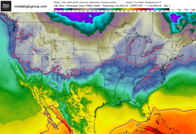
The 12Z NAM/4km WRF suggests a 1040mb Arctic High settles into S Central Texas Monday night into Tuesday Morning.
- Attachments
-
Carla/Alicia/Jerry(In The Eye)/Michelle/Charley/Ivan/Dennis/Katrina/Rita/Wilma/Humberto/Ike/Harvey
Member: National Weather Association
Facebook.com/Weather Infinity
Twitter @WeatherInfinity
Member: National Weather Association
Facebook.com/Weather Infinity
Twitter @WeatherInfinity


It sounded like Old Man Winter just exhaled in Porter. With one big gust, the cold air blew in.
No rain, no rainbows.
We may need to take care of interior pipes and such?
-
Texaspirate11

- Posts: 1278
- Joined: Tue Dec 31, 2013 12:24 am
- Contact:
TxJohn wrote:We may need to take care of interior pipes and such?
I'm going to turn on my faucets tonight - to keep the water going thru the pipes.
That seemed to help last time.
Just because you're disabled, you don't have to be a victim
Be Weather Aware & Prepared!
Barbara Jordan Winner in Media
Disability Integration Consultant
Be Weather Aware & Prepared!
Barbara Jordan Winner in Media
Disability Integration Consultant
-
- Information
-
Who is online
Users browsing this forum: Ahrefs [Bot], Bing [Bot], TexasBreeze and 212 guests