
September: Weekend Rain Chances. 1-2 Inches Possible C/N TX
-
Portastorm

- Posts: 800
- Joined: Wed Feb 03, 2010 3:04 pm
- Location: Southwest Austin/Oak Hill, TX
- Contact:
Interesting little blurb from this morning's NHC tropical outlook:
OTHER SYSTEMS WITH DEVELOPMENT POTENTIAL BEYOND 48 HOURS...
A TROUGH OF LOW PRESSURE COULD FORM OVER THE EXTREME SOUTHWESTERN
GULF OF MEXICO AND BAY OF CAMPECHE IN A FEW DAYS...AND SOME
DEVELOPMENT OF THIS SYSTEM IS POSSIBLE LATER THIS WEEK. THIS SYSTEM
HAS A LOW CHANCE...NEAR 0 PERCENT...OF BECOMING A TROPICAL CYCLONE
DURING THE NEXT 48 HOURS...AND A LOW CHANCE...20 PERCENT...OF
BECOMING A TROPICAL CYCLONE DURING THE NEXT 5 DAYS.
-
srainhoutx

- Site Admin

- Posts: 19616
- Joined: Tue Feb 02, 2010 2:32 pm
- Location: Maggie Valley, NC
- Contact:
Also interesting to see the WPC (formerly known as HPC) mentioning the increasing chance of rainfall later this coming week. Also the latest surface analysis suggests a 1011mb surface low has developed near Padre Island and troughs and a tropical wave in the NW Caribbean is the likely focus of whatever becomes of the mid to late next week potential tropical mischief in the Western Gulf.
EXTENDED FORECAST DISCUSSION
NWS WEATHER PREDICTION CENTER COLLEGE PARK MD
1117 AM EDT SUN SEP 08 2013
VALID 12Z WED SEP 11 2013 - 12Z SUN SEP 15 2013
...OVERVIEW AND GUIDANCE PREFERENCES...
STRONG RIDGING OVER THE CENTRAL NORTH ATLANTIC... JUST NW OF THE
AZORES... ALONG WITH RIDGING OVER SW CANADA COMBINE TO FAVOR DEEP
BUT PROGRESSIVE TROUGHING ALONG THE EASTERN SEABOARD BY THE END OF
THE WEEK. IN ADDITION... SPLITTING ENERGY JUST SOUTH OF ALASKA
SHOULD FAVOR A SLOWLY MOVING CLOSED LOW OFF THE WEST COAST.
CONFIDENCE WOULD GENERALLY BE LOWER THAN AVERAGE GIVEN THAT THE
MODELS HAVE ONLY RECENTLY CONVERGED TOWARD THIS MORE AMPLIFIED
SOLUTION. BUT... THE ENSEMBLE MEANS ARE LIKELY TRYING TO PLAY
CATCH-UP DUE TO THE MEMBER TIMING DIFFERENCES... THOUGH MANY
MEMBERS HAVE SHOWN A SOLUTION NEAR THE LATEST 00Z DETERMINISTIC
CLUSTER FOR SEVERAL CYCLES... SO FORECASTER CONFIDENCE IS NEAR
AVERAGE. THE 00Z GFS/GEFS MEAN LIED ON THE QUICKER SIDE OF THE
GUIDANCE SPREAD AND WAS NOT PREFERRED IN AN INHERENTLY SLOWER
PATTERN IN THE WEST. THE 06Z GFS WAS SLOWER THAN EARLIER RUNS AND
A BIT QUICKER THAN THE 00Z ECMWF. ALONG WITH THE SLOWER/MIDDLE
GROUND 00Z ECENS MEAN... THESE THREE FORMED THE PREFERRED CLUSTER
OF SOLUTIONS FOR THE BASE OF THE FORECAST. THIS ACTED TO TEMPER
THE SHIFT IN CONTINUITY WITHOUT TRENDING TOO ABRUPTLY TOWARD A
MUCH SLOWER/DEEPER SOLUTION.
...SENSIBLE WEATHER HIGHLIGHTS...
MID-LEVEL ENERGY LIFTING THROUGH THE INTERIOR WEST/ROCKIES SHOULD
ENHANCE CONVECTION OVER THE REGION THROUGH THE END OF THE WEEK...
ONLY SLOWLY DIMINISHING AS THE FEATURE DRIFTS EASTWARD TOWARD THE
NORTHERN PLAINS. TEMPERATURES SHOULD AVERAGE ABOVE NORMAL IN THE
INTERIOR PAC NW AND NORTHERN ROCKIES. THE UPPER LOW OFF THE WEST
COAST SHOULD HOLD PRECIPITATION OFFSHORE THROUGH MUCH OF THE
PERIOD... PERHAPS UNTIL NEXT WEEKEND ESPECIALLY OVER COASTAL
OREGON INTO WASHINGTON. FARTHER EAST... THE DIGGING TROUGH WILL
ALLOW TEMPERATURES TO RISE SMARTLY OUT AHEAD OF IT WED-THU/D3-4
BEFORE THE COLD FRONT BRINGS IN MUCH COOLER AIR... PRECEDED BY
SHOWERS/STORMS. PROGRESSIVE NATURE OF THE TROUGH SHOULD LIMIT
HEAVY PRECIPITATION. FRONTAL BOUNDARY /ALBEIT WEAKER/ COULD PUSH
ALL THE WAY TO THE GULF COAST BY SUN/D7... IN A VERY FALL-LIKE
MANNER. EASTERLY FLOW THROUGH FLORIDA TOWARD THE WESTERN GULF
COMBINED WITH ABOVE NORMAL PW VALUES SHOULD KEEP SE TX FAIRLY WET
LATE THIS WEEK.
FRACASSO
Carla/Alicia/Jerry(In The Eye)/Michelle/Charley/Ivan/Dennis/Katrina/Rita/Wilma/Humberto/Ike/Harvey
Member: National Weather Association
Facebook.com/Weather Infinity
Twitter @WeatherInfinity
Member: National Weather Association
Facebook.com/Weather Infinity
Twitter @WeatherInfinity
-
txflagwaver

- Posts: 411
- Joined: Wed Feb 03, 2010 2:37 pm
- Location: Seabrook/Kemah
- Contact:
Same here Susie...brief rain yesterday...Thunder this am woke me up at dark thirty. No actual rain though, just cloudy.
-
srainhoutx
- Site Admin
- Posts: 19616
- Joined: Tue Feb 02, 2010 2:32 pm
- Location: Maggie Valley, NC
- Contact:
The 12Z GFS ensemble members are rather suggestive that something may spin up in the Western Gulf this coming week. Those ensembles also suggest it will not be in any hurry to move which may allow for further development next weekend as well. We will see.
Hour 144:
Hour 180:
Hour 144:
Carla/Alicia/Jerry(In The Eye)/Michelle/Charley/Ivan/Dennis/Katrina/Rita/Wilma/Humberto/Ike/Harvey
Member: National Weather Association
Facebook.com/Weather Infinity
Twitter @WeatherInfinity
Member: National Weather Association
Facebook.com/Weather Infinity
Twitter @WeatherInfinity
Hearing a good bit of thunder up here in Cypress. Picked up 0.01" about an hour or so ago, 0.34 so far this month.
-
srainhoutx
- Site Admin
- Posts: 19616
- Joined: Tue Feb 02, 2010 2:32 pm
- Location: Maggie Valley, NC
- Contact:
The 12Z Euro Ensemble mean suggest lowest pressures offshore of Tampico at 168 hours.
- Attachments
-
Carla/Alicia/Jerry(In The Eye)/Michelle/Charley/Ivan/Dennis/Katrina/Rita/Wilma/Humberto/Ike/Harvey
Member: National Weather Association
Facebook.com/Weather Infinity
Twitter @WeatherInfinity
Member: National Weather Association
Facebook.com/Weather Infinity
Twitter @WeatherInfinity
-
Texas Pirate
HGX disco Sunday afternoon
GFS HAS BEGUN TO HIGHLIGHT AN AREA IN THE BAY OF CAMPECHE WITH
LOWERING PRESSURES AND INCREASING WINDS AND MOISTURE. ENSEMBLES
HAVE SHOW THIS FEATURE AS WELL BUT NOT WITH MUCH IN THE WAY OF
DEVELOPMENT...FOR NOW ITS JUST A WAIT AND WATCH
GFS HAS BEGUN TO HIGHLIGHT AN AREA IN THE BAY OF CAMPECHE WITH
LOWERING PRESSURES AND INCREASING WINDS AND MOISTURE. ENSEMBLES
HAVE SHOW THIS FEATURE AS WELL BUT NOT WITH MUCH IN THE WAY OF
DEVELOPMENT...FOR NOW ITS JUST A WAIT AND WATCH
-
Texas Pirate
srainhoutx wrote:The 12Z Euro Ensemble mean suggest lowest pressures offshore of Tampico at 168 hours.
Mexico, again?!
-
srainhoutx
- Site Admin
- Posts: 19616
- Joined: Tue Feb 02, 2010 2:32 pm
- Location: Maggie Valley, NC
- Contact:
Morning e-mail from Jeff:
Fairly wet pattern of late will begin to dry out today through much of the week.
Deep tropical moisture that has been in place for the past several days allowing the area to enjoy scattered showers and thunderstorms is gradually being pushed S and SW by building high pressure from the NE. There is a strong moisture gradient across SE TX this morning with our NE counties fairly dry and our SW counties wet. Radar shows a few shower off the Matagorda Bay coast indicating where the best moisture resides. Expect to see a fairly active day of scattered showers and thunderstorms across the SW portion of the area from Freeport to Wharton to Columbus and then on SW into the coastal bend and S TX where good moisture resides. Combined effects of drying and subsidence from the ridge aloft to our NE will gradually spread done and across much of the area by Tuesday greatly limiting rain chances.
For the week, tropical waves will progress across the Gulf of Mexico and landfall along the MX and S TX coastlines. Position of the upper level ridge over the central US keeps us on the south edge of the subsidence aloft and dry air. Moisture tropical air mass looks to reside just south of the region, but day to day variations could allow slightly higher coastal rain chances on any given day…would not expect more than about 30%.
Late week focus will be on the Gulf of Mexico as global forecast models are showing lower surface pressures over the Bay of Campeche and SW Gulf with some potential for tropical cyclone formation. This region of the Gulf has been very favorable this year and has already produced several tropical systems. Models show a slow developing system in this region that is slow moving and fairly broad. Currently thinking is that anything that forms should stay south of TX with continued ridging in place, but it is now September with progressive troughs moving across the US, so ridging may not be as firm in place as in July or August.
Deep easterly flow will develop across the Gulf and with gradually lowering surface pressures and a favorable fetch from the far ESE Gulf, tides will begin to increase along the upper and middle TX coast. Tidal models show total water levels nearing 1-2 ft above normal by the middle of this week a result of increased long period swells delivering more water to the beach front.
Tropical Storm Humberto:
Strong easterly wave that moved off the coast of Africa on Saturday has rapidly developed into a well develop tropical cyclone. A large mass of deep convection is surrounded by banding features and as of this morning the system was declared a tropical storm. Given the overall very good organization, expect the system to continue to intensify and reach hurricane intensity (74mph) in the next 36-48 hours. This is in agreement with most of the major global intensity guidance. Humberto is very far east and as he intensifies will feel the weakness to the north allowing a rare turn toward the north over the next 36-48 hours just west of the Cape Verde Islands. The system is then forecast to bend back toward the west in the 96-120 time period as strong ridging builds back in over the top of the system. At this time Humberto will be no threat to any landmasses except a near term brush with the Cape Verde Islands.
- Attachments
-
Carla/Alicia/Jerry(In The Eye)/Michelle/Charley/Ivan/Dennis/Katrina/Rita/Wilma/Humberto/Ike/Harvey
Member: National Weather Association
Facebook.com/Weather Infinity
Twitter @WeatherInfinity
Member: National Weather Association
Facebook.com/Weather Infinity
Twitter @WeatherInfinity
-
wxman57

- Global Moderator

- Posts: 2621
- Joined: Thu Feb 04, 2010 5:34 am
- Location: Southwest Houston (Westbury)
- Contact:
Haven't seen much of that "Fairly wet pattern of late" at my house. Checking my rainfall observations, the greatest total I've measured in a day since May 10th was 0.63" in June. On 3 other occasions I measured near 1/2" since May 10th. Nothing more than that. Measured 3.33" on May 10th, which was the last time I measured over 0.63" in a day. Yard is toasty brown even with $160 a month water bills. The storms with 1"+ amounts keep missing my house by blocks. Measured 0.25" Saturday and 0.05" Sunday. Meanwhile, had minor street flooding 1 mile north of me at the grocery store.
-
srainhoutx
- Site Admin
- Posts: 19616
- Joined: Tue Feb 02, 2010 2:32 pm
- Location: Maggie Valley, NC
- Contact:
The 12Z GFS has trended further N with a possible tropical depression or weak tropical storm later this weekend making landfall just S of Brownville spreading rain further NE into SE Texas.
Carla/Alicia/Jerry(In The Eye)/Michelle/Charley/Ivan/Dennis/Katrina/Rita/Wilma/Humberto/Ike/Harvey
Member: National Weather Association
Facebook.com/Weather Infinity
Twitter @WeatherInfinity
Member: National Weather Association
Facebook.com/Weather Infinity
Twitter @WeatherInfinity
-
srainhoutx
- Site Admin
- Posts: 19616
- Joined: Tue Feb 02, 2010 2:32 pm
- Location: Maggie Valley, NC
- Contact:
The 12Z operational Euro is a tad further S than the GFS suggesting a land falling system between Tuxpan and Tampico. What does raise an eyebrow is the ambient sub 1008mb surface pressures shown across the NW Caribbean Sea and the Western Gulf of Mexico via the reliable guidance. This tends to lend credence that we may actually see some form of tropical development and there is the potential it could be rather large and broad concerning the circulation center.
Carla/Alicia/Jerry(In The Eye)/Michelle/Charley/Ivan/Dennis/Katrina/Rita/Wilma/Humberto/Ike/Harvey
Member: National Weather Association
Facebook.com/Weather Infinity
Twitter @WeatherInfinity
Member: National Weather Association
Facebook.com/Weather Infinity
Twitter @WeatherInfinity
-
srainhoutx
- Site Admin
- Posts: 19616
- Joined: Tue Feb 02, 2010 2:32 pm
- Location: Maggie Valley, NC
- Contact:
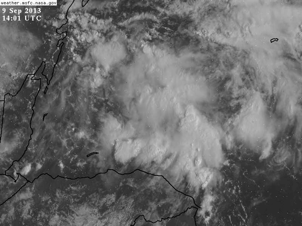
Our friend/member here and on American Weather wxmx, posted this saved loop of a mid level spin already developing in the NW Caribbean.
Carla/Alicia/Jerry(In The Eye)/Michelle/Charley/Ivan/Dennis/Katrina/Rita/Wilma/Humberto/Ike/Harvey
Member: National Weather Association
Facebook.com/Weather Infinity
Twitter @WeatherInfinity
Member: National Weather Association
Facebook.com/Weather Infinity
Twitter @WeatherInfinity
-
srainhoutx
- Site Admin
- Posts: 19616
- Joined: Tue Feb 02, 2010 2:32 pm
- Location: Maggie Valley, NC
- Contact:
The 12Z Euro Ensemble mean for mean sea level pressures are trending further N and lower than previous days as well suggesting a bit more potential for something tropical nearing the Rio Grande Valley and possibly as far N as the Corpus Christi area to Middle Texas Coast. We will see.
- Attachments
-
Carla/Alicia/Jerry(In The Eye)/Michelle/Charley/Ivan/Dennis/Katrina/Rita/Wilma/Humberto/Ike/Harvey
Member: National Weather Association
Facebook.com/Weather Infinity
Twitter @WeatherInfinity
Member: National Weather Association
Facebook.com/Weather Infinity
Twitter @WeatherInfinity
-
Texas Pirate
HGX Disco:
BOTH THE 12Z GFS AND ECMWF RUNS ARE
MORE AGGRESSIVE IN DEVELOPING A TROPICAL CYCLONE IN THE BAY OF
CAMPECHE LATER THIS WEEK AND BRINGING IT WEST NORTHWEST INTO THE
NORTHERN MEXICAN COAST. WHILE THIS FEATURE APPEARS UNLIKELY TO
DIRECTLY AFFECT SOUTHEAST TEXAS IT DOES BEAR WATCHING AS WE ARE
NOW AT THE CLIMATOLOGICAL PEAK OF THE ATLANTIC HURRICANE SEASON.
MOST LIKELY IMPACT TO OUR REGION AT THIS POINT WOULD BE LIMITED TO
SLIGHTLY HIGHER RAIN CHANCES AND SOME SLIGHTLY ELEVATED TIDES.
STAY TUNED. 38

Looks like a pretty good bet for TC formation late this week in the BOC. While most model guidance ends the system in MX south of TX there is enough spread in the ensemble members to raise at least an eye along the TX coast. Additionally, if the system is slower developing, a trough will be moving into the central US by early next week and breaking down the stout ridging over TX. All models forecast the system inland over MX by this point, but the 30km FIM 12Z run does show the system being caught and swung N into the SE TX/SW LA coast...not saying this is going to happen and in fact it is the only guidance with the exception of a few GFSENS that show such a track...but it is September now and I think this system has the best chance of gaining intensity then the previous BOC TC's this year and it could want to bump more northward against the ridge.
Long fetch ENE/E flow is already starting to ramp the tides and lowering pressures will only increase the tides more by the end of the week. Will likely see 1-2 feet above normal by the middle of the week and could be up to 3 ft by the weekend depending on what happens to our south.
Long fetch ENE/E flow is already starting to ramp the tides and lowering pressures will only increase the tides more by the end of the week. Will likely see 1-2 feet above normal by the middle of the week and could be up to 3 ft by the weekend depending on what happens to our south.
-
Katdaddy

- Global Moderator
- Posts: 2502
- Joined: Thu Feb 04, 2010 8:18 am
- Location: League City, Tx
- Contact:
8PM TWO......up to 40% chance during next 5 days.
A BROAD AREA OF LOW PRESSURE IS EXPECTED FORM OVER THE BAY OF
CAMPECHE OR THE EXTREME SOUTHWESTERN GULF OF MEXICO IN A FEW
DAYS...AND ENVIRONMENTAL CONDITIONS SHOULD BE CONDUCIVE FOR SOME
DEVELOPMENT OF THIS LOW. THIS SYSTEM HAS A LOW CHANCE...NEAR 0
PERCENT...OF BECOMING A TROPICAL CYCLONE DURING THE NEXT 48
HOURS...AND A MEDIUM CHANCE...40 PERCENT...OF BECOMING A TROPICAL
CYCLONE DURING THE NEXT 5 DAYS.
-
Paul Robison
Dear Jeff:jeff wrote:Looks like a pretty good bet for TC formation late this week in the BOC. While most model guidance ends the system in MX south of TX there is enough spread in the ensemble members to raise at least an eye along the TX coast. Additionally, if the system is slower developing, a trough will be moving into the central US by early next week and breaking down the stout ridging over TX. All models forecast the system inland over MX by this point, but the 30km FIM 12Z run does show the system being caught and swung N into the SE TX/SW LA coast...not saying this is going to happen and in fact it is the only guidance with the exception of a few GFSENS that show such a track...but it is September now and I think this system has the best chance of gaining intensity then the previous BOC TC's this year and it could want to bump more northward against the ridge.
Long fetch ENE/E flow is already starting to ramp the tides and lowering pressures will only increase the tides more by the end of the week. Will likely see 1-2 feet above normal by the middle of the week and could be up to 3 ft by the weekend depending on what happens to our south.
I have two questions for you.
1. is the FIM more reliable than the GFS?
2. Should Houstonians take the FIM seriously and start getting ready for Ike II?
No to both questions!
-
- Information
-
Who is online
Users browsing this forum: Ahrefs [Bot], Amazon [Bot], Goomba, jasons2k, Pas_Bon and 12 guests