Re: April Weather Discussion. SPC: Slight Risk Late Week!
Posted: Fri Apr 23, 2010 7:01 am
So what are the chances of storms south of I10?? Have to pick up a washer and dryer this afternoon....
Your Infinite Source For All Things Weather
https://www.wxinfinity.com/
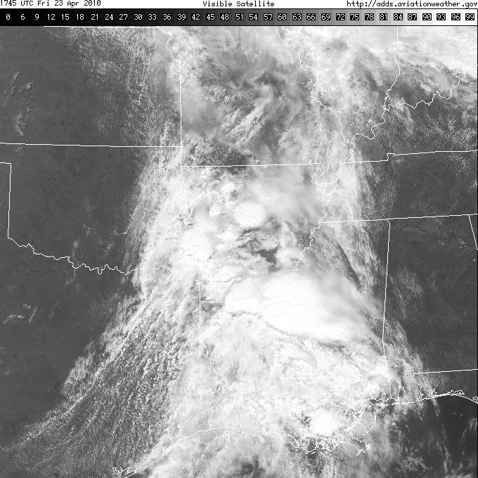
Check this sat loop. Might be a dry line forming near San Angelo / Abilene area.Ed Mahmoud wrote:Just checked obs DFW, FTW, DTO and MWL. Dry line/trough is advancing, just passed FTW and DTO, although dew points not yet dropping, has yet to pass DFW or DAL.
DFW and DAL are socked in. Scattered low clouds about 1000 feet, broken deck 9000, another deck 25,000.
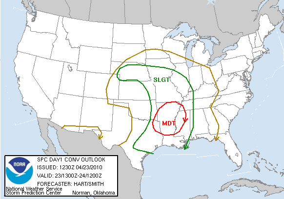
Odds of Metroplex Severe are dropping if the dry line/trough is already advancing.
Only bright light, even back at ABI and SPS, with SW and W winds, dewpoints still above 50ºF, and skys are clearing. Just looked at SPC surface analysis, the dewpoint gradient is fairly broad, the wind shift may be the dry line, if it is, it is a sorry excuse for a dryline.
If it is just a weak trough, the wind shift seems to mark the clearing line, and maybe areas West of DFW will still destabilize. But I hate a sloppy dry line.

So is this saying after midnight Houston area might have a better chance at severe weather - not that I want to see any of it...just asking?wxdata wrote:Noon thinking for Houston's NWS:
"As of now, it looks very marginal (for severe weather today) due to the stout cap we are currently under. Cap will erode in that 06Z-12Z window as main trof axis crosses off to NE and dryline catches up to cold front...but will it be in time for any decent initialization? The best pro is in the upper levels with nice div and 100-plus kt core coming across that may place you all in a lf quad. A lot of ifs....but if these mid-level lapse rates can be realized after midnight, then yes, a more moderate chance for severe seems a safe bet."
yes.ticka1 wrote:
So is this saying after midnight Houston area might have a better chance at severe weather - not that I want to see any of it...just asking?
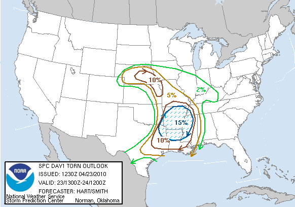
CONCERNING THE TORNADO OUTBREAK SCENARIO...THE THINKING IS THAT A
CLUSTER OF TORNADIC SUPERCELLS WILL ORGANIZE NEAR THE SABINE RIVER
IN FAR NE TX AROUND 12Z SATURDAY AND MOVE ENEWD ACROSS NRN LA INTO
ERN AR AND NWRN MS BY MIDDAY. THE GFS IS FORECASTING THE MCS TO BE
JUST AHEAD OF AND TO THE WEST OF THE MID-LEVEL JET CORE SUGGESTING
THE SETUP COULD BE FAVORABLE FOR STRONG TO VIOLENT TORNADOES AND A
LONG-TRACK TORNADO WILL BE POSSIBLE. AN OUTLOOK UPGRADE TO HIGH RISK
MAY BE NEEDED ACROSS PARTS OF THE REGION AS CONFIDENCE INCREASES
CONCERNING THE MODEL SOLUTIONS. ALTHOUGH THE BRUNT OF THE OUTBREAK
IS EXPECTED DURING THE MORNING AND EARLY AFTERNOON...SUPERCELLS AND
WELL-DEVELOPED LINE-SEGMENTS SHOULD BE CAPABLE OF PRODUCING
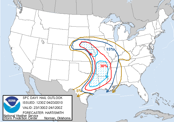
TORNADOES...LARGE HAIL AND WIND DAMAGE THROUGH SATURDAY EVENING.