
August 2025

Still no rain here.
We had 60% for tomorrow, then 50%, now they have us at 40% tomorrow.
We had 60% for tomorrow, then 50%, now they have us at 40% tomorrow.

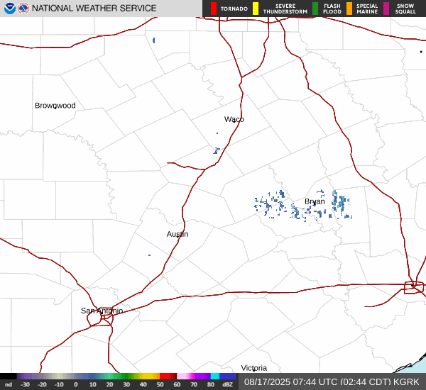
Same here. Cells passed within 5 miles.
Finnegan begin again tomorrow. At least there were clouds.
Downgraded to 20% tomorrow, 30% chance of rain Tuesday and Wednesday.
lol - our NWS page has "Thunderstorm in the vicinity"
-
tireman4

- Global Moderator

- Posts: 6552
- Joined: Wed Feb 03, 2010 9:24 pm
- Location: Humble, Texas
- Contact:
593
FXUS64 KHGX 111133
AFDHGX
Area Forecast Discussion
National Weather Service Houston/Galveston TX
633 AM CDT Mon Aug 11 2025
...New AVIATION...
.KEY MESSAGES...
Issued at 1122 PM CDT Sun Aug 10 2025
- Daily chances for isolated to scattered showers and storms
continues throughout the forecast period with the highest chances
along and south of I-10.
- High temperatures mainly in the low to mid 90s throughout the week
with heat indices peaking in the 102-106F range.
- Increasing temperature trend possible heading into the weekend.
&&
.DISCUSSION...
Issued at 1122 PM CDT Sun Aug 10 2025
Wait the forecast is hot and humid with daily chances of showers and
storms?! Always has been...and that`ll continue throughout the week
as we remain in a general trough-y pattern even after the
departure of the upper level disturbance currently overhead after
Monday. That along with fluctuations of moisture from the Gulf
will keep rain chances in the forecast throughout the week. Rain
chances will remain the highest near and south of I-10, and the
strongest storms will be capable of producing gusty winds and
locally heavy rainfall. This will allow for daytime temperatures
to top out mainly in the low to mid 90s for most of the
week...heat indices will still be in the triple digits though.
Around midweek, mid to upper level high pressure begins to build
in the southeastern CONUS. Moisture wrapping around its western
periphery will push into southeast TX leading to greater moisture
availability for the sea breeze to tap into. This means we will
likely see greater coverage in showers/storms during the afternoon
hours in the middle to later parts of the work week. Keep in mind
though that not everyone will see rain, but if you do you`ll get
a brief reprieve from the heat.
That mid to upper level high still looks to gradually expand
westward along the Gulf Coast going into the weekend leading to
increasing temperatures and decreasing chances for showers and
storms. It still remains to be seen on how much moisture sticks
around into the weekend, but the increased subsidence should at
least limit the coverage of convective development. Probabilities
for high temperatures greater than 95F increase to 50+% for most of
Southeast Texas (except coastal areas) over the weekend...so take
that for what you may.
Batiste
&&
.AVIATION...
(12Z TAF Issuance)
Issued at 608 AM CDT Mon Aug 11 2025
Thunderstorms that developed overnight along the I-10 corridor has
helped to "work over" the atmosphere a bit near IAH/HOU/SGR
leading to a decrease in activity currently with most
thunderstorms developing near the coast. VCTS will continue to be
possible at GLS and LBX through the morning, but isolated
thunderstorms may begin to redevelop along the I-10 corridor this
afternoon thanks to daytime heating and a gradual return of
moisture. Winds will by gusty near any storms that develop. Any
activity over land will end by sunset, then additional showers
and storms may re- develop over the Gulf water late tonight into
early Tuesday.
Otherwise, VFR conditions will prevail with light/variable winds
during the overnight and morning periods, then becoming
predominately southeasterly during the afternoons. Some patchy fog
is possible near CXO, LBX, and SGR near sunrise Tuesday.
Fowler
&&
.MARINE...
Issued at 1122 PM CDT Sun Aug 10 2025
Light to occasionally moderate (with the afternoon seabreeze)
onshore flow and low seas will persist throughout the week. Daily
chances for isolated to scattered showers and storms continue with
activity initiating over the Gulf waters during the overnight to
early morning hours, then moving inland in the late
morning/afternoon hours. Winds and seas could be locally higher in
and around any of the stronger storms. Towards the end of the work
week, onshore flow becomes consistently in the moderate range
leading to wave heights in the Gulf increasing to 3-4 ft.
Batiste
&&
.PRELIMINARY POINT TEMPS/POPS...
College Station (CLL) 95 75 94 76 / 20 10 30 10
Houston (IAH) 94 78 96 79 / 50 10 50 10
Galveston (GLS) 90 81 91 82 / 60 20 40 20
&&
.HGX WATCHES/WARNINGS/ADVISORIES...
TX...None.
GM...None.
&&
$$
DISCUSSION...Batiste
AVIATION...Fowler
MARINE...Batiste
-
tireman4
- Global Moderator
- Posts: 6552
- Joined: Wed Feb 03, 2010 9:24 pm
- Location: Humble, Texas
- Contact:
.KEY MESSAGES...
Issued at 1122 PM CDT Sun Aug 10 2025
- Daily chances for isolated to scattered showers and storms
continues throughout the forecast period with the highest chances
along and south of I-10.
- High temperatures mainly in the low to mid 90s throughout the week
with heat indices peaking in the 102-106F range.
- Increasing temperature trend possible heading into the weekend.
&&
.DISCUSSION...
Issued at 1122 PM CDT Sun Aug 10 2025
Wait the forecast is hot and humid with daily chances of showers and
storms?! Always has been...and that`ll continue throughout the week
as we remain in a general trough-y pattern even after the
departure of the upper level disturbance currently overhead after
Monday. That along with fluctuations of moisture from the Gulf
will keep rain chances in the forecast throughout the week. Rain
chances will remain the highest near and south of I-10, and the
strongest storms will be capable of producing gusty winds and
locally heavy rainfall. This will allow for daytime temperatures
to top out mainly in the low to mid 90s for most of the
week...heat indices will still be in the triple digits though.
Around midweek, mid to upper level high pressure begins to build
in the southeastern CONUS. Moisture wrapping around its western
periphery will push into southeast TX leading to greater moisture
availability for the sea breeze to tap into. This means we will
likely see greater coverage in showers/storms during the afternoon
hours in the middle to later parts of the work week. Keep in mind
though that not everyone will see rain, but if you do you`ll get
a brief reprieve from the heat.
That mid to upper level high still looks to gradually expand
westward along the Gulf Coast going into the weekend leading to
increasing temperatures and decreasing chances for showers and
storms. It still remains to be seen on how much moisture sticks
around into the weekend, but the increased subsidence should at
least limit the coverage of convective development. Probabilities
for high temperatures greater than 95F increase to 50+% for most of
Southeast Texas (except coastal areas) over the weekend...so take
that for what you may.
Batiste
Issued at 1122 PM CDT Sun Aug 10 2025
- Daily chances for isolated to scattered showers and storms
continues throughout the forecast period with the highest chances
along and south of I-10.
- High temperatures mainly in the low to mid 90s throughout the week
with heat indices peaking in the 102-106F range.
- Increasing temperature trend possible heading into the weekend.
&&
.DISCUSSION...
Issued at 1122 PM CDT Sun Aug 10 2025
Wait the forecast is hot and humid with daily chances of showers and
storms?! Always has been...and that`ll continue throughout the week
as we remain in a general trough-y pattern even after the
departure of the upper level disturbance currently overhead after
Monday. That along with fluctuations of moisture from the Gulf
will keep rain chances in the forecast throughout the week. Rain
chances will remain the highest near and south of I-10, and the
strongest storms will be capable of producing gusty winds and
locally heavy rainfall. This will allow for daytime temperatures
to top out mainly in the low to mid 90s for most of the
week...heat indices will still be in the triple digits though.
Around midweek, mid to upper level high pressure begins to build
in the southeastern CONUS. Moisture wrapping around its western
periphery will push into southeast TX leading to greater moisture
availability for the sea breeze to tap into. This means we will
likely see greater coverage in showers/storms during the afternoon
hours in the middle to later parts of the work week. Keep in mind
though that not everyone will see rain, but if you do you`ll get
a brief reprieve from the heat.
That mid to upper level high still looks to gradually expand
westward along the Gulf Coast going into the weekend leading to
increasing temperatures and decreasing chances for showers and
storms. It still remains to be seen on how much moisture sticks
around into the weekend, but the increased subsidence should at
least limit the coverage of convective development. Probabilities
for high temperatures greater than 95F increase to 50+% for most of
Southeast Texas (except coastal areas) over the weekend...so take
that for what you may.
Batiste
Finally got a good rain here. Picked up 1.68” this morning.
On my way to another inch or more. This is nuts lol.
0.00” again.
Just think, a few days ago the NWS had 40% rain chances for Saturday, 60% chances for yesterday and 50% for today.
Just think, a few days ago the NWS had 40% rain chances for Saturday, 60% chances for yesterday and 50% for today.
Well the rain chances formerly known as 50% for today have been lowered to 30% now, the day of.
The trend continues…
The trend continues…
There a disturbance off the Louisiana coast on a boundary.
A rare mid-summer trough over the Red River Valley with outflows. Unfortunately, we're unlikely to benefit from their rains today.
There's an uptick in chances tomorrow, but I wouldn't bet on it.
A rare mid-summer trough over the Red River Valley with outflows. Unfortunately, we're unlikely to benefit from their rains today.
There's an uptick in chances tomorrow, but I wouldn't bet on it.
- Attachments
-
- 20252241611_GOES19-ABI-ga-GEOCOLOR-1000x1000.jpg (857.45 KiB) Viewed 13167 times
Yeah, that mid-level stream of dry air from Mexico...no bueno.
- Attachments
-
- 20252241751_GOES19-ABI-sp-09-1200x1200.jpg (667.59 KiB) Viewed 13140 times
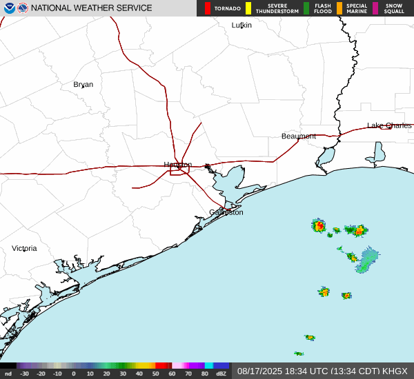
Lucy has been trolling me big time today. Looked like a nice cluster of storms was forming just upstream from me over Conroe and - poof!
A few seabreeze showers busting through the cap with daytime heating.
A cluster of storms has descended from north Texas toward the Hill Country, but we're still in that dry slot/gap.
There was a pop up shower in the area. this evening. Before disappearing there was a trace of rain IMFY. Light rain was largely north and west. Not enough to halt the watering schedule unfortunately.
The boundary should hang around I-35 tonight with a trough off the LA coast. Allegedly, a better chance of rain tomorrow with a bit lower chances through the weekend.
Euro has some ridging around Monday moving through but it's transient. So there's hope for rain in the next 10-20 days...by then climo increases our chances and lessens DR formation.
The 6-10 and 8-14 NWS precipitation forecasts load the dice modestly in our favor.
- Attachments
-
- 610prcp.new-3.gif (910.68 KiB) Viewed 12989 times
-
- 814prcp.new-2.gif (925.59 KiB) Viewed 12989 times
Tomorrow might be kinda interesting around here. Looks kinda promising as of tonight.