
922
FXUS64 KHGX 061140
AFDHGX
Area Forecast Discussion
National Weather Service Houston/Galveston TX
640 AM CDT Wed Aug 6 2025
...New AVIATION...
.KEY MESSAGES...
Issued at 1129 PM CDT Tue Aug 5 2025
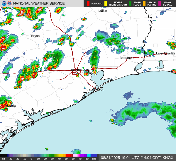
- There will be a daily risk for coastal showers in the morning,
followed by scattered showers and thunderstorms inland in the
afternoon. Most of this activity will remain along and south of
the I-10 corridor.
- Turning hotter in the next few days, although we will still
remain close to normal for this time of the year.
- There is a moderate risk of strong rip currents along all Gulf-
facing beaches most of the week.
&&
.DISCUSSION...
Issued at 1129 PM CDT Tue Aug 5 2025
Mainly tranquil conditions are expected overnight into early
Wednesday morning with light variable winds and low temperatures
in the lower to mid 70s over the Brazos Valley and Piney Woods
region, the mid to upper 70s over areas near and south of I-10,
and the lower 80s along the coast.
We will remain within the southeastern periphery of a mid level
high pressure situated over New Mexico and West Texas for the next
few days. Although the high pressure will help limit shower and
thunderstorm activity, hot moist air and sufficient instability
will help develop a few showers and storms over areas south of
I-10 during the morning hours, expanding northward towards the
Houston metro region in the afternoon. This will seem like a
typical summer weather pattern with some days having slightly
higher chances than others. In addition, we may have some weak
vort maxes pass through our area from time to time, which could
help enhance some showers. Unfortunately, conditions will be
mostly hot and humid with much less chance for rain over the
Brazos Valley and Piney Woods region.
While we are on the topic of hot and humid, be sure to continue
to practice heat safety during the next several days and make the
proper adjustments to help mitigate heat stress while working or
spending time outdoors. Through Friday, the high temperatures will
generally be in the mid 90s for many areas along and north of
I-10, while areas south of I-10 will see highs between the lower
to mid 90s. Heat indices will remain in the lower 100s, with some
areas possibly seeing values between 104-107 deg F. Temperatures
will be a couple of degrees cooler this upcoming weekend into
early next week, as we may have slightly more rainfall and cloud
coverage.
Cotto
&&
.AVIATION...
(12Z TAF Issuance)
Issued at 629 AM CDT Wed Aug 6 2025
KCXO experiencing MVFR VSBYs, all other sites at VFR. VFR expected
to prevail by mid morning at all sites. Winds will be light out of
the southeast, becoming VRB overnight. Isolated TSRA/SHRA moving
inland from the Gulf. Expect this trend to continue through the
morning and into the afternoon hours as the sea breeze moves in.
Activity should generally remain along and south of I-10 corridor.
&&
.MARINE...
Issued at 1129 PM CDT Tue Aug 5 2025
Light winds and seas of 2 feet or less will prevail for much of
the forecast period. There is a daily chance for showers and
thunderstorms, mainly during the late night into late morning
hours, although isolated storms could occur during the early
afternoon hours. Heavy rain and brief periods of stronger winds
can occur with some storms. Outflow boundaries for storms
developing inland could move into the bays and nearshore waters at
times.
&&
.PRELIMINARY POINT TEMPS/POPS...
College Station (CLL) 95 75 95 75 / 0 0 10 0
Houston (IAH) 93 78 94 78 / 30 10 30 0
Galveston (GLS) 91 82 91 81 / 30 10 30 10
&&
.HGX WATCHES/WARNINGS/ADVISORIES...
TX...None.
GM...None.
&&
$$
DISCUSSION...Cotto
AVIATION...Adams
MARINE...Cotto
August 2025

Seasonal August weather for the next week in SETX.
Then, eyes on the tropics.
Then, eyes on the tropics.
-
tireman4

- Global Moderator

- Posts: 6552
- Joined: Wed Feb 03, 2010 9:24 pm
- Location: Humble, Texas
- Contact:
410
FXUS64 KHGX 061734
AFDHGX
Area Forecast Discussion
National Weather Service Houston/Galveston TX
1234 PM CDT Wed Aug 6 2025
...KEY MESSAGES, DISCUSSION, MARINE...
.KEY MESSAGES...
Issued at 1233 PM CDT Wed Aug 6 2025
- Isolated to scattered showers with a few thunderstorms are
expected each day. This activity will begin in the morning across
the coastal waters, then moving further inland in the afternoon.
- Turning hotter in the next few days with highs in the mid to upper
90s and heat indices in the triple digits. Practice heat safety!
- There is a moderate risk of strong rip currents along all Gulf-
facing beaches most of the week.
&&
.DISCUSSION...
Issued at 1233 PM CDT Wed Aug 6 2025
Relatively dry and hot conditions are expected to continue as an
upper-level ridge remains anchored across the southern Rockies. At
the surface, a few features are resulting in isolated to
scattered showers with a few thunderstorms early this afternoon.
We have a weak surface boundary extending along the northwestern
Gulf coast, a surface high pressure to our east and a little bit
of forcing associated with the sea breeze. These features, along
with daytime heating will once again give us another afternoon of
scattered rain and storms through sunset. Most of this activity
will be confined to areas along and south of I-10. A rinse-and-
repeat forecast is expected through Friday as the pattern
persists.
Beyond Saturday, there will be a slight change in the upper-level
pattern. The ridging aloft is expected to weaken and/or move
further to the west. This will allow for a few mid-level shortwave
troughs to move across the region. The outcome?...increased
chance of precipitation through at least early next week.
Temperature-wise, with the influence of the ridge, and 850mb
temperatures in the 19 to 23 degC range, surface highs will
generally be in the mid to upper-90s at least through Friday. We
will generally be below heat advisory criteria; however, afternoon
heat index values could potentially reach 107F, with higher
isolated values possible. Continue practicing heat safety,
especially if outdoors or in a location with no A/C.
JM
&&
.AVIATION...
(12Z TAF Issuance)
Issued at 629 AM CDT Wed Aug 6 2025
KCXO experiencing MVFR VSBYs, all other sites at VFR. VFR expected
to prevail by mid morning at all sites. Winds will be light out of
the southeast, becoming VRB overnight. Isolated TSRA/SHRA moving
inland from the Gulf. Expect this trend to continue through the
morning and into the afternoon hours as the sea breeze moves in.
Activity should generally remain along and south of I-10 corridor.
&&
.MARINE...
Issued at 1233 PM CDT Wed Aug 6 2025
Isolated to scattered showers with a few thunderstorms are
developing along a stalled frontal boundary, which is extending
along the northwestern Gulf. This activity will gradually diminish
this afternoon as the boundary moves/dissipates further inland.
Surface high pressure centered across the Gulf will continue to
provide light onshore winds and seas through the week. A daily
risk of morning showers with isolated storms, moving further
inland in the afternoon can be expected through the end of the
week. Brief heavy downpours and gusty winds are possible near any
strong storms. Rain and storm chances increase this weekend into
early next week.
JM
&&
.PRELIMINARY POINT TEMPS/POPS...
College Station (CLL) 96 75 96 75 / 0 0 0 0
Houston (IAH) 96 78 96 78 / 30 20 20 0
Galveston (GLS) 90 82 90 82 / 40 10 30 10
&&
.HGX WATCHES/WARNINGS/ADVISORIES...
TX...None.
GM...None.
&&
$$
DISCUSSION...JM
AVIATION...Adams
MARINE...JM
-
tireman4
- Global Moderator
- Posts: 6552
- Joined: Wed Feb 03, 2010 9:24 pm
- Location: Humble, Texas
- Contact:
951
FXUS64 KHGX 071124
AFDHGX
Area Forecast Discussion
National Weather Service Houston/Galveston TX
624 AM CDT Thu Aug 7 2025
...New AVIATION...
.KEY MESSAGES...
Issued at 1156 PM CDT Wed Aug 6 2025
- A daily risk for coastal showers in the morning, followed by
scattered showers and thunderstorms inland in the afternoon will
continue through the next several days. Most of this activity
will remain along and south of the I-10 corridor.
- Slightly above normal temperatures expected Thursday, then
cooling back to the lower to mid 90s this weekend. Heat indices
in the lower 100s. Practice heat safety!
- There is a moderate risk of strong rip currents along all Gulf-
facing beaches through the next several days.
&&
.DISCUSSION...
Issued at 1156 PM CDT Wed Aug 6 2025
For the rest of the night, expect warm but tranquil conditions
with mostly clear to partly cloudy skies, light and variable
winds, and low temperatures in the mid 70s for much of the areas
north of I-10, the mid to upper 70s for areas along and south of
I-10, and the lower 80s along the coast.
We will remain under the influence of the mid level high pressure
that is anchored over New Mexico and Northwest Texas. This will
continue to result in hot conditions and lead to high temperatures
mostly in the mid 90s for much of Southeast Texas, with several
spots reaching the upper 90s. Heat indices will remain in the
lower 100s, with some areas possibly seeing values as high as 107
deg F for an hour or two. Thus, be sure to continue to practice
heat safety and make the proper adjustments to help mitigate heat
stress while working or spending time outdoors.
Although the high pressure will help limit shower and
thunderstorm activity, sufficient moisture and instability as well
as the influence of the sea breeze, will be enough for isolated
to scattered showers and thunderstorms generally over the coastal
areas during the morning hours, expanding northward towards the
Houston metro region in the afternoon.
The influence of the mid level high will weaken during the upcoming
weekend and will allow for highs to be a couple of degrees cooler,
although remaining between the lower to mid 90s for most of the
region. We can also expect better development of showers and storms,
i.e. higher chances for rain, as an upper level trough anchors
over East and Southeast Texas. The typical summer pattern will
persist, with showers and storms starting more along the coastal
locations and expanding northward into the Houston metro region
during the late morning and afternoon hours. Some storms may be
efficient rain makers and could lead to ponding of water along
roadways and low lying areas. Be sure to check the radar and
traffic conditions before departing. For those over the Brazos
Valley and Piney Woods region, rain chances will be less, although
a storm or two may develop from time to time.
Cotto
&&
.AVIATION...
(12Z TAF Issuance)
Issued at 624 AM CDT Thu Aug 7 2025
VFR for most sites, except for LBX which is foggy as usual,
bouncing between MVFR and IFR. That will continue for the next
hour or two before improving. Similarly, CIGs near CLL and 6SM and
CXO have me keeping TEMPOs in for MVFR at those two sites for the
next couple of hours as well.
Once morning fog/CIGs clear out, it`s light winds and VFR for all.
Expecting isolated SHRA/TSRA again in the afternoon, mainly pinned
close to the coast and an issue for HOU/SGR coastward, who all get
PROB30s. Do have a PROB30 at IAH as well. This is perhaps a bit
overstated as TSRA north of I-10 looks very isolated to non-
existent. But, it`s close enough to PROB30 to merit keeping it,
and 18Z cycle can reevaluate the afternoon`s potential that far
inland.
&&
.MARINE...
Issued at 1156 PM CDT Wed Aug 6 2025
Light winds and seas of 2 feet or less will prevail for much of
the forecast period.
There is a daily chance for showers and thunderstorms, mainly
during the late night into late morning hours, although isolated
storms could occur during the early afternoon hours. Chance for
showers and thunderstorms will be on the rise during the upcoming
weekend as the ridge weakens overhead and an upper level trough
moves in from the NE. Heavy rain and brief periods of stronger
winds can occur with some storms. Outflow boundaries for storms
developing inland could move into the bays and nearshore waters at
times.
Cotto
&&
.PRELIMINARY POINT TEMPS/POPS...
College Station (CLL) 97 76 97 74 / 10 0 10 0
Houston (IAH) 96 79 96 78 / 20 10 30 10
Galveston (GLS) 89 82 91 82 / 30 10 30 20
&&
.HGX WATCHES/WARNINGS/ADVISORIES...
TX...None.
GM...None.
&&
$$
DISCUSSION...Cotto
AVIATION...Luchs
MARINE...Cotto
-
tireman4
- Global Moderator
- Posts: 6552
- Joined: Wed Feb 03, 2010 9:24 pm
- Location: Humble, Texas
- Contact:
648
FXUS64 KHGX 071804
AFDHGX
Area Forecast Discussion
National Weather Service Houston/Galveston TX
104 PM CDT Thu Aug 7 2025
...New KEY MESSAGES, DISCUSSION, MARINE...
.KEY MESSAGES...
Issued at 100 PM CDT Thu Aug 7 2025
- Hot and humid and generally dry conditions are expected through
at least early this weekend. Heat indices up to 107F are
possible. Practice heat safety!
- Isolated to scattered showers and storms, mainly along and south
of the I-10 corridor will persist through sunset. The same
scenario is expected on Friday.
&&
.DISCUSSION...
Issued at 100 PM CDT Thu Aug 7 2025
The high pressure ridge centered over West Texas/New Mexico will
continue to dominate the weather pattern across Southeast TX,
suppressing widespread rain and storms. At the surface light south
to southeast winds will continue to transport moisture from the Gulf
inland, leading to more moisture/humidity. The combination of heat,
moisture and any sea/baybreeze boundary is responsible of isolated
to scattered showers and storms, primarily developing along the
coast and then inland. As we have seen in the previous days, most of
this activity will be confined to areas along and south of the I-10
corridor. A few of these cells will be capable of producing locally
heavy downpours and gusty winds. This weather pattern is again
expected on Friday. Isolated to scattered showers and storms will
develop over the Gulf waters/coast in the morning, then moving
inland during the afternoon/early evening. Lingering low-level
moisture and light/variable winds will also lead to patchy low-lying
fog early in the morning.
As we head into the weekend, the high-pressure ridge is forecast to
shift westward. This shift will lead to some weaknesses in the mid
to upper-level pattern (trough). Increasing forcing aloft and
daytime heating will increase the chances and coverage for afternoon
showers and storms through at least early next week.
Hot and humid conditions continue. Friday is shaping up to be
another hot day with highs mainly in the mid to upper 90s. However,
as the chances for rain increase into next week, we may see highs
dropping a few degrees. Afternoon heat indices will generally be in
the triple digits. It`s summer in TX, and it also means continuing
to practice heat safety wherever you are.
JM
&&
.AVIATION...
(12Z TAF Issuance)
Issued at 624 AM CDT Thu Aug 7 2025
VFR for most sites, except for LBX which is foggy as usual,
bouncing between MVFR and IFR. That will continue for the next
hour or two before improving. Similarly, CIGs near CLL and 6SM and
CXO have me keeping TEMPOs in for MVFR at those two sites for the
next couple of hours as well.
Once morning fog/CIGs clear out, it`s light winds and VFR for all.
Expecting isolated SHRA/TSRA again in the afternoon, mainly pinned
close to the coast and an issue for HOU/SGR coastward, who all get
PROB30s. Do have a PROB30 at IAH as well. This is perhaps a bit
overstated as TSRA north of I-10 looks very isolated to non-
existent. But, it`s close enough to PROB30 to merit keeping it,
and 18Z cycle can reevaluate the afternoon`s potential that far
inland.
&&
.MARINE...
Issued at 100 PM CDT Thu Aug 7 2025
Light onshore winds, variable at times and low seas will prevail
through at least early next week. A typical summer pattern
continues with isolated to scattered showers and a few
thunderstorms developing over the Gulf waters and along the
islands early in the morning, spreading inland during the day. The
best chance for showers and storms arrives after Saturday as a
weak disturbance moves through the region.
JM
&&
.PRELIMINARY POINT TEMPS/POPS...
College Station (CLL) 96 75 98 75 / 0 10 0 0
Houston (IAH) 97 78 97 78 / 20 10 20 10
Galveston (GLS) 91 82 91 82 / 40 10 20 20
&&
.HGX WATCHES/WARNINGS/ADVISORIES...
TX...None.
GM...None.
&&
$$
DISCUSSION...JM
AVIATION...Luchs
MARINE...JM

The big suck
A few days of Suck, but the easterlies are back on beginning this weekend. There's a chance of isolated, scattered Saturday through at least Wednesday.
I’ve already put my order in for the same Summer next year.


Count me in as well. College Station has not hit 100°F yet. There's been maybe 1 or 2 summers I can remember when we've stayed below 100°F.
By climo, August 8 is the hottest day of the year...and we're expecting about 98°F.
By Sunday we see a pattern change and a chance of isolated and scattered showers every day - 20-30% around here, but that means clouds and lower temps by maybe 3°F
On cue.
Oh, btw - I heard NWS are hiring back some of the Mets...just in time for an uptick in hurricane season activity.
Area Forecast Discussion
National Weather Service Houston/Galveston TX
117 PM CDT Fri Aug 8 2025
...New KEY MESSAGES, DISCUSSION, MARINE...
.KEY MESSAGES...
Issued at 115 PM CDT Fri Aug 8 2025
- Hot and humid conditions are expected through at least early
this weekend. Heat indices up to 107F are possible. Practice
heat safety!
- Chances for showers and storms, mainly along and south of the
I-10 corridor will persist through into next week. Rain chances
increase going into the weekend.
&&
.DISCUSSION...
Issued at 115 PM CDT Fri Aug 8 2025
Upper-level high pressure remains anchored to our west while a weak
surface high pressure moves over southeast Texas. This pattern has
brought even drier conditions today... clearly depicted in the
latest water vapor and visible satellite imagery. Despite moderate
to strong subsidence, warm and humid south to southeast surface
winds will continue to advect more moisture across the coastal
counties this afternoon. While coverage will be more limited, we can
still expect isolated to scattered storms in areas generally along
and south of the I-10 corridor this afternoon through sunset. As we
have seen in the previous nights, a warm and muggy night is
anticipated with patchy, low-lying fog possible early in the
morning.
As we head into the weekend, the aforementioned high sightly shifts
westward, opening the door for more troughiness across our area. A
mid-to-upper level shortwave trough is progged to develop along the
TX coast and move northward into our region Saturday into early
Monday. Sufficient forcing aloft, diurnal heating and surface
convergence due to sea/bay breeze will support better rain and storm
chances compared to what we have experienced over the past few days.
It won`t be a complete washout, but coverage will be more scattered
and even farther inland. This scenario will continue through most of
the upcoming week with daily rain and storm chances (40 to 60
percent), especially in the afternoon.
It will continue to be hot and humid over the next several days;
however, with increasing cloud cover and rain chances, we may see
highs dropping a few degrees. Highs will generally be in the low to
mid 90s. Peak heat index values in the triple digits are expected
each day with values close to 107F at times. Don`t forget to
practice heat safety wherever you are.
JM
&&
Seasonable with a chance of rain all week. Naturally, chances of precipitation are higher southward towards I-10 and the GoM.
I have been blessed with rain almost every single afternoon/evening since Tuesday or so. And it’s been legit rain per day. I’m at .86” today with almost 3” since Tuesday (same total for August). I’ll take it!
A nice little sea breeze revving up south of I-10. I hope a morsel winds it's way up toward CLL. Navasota is typically the end of their journey in the summer.
I’ll take a little Woodlands sea breeze.