Page 4 of 5
Re: Hurricane Earl Western Atlantic
Posted: Mon Aug 30, 2010 9:56 am
by sleetstorm
The northeast Leeward Islands are being pummeled with very heavy rain and wind this morning.
Re: Hurricane Earl Western Atlantic
Posted: Mon Aug 30, 2010 12:04 pm
by texbosoxfan
Steve, I have family on Nantucket Island right now, and while we've been through a few storms out there in the past (Gloria, Bob, No Name, etc.), we've never encountered a Cat 3 storm. Do you see Earl maintaining Cat3 intensity for the next 3-4 days, or do you think he might back down when he hits the colder water of the NE coast?
Re: Hurricane Earl Western Atlantic
Posted: Mon Aug 30, 2010 12:20 pm
by wxman57
texbosoxfan wrote:Steve, I have family on Nantucket Island right now, and while we've been through a few storms out there in the past (Gloria, Bob, No Name, etc.), we've never encountered a Cat 3 storm. Do you see Earl maintaining Cat3 intensity for the next 3-4 days, or do you think he might back down when he hits the colder water of the NE coast?
I think it could easily be a Cat 2 when it passes Nantucket. Fair chance of low-end Category 1 hurricane winds. Strongest winds will be east of the track.
Re: Hurricane Earl Western Atlantic
Posted: Mon Aug 30, 2010 1:05 pm
by sau27
Shot of Earl from Puerto Rico radar
Re: Hurricane Earl Western Atlantic
Posted: Mon Aug 30, 2010 2:26 pm
by desiredwxgd
A little wobble south
Re: Hurricane Earl Western Atlantic
Posted: Mon Aug 30, 2010 3:17 pm
by srainhoutx
Very impressive...
GOES-15 & 13 - Earl during development of his eye
Posted: Mon Aug 30, 2010 3:34 pm
by unome
Re: Hurricane Earl Western Atlantic
Posted: Mon Aug 30, 2010 3:55 pm
by srainhoutx
000
WTNT32 KNHC 302047
TCPAT2
BULLETIN
HURRICANE EARL ADVISORY NUMBER 22
NWS TPC/NATIONAL HURRICANE CENTER MIAMI FL AL072010
500 PM AST MON AUG 30 2010
...EARL BECOMES A CATEGORY FOUR HURRICANE...MOVING AWAY FROM THE
VIRGIN ISLANDS...
SUMMARY OF 500 PM AST...2100 UTC...INFORMATION
----------------------------------------------
LOCATION...19.3N 64.7W
ABOUT 110 MI...180 KM NE OF SAN JUAN PUERTO RICO
MAXIMUM SUSTAINED WINDS...135 MPH...215 KM/HR
PRESENT MOVEMENT...WNW OR 290 DEGREES AT 15 MPH...24 KM/HR
MINIMUM CENTRAL PRESSURE...948 MB...27.99 INCHES
WATCHES AND WARNINGS
--------------------
CHANGES WITH THIS ADVISORY...
THE GOVERNMENT OF THE BAHAMAS HAS ISSUED A TROPICAL STORM WARNING
FOR THE TURKS AND CAICOS ISLANDS...AND A TROPICAL STORM WATCH FOR
THE SOUTHEASTERN BAHAMAS.
THE GOVERNMENT OF ANTIGUA AND BARBUDA HAS REPLACED THE HURRICANE
WARNING FOR THE BRITISH VIRGIN ISLANDS WITH A TROPICAL STORM
WARNING..AND DISCONTINUED THE TROPICAL STORM WARNING FOR ANGUILLA.
THE GOVERNMENT OF THE NETHERLANDS ANTILLES HAS DISCONTINUED THE
HURRICANE WARNING FOR ST. MAARTEN...SABA...AND ST. EUSTATIUS.
THE GOVERNMENT OF FRANCE WILL DISCONTINUE THE HURRICANE WARNING FOR
SAINT MARTIN AND SAINT BARTHELEMY AT 600 PM AST...2200 UTC.
THE HURRICANE WATCH FOR PUERTO RICO HAS BEEN DISCONTINUED...AND THE
HURRICANE WARNING FOR THE U.S. VIRGIN ISLANDS...CULEBRA...AND
VIEQUES HAS BEEN CHANGED TO A TROPICAL STORM WARNING.
Re: Hurricane Earl Western Atlantic
Posted: Mon Aug 30, 2010 4:46 pm
by Andrew
What a beauty. Too bad the islands have to deal with this. One of the best looking hurricanes that I have seen in a good while. We need to keep track of this storm especially during the turn to the NE. That will be a big key to how fast and sharp of a turn it is. That could save or destroy the east coast.
Re: Hurricane Earl Western Atlantic
Posted: Mon Aug 30, 2010 7:56 pm
by Andrew
Re: Hurricane Earl Western Atlantic
Posted: Mon Aug 30, 2010 7:59 pm
by srainhoutx
Looks like a eyewall replacement cycle (ERC) may occur. Could be some nice images if that happens.

It is an amazing cyclone and just enough offshore, so far.
Re: Hurricane Earl Western Atlantic
Posted: Mon Aug 30, 2010 8:19 pm
by Andrew
srainhoutx wrote:Looks like a eyewall replacement cycle (ERC) may occur. Could be some nice images if that happens.
It is an amazing cyclone and just enough offshore, so far.
Yes here is what wxman posted:
As of 5PM CDT, the SEF/ERC probability model is now estimating an 82% chance of at least one event in the next 12 hours, and a 100% chance in the next 36 hours. The model suggests the potential for repeated ERCs in the next 2 days.
So I wouldn't joke too much about noticing an ERC in progress. It is in progress.
Re: Hurricane Earl Western Atlantic
Posted: Mon Aug 30, 2010 9:00 pm
by AndrewLozeau
Re: Hurricane Earl Western Atlantic
Posted: Mon Aug 30, 2010 9:14 pm
by Ptarmigan
Quite an impressive storm. I think Earl could be a Category 5, a first since Felix in 2007. Prayers to our friends in the Virgin Islands getting whacked by Earl.
Re: Hurricane Earl Western Atlantic
Posted: Mon Aug 30, 2010 9:58 pm
by sleetstorm
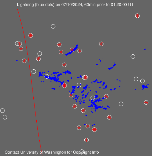
Is there any way to tell how much lightning is being generated by that hurricane like there is for continental thunderstorms?
The last time that I saw Hurricane Earl, its southern most bands stretcheded nearly as far south as the Venezuela coast.
Re: Hurricane Earl Western Atlantic
Posted: Tue Aug 31, 2010 1:13 am
by unome
Global Lightning - not real time, most are 1 hr behind
http://webflash.ess.washington.edu/
Re: Hurricane Earl Western Atlantic
Posted: Tue Aug 31, 2010 9:59 am
by srainhoutx
000
WTNT32 KNHC 311452
TCPAT2
BULLETIN
HURRICANE EARL ADVISORY NUMBER 25
NWS TPC/NATIONAL HURRICANE CENTER MIAMI FL AL072010
1100 AM AST TUE AUG 31 2010
...POWERFUL HURRICANE EARL CONTINUES WITH 135 MPH WINDS...
SUMMARY OF 1100 AM AST...1500 UTC...INFORMATION
-----------------------------------------------
LOCATION...21.2N 67.9W
ABOUT 205 MI...335 KM E OF GRAND TURK ISLAND
ABOUT 1070 MI...1725 KM SSE OF CAPE HATTERAS NORTH CAROLINA
MAXIMUM SUSTAINED WINDS...135 MPH...215 KM/HR
PRESENT MOVEMENT...WNW OR 300 DEGREES AT 14 MPH...22 KM/HR
MINIMUM CENTRAL PRESSURE...939 MB...27.73 INCHES
WATCHES AND WARNINGS
--------------------
CHANGES WITH THIS ADVISORY...
NONE.
SUMMARY OF WATCHES AND WARNINGS IN EFFECT...
A TROPICAL STORM WARNING IS IN EFFECT FOR...
* TURKS AND CAICOS ISLANDS
A TROPICAL STORM WATCH IS IN EFFECT FOR...
* SOUTHEASTERN BAHAMAS
INTERESTS FROM THE CAROLINAS NORTHWARD TO NEW ENGLAND SHOULD MONITOR
THE PROGRESS OF EARL. A HURRICANE WATCH COULD BE REQUIRED FOR
PORTIONS OF THE MID-ATLANTIC COAST LATER TODAY.
Re: Hurricane Earl Western Atlantic
Posted: Tue Aug 31, 2010 2:13 pm
by sleetstorm
Thank you, unome.
Re: Hurricane Earl Western Atlantic
Posted: Tue Aug 31, 2010 3:07 pm
by AndrewLozeau
Re: Hurricane Earl Western Atlantic
Posted: Tue Aug 31, 2010 3:47 pm
by srainhoutx
000
WTNT32 KNHC 312106
TCPAT2
BULLETIN
HURRICANE EARL ADVISORY NUMBER 26...AMENDED
NWS TPC/NATIONAL HURRICANE CENTER MIAMI FL AL072010
500 PM AST TUE AUG 31 2010
AMENDED TO UPDATE HURRICANE WATCH AREA
...LARGE AND INTENSE HURRICANE EARL CHURNING NORTHWESTWARD OVER THE
ATLANTIC...PASSING WELL EAST OF THE TURKS AND CAICOS ISLANDS...
SUMMARY OF 500 PM AST...2100 UTC...INFORMATION
----------------------------------------------
LOCATION...22.0N 68.8W
ABOUT 150 MI...245 KM ENE OF GRAND TURK ISLAND
ABOUT 1000 MI...1605 KM SSE OF CAPE HATTERAS NORTH CAROLINA
MAXIMUM SUSTAINED WINDS...135 MPH...215 KM/HR
PRESENT MOVEMENT...NW OR 305 DEGREES AT 14 MPH...22 KM/HR
MINIMUM CENTRAL PRESSURE...940 MB...27.76 INCHES
WATCHES AND WARNINGS
--------------------
CHANGES WITH THIS ADVISORY...
A HURRICANE WATCH HAS BEEN ISSUED FOR THE EAST COAST OF THE UNITED
STATES FROM NORTH OF SURF CITY NORTH CAROLINA TO THE NORTH
CAROLINA/VIRGINIA BORDER...INCLUDING THE PAMLICO AND ALBEMARLE
SOUNDS.
A TROPICAL STORM WATCH HAS BEEN ISSUED FROM CAPE FEAR NORTH CAROLINA
NORTHEASTWARD TO SURF CITY.
SUMMARY OF WATCHES AND WARNINGS IN EFFECT...
A HURRICANE WATCH IS IN EFFECT FOR...
* NORTH OF SURF CITY NORTH CAROLINA TO THE NORTH CAROLINA/VIRGINIA
BORDER...INCLUDING THE PAMLICO AND ALBEMARLE SOUNDS
A TROPICAL STORM WARNING IS IN EFFECT FOR...
* TURKS AND CAICOS ISLANDS
A TROPICAL STORM WATCH IS IN EFFECT FOR...
* SOUTHEASTERN BAHAMAS
* CAPE FEAR TO SURF CITY
INTERESTS FROM VIRGINIA NORTHWARD TO NEW ENGLAND SHOULD MONITOR
THE PROGRESS OF EARL.
FOR STORM INFORMATION SPECIFIC TO YOUR AREA IN THE UNITED
STATES...INCLUDING POSSIBLE INLAND WATCHES AND WARNINGS...PLEASE
MONITOR PRODUCTS ISSUED BY YOUR LOCAL NATIONAL WEATHER SERVICE
FORECAST OFFICE. FOR STORM INFORMATION SPECIFIC TO YOUR AREA OUTSIDE
THE UNITED STATES...PLEASE MONITOR PRODUCTS ISSUED BY YOUR NATIONAL
METEOROLOGICAL SERVICE.


